| Krag Peak | |
|---|---|
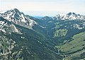
 South aspect | |
| Highest point | |
| Elevation | 9,079 ft (2,767 m) [1] |
| Prominence | 1,240 ft (378 m) [2] |
| Parent peak | Red Mountain (9,537 ft) [3] |
| Isolation | 2.12 mi (3.41 km) [3] |
| Coordinates | 45°03′55″N117°17′21″W / 45.0652516°N 117.2892716°W [1] |
| Geography | |
 Krag Peak Location in Oregon  Krag Peak Krag Peak (the United States) | |
| Location | Eagle Cap Wilderness |
| Country | United States of America |
| State | Oregon |
| County | Baker |
| Parent range | Wallowa Mountains |
| Topo map | USGS Krag Peak |
| Climbing | |
| Easiest route | scrambling [4] |
Krag Peak is a mountain summit located in Baker County, Oregon, US. [1]