Kuhbanan

Last updated • 1 min readFrom Wikipedia, The Free Encyclopedia

Kuhbanan
Persian: كوهبنان
City
msjd jm` w mqbrh shhyd akhwnd zdh khwhbnn.jpg
Iran location map.svg
Red pog.svg
Kuhbanan
Coordinates: 31°24′36″N56°16′57″E / 31.41000°N 56.28250°E / 31.41000; 56.28250 [1]
Country Iran
Province Kerman
County Kuhbanan
District Central
Population
 (2016) [2]
  Total
10,761
Time zone UTC+3:30 (IRST)
Kouhbanan.jpg

Kuhbanan (Persian : كوهبنان) [a] is a city in the Central District of Kuhbanan County, Kerman province, Iran, serving as capital of both the county and the district. [4]

Contents

Etymology

The name Kūhbanān means "pistachio-tree mountain", from the Persian words kūh, meaning "mountain", and banān, which refers to the wild pistachio. [5]

History

Kuhbanan was described by the 10th-century writer al-Muqaddasi as a small town with two gates. The town's jameh mosque was by one of these gates. Outside the walled part of the city was a suburban area, where there were bathhouses and caravanserais. Beyond this suburban area, Kuhbanan was surrounded by farms and orchards that extended as far as the foot of the nearby mountains. [5]

Medieval Kuhbanan was renowned for its production of tutty, an impure oxide of zinc used as a salve for the eyes. As early as the 10th century, al-Muqaddasi listed tutty from Kuhbanan as one of the major exports of Kerman province. He wrote that it formed in finger-like "pipes", which were then purified by being roasted in long furnaces by the same mountainside where the ore was extracted. In the early 1200s, Yaqut al-Hamawi similarly described Kuhbanan, along with the nearby town of Behabad, as a major exporter of tutty. Marco Polo visited Kuhbinan, which he called Cobinan, in the 1300s, and provided a detailed description of the local tutty industry. Around the turn of the 20th century, the British traveler Percy Sykes witnessed the production of tutty in Kuhbanan; the process he described was essentially the same as that used hundreds of years earlier. [5]

Demographics

Population

At the time of the 2006 National Census, the city's population was 10,112 in 2,623 households. [6] The following census in 2011 counted 11,093 people in 3,189 households. [7] The 2016 census measured the population of the city as 10,761 people in 3,296 households. [2]

See also

Flag of Iran.svg Iranportal

Notes

  1. Also romanized as Kūh Banān, Kūhbanān, and Kūhbonān; also known as Koobanan and Kūh Baneh [3]

Related Research Articles

<span class="mw-page-title-main">Kerman province</span> Province of Iran

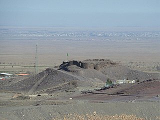
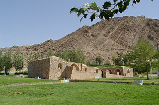
Kerman province is the largest of the 31 provinces of Iran. Its capital is the city of Kerman.

Sirjan is a city in the Central District of Sirjan County, Kerman province, in the south of Iran, serving as capital of both the county and the district. The city is 960 km (600 mi) from the Iranian capital of Tehran, and 175 km (109 mi) from the provincial capital of Kerman. It is known for its pistachios, Kilim and its wind towers, locally known as Bādgir-e Chopoqi.

<span class="mw-page-title-main">Baft County</span> County in Kerman province, Iran

Baft County is in Kerman province, Iran. Its capital is the city of Baft.

<span class="mw-page-title-main">Zarand County</span> County in Kerman province, Iran

Zarand County is in Kerman province, Iran. Its capital is the city of Zarand.

<span class="mw-page-title-main">Gonabad County</span> County in Razavi Khorasan province, Iran

Gonabad County is in Razavi Khorasan Province, Iran. Its capital is the city of Gonabad.

<span class="mw-page-title-main">Kuhbanan County</span> County in Kerman province, Iran

Kuhbanan County is in Kerman province, Iran. Its capital is the city of Kuhbanan.

Narmashir is a city in the Central District of Narmashir County, Kerman province, Iran, serving as capital of both the county and the district.

Yazdanabad District is in Zarand County, Kerman province, Iran. Its capital is the city of Yazdan Shahr.

<span class="mw-page-title-main">Anduhjerd</span> City in Kerman province, Iran

Anduhjerd is a city in Shahdad District of Kerman County, Kerman province, Iran, serving as the administrative center for Anduhjerd Rural District.

Golbaf District is in Kerman County, Kerman province, Iran. Its capital is the city of Golbaf.

Jupar is a city in Mahan District of Kerman County, Kerman province, Iran.

The Central District of Kuhbanan County is in Kerman province, Iran. Its capital is the city of Kuhbanan.

Toghrol ol Jerd District is in Kuhbanan County, Kerman province, Iran. Its capital is the city of Kianshahr.

Kianshahr is a city in, and the capital of, Toghrol ol Jerd District of Kuhbanan County, Kerman province, Iran. It also serves as the administrative center for Toghrol ol Jerd Rural District.

Javar Rural District is in the Central District of Kuhbanan County, Kerman province, Iran. Its capital is the village of Gavar.

Khorramdasht Rural District is in the Central District of Kuhbanan County, Kerman province, Iran. Its capital is the village of Qaryeh Ali.

Toghrol ol Jerd Rural District is in Toghrol ol Jerd District of Kuhbanan County, Kerman province, Iran. It is administered from the city of Kianshahr.

Khanmakan is a village in Toghrol ol Jerd Rural District, Toghrol ol Jerd District, Kuhbanan County, Kerman province, Iran.

Gavar is a village in Javar Rural District of the Central District of Kuhbanan County, Kerman province, Iran.

Qaryeh Ali is a village in, and the capital of, Khorramdasht Rural District of the Central District of Kuhbanan County, Kerman province, Iran.

References

  1. OpenStreetMap contributors (7 December 2024). "Kuhbanan, Kuhbanan County" (Map). OpenStreetMap (in Persian). Retrieved 7 December 2024.
  2. 1 2 Census of the Islamic Republic of Iran, 1395 (2016): Kerman Province. amar.org.ir (Report) (in Persian). The Statistical Center of Iran. Archived from the original (Excel) on 20 October 2020. Retrieved 19 December 2022.
  3. Kuhbanan can be found at GEOnet Names Server, at this link, by opening the Advanced Search box, entering "-3072278" in the "Unique Feature Id" form, and clicking on "Search Database".
  4. Aref, Mohammada Reza (25 April 1400) [Approved 25 November 1383]. Divisional reforms and changes in Kerman province. rc.majlis.ir (Report) (in Persian). Ministry of the Interior, Political-Defense Commission of the Government Board. Proposal 1.4.42.50870; Letter 58538/T26118H. Archived from the original on 14 April 2021. Retrieved 2 February 2024 via Islamic Parliament Research Center of the Islamic Republic of Iran.
  5. 1 2 3 Le Strange, Guy (1905). The Lands of the Eastern Caliphate: Mesopotamia, Persia, and Central Asia, from the Moslem Conquest to the Time of Timur. New York: Barnes & Noble, Inc. p. 309. OCLC   1044046.
  6. Census of the Islamic Republic of Iran, 1385 (2006): Kerman Province. amar.org.ir (Report) (in Persian). The Statistical Center of Iran. Archived from the original (Excel) on 20 September 2011. Retrieved 25 September 2022.
  7. Census of the Islamic Republic of Iran, 1390 (2011): Kerman Province. irandataportal.syr.edu (Report) (in Persian). The Statistical Center of Iran. Archived from the original (Excel) on 29 March 2023. Retrieved 19 December 2022 via Iran Data Portal, Syracuse University.