
Krishna district is a district in the coastal Andhra Region in Indian state of Andhra Pradesh, with Machilipatnam as its administrative headquarters. It is surrounded on the East by Bay of Bengal, West by Guntur, Bapatla and North by Eluru and NTR districts and South again by Bay of Bengal.

Vizianagaram, also known as Vijayanagaram, is a city and the headquarters of the Vizianagaram district in the Indian state of Andhra Pradesh. It is located in the Eastern Ghats, about 24 km (15 mi) west of the Bay of Bengal and 40 km (25 mi) north-northeast of Visakhapatnam. The city has a population of 228,025 and was established as the capital of the Vizianagaram estate by Raja Vijayaram Raj from the Pusapati dynasty. The rulers had a notable role in the history of the region in the 18th century and were patrons of education and arts.
Amaravathi is a village on the banks of the Krishna River, in the Palnadu district of the Indian state of Andhra Pradesh. It is the headquarters of Amaravathi mandal, and forms part of the Andhra Pradesh Capital Region with its headquarters at new Amaravati 35 km (22 mi) east, whose name is also borrowed from that of the older Amaravathi.

Vizianagaram district is one of the six districts in the Uttarandhra region of the Indian state of Andhra Pradesh with its headquarters located at Vizianagaram. The district was once the part of ancient Kalinga.Saripilli Dibbilingeswara temple, Jayathi Mallikarjuna Temple are the finest examples of ancient Eastern Ganga Dynasty built monuments in the district. The district is bounded on the east by the district of Srikakulam, north by Parvathipuram Manyam south by Visakhapatnam, Anakapalli, southeast by the Bay of Bengal, and west by Alluri Sitharama Raju district. It was formed on 1 June 1979, with some parts carved from the neighbouring districts of Srikakulam and Visakhapatnam. The district is named after the princely state of Vizianagaram. In 2011, it was the least populous district in Andhra Pradesh.

Bhattiprolu is a village in Bapatla district of the Indian state of Andhra Pradesh. It is the headquarters of Bhattiprolu mandal in Tenali revenue division. The Buddhist stupa in the village is one of the centrally protected monuments of national importance. One of the earliest evidence of Brahmi script in South India comes from Bhattiprolu. The script was written on an urn containing Buddha's relics. The script has been named Bhattiprolu script.

Gajapathinagaram is a census town in Vizianagaram district of the Indian state of Andhra Pradesh. It is located in Gajapathinagaram mandal of Vizianagaram revenue division. It is located on National Highway 26 between Vizianagaram and Ramabhadrapuram.

Nelli-marla is a census town in Vizianagaram district of the Indian state of Andhra Pradesh. It is in Nellimarla mandal of Vizianagaram revenue division.

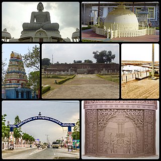
Srungavarapukota, popularly known by its abbreviated form S.Kota, is a neighbourhood in the district of Vizianagaram, India. S.Kota is located on Visakhapatnam – Araku road. The town was upgraded from gram panchayat to Nagar Panchayat in the year 2011.
Komarada is a village in Parvathipuram Manyam district of the Indian state of Andhra Pradesh.
Jiyyammavalasa is a village in Parvathipuram Manyam district of the Indian state of Andhra Pradesh.
Donkinavalasa is a village and panchayat in Badangi mandal of Vizianagaram district, Andhra Pradesh, India. It is located about 42 km from Vizianagaram city. There is a railway station in the Vizianagaram-Raipur section of East Coast Railway, Indian Railways.

North Andhra or Uttara Andhra, also known as Kalinga Andhra, is a geographic region in the Indian state of Andhra Pradesh. It is between the Eastern Ghats and the coast of the Bay of Bengal. It comprises six northern districts of the state, Srikakulam, Parvathipuram Manyam, Vizianagaram, Visakhapatnam, Alluri Sitharama Raju and Anakapalli. As of 2011 census of India, the region with six districts has a population of 9,338,177.
Nizampatnam is a village in Bapatla district of the Indian state of Andhra Pradesh. It is the mandal headquarters of Nizampatnam mandal in Repalle revenue division. The Dutch occupied the city for trading from 1606−1668.

River Champavathi is a small river which originates in the Eastern Ghats at an altitude of 1,200 metres above mean sea level near Andra village and flows eastwards and joins the Bay of Bengal near the village Konada. The river passes through Gajapathinagaram, Nellimarla, Saripalli, Denkada, Palem and Natavalasa of Vizianagaram district. The river has four main tributaries Eduvampula Gedda, Chitta Gedda, Pothula Gedda and Gadi Gedda. The basin has a drainage area of 1,410 square kilometres. This area is divisible into Hilly terrain, Vizianagaram plains and Coastal plains.
Pedabondapalli is a village/Gram panchayat in Parvathipuram mandal, Vizianagaram district, Andhra Pradesh, India.
Vizianagaram is a city in the Indian state of Andhra Pradesh. The city and its region contain natural features such as beaches along the Bay of Bengal coast, historic forts, temples as well as landmarks in the city itself. Heritage-tourism is supported by the presence of historic forts. The Andhra Pradesh Tourism Development Corporation is the state tourism department, responsible for maintaining, promoting and developing the tourism sector.
The Bobbili Fort, located in the Vizianagaram district of the Indian state of Andhra Pradesh, was built during the middle of the 19th century in Bobbili. It has a historical link to the nearby mud fort of the same name which was destroyed during the Bobbili war in 1757 in a feud between the Rajas of Bobbili and the neighbouring Maharaja of Vizianagaram.