Kutigi

Last updated

Kutigi is a town in central Nigeria, border to Bida, makwo and north of the Niger River. The countryside is generally flat with rolling hills, with grassland and trees. [1]

It is the headquarters of Lavun Local Government Area in Niger State, Nigeria. [2] [3]

This is a place situated in Lavun, with a geographical coordinates are 9° 12' 0" North, 5° 36' 0" East and its original name (with diacritics) is Kutigi. it's a Nupe, speaking area. [4]

Related Research Articles

<span class="mw-page-title-main">Niger</span> Country in West Africa

Niger or the Niger, officially the Republic of the Niger, is a landlocked country in West Africa. It is a unitary state bordered by Libya to the northeast, Chad to the east, Nigeria to the south, Benin and Burkina Faso to the southwest, Mali to the west, and Algeria to the northwest. It covers a land area of almost 1,270,000 km2 (490,000 sq mi), making it the second-largest landlocked country in West Africa, after Chad. Over 80% of its land area lies in the Sahara. Its predominantly Muslim population of about 25 million live mostly in clusters in the further south and west of the country. The capital Niamey is located in Niger's southwest corner.

Diffa is a city and Urban Commune in the extreme southeast of Niger, near the border with Nigeria. It is the administrative seat of both Diffa Region, and the smaller Diffa Department. As of 2011, the commune had a total population of 48,005 people.

<span class="mw-page-title-main">Kumba</span> Place in Southwest Region, Cameroon Ambazonia

Kumba is a metropolitan city in the Meme department, Southwest Region, Western Cameroon, commonly referred to as "K-town" colloquially. Kumba is the largest and most developed city in the Meme Department and is increasingly drawing in residents from the local villages such as Mbonge. It is also the largest urban area in the South-West. Kumba has an estimated population of about 400,000 with three quarters of this population being young due to advancement in medicine and lowering infant mortality. The N8 and N16 highways meet at Kumba.

<span class="mw-page-title-main">Niger State</span> State of Nigeria

Niger is a state in the North Central region of Nigeria and the largest state in the country. Niger state has three political zones, zone A,B and C. The state's capital is at Minna. Other major cities are Bida, Kontagora and Suleja. It was formed in 1976 when the then North-Western State was divided into Niger State and Sokoto State. It is home to Ibrahim Babangida and Abdulsalami Abubakar, two of Nigeria's former military rulers. The Nupe, Gbagyi, Kamuku, Kambari, Gungawa, Hun-Saare, Hausa and Koro form the majority of numerous indigenous tribes of Niger State.

<span class="mw-page-title-main">Niger Delta</span> The delta of the river Niger

The Niger Delta is the delta of the Niger River sitting directly on the Gulf of Guinea on the Atlantic Ocean in Nigeria. It is located within nine coastal southern Nigerian states, which include: all six states from the South South geopolitical zone, one state (Ondo) from South West geopolitical zone and two states from South East geopolitical zone.

<span class="mw-page-title-main">Diffa Region</span> Region of Niger

Diffa is one of the seven Regions of Niger, located in the southeast of the country. The capital of the region is Diffa.

<span class="mw-page-title-main">Pategi</span> Town and LGA in Kwara State, Nigeria

Pategi or Patigi is a town and Local government in Kwara State, Nigeria with the headquarters located at the town. The town is the headquarters of Pategi Emirate. It is inhabited by the Nupe people who also exhibit a linguistic repertoire of the Yoruba dialect. They are farmers, aquatic sellers/fishers and traders. They are known to be governed by a monarch.

Bida is a Local Government Area in Niger State, Nigeria and a city on the A124 highway which occupies most of the area.

Environmental issues in the Niger Delta are caused by its petroleum industry. The delta covers 20,000 km2 (7,700 sq mi) within wetlands of 70,000 km2 (27,000 sq mi) formed primarily by sediment deposition. Home to 20 million people and 40 different ethnic groups, this floodplain makes up 7.5% of Nigeria's total land mass. It is the largest wetland and maintains the third-largest drainage basin in Africa. The Delta's environment can be broken down into four ecological zones: coastal barrier islands, mangrove swamp forests, freshwater swamps, and lowland rainforests. Fishing and farming are the main sources of livelihoods for majority of her residents.

Nupe is a Volta–Niger language of the Nupoid branch primarily spoken by the Nupe people of the North Central region of Nigeria. Its geographical distribution stretches and maintains pre-eminence in Niger State as well as Kwara, Kogi, Nasarawa and the Federal Capital Territory.

Idris Legbo Kutigi was a Nigerian lawyer and jurist. He was Attorney General and Commissioner for Justice in Niger State before becoming a high court judge. He joined the Supreme Court of Nigeria in 1992 and served as Chief Justice from 30 January 2007 to 30 December 2009.

Katcha is a local government area of Niger State, in central Nigeria. Its headquarters are in the town of Katcha. Badeggi is one of the major towns of the local government area, located on the A124 highway in the west of the area at 9°03′00″N6°09′00″E.

Lavun is a Local Government Area in Niger State, Nigeria. Its headquarters are in the town of Kutigi in the south of the area at9°12′00″N5°36′00″E. The Kaduna River forms the eastern border of the LGA.

Professor Adamu Ncahma Baba-Kutigi was born 10 June 1956, in Kutigi, Lavun Local Government, Area of Niger State. He was former Acting Vice Chancellor of the Federal University of Dutsinma.

Niger South Senatorial District is known as Zone A within Niger State. Bima Muhammad Enagi of the All Progressives Congress, APC is the current representative of Niger South in the Senate. The Niger South Senatorial District covers 8 local government areas which includes:

  1. Agaie local government area
  2. Bida local government area
  3. Edati local government area
  4. Gbako local government area
  5. Katcha local government area
  6. Lapai local government area
  7. Lavun local government area
  8. Mokwa local government area

The Niger State House of Assembly is the legislative arm of the government of Niger State of Nigeria. It is a unicameral legislature with 27 members elected from the 25 local government areas of the state. Local government areas
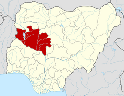
 with considerable lager population are delineated into two constituencies to give equal representation. This makes the number of legislators in the Niger State House of Assembly 27.

The Anglican Diocese of Kutigi is one of eleven within the Anglican Province of Lokoja, itself one of 14 provinces within the Church of Nigeria. The current bishop is Jeremiah Kolo

<span class="mw-page-title-main">2023 Niger State gubernatorial election</span> 2023 gubernatorial election in Niger State, Nigeria

The 2023 Niger State gubernatorial election will take place on 11 March 2023, to elect the Governor of Niger State, concurrent with elections to the Niger State House of Assembly as well as twenty-seven other gubernatorial elections and elections to all other state houses of assembly. The election will be held two weeks after the presidential election and National Assembly elections. Incumbent APC Governor Abubakar Sani Bello is term-limited and cannot seek re-election to a third term.

The 2019 Nigerian House of Representatives elections in Niger State was held on February 23, 2019, to elect members of the House of Representatives to represent Niger State, Nigeria.

<span class="mw-page-title-main">2023 Nigerian presidential election in Niger State</span>

The 2023 Nigerian presidential election in Niger State will be held on 25 February 2023 as part of the nationwide 2023 Nigerian presidential election to elect the president and vice president of Nigeria. Other federal elections, including elections to the House of Representatives and the Senate, will also be held on the same date while state elections will be held two weeks afterward on 11 March.

References

  1. "Kutigi: Nigeria" . Retrieved 19 May 2019.
  2. Orekoya, Tayo (2001). Local government administration in Nigeria. Vol. 2. Pure Language Communications. ISBN   9789783544901.
  3. = 9°27′N5°38′E / 9.450°N 5.633°E Coordinates: 9°27′N5°38′E / 9.450°N 5.633°E .
  4. Area place kutigi " Kutigi Lavun Nigeria", Maplandia source. 27 June 2019.