Bida | |
---|---|
LGA and city | |
Coordinates: 9°05′N6°01′E / 9.083°N 6.017°E | |
Country | Nigeria |
State | Niger State |
Government | |
• Local Government Chairman and the Head of the Local Government Council | Hon. Bala Shaba |
• Etsu | Yahaya Abubakar |
Area | |
• Total | 1,698 km2 (656 sq mi) |
Population (2006 census) | |
• Total | 266,008 |
Time zone | UTC+1 (WAT) |
3-digit postal code prefix | 912 |
ISO 3166 code | NG.NI.BI |
Bida is a Local Government Area in Niger State, Nigeria and a city on the A124 highway which occupies most of the area. [1]
The LGA has an area of 51 km2 (20 sq mi) and a population of 188,181 at the 2006 census.
The postal code of the area is 912. [2]
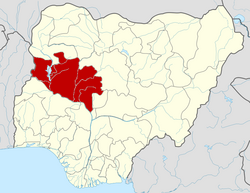
Bida is the second largest city in Niger State with an estimated population of 178,840 (2007). [3] It is located southwest of Minna, capital of Niger State, and is a dry, arid town. [4]
Districts include Katcha, Enagi, Baddeggi, Agaie, Pategi, Lemu, Kutigi, and others. [4]
There are other places in Bida such as Bamisu estate, Ramatu dangana, ECWA poly road, Small Market, Main Market and the Federal Medical Centre (Bida) others. There are also different schools like Federal Government Girls College Bida, Federal Polytechnic Staff Secondary School, Government College, Bida and others. [5]
The town is known for its production of traditional crafts, notably glass, bronze articrafts and brass wares. Bida is also known for its Durbar festival and the Nupe Day Festival. It is also the home to the Federal Polytechnic, Bida, Federal Medical Centre and Niger State School of Nursing. [6]
Temperatures rarely drop below 56°F or rise over 101°F in the humid, partly cloudy dry season, which has a hot and uncomfortable range of 62°F to 95°F. [7] [8]
The hot season lasts for 2.7 months, from February 3 to April 23, with an average daily high temperature of over 93°F. The hottest month of the year in Bida is April, with an average high temperature of 94°F and low temperature of 76°F. [9]
With an average daily maximum temperature below 86°F, the chilly season lasts 3.3 months, from June 28 to October 7. With an average low of 64°F and a high of 90°F, December is the coldest month of the year in Bida. [10]
The major ethnic group is the Nupe. Bida is the headquarters of the Nupe Kingdom led by the Etsu Nupe (presently Etsu Yahaya Abubakar). The leadership style of the ancient town of Bida is emirship, and the head of the town is addressed as Etsu Nupe. Other tribes include Igbo, Yoruba, Hausa, Igala and Gbagi, Ibira. [11] [12]
Katsina, likely from "Tamashek" or mazza (men) with "inna" (mother) is a Local Government Area and the capital city of Katsina State, in northern Nigeria. Katsina is located some 260 kilometres (160 mi) east of the city of Sokoto and 135 kilometres (84 mi) northwest of Kano, close to the border with Niger Republic.
Minna is a city in Middle Belt Nigeria. It is the capital city of Niger State, one of Nigeria's 36 federal states. It consists of the major ethnic groups: the Gbagyi, the Nupe and the Bassa.
Niger is a state in the North Central region of Nigeria and the largest state in the country by area. Niger state has three political zones, zone A, B and C. The state's capital is at Minna. Other major cities are Bida, Kontagora and Suleja. It was formed in 1976 when the then North-Western State was divided into Niger State and Sokoto State. It is home to Ibrahim Babangida and Abdulsalami Abubakar, two of Nigeria's former military rulers. The Nupe, Gbagyi, Kamuku, Kambari, Gungawa, Hun-Saare, Hausa and Koro form the majority of numerous indigenous tribes of Niger State.
Yenagoa is a Local Government Area and capital city of Bayelsa State, southern Nigeria. It is located at the southern part of the country at coordinates 4°55′29″N6°15′51″E.
The Nupe is an ethnic group native to the North Central of Nigeria. They are the dominant ethnic group in Niger State and a minority in Kwara State. The Nupe are also present in Kogi State and The Federal Capital Territory.
Pategi or Patigi is a town and local government in Kwara State, Nigeria with the headquarters located at the town. The town is the headquarters of Pategi Emirate. It is inhabited by the Nupe people who speak the Nupe language. They are farmers, aquatic sellers/fishers and traders. They are known to be governed by a monarch.
Suleja is a city in Niger State, Nigeria, pop. (2016) local government area, 260,240, just north of Abuja, capital of the Suleja Emirate. It is sometimes confused with the nearby city of Abuja, due to its proximity, and the fact that it was originally called Abuja before the Nigerian government adopted the name from the then Emir Sulayman Bal for its new federal capital in 1976.
Agaie is a Local Government Area in Niger State, Nigeria. Its headquarters are in the town of Agaie on the A124 highway.
Kaura Namoda is a Local Government Area in Zamfara State, Nigeria. Its headquarters is in the town of Kaura-Namoda, home to the Federal Polytechnic, Kaura-Namoda. It has an area of 868 km2 and a population of 281,367 at the 2006 census.
Southern Ijaw is a Local Government Area of Bayelsa State, Southern part of Nigeria. Its headquarters are in the town of Oporoma in the north of the area at 4°48′17″N6°04′44″E. The area has a coastline of approximately 60 km on the Bight of Benin.
Tafa is a Local Government Area in Niger State, Nigeria, adjoining the Federal Capital Territory. Its headquarters is in the town of Wuse.
Lapai is a Local Government Area in Niger State, Nigeria, adjoining the Federal Capital Territory. Its headquarters are in the town of Lapai on the A124 highway in the west of the area at 9°03′00″N6°34′00″E.
Bosso is a Local Government Area in Minna, Niger State, Nigeria. Its headquarters are in the town of Maikunkele.
Paikoro Local Government is one of the 774 Local Government Areas of Nigeria and one of 25 Local Government areas in Niger-State Nigeria. Paikoro Local Government headquarter is located in Paiko town about 25 km south-east of the state capital Minna.
Wushishi is a Local Government Area in Niger State, Nigeria. Its headquarters is in the town of Wushishi.
Agwara is a Local Government Area in Niger State, Nigeria. Its headquarters are in the town of Agwara.
Rijau is a Local Government Area in Niger State, Nigeria. Its headquarters are in the town of Rijau.
Katcha is a local government area of Niger State, in central Nigeria. Its headquarters are in the town of Katcha. Badeggi is one of the major towns of the local government area, located on the A124 highway in the west of the area at 9°03′00″N6°09′00″E.
Mokwa is a Local Government Area in Niger State, Nigeria. Its headquarters are in the town of Mokwa on the A1 highway in the west of the area.
The Bida Emirate is a traditional state in Nigeria, a successor to the old Nupe Kingdom, with its headquarters in Bida, Niger State. The head of the state is the Etsu Nupe, considered the leader of the Nupe people.
{{cite book}}
: CS1 maint: multiple names: authors list (link)