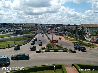
Minna is a city in Middle Belt Nigeria. It is the capital city of Niger State, one of Nigeria's 36 federal states. It consists of two major ethnic groups: the Gbagyi and the Nupe.

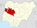
Niger is a state in the North Central region of Nigeria and the largest state in the country by area. Niger state has three political zones, zone A, B and C. The state's capital is at Minna. Other major cities are Bida, Kontagora and Suleja. It was formed in 1976 when the then North-Western State was divided into Niger State and Sokoto State. It is home to Ibrahim Babangida and Abdulsalami Abubakar, two of Nigeria's former military rulers. The Nupe, Gbagyi, Kamuku, Kambari, Gungawa, Hun-Saare, Hausa and Koro form the majority of numerous indigenous tribes of Niger State.

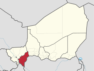
Dosso is one of the eight Regions of Niger. The region has an area of 31,002 square kilometres (11,970 sq mi), with a population of 2,078,339 as of 2011.

Asaba is the capital of Delta State, Nigeria. A rapidly growing city, it is located at the western bank of the Niger River, in the Oshimili South Local Government Area. Asaba had a population of 149,603 as at the 2006 census, and a fast growing metropolitan population of over half a million people.

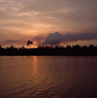
Bayelsa is a state in the South South region of Nigeria, located in the core of the Niger Delta. Bayelsa State was created in 1996 and was carved out from Rivers State, making it one of the newest states in the federation. The capital, Yenagoa, is susceptible to high risk of annual flooding. It shares a boundary with Rivers State to the east and Delta State to the north across the Niger River for 17 km and the Forçados River for 198 km, with the waters of the Atlantic Ocean dominating its southern borders. It has a total area of 10,773 square kilometres (4,159 sq mi). The state comprises eight local government areas: Ekeremor, Kolokuma/Opokuma, Yenagoa, Nembe, Ogbia, Sagbama, Brass and Southern Ijaw. The state is the smallest in Nigeria by population as of the 2006 census. Being in the Niger Delta, Bayelsa State has a riverine and estuarine setting, with bodies of water within the state preventing the development of significant road infrastructure.
Yenagoa is a Local Government Area and capital city of Bayelsa State, southern Nigeria. It is located at the southern part of the country at coordinates 4°55′29″N6°15′51″E.
Bida is a Local Government Area in Niger State, Nigeria and a city on the A124 highway which occupies most of the area.
Kaura Namoda is a Local Government Area in Zamfara State, Nigeria. Its headquarters is in the town of Kaura-Namoda, home to the Federal Polytechnic, Kaura-Namoda. It has an area of 868 km2 and a population of 281,367 at the 2006 census.
Kaltungo is one among the 11 Local Governments Area of Gombe State, Nigeria. Its headquarters is in the town of Kaltungo in the western part of the Local Government Area on the A345 highway at 9°48′51″N11°18′32″E.
Baure is a Local Government Area in Katsina State, Nigeria, sharing a border with the Republic of Niger. Its headquarters is located in the town of Baure in the northwest of the area at 12°50′10″N8°44′47″E.

Gurara is a Local Government Area in Niger State, Nigeria, adjoining the Federal Capital Territory. Its headquarters are in the town of Gawu. Major inhabitants are the Gwari people. The Gurara Waterfalls is found here.
Tafa is a Local Government Area in Niger State, Nigeria, adjoining the Federal Capital Territory. Its headquarters is in the town of Wuse.
Chanchaga is a Local Government Area in Niger State, Nigeria. Its headquarters is in the state capital of Minna which occupies much of the Local Government Area.
Paikoro Local Government is one of the 774 Local Government Areas of Nigeria and one of 25 Local Government areas in Niger-State Nigeria. Paikoro Local Government headquarter is located in Paiko town about 25 km south-east of the state capital Minna.
Mariga is a Local Government Area in Niger State, Nigeria. Its headquarters are in the town of Bangi in the north of the area. Other towns in the LGA are Igwama and Inkwai. Various endangered Kamuku languages are spoken in Mariga LGA.
Katcha is a local government area of Niger State, in central Nigeria. Its headquarters are in the town of Katcha. Badeggi is one of the major towns of the local government area, located on the A124 highway in the west of the area at 9°03′00″N6°09′00″E.
Yusufari is a Local Government Area in Yobe State, Nigeria. Its headquarters are in the town of Yusufari in the south-east of the area at 13°04′06″N11°10′33″E. It shares a border in the north with The Republic of Niger.
Sabon Birni is a Local Government Area in Sokoto State, Nigeria. Its headquarters are in the town of Sabon Birni.
Illela is a Local Government Area in Sokoto State, Nigeria. Its headquarters are in the town of Illela.

Federal University of Technology Minna (FUTMINNA) is a Federal Government owned University located in Minna, Nigeria.


