Mokwa

Last updated

Mokwa
LGA and town
Nigeria location map.svg
Red pog.svg
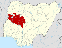
Mokwa
Location in Nigeria
Coordinates: 9°12′N5°20′E / 9.200°N 5.333°E / 9.200; 5.333
CountryFlag of Nigeria.svg  Nigeria
State Niger State
Council ChairmanFeb 11 2016
Government
  Local Government Chairman and the Head of the Local Government CouncilHon. Amb. Jibril Abdullahi Muregi
Area
  Total4,338 km2 (1,675 sq mi)
Population
 (2006 census)
  Total244,937
  Density56/km2 (150/sq mi)
Time zone UTC+1 (WAT)
3-digit postal code prefix
912
ISO 3166 code NG.NI.MO
Mokwa

Mokwa is a Local Government Area in Niger State, Nigeria. Its headquarters are in the town of Mokwa on the A1 highway in the west of the area.

Mokwa is a town in Niger state with an estimated population of 244,937 (2006). The long southern border of the LGA is formed by the Niger River from Lake Jebba in the west beyond the confluence of the Kaduna River in the east. Kwara State and Kogi State are across the Niger from the LGA. The A1 highway crosses the Niger at Gana to Jebba in Kwara State.

Mokwa is a Nupe kingdom led by the Ndalile (presently Lile Shaba Aliyu) and consisting of sub-districts such as Muwo, Bokani, Kudu, Kpaki, Jebba, Rabba, Ja'agi and others. The leadership style of Mokwa town is emirship, and the head of the town is addressed as Ndalile.[ citation needed ] It has an area of 4,338 km2 and a population of 244,937 at the 2006 census.

The postal code of the area is 912. [1]

Climate

The temperature in the region fluctuates year-round, ranging from 63°F to 98°F, with occasional dips below 57°F or above 103°F. [2] [3]

From February 3 to April 26, the hot season, with an average daily high temperature exceeding 95°F, lasts for 2.7 months. In Mokwa, April is the hottest month of the year, with an average high of 96°F and low of 77°F. [4] [3]

The 3.3-month cool season, which runs from July 1 to October 11, has an average daily maximum temperature of less than 87°F. With an average low of 64°F and high of 92°F, December is the coldest month of the year in Mokwa. [2] [4]

Related Research Articles

<span class="mw-page-title-main">Niger State</span> State of Nigeria

Niger is a state in the North Central region of Nigeria and the largest state in the country by area. Niger state has three political zones, zone A, B and C. The state's capital is at Minna. Other major cities are Bida, Kontagora and Suleja. It was formed in 1976 when the then North-Western State was divided into Niger State and Sokoto State. It is home to Ibrahim Babangida and Abdulsalami Abubakar, two of Nigeria's former military rulers. The Nupe, Gbagyi, Kamuku, Kambari, Gungawa, Hun-Saare, Hausa and Koro form the majority of numerous indigenous tribes of Niger State.

Yenagoa is a Local Government Area and capital city of Bayelsa State, southern Nigeria. It is located at the southern part of the country at coordinates 4°55′29″N6°15′51″E.

<span class="mw-page-title-main">Pategi</span> Town and LGA in Kwara State, Nigeria

Pategi or Patigi is a town and local government in Kwara State, Nigeria with the headquarters located at the town. The town is the headquarters of Pategi Emirate. It is inhabited by the Nupe people who speak the Nupe language. They are farmers, aquatic sellers/fishers and traders. They are known to be governed by a monarch.

Bida is a Local Government Area in Niger State, Nigeria and a city on the A124 highway which occupies most of the area.

<span class="mw-page-title-main">Gboko</span> LGA in Benue state

Gboko is a Local Government Area in Benue state, North-central Nigeria. It is headquartered in the town of Gboko.

Agaie is a Local Government Area in Niger State, Nigeria. Its headquarters are in the town of Agaie on the A124 highway.

Ankpa is a Local Government Area in Kogi State, Nigeria. Its headquarters are in the town of Ankpa on the A233 highway in the west of the area at7°22′14″N7°37′31″E.

Demsa is a Local Government Area of Adamawa State, Nigeria with headquarters located in Demsa. Demsa lies on the Benue River.

<span class="mw-page-title-main">Kaiama</span> LGA and town in Kwara State, Nigeria

Kaiama is a Local Government Area and town in northwestern Kwara State, Nigeria. Its headquarters are in the town of Kaiama.

Birnin Gwari is a Local Government Area in Kaduna State, Nigeria. Its headquarters are in the town of Birnin Gwari.

Lapai is a Local Government Area in Niger State, Nigeria, adjoining the Federal Capital Territory. Its headquarters are in the town of Lapai on the A124 highway in the west of the area at 9°03′00″N6°34′00″E.

Chanchaga is a Local Government Area in Niger State, Nigeria. Its headquarters is in the state capital of Minna which occupies much of the Local Government Area.

Paikoro Local Government is one of the 774 Local Government Areas of Nigeria and one of 25 Local Government areas in Niger-State Nigeria. Paikoro Local Government headquarter is located in Paiko town about 25 km south-east of the state capital Minna.

Wushishi is a Local Government Area in Niger State, Nigeria. Its headquarters is in the town of Wushishi.

Agwara is a Local Government Area in Niger State, Nigeria. Its headquarters are in the town of Agwara.

Rijau is a Local Government Area in Niger State, Nigeria. Its headquarters are in the town of Rijau.

Mashegu is a Local Government Area in Niger State, Nigeria. Its headquarters are in the town of Mashegu in the east of the area. Mashegu is bounded by the Niger River in the west and the Kaduna River in the northeast.

Katcha is a local government area of Niger State, in central Nigeria. Its headquarters are in the town of Katcha. Badeggi is one of the major towns of the local government area, located on the A124 highway in the west of the area at 9°03′00″N6°09′00″E.

Machina is a Local Government Area in Yobe State, Nigeria. Its headquarters are in the town of Machina at 13°08′11″N10°02′57″E. It shares a border in the north with The Republic of Niger.

Jakusko is a Local Government Area in Yobe State, Nigeria. Its headquarters are in the town of Jakusko in the west of the area at 12°22′09″N10°46′23″E.

References

  1. "Post Offices- with map of LGA". NIPOST. Archived from the original on 2012-11-26. Retrieved 2009-10-20.
  2. 1 2 "Mokwa Climate, Weather By Month, Average Temperature (Nigeria) - Weather Spark". weatherspark.com. Retrieved 2023-09-10.
  3. 1 2 Atlas, Weather. "Yearly & Monthly weather - Mokwa, Nigeria". Weather Atlas. Retrieved 2023-09-10.
  4. 1 2 "Simulated historical climate & weather data for Mokwa". meteoblue. Retrieved 2023-09-27.