Mariga headquarter Bangi | |
|---|---|
LGA and town | |
 Interactive map of Mariga | |
 Mariga Location in Nigeria | |
| Coordinates: 10°42′N5°50′E / 10.700°N 5.833°E | |
| Country | |
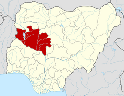
| State | Niger State |
| Government | |
| • Local Government Chairman and the Head of the Local Government Council | Hon. Abbas Adamu Kasuwan Garba |
| Area | |
• Total | 5,552 km2 (2,144 sq mi) |
| Population (2006 census) | |
• Total | 199,430 |
| Time zone | UTC+1 (WAT) |
| 3-digit postal code prefix | 922 |
| ISO 3166 code | NG.NI.MR |
Mariga is a Local Government Area in Niger State, Nigeria. Its headquarters are in the town of Bangi in the north of the area. Other towns in the LGA are Igwama and Inkwai. Various endangered Kamuku languages are spoken in Mariga LGA. [1]
Contents
It has an area of 5,552 km2 and a population of 199,430 at the 2006 census. Mariga is the commercial nerve center of northern part of Niger State and is the second largest Local Government in the state.
Mariga's economy is primarily based on agriculture and Trade. Agriculture mainly consists of maize, groundnuts and guinea corn production. Mariga is a market town for the surrounding area, and is home to traders specializing in the buying and selling of cattle, as well as major crop exporters.