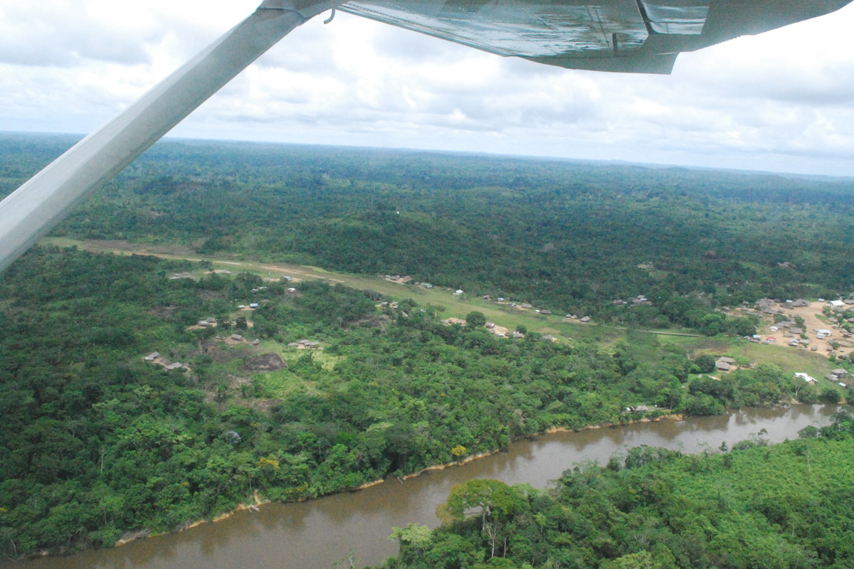
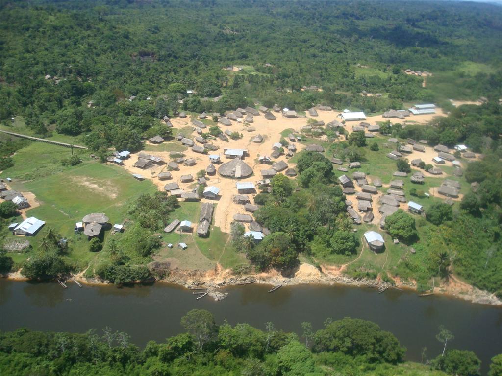
Kwamalasamutu, also Kwamalasamoetoe, is a Tiriyó Amerindian village in the Sipaliwini District of Suriname, and home to the granman of the northern Trios. Kwamalasamutu is the biggest village of the Tiriyó tribe and is located near the disputed border with Guyana.

Blue Wing Airlines n.v. is an airline with its head office on the grounds of Zorg en Hoop Airport in Paramaribo, Suriname. The airline started operations in January 2002 and operates charter and scheduled services from Paramaribo to destinations in the interior of Suriname, Guyana, Brazil, Venezuela and the Caribbean area. Its main base is Zorg en Hoop Airport. The airline is on the list of air carriers banned in the EU for safety violations. They were temporarily removed from the list on 28 November 2007 after implementing a corrective action plan ordered by the EU Transportation Commission. However, on 6 July 2010, the airline was banned again from European and French territory airspace as a result of three accidents involving Blue Wing Airlines: one on 3 April 2008 with 19 fatalities, another accident on 15 October 2009 that led to four unspecified injuries, and a third incident on 15 May 2010 with 8 fatalities. As of 2023, Blue Wing Airlines was banned from operating within the European Union.
Vier Gebroeders Airstrip, also known as Meyers' airstrip or Mamija airstrip, is and airport near Vier Gebroeders, Suriname. The runway is on the border with Brazil.
Tepoe Airstrip is an airstrip serving Pelelu Tepu, Suriname. The runway extends southwest from the village.
Rudi Kappel Airstrip is located 9 kilometres (5.6 mi) south of the Tafelberg tepui in Suriname. It was constructed as part of Operation Grasshopper. It used to be named Tafelberg Airstrip, but was renamed Rudi Kappel Airstrip, after the co-pilot of a flight that crashed near Vincent Fayks Airport on 6 October 1959.
Afobaka Airstrip is an airstrip near Afobaka, a village in the Brokopondo District of Suriname. The airstrip is primarily used for emergency evacuation and gold shipment. It is 5 kilometres (3.1 mi) from the campsite of the Gross Rosebel gold mine, which has its own airstrip.
Albina Airstrip is an airport serving Albina, the capital of the Marowijne District of Suriname. It is one of the oldest airports in Suriname, in use since 1953, when the Piper Cub (PZ-NAC) of Kappel-van Eyck named "Colibri" landed there from Zorg en Hoop Airport.
Bakhuys Airstrip is an airstrip near the village of Bakhuys and the Bakhuys Mountains in Suriname. There is rising terrain to the south.

Cayana Airstrip is an airstrip serving the villages around Kajana in the Sipaliwini District of Suriname. The runway is just west of Kajana, across the Suriname River.
Donderskamp Airstrip is an airstrip near Donderskamp, Suriname.
Käyser Airstrip, also Käyser Jan Gouka Airstrip is near the Käyser Mountains range in Sipaliwini District, Suriname. It was constructed as part of Operation Grasshopper and has one long grass runway. Fishing and wildlife tours are prime users of the airstrip.

Laduani Airstrip, is an airport serving Aurora, Suriname.
Lawa Anapaike Airstrip is an airstrip serving the Wayana village of Kawemhakan on the Lawa River in Suriname. The airstrip of this relatively modern indigenous village is named after its former chief Anapaike.
Lawa Antino Airstrip is an airstrip serving the gold mining concessions near the town of Benzdorp in Suriname. The runway is 9 kilometres (5.6 mi) southwest of the town.

Lawa Cottica Airstrip, is an airstrip serving Cottica, Suriname. Cottica is on the Lawa River, which forms part of the eastern border of Suriname.
Poesoegroenoe Airstrip serves the village of Poesoegroenoe, in the Sipaliwini District of Suriname.
Sipaliwini Airstrip is an airstrip located near the village of Sipaliwini Savanna, in the most southern part of Suriname in the Sipaliwini District. It was constructed as part of Operation Grasshopper and the runway of the airstrip was publicly opened in 1962.

Coeroeni is a resort in Suriname, located in the Sipaliwini District. Its population at the 2012 census was 1,046. The resort is mainly inhabited by indigenous people of the Tiriyó tribe. Kwamalasamutu is the main village of the resort and home to the granman Asongo Alalaparu.
Caricom Airways, which stands for Caribbean Commuter Airways, was a regional airline from the Caribbean, with the headquarters of the company at Paramaribo, Suriname. From the down-town Zorg en Hoop Airport in Suriname, Caricom Airways mainly flew charter flights to various destinations in the interior of Suriname, the Caribbean and Northern Brazil.
