Ain is a French department in the Auvergne-Rhône-Alpes region, Eastern France. Named after the Ain river, it is bordered by the Saône and Rhône rivers. Ain is located on the country's eastern edge, on the Swiss border, where it neighbours the cantons of Geneva and Vaud. In 2019, it had a population of 652,432.

Ambérieux-en-Dombes is a commune in the department of Ain in the Auvergne-Rhône-Alpes region of eastern France.
Ars-sur-Formans is a commune in the Ain department in the Auvergne-Rhône-Alpes region of eastern France.

Baneins is a commune in the Ain department in the Auvergne-Rhône-Alpes region of eastern France.

Birieux is a commune in the Ain department in eastern France.

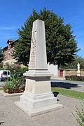
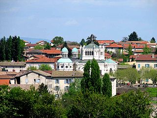
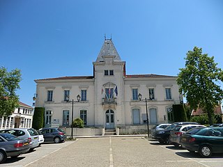
Châtillon-sur-Chalaronne is a commune in the Ain department in eastern France.

Romans is a commune in the Ain department in eastern France.

Saint-Didier-sur-Chalaronne is a commune in the Ain department in eastern France.

Saint-Étienne-sur-Chalaronne is a commune in the Ain department in eastern France.

Thoissey is a commune in the Ain department in eastern France.
Villars-les-Dombes is a commune in the Ain department in eastern France. Its people are known as Villardois.

The arrondissement of Bourg-en-Bresse is an arrondissement of France in the Ain department in the Auvergne-Rhône-Alpes region. It has 199 communes. Its population is 331,400 (2016), and its area is 2,873.7 km2 (1,109.5 sq mi).

Astaillac is a commune in the Corrèze department in the Nouvelle-Aquitaine region of central France.
Aisey-sur-Seine is a commune in the Côte-d'Or department in the Bourgogne-Franche-Comté region of eastern France.

Barbirey-sur-Ouche is a commune in the Côte-d'Or department in the Bourgogne-Franche-Comté region of eastern France.
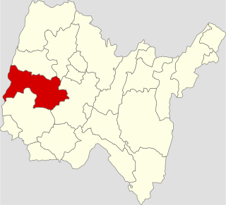
The canton of Châtillon-sur-Chalaronne is an administrative division in eastern France. At the French canton reorganisation which came into effect in March 2015, the canton was expanded from 16 to 26 communes:
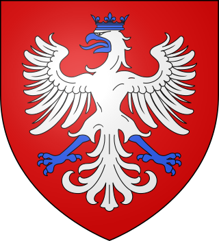
The House of Coligny was the name of an old and important French noble family, originating from the Bresse region of France. The head of the family held the title Duke of Châtillon, created in 1643. Their bloodline ended in 1694.
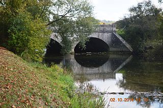
The Chalaronne is a 52 km (32 mi) long river in the Ain department in eastern France. Its source is at Lapeyrouse, in the Dombes. It flows generally northwest. It is a left tributary of the Saône, into which it flows between Saint-Didier-sur-Chalaronne and Thoissey.

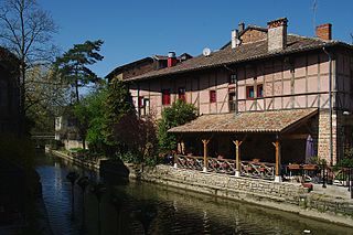
The Château de Châtillon-sur-Chalaronne is a ruined castle in the commune of Châtillon-sur-Chalaronne in the Ain département of France.

Marlieux—Châtillon station is a French railway station located in the commune of Marlieux, Ain department in the Auvergne-Rhône-Alpes region. As its name suggests the station is located within proximity of, and serves the nearby commune of Châtillon-sur-Chalaronne. It is located at kilometric point (KP) 45.760 on the Lyon–Bourg-en-Bresse railway, between the stations of Villars-les-Dombes and Saint-Paul-de-Varax.