
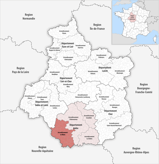
Indre ; is a department in central France named after the river Indre. The inhabitants of the department are known as the Indriens and Indriennes. Indre is part of the current administrative region of Centre-Val de Loire. The region is bordered by the departments of Indre-et-Loire to the west, Loir-et-Cher to the north, Cher to the east, Creuse, and Haute-Vienne to the south, and Vienne to the southwest. The préfecture (capital) is Châteauroux and there are three subpréfectures at Le Blanc, La Châtre and Issoudun. It had a population of 219,316 in 2019.

Nohant-Vic is a commune in the Indre department in central France.
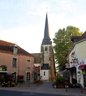
Issoudun is a commune in the Indre department, administrative region of Centre-Val de Loire, France. It is also referred to as Issoundun, which is the ancient name.

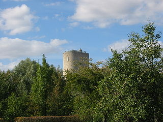
La Châtre is a commune in the Indre department in central France.

The 4 arrondissements of the Indre department are:
- Arrondissement of Le Blanc, with 57 communes. The population of the arrondissement was 31,714 in 2016.
- Arrondissement of Châteauroux, with 84 communes. The population of the arrondissement was 129,106 in 2016.
- Arrondissement of La Châtre, with 51 communes. The population of the arrondissement was 28,433 in 2016.
- Arrondissement of Issoudun, with 49 communes. The population of the arrondissement was 34,252 in 2016.
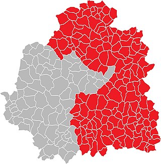
The arrondissement of Le Blanc is an arrondissement of France in the Indre department in the Centre-Val de Loire region. It has 57 communes. Its population is 31,714 (2016), and its area is 1,782.3 km2 (688.1 sq mi).
The arrondissement of Châteauroux is a district (arrondissement) of France in the Indre department in the administrative region of Centre-Val de Loire. It has 84 communes. Its population is 129,106 (2016), and its area is 2,621.9 km2 (1,012.3 sq mi).

The arrondissement of La Châtre is an arrondissement of France in the Indre department in the Centre-Val de Loire region. It has 51 communes. Its population is 28,433 (2016), and its area is 1,204.2 km2 (464.9 sq mi).

Châtres is a commune in the Seine-et-Marne department in the Île-de-France region in north-central France.
The Canton of Saint-Benoît-du-Sault is a French former administrative subdivision, situated in the Indre département and the Centre région. It had 5,139 inhabitants (2012). It was disbanded following the French canton reorganisation which came into effect in March 2015. It consisted of 14 communes, which joined the canton of Saint-Gaultier in 2015.
Lourdoueix-Saint-Pierre is a commune in the Creuse department in the Nouvelle-Aquitaine region in central France.
Saint-Vincent-la-Châtre is a commune in the Deux-Sèvres department in western France.
Châtres is a commune in the Dordogne department in Nouvelle-Aquitaine in southwestern France.
La Ville-aux-Dames is a commune in the Indre-et-Loire department in central France.

Brizay is a commune in the Indre-et-Loire department in central France.
Châtres-sur-Cher is a commune in the Loir-et-Cher department, central France.

Ruffec is a commune in the Indre department in central France.
The canton of La Châtre is an administrative division of the Indre department, central France. Its borders were modified at the French canton reorganisation which came into effect in March 2015. Its seat is in La Châtre.
The canton of Saint-Gaultier is an administrative division of the Indre department, central France. Its borders were modified at the French canton reorganisation which came into effect in March 2015. Its seat is in Saint-Gaultier.
The 2nd constituency of Indre is a French legislative constituency in the Indre département.


