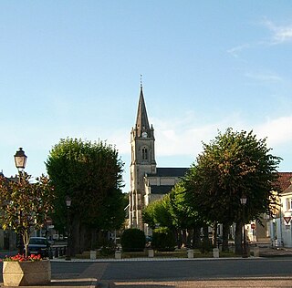
Yzeures-sur-Creuse is a commune in the department of Indre-et-Loire, Centre-Val de Loire, France.
Saint-Junien-la-Bregère is a commune in the Creuse department in central France.
Saint-Priest-la-Marche is a commune in the Cher department in the Centre-Val de Loire region of France.
Basville is a commune in the Creuse department in the Nouvelle-Aquitaine region in central France.

Budelière is a commune in the Creuse department in the Nouvelle-Aquitaine region in central France.
La Chapelle-Saint-Martial is a commune in the Creuse department in the Nouvelle-Aquitaine region in central France.
Clairavaux is a commune in the Creuse department in the Nouvelle-Aquitaine region in central France.

La Courtine is a commune in the Creuse department in the Nouvelle-Aquitaine region in central France.

Lavaufranche is a commune in the Creuse department in the Nouvelle-Aquitaine region in central France.
Saint-Julien-la-Genête is a commune in the Creuse department in central France.
Saint-Merd-la-Breuille is a commune in the Creuse department, in the Nouvelle-Aquitaine region, France.

Saint-Priest-la-Feuille is a commune in the Creuse department in central France.
Saint-Priest-la-Plaine is a commune in the Creuse department in central France.

Saint-Silvain-Bas-le-Roc is a commune in the Creuse department in central France.

Tournon-Saint-Martin is a commune in the Indre department in central France.

Ciron is a commune in the Indre department in central France. It is notable for its twelfth-century lanterne des morts, Eglise Saint-Georges, and the chateau Romefort by the picturesque river Creuse. An abandoned railroad goes through the village south of national route D951, which bisects the village.
The Canton of Felletin is a canton situated in the Creuse département and in the Nouvelle-Aquitaine region of central France.
The Canton of Gentioux-Pigerolles is a former canton situated in the Creuse département and in the Limousin region of central France. It was disbanded following the French canton reorganisation which came into effect in March 2015. It consisted of seven communes, which joined the canton of Felletin in 2015. It had 1,458 inhabitants (2012).
The communauté de communes du Plateau de Gentioux was created on December 15, 1992 and is located in the Creuse and Corrèze departements of the Limousin region of central France. It was created in January 1993. It was merged into the new Communauté de communes Creuse Grand Sud in January 2014.
The Communauté de communes Creuse Grand Sud is a communauté de communes, an intercommunal structure, in the Creuse department, in the Nouvelle-Aquitaine region, central France. It was created in January 2014 by the merger of the former communautés de communes Aubusson-Felletin and Plateau de Gentioux. Its area is 612.6 km2, and its population was 11,915 in 2018. Its seat is in Aubusson.


