Vidaillat

Last updated

Vidaillat
Location of Vidaillat
Vidaillat
France location map-Regions and departements-2016.svg
Red pog.svg
Vidaillat
Aquitaine-Limousin-Poitou-Charentes region location map.svg
Red pog.svg
Vidaillat
Coordinates: 45°57′32″N1°54′28″E / 45.9589°N 1.9078°E / 45.9589; 1.9078
Country France
Region Nouvelle-Aquitaine
Department Creuse
Arrondissement Guéret
Canton Ahun
Intercommunality CC Creuse Sud Ouest
Government
  Mayor (20202026) Martine Laporte [1]
Area
1
23.59 km2 (9.11 sq mi)
Population
 (2021) [2]
195
  Density8.3/km2 (21/sq mi)
Time zone UTC+01:00 (CET)
  Summer (DST) UTC+02:00 (CEST)
INSEE/Postal code
23260 /23250
Elevation444–760 m (1,457–2,493 ft)
(avg. 500 m or 1,600 ft)
1 French Land Register data, which excludes lakes, ponds, glaciers > 1 km2 (0.386 sq mi or 247 acres) and river estuaries.

Vidaillat (French pronunciation: [vidaja] ; Occitan : Vidalhac) is a commune in the Creuse department in the Nouvelle-Aquitaine region in central France.

Contents

Geography

A forestry and farming area comprising the village and several hamlets situated in the valley of the Thaurion river, some 15 miles (24 km) south of Guéret at the junction of the D34, D36 and the D45 roads.

Population

Historical population
YearPop.±%
1962278    
1968305+9.7%
1975225−26.2%
1982223−0.9%
1990183−17.9%
1999162−11.5%
2008170+4.9%

Sights

See also

Related Research Articles

<span class="mw-page-title-main">Arrondissement of Guéret</span> Arrondissement in Nouvelle-Aquitaine, France

The arrondissement of Guéret is an arrondissement of France in the Creuse department in the Nouvelle-Aquitaine region. It has 127 communes. Its population is 74,822 (2016), and its area is 2,736.7 km2 (1,056.6 sq mi).
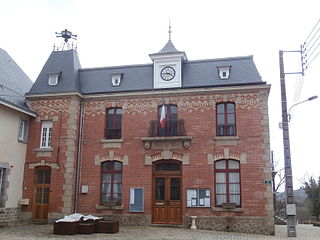
<span class="mw-page-title-main">Bussière-Dunoise</span> Commune in Nouvelle-Aquitaine, France

Bussière-Dunoise is a commune in the Creuse department in the Nouvelle-Aquitaine region in central France.

Domeyrot is a commune in the Creuse department in the Nouvelle-Aquitaine region in central France.

Gartempe is a commune in the Creuse department in the Nouvelle-Aquitaine region in central France.

<span class="mw-page-title-main">Lussat, Creuse</span> Commune in Nouvelle-Aquitaine, France

Lussat is a commune in the Creuse department in the Nouvelle-Aquitaine region in central France.

Nouzerolles is a commune in the Creuse department in the Nouvelle-Aquitaine region in central France.

Saint-Éloi is a commune in the Creuse department in central France.

Saint-Laurent is a commune in the Creuse department in central France.

<span class="mw-page-title-main">Saint-Loup, Creuse</span> Commune in Nouvelle-Aquitaine, France

Saint-Loup is a commune in the Creuse department in central France.

Saint-Maixant is a commune in the Creuse department in central France.

<span class="mw-page-title-main">Saint-Sébastien, Creuse</span> Commune in Nouvelle-Aquitaine, France

Saint-Sébastien is a commune in the Creuse department in central France.

<span class="mw-page-title-main">Saint-Silvain-Bas-le-Roc</span> Commune in Nouvelle-Aquitaine, France

Saint-Silvain-Bas-le-Roc is a commune in the Creuse department in central France.

<span class="mw-page-title-main">Villard, Creuse</span> Commune in Nouvelle-Aquitaine, France

Villard is a commune in the Creuse department in the Nouvelle-Aquitaine region in central France.

Saint-Priest is a commune in the Creuse department in central France.
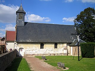
<span class="mw-page-title-main">Creuse, Somme</span> Commune in Hauts-de-France, France

Creuse is a commune in the Somme department in Hauts-de-France in northern France.

<span class="mw-page-title-main">Néons-sur-Creuse</span> Commune in Centre-Val de Loire, France

Néons-sur-Creuse is a commune in the Indre department in central France.

<span class="mw-page-title-main">Ciron, Indre</span> Commune in Centre-Val de Loire, France

Ciron is a commune in the Indre department in central France. It is notable for its twelfth-century lanterne des morts, Eglise Saint-Georges, and the chateau Romefort by the picturesque river Creuse. An abandoned railroad goes through the village south of national route D951, which bisects the village.

The Canton of Ahun is a canton situated in the Creuse département and in the Nouvelle-Aquitaine region of central France.

The communauté de communes C.I.A.T.E. du Pays Creuse-Thaurion-Gartempe was located in the Creuse département of the Limousin region of central France. It was created in January 1994. It was merged into the new Communauté de communes Creuse Sud Ouest in January 2017.

The Communauté de communes Creuse Sud Ouest is a communauté de communes, an intercommunal structure, in the Creuse department, in the Nouvelle-Aquitaine region, central France. It was created in January 2017 by the merger of the former communautés de communes CIATE du Pays Creuse-Thaurion-Gartempe and Bourganeuf et Royère-de-Vassivière. Its area is 908.6 km2, and its population was 13,563 in 2018. Its seat is in Saint-Dizier-Masbaraud.

References

  1. "Répertoire national des élus: les maires" (in French). data.gouv.fr, Plateforme ouverte des données publiques françaises. 13 September 2022.
  2. "Populations légales 2021" (in French). The National Institute of Statistics and Economic Studies. 28 December 2023.