Lacave, Lot

Last updated

Lacave
Lacave-Chateau Belcastel.jpg
The chateau in Lacave
Location of Lacave
Lacave, Lot
France location map-Regions and departements-2016.svg
Red pog.svg
Lacave
Languedoc-Roussillon-Midi-Pyrenees region location map.svg
Red pog.svg
Lacave
Coordinates: 44°50′43″N1°33′32″E / 44.8453°N 1.5589°E / 44.8453; 1.5589
Country France
Region Occitania
Department Lot
Arrondissement Gourdon
Canton Souillac
Intercommunality Causses et Vallée de la Dordogne
Government
  Mayor (20202026) Stéphane Chambon [1]
Area
1
21.19 km2 (8.18 sq mi)
Population
 (2021) [2]
257
  Density12/km2 (31/sq mi)
Time zone UTC+01:00 (CET)
  Summer (DST) UTC+02:00 (CEST)
INSEE/Postal code
46144 /46200
Elevation80–349 m (262–1,145 ft)
(avg. 100 m or 330 ft)
1 French Land Register data, which excludes lakes, ponds, glaciers > 1 km2 (0.386 sq mi or 247 acres) and river estuaries.

Lacave (French pronunciation: [lakav] ; Occitan : La Cava) is a commune of France, situated in the North-West of the Lot department, within the Occitanie region.

Contents

Geography

Situated in the foothills of the "Causse de Gramat" at the confluence of the Dordogne and the Ouysse, 12 km from Souillac and 8 km from Rocamadour.

History

Inhabited since the time of the Solutrean and Magdalenian cultures of the Paleolithic era.

Administration

List of mayors
PeriodName
1989–2020André Lestrade
2020–incumbentStéphane Chambon

Population

At the start of the 20th century, Lacave had 519 inhabitants "with just 27 concentrated in the main town". [3]

Historical population
YearPop.±% p.a.
1793 557    
1821 647+0.54%
1846 647+0.00%
1872 565−0.52%
1901 553−0.07%
1926 385−1.44%
1946 324−0.86%
1962 320−0.08%
YearPop.±% p.a.
1968 302−0.96%
1975 270−1.59%
1982 249−1.15%
1990 241−0.41%
1999 293+2.19%
2009 284−0.31%
2014 280−0.28%
2020 249−1.94%
Source: EHESS [4] and INSEE (1968–2020) [5]

See also

Related Research Articles

<span class="mw-page-title-main">Dordogne</span> Department of France in Nouvelle-Aquitaine

Dordogne is a large rural department in south west France, with its prefecture in Périgueux. Located in the Nouvelle-Aquitaine region roughly half-way between the Loire Valley and the Pyrenees, it is named after the river Dordogne, which runs through it. It corresponds roughly to the ancient county of Périgord. In January 2023, Dordogne had a population of 412,807.

<span class="mw-page-title-main">Tarn-et-Garonne</span> Department of France

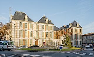
Tarn-et-Garonne is a department in the Occitania region in Southern France. It is traversed by the rivers Tarn and Garonne, from which it takes its name. The area was originally part of the former provinces of Quercy and Languedoc. The department was created in 1808 under Napoleon, with territory taken from the neighbouring Lot, Haute-Garonne, Lot-et-Garonne, Gers and Aveyron departments.

<span class="mw-page-title-main">Fresnes, Val-de-Marne</span> Commune in Île-de-France, France

Fresnes is a commune in the Val-de-Marne department in the southern suburbs of Paris, France. It is located 11.2 km (7.0 mi) from the center of Paris, next to Antony, Sceaux and Rungis. It is drained by the River Bièvre.

<span class="mw-page-title-main">Arrondissement of Gourdon</span> Arrondissement in Occitania, France

The arrondissement of Gourdon is an arrondissement of France in the Lot department in the Occitanie region. It has 97 communes. Its population is 46,838 (2016), and its area is 1,762.3 km2 (680.4 sq mi).

<span class="mw-page-title-main">Carennac</span> Commune in Occitania, France

Carennac is a commune in the Lot department in south-western France in the historical region of Quercy.

<span class="mw-page-title-main">Goujounac</span> Commune in Occitania, France

Goujounac is a commune in the Lot department in south-western France.

<span class="mw-page-title-main">Fontaine-lès-Hermans</span> Commune in Hauts-de-France, France

Fontaine-lès-Hermans is a commune in the Pas-de-Calais department in the Hauts-de-France region of France.

<span class="mw-page-title-main">Ligny-lès-Aire</span> Commune in Hauts-de-France, France

Ligny-lès-Aire is a commune in the Pas-de-Calais department in the Hauts-de-France region of France.

<span class="mw-page-title-main">Maisnil-lès-Ruitz</span> Commune in Hauts-de-France, France

Maisnil-lès-Ruitz is a commune in the Pas-de-Calais department in the Hauts-de-France region of France.

<span class="mw-page-title-main">Noyelles-lès-Vermelles</span> Commune in Hauts-de-France, France

Noyelles-lès-Vermelles is a commune in the Pas-de-Calais department in the Hauts-de-France region of France.

<span class="mw-page-title-main">Westrehem</span> Commune in Hauts-de-France, France

Westrehem is a commune in the Pas-de-Calais department in the Hauts-de-France region of France.

<span class="mw-page-title-main">Souillac, Lot</span> Commune in Occitania, France

Souillac is a commune in the Lot department in south-western France, on the river Dordogne. It is the site of the Brive–Souillac Airport, which opened in 2010. The town hosts an annual jazz festival in July. The abbey church has famous Romanesque carvings.

La Bastide-du-Salat is a commune in the Ariège department in the Occitanie region of south-western France.

Lacave is a commune in the Ariège department in southwestern France.

<span class="mw-page-title-main">Montvalent</span> Commune in Occitania, France

Montvalent is a commune in the Lot department in south-western France.

Lugagnac is a commune in south-western France. Lugagnac is situated in the Lot department, Occitanie region 24 kilometres from Cahors, the department capital. The commune is 497 kilometres from Paris, France.

<span class="mw-page-title-main">Martel, Lot</span> Commune in Occitania, France

Martel is a commune in the Lot department in southwestern France. It is a small medieval town in a region well known for its walnuts and truffles.

Calleville-les-Deux-Églises is a commune in the Seine-Maritime department in the Normandy region in north-western France.

<span class="mw-page-title-main">Astaffort</span> Place in Nouvelle-Aquitaine, France

Astaffort is a commune in the Lot-et-Garonne department in southwestern France. It is situated on the river Gers, about 15 km south of Agen. Astaffort has a mill and the church of Sainte-Geneviève.

The canton of Souillac is an administrative division of the Lot department, southern France. Its borders were modified at the French canton reorganisation which came into effect in March 2015. Its seat is in Souillac.

References

  1. "Répertoire national des élus: les maires" (in French). data.gouv.fr, Plateforme ouverte des données publiques françaises. 13 September 2022.
  2. "Populations légales 2021". The National Institute of Statistics and Economic Studies. 28 December 2023.
  3. Le Lot chapter Souillac et Lacave p.223 - Armand Viré - Réédition de l'ouvrage de 1907 - ISBN   2-7455-0049-X
  4. Des villages de Cassini aux communes d'aujourd'hui: Commune data sheet Lacave, EHESS (in French).
  5. Population en historique depuis 1968, INSEE