Laguna Vilama

Last updated
Laguna Vilama
Llama voladora, Laguna Vilama, Jujuy, Argentina - panoramio.jpg
Relief Map of Argentina.jpg
Red pog.svg
Laguna Vilama
Location in Argentina
Location Jujuy Province
Coordinates 22°35′S66°55′W / 22.583°S 66.917°W / -22.583; -66.917 [1]
Type Salt lake
Basin  countriesArgentina
Surface area4,590 ha (11,300 acres)
Average depth0.2 m (7.9 in)
Surface elevation4,650 metres (15,260 ft) [1]

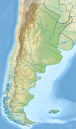
Laguna Vilama is a salt lake in northwestern Argentina, within the Vilama caldera. It is shallow and covers a surface area of 4,590 hectares (11,300 acres).

Contents

Lake

Laguna Vilama lies in the Jujuy Province of Argentina, close to the Sur Lípez Province of Bolivia and to the tripoint with Chile, Cerro Zapaleri. [2] Mountains in the region include the Cerro Tinte, [3] Zapaleri and other peaks of the Serranía de Dulcenombre. On the eastern shore of the lake lie abandoned tin mines; other resources of partly volcanic origin are basalt and gold [4] and the salt ulexite which was obtained from the Pirquitas mine on the shore of Laguna Vilama. [5]

This lake belongs to a group of remote Andean lakes that formed during the Tertiary. These lakes lie at elevations of 4,200–6,000 metres (13,800–19,700 ft) and are characterized by extreme environmental conditions, including high amounts of heavy metals such as arsenic, high salinity, high UV radiation, high daily temperature fluctuations and low availability of nutrients. The UV radiation is especially problematic for lifeforms inhabiting the lakes and acts as a mutagen, damaging cellular DNA. [6] Lakes in the neighbourhood of Laguna Vilama include Laguna Coruto to the northwest across the border with Bolivia and Laguna Palar to the southeast, [3] and there are more waterbodies east of Vilama. [7]

Laguna Vilama lies at 4,650 metres (15,260 ft) elevation in the Puna of Argentina and has a surface area of 4,590 hectares (11,300 acres) and an average depth of 0.2 metres (7.9 in). [1] It is one of the largest lakes in the Puna [8] and developed within the southern moat of the Vilama caldera; the volcano draws its name from the lake. [9] The waters of the lake are extremely clear and have a low chlorophyll content owing to a lack of nutrients. However, they are also rich in arsenic and extremely saline [1] with sodium chloride being the predominant salt. [10] A hot spring is found at its shores. [11]

Climate and environment

The climate of the region is dry with precipitation of less than 150 millimetres per year (5.9 in/year) and cold with mean temperature of 2 °C (36 °F); [2] temperatures can reach 20 °C (68 °F) during the day and drop to −40 °C (−40 °F) during the night. [1] Precipitation mostly originates from the South American Monsoon. [12]

Laguna Vilama and some neighbouring lakes have been classified as Ramsar sites in 2000. [8] The environment around these lakes is called "Desert Puna" or "Salt Puna" and is uninhabited owing to its dry climate. [2] Vegetation includes ferns [13] and grasses in part associated with wetlands such as Festuca , Oxychloe andina , Parastrephia and Werneria pygmaea as well as Polylepis and Yareta . At Laguna Vilama and other lakes birds like Andean geese, Darwin's rhea, ducks and flamingos can be observed, mammals in the region include chinchillas, vicuñas and vizcachas. [4]

Microbial mats have been observed at Laguna Vilama. [14] [15] Diatoms can be found in the lake waters, and the diatom species Staurophora vilamae , [16] the bacterial species Halomonas vilamensis [17] and Halopeptonella vilamensis - now known as Spiribacter vilamensis - [18] were first discovered in Laguna Vilama. [19]

The environment around these lakes has remained stable over the last three millennia, [2] but since the 1970s a trend towards a drier climate has been observed, accompanied by a shrinkage of the lake. [20]

Human use

Despite the dry climate, animals, minerals and wetlands have drawn humans to the region. [2] The grasses and herbs are used by inhabitants of the towns of Cusi Cusi in Argentina and Quetena in Bolivia as pasture, birds are used for their eggs and feathers in e.g. religious ceremonies and larger mammals are hunted. [4] In addition, mining took place. [21]

Archeological sites are found, including chullpas, [21] the site Chillagua Grande close to the southern margin of Laguna Vilama. There, enclosures and formerly roofed buildings were identified, [22] which were later used as refuge for pastoralists and travellers. [23] On the eastern shore lies Isla Vilama directly on the shores of the lake; this site features a number of lithic tools and appears to have been used by flamingo hunters. [24]

Related Research Articles

<span class="mw-page-title-main">Peinado</span> Mountain in Argentina

Peinado is a stratovolcano in Catamarca Province, Argentina. It consists of a volcanic cone with a summit crater, surrounded at its foot by lava flows erupted from flank vents. It began erupting about 100,000 years ago, with the last eruption about 36,800 years ago. Future eruptions are possible.

<span class="mw-page-title-main">Argentine Northwest</span>

The Argentine Northwest is a geographic and historical region of Argentina composed of the provinces of Catamarca, Jujuy, La Rioja, Salta, Santiago del Estero and Tucumán.

<span class="mw-page-title-main">Galán</span> Mountain in Argentina

Cerro Galán is a caldera in the Catamarca Province of Argentina. It is one of the largest exposed calderas in the world and forms part of the Central Volcanic Zone of the Andes, one of the three volcanic belts found in South America. One of several major caldera systems in the Central Volcanic Zone, the mountain is grouped into the Altiplano–Puna volcanic complex.

<span class="mw-page-title-main">Salar de Atacama</span> Salt flat in Chile

Salar de Atacama, located 55 km (34 mi) south of San Pedro de Atacama, is the largest salt flat in Chile. It is surrounded by mountains and lacks drainage outlets. To the east, it is enclosed by the main chain of the Andes, while to the west lies a secondary mountain range called Cordillera de Domeyko. The landscape is dominated by imposing volcanoes such as Licancabur, Acamarachi, Aguas Calientes, and Láscar, the latter being one of Chile's most active volcanoes. These volcanoes are situated along the eastern side of the Salar de Atacama, forming a north–south trending line that separates it from smaller endorheic basins.

<span class="mw-page-title-main">Laguna Lejía</span>

Laguna Lejía is a salt lake located in the Altiplano of the Antofagasta Region of northern Chile. The landscape of the area is dominated by the volcanoes Chiliques, Lascar, Aguas Calientes and Acamarachi. It is shallow and has no outlet, covering a surface area of about 1.9 square kilometres (0.73 sq mi) in the present-day.

<span class="mw-page-title-main">Zapaleri</span> Mountain in Argentina

Zapaleri is a volcano whose summit is the tripoint of the borders of Argentina, Bolivia and Chile. A number of railways are in the area. It is part of Potosí Department (Bolivia), Jujuy Province (Argentina), and Antofagasta Region (Chile). The volcano formed on top of the 2.89 mya Tara Ignimbrite from the Guacha caldera and the basement beneath the volcano is formed from Cretaceous and Tertiary rocks affected by tectonic deformation. Volcanic rocks are andesite, basalt, dacite and rhyolite. Late Cretaceous rocks are also found in the area, as are Pleistocene shoshonite volcanic rocks.

<span class="mw-page-title-main">Salar de Talar</span>

Salar de Talar is a 46 square kilometres salt flat located in the high puna of northern Chilean Andes, at an altitude of 3,950 m. It is part of a series of salt lakes and salt flats located at the foothills of a chain of volcanoes stretching along the eastern side of the much greater Salar de Atacama.

Salar de Pedernales is a large salt flat in the Atacama Region of Chile. It lies east of the Cordillera Domeyko at an elevation of 3,370 metres (11,060 ft). The salt flat has an irregular shape and consists mostly of gypsum and rock salt, with an area of 0.6 square kilometres (0.23 sq mi)-1.1 square kilometres (0.42 sq mi) covered by open water. During the late Pleistocene, the climate was wetter and thus open water covered a much larger area of Salar de Pedernales.

<span class="mw-page-title-main">Tuyajto Lake</span> Lake in Antofagasta Region, Chile

Tuyajto Lake is a salt lake located in the Antofagasta Region, northern Chile. Located at an elevation of about 4,010 metres (13,160 ft), its surface area presently fluctuates between 1.7–2.7 square kilometres (0.66–1.04 sq mi) but in the past it was considerably larger; this led to humans going to the lake and creating archeological sites there. Presently, the lake is groundwater-fed and has no surface outlet but water might seep out underground. It is part of the Los Flamencos Natural Reserve.

<span class="mw-page-title-main">Cerro Panizos</span>

Panizos is a Late Miocene caldera in the Potosí Department of Bolivia and the Jujuy Province of Argentina. It is part of the Altiplano-Puna volcanic complex of the Central Volcanic Zone in the Andes. 50 volcanoes active in recent times are found in the Central Volcanic Zone, and several major caldera complexes are situated in the area. The caldera is located in a difficult-to-access part of the Andes.

Pairique volcanic complex is a volcanic complex in the Jujuy Province, Argentina.

Tocomar is a Pleistocene volcano in the Jujuy Province, Argentina. It is part of the Andean Volcanic Belt, more specifically to its sub-belt the Central Volcanic Zone. The Central Volcanic Zone consists of about 44 active volcanoes and large calderas of the Altiplano-Puna volcanic complex. Volcanism there is caused by the subduction of the Nazca Plate beneath the South America Plate in the Peru-Chile Trench. At Tocomar, volcanism is further influenced by a large fault zone, the Calama-Olacapato-El Toro fault, which runs diagonally across the volcanic arc.

Vilama is a Miocene caldera in Bolivia and Argentina. Straddling the border between the two countries, it is part of the Central Volcanic Zone, one of the four volcanic belts in the Andes. Vilama is remote and forms part of the Altiplano-Puna volcanic complex, a province of large calderas and associated ignimbrites that were active since about 8 million years ago, sometimes in the form of supervolcanoes.

<span class="mw-page-title-main">Ojos de Mar</span>

Ojos de Mar is a group of 3–6 small water bodies close to the town of Tolar Grande in Argentina and an important tourist attraction there. They are inhabited by extremophile microorganisms of interest to biotechnology; stromatolites have also been found there.

<span class="mw-page-title-main">Laguna Socompa</span> Lake in Argentina

Laguna Socompa is a small lake in the Salta Province of Argentina, at the foot of Socompa volcano. It covers an area of about 200 hectares and has an average depth of about 0.45–0.62 metres. The lake is fed by arroyos and springs, some of which are hot springs. Its waters are very rich in arsenic and otherwise salty and slightly alkaline; these properties and the regionally high UV radiation give Laguna Socompa extreme environmental conditions.

<span class="mw-page-title-main">Salar del Hombre Muerto</span>

Salar del Hombre Muerto is a salt pan in Argentina, in the Antofagasta de la Sierra Department on the border between the Salta and Catamarca Provinces. It covers an area of 600 square kilometres (230 sq mi) and is in part covered by debris. During the Pleistocene it was sometimes a lake, but today only parts of the salt pan are covered by perennial water bodies; its major tributary is the Rio de Los Patos.

Pasto Ventura is an area in the Catamarca Province of Argentina. It features about 14 small Pleistocene volcanoes, mostly cinder cones with associated lava flows but also lava domes, tuff rings and two maars. The volcanoes are accompanied by pyroclastic deposits and their total volume reaches about 0.42 cubic kilometres (0.10 cu mi). Argon-argon dating has yielded ages ranging from 1.3 million years to about 270,000 years for volcanic rocks in the field.

<span class="mw-page-title-main">Laguna Negra, Catamarca</span> Lake in Catamarca Province, Argentina

Laguna Negra is a lake in the Catamarca Province of Argentina. It lies on the Puna high plateau next to two other lakes and salt flats. The lake is less than 2 metres deep and forms a rough rectangle with a surface of 8.6 square kilometres (3.3 sq mi). Laguna Negra loses its water through evaporation, and is replenished through surface runoff and groundwater which ultimately originate to a large part from snowmelt. The waters of the lake are salty.

Cerro Tuzgle is a dormant stratovolcano in the Susques Department of Jujuy Province in northwestern Argentina. Tuzgle is a prominent volcano of the back arc of the Andes and lies about 280 kilometres (170 mi) east of the main volcanic arc. Part of the Central Volcanic Zone of the Andes, its summit is 5,486 metres (17,999 ft) above sea level and it grew during different stages over a caldera and lava domes. Some major lava flows emanate from the summit crater, and one confirmed and one possible flank collapse unit as well as an ignimbrite sheet are associated with Tuzgle.

<span class="mw-page-title-main">Laguna de los Pozuelos Natural Monument</span>

Laguna de los Pozuelos Natural Monument is a nature preservation reserve located in the Jujuy province, in the Puna region, Argentina. It covers an area of 16,000 hectares and is at an altitude of 4,000 metres (13,000 ft) above sea level. It is part of the Puna Seca Central Andean Ecoregion. The reserve was created in 1980, under Provincial Law Nº 3,749/80, aiming to preserve the steppe environment and its lagoon, including the region's typical fauna.

References

  1. 1 2 3 4 5 Farías et al. 2009, p. 3.
  2. 1 2 3 4 5 Nielsen 2003, p. 82.
  3. 1 2 Nielsen 2003, p. 100.
  4. 1 2 3 Nielsen 2003, p. 83.
  5. Garrett, Donald E. (1998). Borates: Handbook of Deposits, Processing, Properties, and Use. Elsevier. p. 194. ISBN   9780080500218.
  6. Farías et al. 2009, p. 1.
  7. Santamans et al. 2021, p. 3.
  8. 1 2 Morales, Marcelo R.; Seeligmann, Claudia; Maidana, Nora I. (2011). "El género Navicula sensu stricto (Bacillariophyceae) en humedales de altura de Jujuy, Argentina". Boletín de la Sociedad Argentina de Botánica. 46 (1–2): 13–29. ISSN   1851-2372.
  9. Soler, M. M.; Caffe, P. J; Coira, B. L.; Onoe, A. T.; Kay, S. Mahlburg (1 July 2007). "Geology of the Vilama caldera: A new interpretation of a large-scale explosive event in the Central Andean plateau during the Upper Miocene". Journal of Volcanology and Geothermal Research. 164 (1): 44. Bibcode:2007JVGR..164...27S. doi:10.1016/j.jvolgeores.2007.04.002. ISSN   0377-0273.
  10. Seeligmann, Claudia T.; Maidana, Nora I. (26 November 2019). "Consideraciones sobre la comunidad de diatomeas en relación a gradientes de altitud y salinidad en humedales de la Puna y los Altos Andes (Catamarca y Jujuy, Argentina)". Boletín de la Sociedad Argentina de Botánica (in Spanish). 54 (4): 482. doi: 10.31055/1851.2372.v54.n4.23902 . ISSN   1851-2372.
  11. Peralta Arnold, Y.; Cabassi, J.; Tassi, F.; Caffe, P. J.; Vaselli, O. (15 May 2017). "Fluid geochemistry of a deep-seated geothermal resource in the Puna plateau (Jujuy Province, Argentina)" (PDF). Journal of Volcanology and Geothermal Research. 338: 123. Bibcode:2017JVGR..338..121P. doi:10.1016/j.jvolgeores.2017.03.030. hdl: 2158/1087501 . ISSN   0377-0273.
  12. Santamans et al. 2021, p. 2.
  13. de la Sota, Elías R. (1973). "Sinopsis de las Pteridófitas del Noroeste de Argentina, II". Darwiniana. 18 (1/2): 211–212. ISSN   0011-6793.
  14. Vignale, Federico A.; Lencina, Agustina I.; Stepanenko, Tatiana M.; Soria, Mariana N.; Saona, Luis A.; Kurth, Daniel; Guzmán, Daniel; Foster, Jamie S.; Poiré, Daniel G.; Villafañe, Patricio G.; Albarracín, Virginia H.; Contreras, Manuel; Farías, María E. (1 January 2022). "Lithifying and Non-Lithifying Microbial Ecosystems in the Wetlands and Salt Flats of the Central Andes". Microbial Ecology. 83 (1): 10. doi:10.1007/s00248-021-01725-8. ISSN   1432-184X.
  15. Farias, Maria E.; Alvarez, Héctor M.; Seufferheld, Manfredo J. (1 October 2008). "Role of Polyphosphates in Microbial Adaptation to Extreme Environments". Appl. Environ. Microbiol. 74 (19): 5867–5874. doi:10.1128/AEM.00501-08. ISSN   0099-2240. PMC   2565944 . PMID   18708516.
  16. Morales, Marcelo; Seeligmann, Claudia; Maidana, Nora I. (December 2009). "Bacillariophyceae del complejo lagunar Vilama (Jujuy, Argentina)". Boletín de la Sociedad Argentina de Botánica. 44 (3–4): 257–271. ISSN   1851-2372.
  17. Menes, Rodolfo Javier; Viera, Claudia Elizabeth; Farías, María Eugenia; Seufferheld, Manfredo J. (2011). "Halomonas vilamensis sp. nov., isolated from high-altitude Andean lakes". International Journal of Systematic and Evolutionary Microbiology. 61 (5): 1211–1217. doi: 10.1099/ijs.0.023150-0 . hdl: 11336/17172 . PMID   20584819.
  18. León, María José; Galisteo, Cristina; Ventosa, Antonio; Sánchez-Porro, Cristina (2020). "Spiribacter aquaticus Leon et al. 2017 is a later heterotypic synonym of Spiribacter roseus Leon et al. 2016. Reclassification of Halopeptonella vilamensis Menes et al. 2016 as Spiribacter vilamensis comb. nov". International Journal of Systematic and Evolutionary Microbiology. 70 (4): 2873–2878. doi: 10.1099/ijsem.0.004113 . ISSN   1466-5026. PMID   32238225.
  19. Menes, Rodolfo Javier; Viera, Claudia Elizabeth; Farías, María Eugenia; Seufferheld, Manfredo J. (1 January 2016). "Halopeptonella vilamensis gen. nov, sp. nov., a halophilic strictly aerobic bacterium of the family Ectothiorhodospiraceae". Extremophiles. 20 (1): 19–25. doi:10.1007/s00792-015-0793-7. ISSN   1433-4909. PMID   26475627. S2CID   17910685.
  20. Villalba, R.; Grau, H. R.; Carilla, J.; Morales, M. S. (15 September 2015). "Multi-century lake area changes in the Southern Altiplano: a tree-ring-based reconstruction". Climate of the Past. 11 (9): 1139. Bibcode:2015CliPa..11.1139M. doi: 10.5194/cp-11-1139-2015 . hdl: 11336/81185 . ISSN   1814-9324.
  21. 1 2 Raviña, María Gabriela; Fernández, Ana María; De Feo, Carlos Alberto (2007). "Las cabeceras del río Grande de San Juan y sus relaciones con áreas vecinas durante los últimos momentos del desarrollo cultural prehispánico". Cuadernos de la Facultad de Humanidades y Ciencias Sociales. Universidad Nacional de Jujuy (32): 135–149. ISSN   1668-8104.
  22. Nielsen 2003, p. 90.
  23. Nielsen 2003, p. 93.
  24. Nielsen 2003, p. 91.

Sources