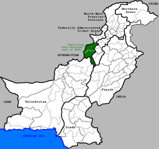
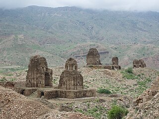
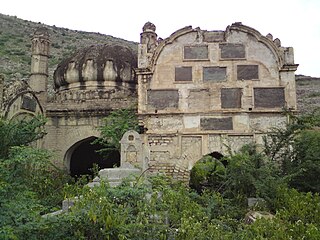
Waziristan is a mountainous region covering the former FATA agencies of North Waziristan and South Waziristan which are now districts of Khyber Pakhtunkhwa province of Pakistan. Waziristan covers some 11,585 square kilometres (4,500 sq mi). The area is populated by ethnic Pashtuns. It is named after the Wazir tribe. The language spoken in the valley is Pashto, predominantly the Waziri dialect. The region forms the southern part of Pakistan's Federally Administered Tribal Areas, which is now part of Khyber Pakhtunkhwa province. The 16th-century Pashtun revolutionary leader and warrior-poet Bayazid Pir Roshan, who wrote the oldest known book in Pashto, was based in Kaniguram, Waziristan.

Bannu District is a district in Bannu Division of Khyber Pakhtunkhwa province in Pakistan. It was recorded as a district in 1861 during the British Raj. It is one of 26 districts that make up the Khyber Pakhtunkhwa province of Pakistan. It borders North Waziristan to the northwest, Karak to the northeast, Lakki Marwat and Bettani to the southeast, and South Waziristan to the southwest. It is represented in the provincial assembly by four MPAs.
Dera Ismail Khan District is a district in Dera Ismail Khan Division of Khyber Pakhtunkhwa province in Pakistan. The capital of the district is the town of Dera Ismail Khan. The district has an area of 9,334 km2 (3,604 sq mi) and a population of 1,627,132 as of the 2017 Census.
The Marwat is a Pashtun tribe, a branch of the Lohani tribe and belong to Lodi section, located primarily in Lakki Marwat District, parts of Dera Ismail Khan District, some villages of Tank district in Pakistan and in the Katawaz area of Afghanistan. The Marwats are also known as Spin Lohani, and their most closely related kin are other Lohani tribes like Miankhel (Pasani), Daulat Khel and Tatur. The Marwats were named for their ancestor Marwat Khan Lodi.

Orakzai District is a district in Kohat Division of Khyber Pakhtunkhwa province in Pakistan. Until 2018, it was an agency of Federally Administered Tribal Areas. With the merger of FATA with Khyber Pakhtunkhwa, it became a district. Before to 1973, it was part of FR Kohat.

Lakki Marwat is a district in Bannu Division of Khyber Pakhtunkhwa province in Pakistan. It was created as an administrative district on July 1, 1992, prior to which it was a tehsil of Bannu District.

South Waziristan District was a district in Dera Ismail Khan Division of Khyber Pakhtunkhwa before splitting in to Lower South Waziristan District and Upper South Waziristan District and the southern part of Waziristan, a mountainous region of northwest Pakistan, that covers some 11,585 km2 (4,473 mi²). Waziristan comprises the area west and southwest of Peshawar between the Tochi River to the north and the Gomal River to the south. The region was an independent tribal territory from 1893, remaining outside of British-ruled empire and Afghanistan. Tribal raiding into British-ruled territory was a constant problem for the British, requiring frequent punitive expeditions between 1860 and 1945. Troops of the British Raj coined a name for this region "Hell's Door Knocker" in recognition of the fearsome reputation of the local fighters and inhospitable terrain. The capital city of South Waziristan is Wanna. South Waziristan is divided into the three administrative subdivisions of Ladha, Sarwakai, and Wanna. These three subdivisions are further divided into eight Tehsils: Ladha, Makin, Sararogha, Sarwakai, Tiarza, Wanna, Barmal, and Toi Khula.
Mīrānshāh or Mīrāmshāh is a small town that is the administrative headquarters of North Waziristan District, Khyber Pakhtunkhwa province of Pakistan. Miranshah lies on the banks of the Tochi River in a wide valley surrounded by the foothills of the Hindu Kush mountains. It is located at an elevation of about 930 metres (3,050 ft), 17 kilometres (11 mi) from the Pakistan-Afghanistan border. The nearest city in Pakistan is Bannu, about 55 kilometres (34 mi) to the east, while the nearest city across the border in Afghanistan is Khost, 60 kilometres (37 mi) to the northwest.
Kohat Division is one of seven divisions in Pakistan's Khyber Pakhtunkhwa province. It consists of five districts: Hangu, Karak, Kohat, Kurram, and Orakzai. According to the 2017 Pakistani Census, the division had a population of 3,211,458, making it the third-least populous division in the province, and it spans 12,377 km2 (4,779 sq mi) of area, and this makes it the fourth-largest division by area in the province. Kohat is the division's largest city and namesake, with over 220,000 inhabitants. The division borders Bannu Division to the south and west, Peshawar Division to the north and east, the province of Punjab, Pakistan to its east, and the country of Afghanistan to its northwest.

Bannu Division is one of seven divisions in Pakistan's Khyber Pakhtunkhwa province. It consists of three districts: Bannu, Lakki Marwat, and North Waziristan. According to the 2017 Pakistani Census, the division had a population of 2,656,801, making it the least populous division in the province, but it spans 9,975 km2 (3,851 sq mi) of area, and this makes it the third-smallest division by area in the province. Lakki Marwat is the largest city of Bannu Division, with around 60,000 people, while the division's namesake and second-largest city is Bannu, with just under 50,000 people. The division borders Dera Ismail Khan Division to the south and west, Kohat Division to the north and east, and the province of Punjab, Pakistan to its east.

The Bettani, also spelled Baittani or Bhittani, is a Pashtun tribe located mostly in Afghanistan and Pakistan. The Bettani are named after Shaykh Beṭ, their legendary ancestor who is said to be the second son of Qais Abdur Rashid. The Bettani's are Sunni Muslims of Hanafi sect. The Bettani confederacy includes the tribes of Bettanis, and Matti tribes progeny of BiBi Mattu daughter of Sheikh Bettan. These include Lodi also known as Lohani, as well as the tribes of Marwat, and Niazi while Shirani has also been mentioned as part of Bettanis.

The Frontier Regions of Pakistan were a group of small administrative units in the Federally Administered Tribal Areas (FATA), lying immediately to the east of the seven main tribal agencies and west of the settled districts of Khyber Pakhtunkhwa. Each of the Frontier Regions was named after an adjoining settled district and was administered by the district coordination officer (DCO) of that adjacent district. The overall administration of the Frontier Regions was carried out by the FATA Secretariat based in Peshawar, the capital of Khyber Pakhtunkhwa. The six Frontier Regions were:

Bannu Subdivision, formerly Frontier Region Bannu, is a subdivision in Khyber Pakhtunkhwa province of Pakistan. The region is named after Bannu District, which lies to the east, and also borders Karak District and Hangu District to the north, North Waziristan to the west, and Lakki Marwat Subdivision to the south. It is administered by the district coordination officer (DCO) of Bannu District.

Dera Ismail Khan Subdivision formerly Frontier Region Dera Ismail Khan is a subdivision in Khyber Pakhtunkhwa province of Pakistan. The region is named after Dera Ismail Khan District which lies to the east and also borders South Waziristan to the north, Dera Ghazi Khan and Musa Khel to the south and Zhob to the west. It is administered by the district coordination officer (DCO) of Dera Ismail Khan District. The main village of the frontier region is Darazinda, which borders South Waziristan.
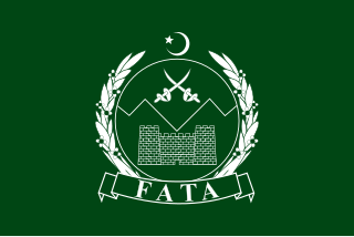
The Federally Administered Tribal Areas was a semi-autonomous tribal region in northwestern Pakistan that existed from 1947 until being merged with neighbouring province Khyber Pakhtunkhwa in 2018. It consisted of seven tribal agencies (districts) and six frontier regions, and were directly governed by Pakistan's federal government through a special set of laws called the Frontier Crimes Regulations.
Tank Subdivision formerly Frontier Region Tank is a subdivision in Khyber Pakhtunkhwa province of Pakistan. The region is named after Tank District which lies to the south-east and also borders South Waziristan to the north, south and west and Lakki Marwat District to the north-east. The capital is Jandola however it is administered by the district coordination officer (DCO) of Tank District.
Kohat Subdivision formerly Frontier Region Kohat is a subdivision in Khyber Pakhtunkhwa province of Pakistan. The region is located adjacent to the Kohat District, and therefore derives its name from Kohat. Kohat subdivision also shares its boundary with Peshawar District to the north, Nowshera District to the east and Orakzai Agency to the west. It is administered under the overall supervision and administrative command of Deputy Commissioner (DC) Kohat. The main towns in Kohat subdivision is Darra Adam Khel and Jawaki Adam Khel.
Tank is a tehsil located in Tank District, Khyber Pakhtunkhwa, Pakistan.
On 31 May 2018, with the application of 25th Amendment, Federally Administrated Tribal Areas ceased to exist, and stood merged into neighbouring province of Khyber Pakhtunkhwa.

