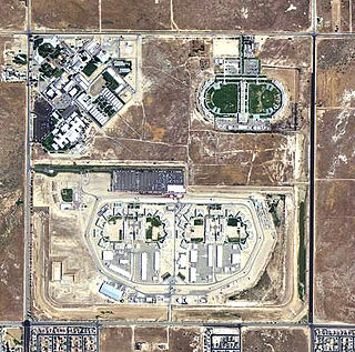
War Eagle Field is a former airfield located in the Mojave Desert, about 5-mile (8.0 km) west of Lancaster, California. It is currently used as a detention facility.

Moore Air Base is an inactive United States Air Force facility located fourteen miles (21 km) northwest of Mission, Texas. It was deactivated on 1 February 1961. The installation was sold to private concerns and partially transferred to the Department of Agriculture on 15 July 1963.

Twentynine Palms Airport is a public use airport located six nautical miles (11 km) east of the central business district of Twentynine Palms, a city in San Bernardino County, California, United States. It is owned by the County of San Bernardino.

Sequoia Field Airport is a county-owned, public-use airport located eight nautical miles (15 km) north of the central business district of Visalia, a city in Tulare County, California, United States.

Fort Stockton–Pecos County Airport is two miles NW of Fort Stockton, Texas; it is owned and operated by Pecos County, Texas.
Avenger Field is a Texas airport in Nolan County, three miles west of Sweetwater. The National Plan of Integrated Airport Systems for 2011–2015 called it a general aviation facility.

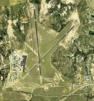
Garner Field is an airport in Uvalde County, Texas, three miles east of the city of Uvalde, which owns it. It is named for John Nance Garner, 32nd Vice President of the United States.

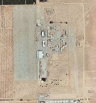
Airglades Airport is a county-owned public-use airport in Hendry County, Florida, United States. It is located 5 miles (8.0 km) west of the central business district of Clewiston, Florida.

Malden Regional Airport is a city-owned, public-use airport located three nautical miles (6 km) north of the central business district of Malden, a city in Dunklin County, Missouri, United States. This airport is included in the National Plan of Integrated Airport Systems, which categorized it as a general aviation facility.
Echeverria Field is an abandoned airfield, located approximately 15 miles (24 km) west of Wickenburg, Arizona.

Hancock Field is a former airport and military airfield about 2 miles (3.2 km) south-southeast of Santa Maria, California. Also known as Santa Maria Municipal Airport, the airport was closed about 1959 and today is the site of Allan Hancock College.
Taylor Field, now an industrial park, was an airport and military airfield located near Ocala, Florida. It was closed in 1962 and replaced by Ocala International Airport-Jim Taylor Field.

Val Verde County Airport is a former airport, located in Del Rio, Texas. Airport operations ended in 1959. Today the former airport is a residential site.

Harrell Field is five miles northeast of Camden, in Ouachita County, Arkansas, United States. The FAA's National Plan of Integrated Airport Systems for 2009–2013 categorizes it as a general aviation facility.

Eagle Field is a privately owned, private use airport in Fresno County, California, United States. It is located seven nautical miles southwest of the central business district of Dos Palos, a city in neighboring Merced County.
W. R. Byron Airport is a privately owned, private use airport in Riverside County, California, United States. It is located four nautical miles northwest of the central business district of Blythe, California, within the city limits.

Hicks Field is a former World War I military airfield, located 5.6 miles (9.0 km) North-northwest of Saginaw, Texas. It operated as a training field for the Air Service, United States Army between 1917 until 1920. It was one of thirty-two Air Service training camps established after the United States entry into World War I in April 1917.

During World War II civilian flying schools, under government contract, provided a considerable part of the flying training effort undertaken by the United States Army Air Forces.

The 29th Flying Training Wing was a wing of the United States Army Air Forces. It was last assigned to the Western Flying Training Command, and was disbanded on 16 June 1946 at Napier Field, Alabama. The wing controlled World War II Phase One primary flying training units of the Army Air Forces Training Command. Headquartered at Moody Field, Georgia for most of its operational service, it controlled contract civilian-operated pilot schools primarily in the Southeastern United States.

The 36th Flying Training Wing was a wing of the United States Army Air Forces. It was last assigned to the Western Flying Training Command, and was disbanded on 1 November 1945 at Santa Ana Army Air Base, California.

