Lavezares

Last updated
Lavezares
Municipality of Lavezares
Flag of Lavezares, Northern Samar.png
Ph locator northern samar lavezares.png
Map of Northern Samar with Lavezares highlighted
OpenStreetMap
Lavezares
Philippines location map (square).svg
Red pog.svg
Lavezares
Location within the Philippines
Coordinates: 12°32′N124°20′E / 12.53°N 124.33°E / 12.53; 124.33
Country Philippines
Region Eastern Visayas
Province Northern Samar
District 1st district
Founded 1875
Named for Guido de Lavezaris
Barangays 26 (see Barangays)
Government
[1]
  Type Sangguniang Bayan
   Mayor Edito B. Saludaga
   Vice Mayor Ricardo O. Chan
   Representative Paul R. Daza
  Councilors
List
   Electorate 21,548 voters (2022)
Area
[2]
  Total119.50 km2 (46.14 sq mi)
Elevation
45 m (148 ft)
Highest elevation
222 m (728 ft)
Lowest elevation
−1 m (−3 ft)
Population
 (2020 census) [3]
  Total29,390
  Density250/km2 (640/sq mi)
   Households
6,784
Economy
   Income class 4th municipal income class
   Poverty incidence
34.14
% (2018) [4]
   Revenue 127.3 million (2020)
   Assets 377.7 million (2020)
   Expenditure 113.3 million (2020)
   Liabilities 93.64 million (2020)
Service provider
  ElectricityNorthern Samar Electric Cooperative (NORSAMELCO)
Time zone UTC+8 (PST)
ZIP code
6404
PSGC
IDD : area code +63(0)55
Native languages Waray
Tagalog

Lavezares, officially the Municipality of Lavezares (Waray : Bungto han Lavezares; Tagalog : Bayan ng Lavezares), is a 4th class municipality in the province of Northern Samar, Philippines. According to the 2020 census, it has a population of 29,390 people. [3]

Contents

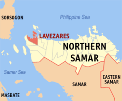
It is bounded on the west by the municipality of Allen, on the north-west by San Bernardino Strait, on the south and south-west by the municipality of Victoria, on the east by the municipality of Rosario and on the north by the municipality of Biri.

History

Lavezares was just a visita during the late 19th century. In this period of time, Barobaybay, Villa and MacArthur served as the oldest pueblos of the old municipality.

During the Spanish period, Lavezares was controlled by secular priests. It was named in honor of the Spanish Governor-General Guido de Lavezares who helped them become separated from the Municipality of Allen, and be an independent municipality. Sitios of Lavezares including Caburihan, Ocad, Caragas, Cataogan and Sabang-Tabok were converted into barangays though Republic Act 2370 (the Barrio Charter Act) and Republic Act 3590 (the Revised Barrio Charter Act). And shortly, the municipality was administered by the capitanes, presidentes and municipal mayors.

Geography

Lavezares has a land area of 11,950 hectares (29,500 acres), with a topography that is generally characterized by very rugged terrain with many steep and elevated areas classified as undulating to hilly. Technically, there are only two hills in the area, these are located in the southernmost part of Barangays Chansvilla and Toog. No mountain can be found in the area.

There are also no major plains but a few flat lands that not very extensive. The coastal areas of Lavezares are limited and have generally moderately terrain. Bacolods which serve as natural breakwater on different coasts of the municipality can be found along the coasts of Barangays Balicuatro, Villa, Bani and Magsaysay among others. They are protected as part of the Biri Larosa Protected Landscape and Seascape.

Land reclamation in different parts of the municipality particularly in island barangays of San Juan, San Isdro, Magsaysay and Bani is continuously being done. The coastal barangays along the mainland are similarly reclaiming lands which include the coasts of Barangays Libas, Cataogan, Sabang-Tabok, Urdaneta and Barobaybay.

Climate

Climate data for Lavezares, Northern Samar
MonthJanFebMarAprMayJunJulAugSepOctNovDecYear
Average high °C (°F)27
(81)
28
(82)
29
(84)
30
(86)
31
(88)
30
(86)
29
(84)
29
(84)
29
(84)
29
(84)
29
(84)
28
(82)
29
(84)
Average low °C (°F)22
(72)
22
(72)
22
(72)
22
(72)
24
(75)
24
(75)
24
(75)
24
(75)
24
(75)
24
(75)
23
(73)
23
(73)
23
(74)
Average precipitation mm (inches)84
(3.3)
59
(2.3)
58
(2.3)
55
(2.2)
93
(3.7)
133
(5.2)
149
(5.9)
125
(4.9)
155
(6.1)
165
(6.5)
140
(5.5)
136
(5.4)
1,352
(53.3)
Average rainy days18.113.615.816.121.725.526.625.124.825.822.720.1255.9
Source: Meteoblue [5]

Barangays

Lavezares is politically subdivided into 26 barangays. Each barangay consists of puroks and some have sitios.

12 of which are considered as inland barangays and 14 coastal barangays, which can be subclassified into 5 island barangays and 9 barangays situated along the coast of the mainland.

Inland barangays:

Coastal barangays:

  • Balicuatro
  • Barobaybay
  • Cataogan (Poblacion)
  • Libas
  • Libertad
  • Sabang-Tabok (Poblacion)
  • San Agustin
  • Villa
  • Urdaneta
  • Bani (island barangay)
  • Magsaysay (island barangay)
  • Maravilla (island barangay)
  • San Isidro (island barangay)
  • San Juan (island barangay)

The smallest barangay is Cataogan, while the largest is Bani. According to the Provincial Physical Framework Plan of 2004–2013, the municipality is suitable for irrigated rice, fish ponds, trees and crops.

The mainland is attached entirely to the entire Samar Island. Maravilla Island, San Juan Island and Bani Island are the three major islands of the municipality.

Demographics

Population census of Lavezares
YearPop.±% p.a.
1903 3,688    
1918 5,953+3.24%
1939 9,501+2.25%
1948 18,508+7.69%
1960 15,186−1.63%
1970 16,336+0.73%
1975 20,251+4.40%
1980 20,007−0.24%
1990 19,058−0.48%
1995 20,492+1.37%
2000 23,991+3.44%
2007 26,131+1.19%
2010 27,464+1.83%
2015 28,770+0.89%
2020 29,390+0.42%
Source: Philippine Statistics Authority [6] [7] [8] [9]

Economy

Government

The political body of Lavezares was established in 1875 under the Spanish colonial power wherein the local executive was alluded as Capitanes. From 1903 to 1935, the persons who assumed the position were called Presidentes, and from 1936 until present where they were referred to as Municipal Mayors.

PositionNameTerm of Office
Capitan (appointed)
Silvino Flores
1875-1877
Justiniano Morillo
1877-1879
Victorio Alvanes
1879-1881
Evaristo Martires
1881-1883
Angeles de Leon
1883-1886
Patricio Ebron
1886-1888
Feliciano Adriatico
1888-1892
Lucio Flores
1892-1894
Anastacio Adriatico
1894-1898
Cepriano de Leon
1898-1903
Presidente (appointed)
Lasaro Cuyco
1903-1908
Martin Custan
1908-1912
Presidente (elected)
Gregorio Adriatico
1912-1916
Elias Bogtong
1916-1921
Melecio Cuyuco
1921-1927
Juan Ymata
1927-1931
Eugenio Tingkingco
1931-1935
Municipal Mayor (elected)
Antonio Martires
1936-1938
Pascualito Clutario
1938-1946
Julio Turla
1946-1955
Gabriel Querobines
1956-1959
Basilio Chan
1960-1978
Municipal Mayor
Rodrigo Chan
1978-1979 (appointed); 1980-1986 (elected)
Miguel Adriatico
1986-1987 (appointed)
Municipal Mayor (appointed)
Celedonio Saludaga, Jr
1987-1988
Municipal Mayor (elected)
Miguel Adriatico, Jr
1989-1991
Quintin Saludaga, Jr
1992-2001
Celedonio Saludaga, Jr
2001-2010

Transportation

Access to Lavezares has two options: from Manila, a fourteen to fifteen hours of bus ride with Roll-on/roll-off vessels from Matnog, Sorsogon, to the port of Allen, Northern Samar, or taking a plane to Catarman and a jeepney ride to Lavezares both serving as the main transport facility towards this portion.

Tourism

In this coastal province of Northern Samar, eco-tourism may just become an alternative income generator aside from coconuts and fishing.

True to mention are the white sand beaches abounding among its coastal and groups of island barangays that comprises the municipality though some parts have strong underwater current not suitable for a beach resort. Current white sand beach resorts are found at barangays Urdaneta and Barobaybay and waters between Bani Island and Barobaybay. The resorts offer huts along the beachfront and for overnight stays, tourist inns are available.

The coral reefs in Bancauan Island, Bani Island, Barangay Maravilla and Barangay San Juan are good for scuba diving.

The sunsets can be viewed at Lavezares Bay and Barangay Barobaybay, but Barangay Maravilla provides the most outstanding view because of the island's north to south orientation with just the vast sea on sight.

Education

Related Research Articles

<span class="mw-page-title-main">Buenavista, Guimaras</span> Municipality in Guimaras, Philippines

Buenavista, officially the Municipality of Buenavista, is a 2nd class municipality and the largest settlement in the province of Guimaras, Philippines. According to the 2020 census, it has a population of 52,899 people.

<span class="mw-page-title-main">Almagro, Samar</span> Municipality in Samar, Philippines

Almagro, officially the Municipality of Almagro, is a 5th class municipality in the province of Samar, Philippines. According to the 2020 census, it has a population of 9,273 people.

<span class="mw-page-title-main">San Sebastian, Samar</span> Municipality in Samar, Philippines

San Sebastian, officially the Municipality of San Sebastian, is a 6th class municipality in the province of Samar, Philippines. According to the 2020 census, it has a population of 8,704 people.

<span class="mw-page-title-main">Talalora</span> Municipality in Samar, Philippines

Talalora, officially the Municipality of Talalora, is a 6th class municipality in the province of Samar, Philippines. According to the 2020 census, it has a population of 7,856 people.

<span class="mw-page-title-main">Allen, Northern Samar</span> Municipality in Northern Samar, Philippines

Allen, officially the Municipality of Allen, is a 5th class municipality in the province of Northern Samar, Philippines. According to the 2020 census, it has a population of 25,228 people.

<span class="mw-page-title-main">Bobon</span> Municipality in Northern Samar, Philippines

Bobon, officially the Municipality of Bobon, is a 4th class municipality in the province of Northern Samar, Philippines. According to the 2020 census, it has a population of 25,964 people.

<span class="mw-page-title-main">Capul</span> Municipality in Northern Samar, Philippines

Capul, officially the Municipality of Capul, is a 5th class island municipality in the province of Northern Samar, Philippines. According to the 2020 census, it has a population of 12,323 people.

<span class="mw-page-title-main">Lope de Vega, Northern Samar</span> Municipality in Northern Samar, Philippines

Lope de Vega, officially the Municipality of Lope de Vega, is a 4th class municipality in the province of Northern Samar, Philippines. According to the 2020 census, it has a population of 14,690 people.

<span class="mw-page-title-main">Mapanas</span> Municipality in Northern Samar, Philippines

Mapanas, officially the Municipality of Mapanas, is a 5th class municipality in the province of Northern Samar, Philippines. According to the 2020 census, it has a population of 14,234 people.

<span class="mw-page-title-main">Mondragon, Northern Samar</span> Municipality in the Philippines

Mondragon, officially the Municipality of Mondragon, is a 3rd class municipality in the province of Northern Samar, Philippines. According to the 2020 census, it has a population of 41,415 people.

<span class="mw-page-title-main">San Jose, Northern Samar</span> Municipality in Northern Samar, Philippines

San Jose, officially the Municipality of San Jose, is a 5th class municipality in the province of Northern Samar, Philippines. According to the 2020 census, it has a population of 17,641 people.

<span class="mw-page-title-main">San Vicente, Northern Samar</span> Municipality in Northern Samar, Philippines

San Vicente, officially the Municipality of San Vicente, is a 6th class municipality in the province of Northern Samar, Philippines. According to the 2020 census, it has a population of 6,928 people.

<span class="mw-page-title-main">Balangkayan</span> Municipality in Eastern Samar, Philippines

Balangkayan, officially the Municipality of Balangkayan, is a 5th class municipality in the province of Eastern Samar, Philippines. According to the 2020 census, it has a population of 10,185 people.

<span class="mw-page-title-main">Dolores, Eastern Samar</span> Municipality in Eastern Samar, Philippines

Dolores, officially the Municipality of Dolores, is a 3rd class municipality in the province of Eastern Samar, Philippines. According to the 2020 census, it has a population of 44,626 people.

<span class="mw-page-title-main">General MacArthur, Eastern Samar</span> Municipality in Eastern Samar, Philippines

General MacArthur, officially the Municipality of General MacArthur, is a 5th class municipality in the province of Eastern Samar, Philippines. According to the 2020 census, it has a population of 14,411 people.

<span class="mw-page-title-main">Giporlos</span> Municipality in Eastern Samar, Philippines

Giporlos, officially the Municipality of Giporlos, is a 5th class municipality in the province of Eastern Samar, Philippines. According to the 2020 census, it has a population of 13,117 people.

<span class="mw-page-title-main">Jipapad</span> Municipality in Eastern Samar, Philippines

Jipapad, officially the Municipality of Jipapad, is a 5th class municipality in the province of Eastern Samar, Philippines. According to the 2020 census, it has a population of 8,439 people.

<span class="mw-page-title-main">Llorente, Eastern Samar</span> Municipality in Eastern Samar, Philippines

Llorente, officially the Municipality of Llorente, is a 3rd class municipality in the province of Eastern Samar, Philippines. According to the 2020 census, it has a population of 21,459 people.

<span class="mw-page-title-main">Oras, Eastern Samar</span> Municipality in Eastern Visayas, Philippines

Oras, officially the Municipality of Oras, is a 3rd class municipality in the province of Eastern Samar, Philippines. According to the 2020 census, it has a population of 37,451 people.

<span class="mw-page-title-main">Sulat</span> Municipality in Eastern Samar, Philippines

Sulat, officially the Municipality of Sulat, is a 4th class municipality in the province of Eastern Samar, Philippines. According to the 2020 census, it has a population of 15,758 people.

References

  1. Municipality of Lavezares | (DILG)
  2. "2015 Census of Population, Report No. 3 – Population, Land Area, and Population Density" (PDF). Philippine Statistics Authority. Quezon City, Philippines. August 2016. ISSN   0117-1453. Archived (PDF) from the original on May 25, 2021. Retrieved July 16, 2021.
  3. 1 2 Census of Population (2020). "Region VIII (Eastern Visayas)". Total Population by Province, City, Municipality and Barangay. Philippine Statistics Authority . Retrieved 8 July 2021.
  4. "PSA Releases the 2018 Municipal and City Level Poverty Estimates". Philippine Statistics Authority. 15 December 2021. Retrieved 22 January 2022.
  5. "Lavezares, Northern Samar : Average Temperatures and Rainfall". Meteoblue. Retrieved 6 January 2019.
  6. Census of Population (2015). "Region VIII (Eastern Visayas)". Total Population by Province, City, Municipality and Barangay. Philippine Statistics Authority . Retrieved 20 June 2016.
  7. Census of Population and Housing (2010). "Region VIII (Eastern Visayas)". Total Population by Province, City, Municipality and Barangay. National Statistics Office . Retrieved 29 June 2016.
  8. Censuses of Population (1903–2007). "Region VIII (Eastern Visayas)". Table 1. Population Enumerated in Various Censuses by Province/Highly Urbanized City: 1903 to 2007. National Statistics Office.
  9. "Province of Northern Samar". Municipality Population Data. Local Water Utilities Administration Research Division. Retrieved 17 December 2016.
  10. "Poverty incidence (PI):". Philippine Statistics Authority. Retrieved December 28, 2020.
  11. "Estimation of Local Poverty in the Philippines" (PDF). Philippine Statistics Authority. 29 November 2005.
  12. "2003 City and Municipal Level Poverty Estimates" (PDF). Philippine Statistics Authority. 23 March 2009.
  13. "City and Municipal Level Poverty Estimates; 2006 and 2009" (PDF). Philippine Statistics Authority. 3 August 2012.
  14. "2012 Municipal and City Level Poverty Estimates" (PDF). Philippine Statistics Authority. 31 May 2016.
  15. "Municipal and City Level Small Area Poverty Estimates; 2009, 2012 and 2015". Philippine Statistics Authority. 10 July 2019.
  16. "PSA Releases the 2018 Municipal and City Level Poverty Estimates". Philippine Statistics Authority. 15 December 2021. Retrieved 22 January 2022.