Leons Lions | |
|---|---|
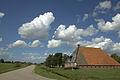
Village | |
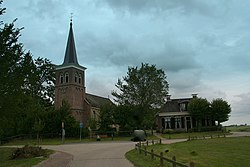 Leons church | |
 Coat of arms | |
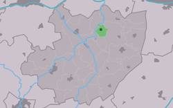 Location in the former Littenseradiel municipality | |
 Leons Location in the Netherlands  Leons Leons (Netherlands) | |
| Coordinates: 53°9′4″N5°40′41″E / 53.15111°N 5.67806°E | |
| Country | |
| Province | |
| Municipality | |
| Area | |
• Total | 1.92 km2 (0.74 sq mi) |
| Elevation | 0.8 m (2.6 ft) |
| Population (2021) [1] | |
• Total | 25 |
| • Density | 13/km2 (34/sq mi) |
| Postal code | 8833 [1] |
| Dialing code | 0517 |
Leons (Dutch : Lions) is a small village in Leeuwarden municipality in the Dutch province of Friesland. Situated in pastoral farming country, the village had around 26 inhabitants in January 2017. [3]