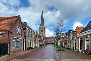
Stiens is a town in the municipality of Leeuwarden, Netherlands. As of January 2017, the town had a population of about 7,545. Between 1944 and 2018, it was the capital of the municipality of Leeuwarderadeel.

Aalsum is a village in the Dutch province of Friesland. It is located in the municipality Noardeast-Fryslân, about 1 km north of Dokkum. It had a population of around 125 in January 2017

Ee or Ie is a village in the northern Netherlands. It is located in the municipality of Noardeast-Fryslân, Friesland, east of Dokkum. Ie had approximately 834 inhabitants in January 2017. Before 2019, the village was part of the Dongeradeel municipality.
Boksum is a village in Waadhoeke municipality in the province of Friesland, the Netherlands. It had a population of around 400 people in 2020 Before 2018, the village was part of the Menameradiel municipality.

Allingawier is a small village in Súdwest-Fryslân municipality in the Dutch province of Friesland. It is about 7 km southwest of the city of Bolsward.

Arum is a village in the Súdwest-Fryslân municipality in the Dutch province of Friesland. It is about 5 km southeast of the city of Harlingen.

Holwert is a village in Noardeast-Fryslân municipality in the northern Netherlands, in the province of Friesland. It had a population of around 1,607 in January 2017. Before 2019, the village was part of the Dongeradeel municipality.

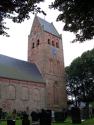
Ferwert is a village in Noardeast-Fryslân in the province of Friesland, the Netherlands. It had a population of around 1787 in January 2017. Before 2019, the village was part of the Ferwerderadiel municipality.

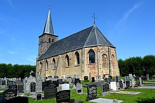
Hegebeintum is a small village in Noardeast-Fryslân in the province of Friesland, the Netherlands. It had a population of around 90 in January 2017. Before 2019, the village was part of the Ferwerderadiel municipality.
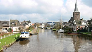
Warten is a village in the municipality of Leeuwarden in the province of Friesland, the Netherlands. It had a population of around 915 in January 2017.

Brantgum is a village in Noardeast-Fryslân in the province of Friesland, the Netherlands. It had a population of around 236 in January 2017. Before 2019, the village was part of the Dongeradeel municipality.

Hantumhuzen is a village in Noardeast-Fryslân in the province of Friesland, the Netherlands. It had a population of around 200 in January 2017. Before 2019, the village was part of the Dongeradeel municipality.
Jouswier is a small village in Noardeast-Fryslân in the province of Friesland, the Netherlands. It had a population of around 44 in January 2017. Before 2019, the village was part of the Dongeradeel municipality.
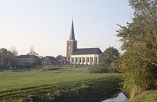
Tzum is a village in Waadhoeke municipality in the province of Friesland, the Netherlands. It had a population of around 1,110 in 2023. Tzum is known for its 72 metre tall church tower.

Hempens is a village in Leeuwarden municipality in the province of Friesland, the Netherlands.

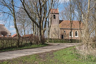
Easterwierrum is a village in Súdwest-Fryslân in the province of Friesland, the Netherlands. It had a population of around 332 in January 2017.
Mantgum is a village in Leeuwarden municipality in the province Friesland of the Netherlands and had around 1,172 citizens in January 2017.

Hinnaard is a small village in Súdwest-Fryslân in the province of Friesland, the Netherlands. It had a population of around 44 in January 2017.

Schettens is a village in Súdwest-Fryslân in the province of Friesland, the Netherlands. It had a population of around 285 in January 2017.

Hichtum is a small village in Súdwest-Fryslân municipality in the province of Friesland, the Netherlands. It had a population of around 80 in January 2017.


