Liberty Grove, Tennessee | |
|---|---|
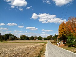 Buildings and fields in Liberty Grove | |
 Liberty Grove  Liberty Grove | |
| Coordinates: 35°02′29″N87°22′59″W / 35.04139°N 87.38306°W | |
| Country | United States |
| State | Tennessee |
| County | Lawrence |
| Elevation | 873 ft (266 m) |
| Time zone | UTC-6 (Central (CST)) |
| • Summer (DST) | UTC-5 (CDT) |
| Area code | 931 |
| GNIS feature ID | 1315389 [1] |
Liberty Grove is an unincorporated community in Lawrence County, Tennessee, United States. [1] It is situated along Tennessee State Route 227 between Loretto to the northwest and the Alabama state line to the southeast, in southeastern Lawrence County.
