Saint Joseph, Tennessee

Last updated

Saint Joseph, Tennessee
St-Joseph-Bank-tn1.jpg
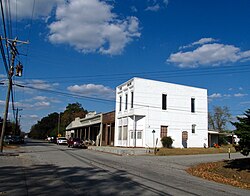
Buildings along Main Street
Lawrence County Tennessee Incorporated and Unincorporated areas St. Joseph Highlighted 4766160.svg
Location of St. Joseph in Lawrence County, Tennessee.
Coordinates: 35°2′6″N87°30′8″W / 35.03500°N 87.50222°W / 35.03500; -87.50222
Country United States
State Tennessee
County Lawrence
Area
[1]
  Total3.77 sq mi (9.75 km2)
  Land3.77 sq mi (9.75 km2)
  Water0.00 sq mi (0.00 km2)
Elevation
794 ft (242 m)
Population
 (2020) [2]
  Total790
  Density209.77/sq mi (80.99/km2)
Time zone UTC-6 (Central (CST))
  Summer (DST) UTC-5 (CDT)
ZIP code
38481 [3]
Area code 931
FIPS code 47-66160 [4]
GNIS feature ID1300456 [5]

Saint Joseph (usually shortened to St. Joseph) is a city in Lawrence County, Tennessee, United States. The population was 782 at the 2010 census, down from 829 in 2000.

Contents

History

The St. Joseph area was settled by German Catholic immigrants in the early 1870s. These settlers established St. Joseph Catholic Church, which is still home to a Catholic parish. By the late 1880s, St. Joseph had about twenty-five houses, a school, and a store. [6]

Geography

St. Joseph is located at 35°2′6″N87°30′8″W / 35.03500°N 87.50222°W / 35.03500; -87.50222 (35.034920, -87.502158). [7] The city is situated on a relatively broad ridge between the Shoal Creek Valley to the west and the Bluewater Creek Valley to the east. Little Bluewater Creek, a tributary of the latter, flows through St. Joseph. The city's boundaries stretch northeastward to the outskirts of Loretto and southward to the Tennessee-Alabama state line.

U.S. Route 43 traverses St. Joseph, connecting the city to Lawrenceburg to the northeast and the Muscle Shoals area to the south. Tennessee State Route 227 connects St. Joseph with Iron City in the Shoal Creek Valley to the west.

According to the United States Census Bureau, the city has a total area of 3.6 square miles (9.3 km2), all land.

Demographics

Historical population
CensusPop.Note
1960 547
1970 63716.5%
1980 89740.8%
1990 789−12.0%
2000 8295.1%
2010 782−5.7%
2020 7901.0%
Sources: [8] [9] [2]

2020 census

Saint Joseph racial composition [10]
RaceNumberPercentage
White (non-Hispanic)74794.56%
Native American 30.38%
Asian 30.38%
Other/Mixed 212.66%
Hispanic or Latino 162.03%

As of the 2020 United States census, there were 790 people, 349 households, and 225 families residing in the city.

2000 census

As of the census [4] of 2000, there were 829 people, 342 households, and 247 families residing in the city. The population density was 231.1 inhabitants per square mile (89.2/km2). There were 374 housing units at an average density of 104.2 per square mile (40.2/km2). The racial makeup of the city was 98.19% White, 0.97% African American, 0.12% Native American, and 0.72% from two or more races. Hispanic or Latino of any race were 2.29% of the population.

There were 342 households, out of which 32.7% had children under the age of 18 living with them, 52.9% were married couples living together, 14.3% had a female householder with no husband present, and 27.5% were non-families. 24.9% of all households were made up of individuals, and 14.3% had someone living alone who was 65 years of age or older. The average household size was 2.42 and the average family size was 2.88.

In the city, the population was spread out, with 24.6% under the age of 18, 9.0% from 18 to 24, 28.0% from 25 to 44, 23.5% from 45 to 64, and 14.8% who were 65 years of age or older. The median age was 37 years. For every 100 females, there were 90.1 males. For every 100 females age 18 and over, there were 85.5 males.

The median income for a household in the city was $27,961, and the median income for a family was $30,781. Males had a median income of $26,375 versus $20,486 for females. The per capita income for the city was $13,038. About 7.6% of families and 14.1% of the population were below the poverty line, including 20.2% of those under age 18 and 14.4% of those age 65 or over.

Related Research Articles

<span class="mw-page-title-main">Lauderdale County, Alabama</span> County in Alabama, United States

Lauderdale County is a county located in the northwestern corner of the U.S. state of Alabama. At the 2020 census the population was 93,564. Its county seat is Florence. Its name is in honor of Colonel James Lauderdale, of Tennessee. Lauderdale is part of the Florence-Muscle Shoals, AL Metropolitan Statistical Area, also known as "The Shoals".
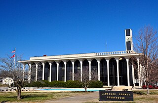
<span class="mw-page-title-main">Lawrence County, Tennessee</span> County in Tennessee, United States

Lawrence County is a county located in the U.S. state of Tennessee. As of the 2020 census, the population was 44,159. Its county seat and largest city is Lawrenceburg. Lawrence County comprises the Lawrenceburg, TN Micropolitan Statistical Area, which is also included in the Nashville-Davidson-Murfreesboro, TN Combined Statistical Area.

<span class="mw-page-title-main">Humphreys County, Tennessee</span> County in Tennessee, United States

Humphreys County is a county located in the western part of Middle Tennessee, in the U.S. state of Tennessee. As of the 2020 census, the population was 18,990. Its county seat is Waverly.
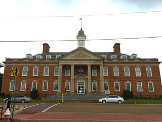
<span class="mw-page-title-main">Hardin County, Tennessee</span> County in Tennessee, United States

Hardin County is a county located in the U.S. state of Tennessee. As of the 2020 census, the population was 26,831. The county seat is Savannah. Hardin County is located north of and along the borders of Mississippi and Alabama. The county was founded in November 1819 and named posthumously for Col. Joseph Hardin, a Revolutionary War soldier and a legislative representative for the Province of North Carolina; the State of Franklin; and the Southwest Territory. Hardin County was the site of the Battle of Shiloh during the Civil War.

<span class="mw-page-title-main">Sheffield, Alabama</span> City in Alabama, United States

Sheffield is a city in Colbert County, Alabama, United States, and is included in the Florence-Shoals metropolitan area. As of the 2010 census, the population of the city was 9,039. Sheffield is the birthplace of "country-soul pioneer" and songwriter Arthur Alexander, French horn player Willie Ruff, notable attorney, actor, former senator and presidential contender Fred Thompson, Watergate committee U.S. Senator Howell Heflin and U.S. Senator Mitch McConnell, whose father was working in nearby Athens when he was born. It sometimes is referred to as "the City of Senators" due to the births of Heflin, McConnell and Thompson within its borders. Col. Harland Sanders worked in the Sheffield depot for Southern Railway in the 1907. It is also home to the Muscle Shoals Sound Studio where many popular 20th century musicians recorded their work, including Alexander and Ruff. It is the site of historic Helen Keller Hospital, formerly known as Colbert County Hospital and originally constructed in 1921. It was changed to Helen Keller Hospital in 1979, and Keller's birthplace Ivy Green is located less than one mile southwest of the hospital in adjacent Tuscumbia.

<span class="mw-page-title-main">Arab, Alabama</span> City in Alabama, United States

Arab is a city in Marshall County in the northern part of the U.S. state of Alabama, located 10 miles (16 km) from Guntersville Lake and Guntersville Dam, and is included in the Huntsville-Decatur Combined Statistical Area. The population was 8,461 at the 2020 census.
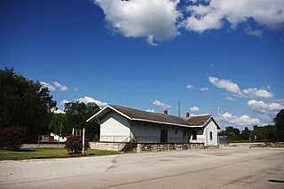
<span class="mw-page-title-main">Town Creek, Alabama</span> Town in Alabama, United States

Town Creek is a town in Lawrence County, Alabama, United States, and is included in the Decatur Metropolitan Area, as well as the Huntsville-Decatur Combined Statistical Area. It incorporated in March 1875. As of the 2010 census, the population of the town is 1100, down from 1216 in 2000. Since 1920, it has been the second largest town in Lawrence County after Moulton.

<span class="mw-page-title-main">Joiner, Arkansas</span> City in Arkansas, United States

Joiner is a city in Mississippi County, Arkansas, United States. The population was 498 as of the 2020 census, down from 576 at the 2010 census.

<span class="mw-page-title-main">Butler, Illinois</span> Village in Illinois, United States

Butler is a small village in Montgomery County, Illinois, United States. The population was 164 at the 2020 census.

<span class="mw-page-title-main">Lynnville, Tennessee</span> Town in Tennessee, United States

Lynnville is a town in Giles County, Tennessee. The population was 287 at the 2010 census. The name is from a local creek. Richland High School is located in Lynnville and serves the town and surrounding areas.

<span class="mw-page-title-main">Minor Hill, Tennessee</span> City in Tennessee, United States

Minor Hill is a city in Giles County, Tennessee, United States. The population was 537 at the 2010 census.

<span class="mw-page-title-main">Ethridge, Tennessee</span> Town in Tennessee, United States

Ethridge is a town in Lawrence County, Tennessee, United States. The population was 465 at the 2010 census, down from 536 at the 2000 census.

<span class="mw-page-title-main">Lawrenceburg, Tennessee</span> City in Tennessee, United States

The city of Lawrenceburg is the county seat of Lawrence County, Tennessee, United States, The largest city on the state's southern border between Chattanooga and Memphis, it lies on the banks of Shoal Creek. The population was 11,633 at the 2020 United States Census. The city is named after War of 1812 American Navy officer James Lawrence.

<span class="mw-page-title-main">Loretto, Tennessee</span> City in Tennessee, United States

Loretto is a city in Lawrence County, Tennessee, United States. The population was 1,714 at the 2010 census, and 1,739 at the 2020 census.

<span class="mw-page-title-main">Philadelphia, Tennessee</span> City in Tennessee, United States

Philadelphia is a city in Loudon County, Tennessee, United States. Its population was 656 at the 2010 census. It is included in the Knoxville Metropolitan Statistical Area.
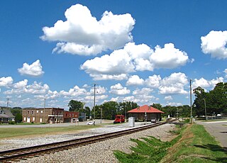
<span class="mw-page-title-main">Niota, Tennessee</span> City in Tennessee, United States

Niota is a city in McMinn County, Tennessee, United States. The population was estimated at 772 in 2020 by the U.S. Census Bureau.
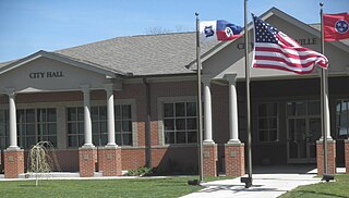
<span class="mw-page-title-main">Lobelville, Tennessee</span> City in Tennessee, United States

Lobelville is a city in Perry County, Tennessee, United States that was established as a trading post on the Buffalo River in 1854. The population was 897 at the 2010 census.

<span class="mw-page-title-main">Collinwood, Tennessee</span> City in Tennessee, United States

Collinwood is a city in Wayne County, Tennessee, United States. The population was 982 at the 2010 census, down from 1,024 in 2000.

<span class="mw-page-title-main">Doyle, Tennessee</span> Town in Tennessee, United States

Doyle is a town in White County, Tennessee, United States. The population was 537 at the 2010 census.

<span class="mw-page-title-main">Iron City, Tennessee</span> Census-designated place in Tennessee, United States

Iron City is a census-designated place and former city in Lawrence and Wayne counties, Tennessee. The population was 167 at the 2010 census.
References

  1. "ArcGIS REST Services Directory". United States Census Bureau. Retrieved October 15, 2022.
  2. 1 2 "Census Population API". United States Census Bureau. Retrieved October 15, 2022.
  3. "Saint Joseph ZIP Code". zipdatamaps.com. 2022. Retrieved November 11, 2022.
  4. 1 2 "U.S. Census website". United States Census Bureau . Retrieved January 31, 2008.
  5. "US Board on Geographic Names". United States Geological Survey. October 25, 2007. Retrieved January 31, 2008.
  6. Goodspeed's History of Lawrence County, Tennessee (Goodspeed Publishing Company, 1886). Accessed at TNGenWeb.org, November 3, 2016.
  7. "US Gazetteer files: 2010, 2000, and 1990". United States Census Bureau. February 12, 2011. Retrieved April 23, 2011.
  8. "Census of Population and Housing: Decennial Censuses". United States Census Bureau . Retrieved March 4, 2012.
  9. "Incorporated Places and Minor Civil Divisions Datasets: Subcounty Resident Population Estimates: April 1, 2010 to July 1, 2012". Population Estimates. U.S. Census Bureau. Archived from the original on June 11, 2013. Retrieved December 11, 2013.
  10. "Explore Census Data". data.census.gov. Retrieved December 25, 2021.