Related Research Articles

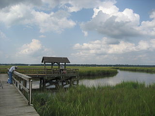
Daufuskie Island, located between Hilton Head Island and Savannah, is the southernmost inhabited sea island in South Carolina. It is 5 miles (8 km) long by almost 2.5 miles (4.0 km) wide – approximate surface area of 8 square miles (21 km2). With over 3 miles (5 km) of beachfront, Daufuskie is surrounded by the waters of Calibogue Sound, the Intracoastal Waterway and the Atlantic Ocean. It was listed as a census-designated place in the 2020 census with a population of 557.
James Island is a town in Charleston County, South Carolina, United States. It is located in the central and southern parts of James Island. James Island is included within the Charleston-North Charleston-Summerville metropolitan area and the Charleston-North Charleston Urbanized Area.
Fig Island, also known as 38CH42, is an archaeological site on the Atlantic Coast of South Carolina, consisting of three shell rings. Shell rings are curved shell middens wholly or partially surrounding a clear central area or plaza. The site includes one of the largest and most complex shell rings in North America, and one of the best preserved circular shell rings.

The Thomas Point Shoal Light, also known as Thomas Point Shoal Light Station, is a historic lighthouse in the Chesapeake Bay on the east coast of the United States, and the most recognized lighthouse in Maryland. It is the only screw-pile lighthouse in the bay which stands at its original site. The current structure is a 1½ story hexagonal wooden cottage, equipped with a foghorn as well as the light.
The Pilot Island Light is a lighthouse located near Gills Rock, on Pilot Island at the east end of Death's Door passage, in Door County, Wisconsin.

The Morris Island Lighthouse is a lighthouse on Morris Island in South Carolina. The light stands on the southern side of the entrance to Charleston Harbor, north of the City of Folly Beach. At 161 ft, it is the tallest lighthouse in South Carolina. The lighthouse was named to the National Register of Historic Places in 1982.

Greens Ledge Lighthouse is a historic offshore lighthouse in the western Long Island Sound near Norwalk, Connecticut and Darien, Connecticut. It is one of 33 sparkplug lighthouses still in existence in the United States and remains an active aid to navigation. It sits in ten feet of water on the west end of Greens Ledge, a shallow underwater reef that runs a mile west of Sheffield Island and is roughly a mile south of the entrance to Five Mile River at Rowayton. Completed in 1902 by the Philadelphia Construction Company, the cast-iron structure is approximately 90 feet tall including roughly 15 feet of the submerged caisson. In 1933, more than 30,000 tons of rocks from the excavation of Radio City Music Hall were added to the riprap foundation. The light was added to the National Register of Historic Places as Greens Ledge Lighthouse on May 29, 1990.

Charleston Light, also known as Sullivan's Island Lighthouse, is located on Sullivan's Island, South Carolina, which is the northern entrance to Charleston Harbor. The lighthouse was erected to replace the defunct Morris Island Light on Morris Island, which was at risk of being destroyed by erosion, but remains standing and was stabilized in 2010. Construction was started in 1960, and it was first lit on June 15, 1962.

Wolf Trap Light is a caisson lighthouse in the Virginia portion of the Chesapeake Bay, about seven and a half miles northeast of New Point Comfort Light. It is listed on the National Register of Historic Places.

The Old Exchange & Provost Dungeon, also known as the Custom House, and The Exchange, is a historic building at East Bay and Broad Streets in Charleston, South Carolina. Built in 1767–1771, it has served a variety of civic institutional functions, including notably as a prisoner of war facility operated by British forces during the American Revolutionary War. The building was designated a National Historic Landmark in 1973. It is now a museum operated by the Daughters of the American Revolution.
St. Michael's AnglicanChurch is a historic church and the oldest surviving religious structure in Charleston, South Carolina. It is located at Broad and Meeting streets on one of the Four Corners of Law, and represents ecclesiastical law. It was built in the 1750s by order of the South Carolina Assembly. It is listed on the National Register of Historic Places and is a National Historic Landmark.

This is a list of the National Register of Historic Places listings in Charleston County, South Carolina.
Sea Pines is a historic archeological site located at Sea Pines Resort, Hilton Head Island, Beaufort County, South Carolina. The site is one of 20 or more prehistoric Indian shell middens in a ring shape located from the central coast of South Carolina to the central coast of Georgia. It is believed to date early in the second millennium BC, and to contain some of the earliest pottery known in North America. The Sea Pines ring stands about two feet above a flat central area, which is about five feet above mean sea level.
Skull Creek is a historic archeological site located at Hilton Head Island, Beaufort County, South Carolina. The site includes two of 20 or more prehistoric Indian shell middens in a ring shape located from the central coast of South Carolina to the central coast of Georgia. It probably dates from early in the second millennium BC, and is likely to contain some of the earliest pottery known in North America. The Skull Creek rings are the only known example of a later ring superimposed over an earlier one.
Green's Shell Enclosure is a historic archeological site located at Hilton Head Island, Beaufort County, South Carolina. The site includes one of 20 or more prehistoric Indian shell middens in a ring shape located from the central coast of South Carolina to the central coast of Georgia. They are believed to date early in the second millennium BC, and they contain some of the earliest pottery known in North America.
Auld Mound (38CH41), also known as Yough Hall Plantation Shell Ring, is a historic mound located near Mount Pleasant, Charleston County, South Carolina. It is one of 20 or more prehistoric shell rings located from the central coast of South Carolina to the central coast of Georgia. On average, it measures 174 feet in diameter and stands 2 to 3 feet high. The midden is largely composed of oyster shell.
Buzzard's Island Site is a historic mound located near Mount Pleasant, Charleston County, South Carolina. It is one of 20 or more prehistoric shell rings located from the central coast of South Carolina to the central coast of Georgia. On average, it measures 178 feet in diameter and stands 3 feet high. The midden is largely composed of oyster shell.

Sewee Mound (38CH45), also known as the Old Fort, is a historic mound located near Awendaw, South Carolina. It is one of 20 or more prehistoric shell rings located from the central coast of South Carolina to the central coast of Georgia. On average, it measures 149 feet in diameter and stands 10 feet high. The midden is largely composed of oyster shell. A smaller midden is located nearby.
Hanckel Mound (38CH7) is a historic mound located near Rockville, Charleston County, South Carolina. It is one of 20 or more prehistoric shell rings located from the central coast of South Carolina to the central coast of Georgia. On average, it measures 158 feet in diameter and stands 8 feet high. The midden is largely composed of oyster shell.
Horse Island (38CH14) is a historic mound located near Rockville, Charleston County, South Carolina. It is one of 20 or more prehistoric shell rings located from the central coast of South Carolina to the central coast of Georgia. On average, it measures 156 feet in diameter and stands 4 feet high. The midden is largely composed of oyster shell.
References
- 1 2 "National Register Information System". National Register of Historic Places . National Park Service. July 9, 2010.
- ↑ Lawrence, David R. (January 1990). "Lighthouse Point Shell Ring" (pdf). National Register of Historic Places - Nomination and Inventory. Retrieved August 1, 2014.
- ↑ "Lighthouse Point Shell Ring, Charleston County (Address Restricted)". National Register Properties in South Carolina. South Carolina Department of Archives and History. Retrieved August 1, 2014.
| Topics |  | |
|---|---|---|
| Lists by county |
| |
| Lists by city | ||
| Other lists | ||
| | This article about a property in Charleston County, South Carolina on the National Register of Historic Places is a stub. You can help Wikipedia by expanding it. |