Lilstock Formation

Last updated
Lilstock Formation
Stratigraphic range: Rhaetian
~205–202  Ma
O
S
D
C
P
T
J
K
Pg
N
Type Formation
Unit of Penarth Group
Sub-unitsCotham Member, Langport Member
Underlies Blue Lias Formation, Scunthorpe Mudstone Redcar Mudstone Formation
Overlies Westbury Formation
Thickness1–10 m (3.3–32.8 ft)
Lithology
Primary Shale, siltstone, limestone, mudstone
Location
Coordinates 51°12′N3°18′W / 51.2°N 3.3°W / 51.2; -3.3 Coordinates: 51°12′N3°18′W / 51.2°N 3.3°W / 51.2; -3.3
Approximate paleocoordinates 35°30′N0°30′E / 35.5°N 0.5°E / 35.5; 0.5
Region England
CountryFlag of the United Kingdom.svg  United Kingdom
Type section
Named for Lilstock
United Kingdom relief location map.jpg
Pink ff0080 pog.svg
Lilstock Formation (the United Kingdom)
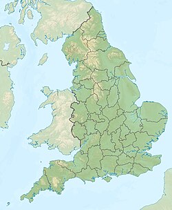
England relief location map.jpg
Pink ff0080 pog.svg
Lilstock Formation (England)

The Lilstock Formation is a geologic formation in England. It preserves bivalve, insect and other invertebrate fossils, as well as fossil fish of Agkistracanthus mitgelensis and the basal theropod dinosaur Newtonsaurus cambrensis dating back to the Rhaetian of the Triassic period. [1] [2]

Contents

White Lias

The White lias is a rare, fine-grained form of limestone from the late Triassic period, occurring only in certain parts of Somerset and infrequently in Warwickshire. [3] It gets the name ‘lias’ from the quarrymen's dialect for ‘layers’, referring to its natural state when quarried.

White lias is part of the Langport Member of the Lilstock Formation, [4] a multi-layered bed of stone formed from shale and limestone. At its base is a bone-bed yielding ancient marine, reptilian and ammonite fossils. [3]

White lias varies in colour from white-cream to pale grey and is traditionally used for building and flooring. [3] Evidence of its use can be seen in manor houses, churches and cathedrals all over the UK. It is most prevalent in the Somerset towns of Midsomer Norton, Radstock, Langport and Wincanton. [3] Bowdens quarry in Langport is the only supplier of white lias, and of the more commonly found blue lias and grey varieties.

See also

Related Research Articles

Geology of Dorset

Dorset is a county in South West England on the English Channel coast. Covering an area of 2,653 square kilometres (1,024 sq mi); it borders Devon to the west, Somerset to the north-west, Wiltshire to the north-east, and Hampshire to the east. The great variation in its landscape owes much to the underlying geology, which includes an almost unbroken sequence of rocks from 200 to 40 million years ago (Mya) and superficial deposits from 2 Mya to the present. In general, the oldest rocks appear in the far west of the county, with the most recent (Eocene) in the far east. Jurassic rocks also underlie the Blackmore Vale and comprise much of the coastal cliff in the west and south of the county; although younger Cretaceous rocks crown some of the highpoints in the west, they are mainly to be found in the centre and east of the county.

A bone bed is any geological stratum or deposit that contains bones of whatever kind. Inevitably, such deposits are sedimentary in nature. Not a formal term, it tends to be used more to describe especially dense collections such as Lagerstätte. It is also applied to brecciated and stalagmitic deposits on the floor of caves, which frequently contain osseous remains.

Polden Hills

Polden Hills in Somerset, England are a long, low ridge, extending for 10 miles (16 km), and separated from the Mendip Hills, to which they are nearly parallel, by a marshy tract, known as the Somerset Levels. They are now bisected at their western end by the M5 motorway and a railway, the Bristol and Exeter Railway, part of the Great Western Main Line.

Geology of Somerset

Somerset is a rural county in the southwest of England, covering 4,171 square kilometres (1,610 sq mi). It is bounded on the north-west by the Bristol Channel, on the north by Bristol and Gloucestershire, on the north-east by Wiltshire, on the south-east by Dorset, and on the south west and west by Devon. It has broad central plains with several ranges of low hills. The landscape divides into four main geological sections from the Silurian through the Devonian and Carboniferous to the Permian which influence the landscape, together with water-related features.

The Keuper is a lithostratigraphic unit in the subsurface of large parts of west and central Europe. The Keuper consists of dolomite, shales or claystones and evaporites that were deposited during the Middle and Late Triassic epochs. The Keuper lies on top of the Muschelkalk and under the predominantly Lower Jurassic Lias or other Early Jurassic strata.

Purbeck Group

The Purbeck Group is an Upper Jurassic to Lower Cretaceous lithostratigraphic group in south-east England. The name is derived from the district known as the Isle of Purbeck in Dorset where the strata are exposed in the cliffs west of Swanage.

Blue Anchor to Lilstock Coast SSSI

Blue Anchor to Lilstock Coast SSSI is a 742.8 hectare geological Site of Special Scientific Interest between Blue Anchor and Lilstock in Somerset, notified in 1971.

Geology of Gloucestershire

Gloucestershire is one of the most geologically and scenically diverse counties in England, with rocks from the Precambrian through to the Jurassic represented. These varying rock-types are responsible for the three major areas of the county, each with its own distinctive scenery and land-use - the Forest of Dean in the west, bordering Wales, the Cotswolds in the east, and in between, the Severn Vale.

Blue Lias Triassic/Jurassic geological formation in the UK

The Blue Lias is a geological formation in southern, eastern and western England and parts of South Wales, part of the Lias Group. The Blue Lias consists of a sequence of limestone and shale layers, laid down in latest Triassic and early Jurassic times, between 195 and 200 million years ago. The Blue Lias is famous for its fossils, especially ammonites.

The Lias Group or Lias is a lithostratigraphic unit found in a large area of western Europe, including the British Isles, the North Sea, the Low Countries and the north of Germany. It consists of marine limestones, shales, marls and clays.

Inferior Oolite

The Inferior Oolite is a sequence of Jurassic age sedimentary rocks in Europe. It was deposited during the Middle Jurassic. The Inferior Oolite Group as more recently defined is a Jurassic lithostratigraphic group in southern and eastern England. It has been variously known in the past as the Under Oolite, the Inferior Oolite, the Inferior Oolite Series and the Redbourne Group.

Whitby Mudstone

The Whitby Mudstone is a Toarcian geological formation in Yorkshire and Worcestershire, England. The formation, part of the Lias Group, is present in the Cleveland and Worcester Basins and the East Midlands Shelf.

Fossiliferous limestone

Fossiliferous limestone is any type of limestone, made mostly of calcium carbonate (CaCO3) in the form of the minerals calcite or aragonite, that contains an abundance of fossils or fossil traces. The fossils in these rocks may be of macroscopic or microscopic size. The sort of macroscopic fossils often include crinoid stems, brachiopods, gastropods, and other hard shelled mollusk remains.

The Penarth Group is a Rhaetian age (Triassic) lithostratigraphic group which is widespread in Britain. It is named from the seaside town of Penarth near Cardiff in south Wales where strata of this age are exposed in coastal cliffs southwards to Lavernock Point. This sequence of rocks was previously known as the Rhaetic or Rhaetic Beds.

Cotham Marble

Cotham Marble or Landscape Marble is a variety of Rhaetian stromatolitic limestone from the Penarth Group, found in south Wales and southwestern England in the area around Bristol, possibly extending to the south coast in east Devon. It is named after Cotham House in Cotham, Bristol. This limestone was used for ornamental purposes, particularly during the Victorian era. On cut and polished faces the stone has the appearance of a landscape, complete with ploughed fields, trees, and hedges.

Charmouth Mudstone Formation Geological formation in England

The Charmouth Mudstone Formation is a geological formation in England. It preserves fossils dating back to the early part of the Jurassic period (Sinemurian–Pliensbachian). It forms part of the lower Lias Group. It is most prominently exposed at its type locality in cliff section between Lyme Regis and Charmouth but onshore it extends northwards to Market Weighton, Yorkshire, and in the subsurface of the East Midlands Shelf and Wessex Basin. The formation is notable for its fossils, including those of ammonites and marine reptiles and rare dinosaur remains. The formation played a prominent role in the history of early paleontology, with its Lyme Regis-Charmouth exposure being frequented by fossil collectors including Mary Anning.

<i>Dracoraptor</i> Genus of reptiles (fossil)

Dracoraptor is a genus of coelophysoid dinosaur that lived during the Hettangian stage of the Early Jurassic Period of what is now Wales, sometime between 201 to 199 million years ago. It was discovered in 2014 at the Blue Lias Formation of the United Kingdom, and named in 2016 by British palaeontologist David Martill and colleagues, with the type species being Dracoraptor hanigani.

Finedon Top Lodge Quarry

Finedon Top Lodge Quarry, also known as Finedon Gullet is a 0.9 hectare geological Site of Special Scientific Interest east of Wellingborough in Northamptonshire. It is a Geological Conservation Review site revealing a sequence of middle Jurassic limestones, sandstones and ironstones, and is the type section for a sequence of sedimentary rocks known as the 'Wellingborough Member'. It was created by quarrying for the underlying ironstone for use at Wellingborough and Corby Steelworks; the ore was transported by the 1,000 mm gauge Wellingborough Tramway.

Fossil Beach (Sedbury Cliffs) Human settlement in England

Fossil Beach, at Sedbury, Gloucestershire, England, is beneath the Sedbury Cliffs by the River Severn and is known as a rich source of easily discovered fossils. It is within the Severn Estuary Site of Special Scientific Interest (SSSI).

Beacon Limestone Formation Geological formation in England

The Beacon Limestone Formation, historically known as the Junction Bed, is a formation of early Jurassic age (Pliensbachian–Toarcian). It lies above the Dyrham Formation and below the Bridport Sand Formation. It forms part of the Lias Group. It is found within the Wessex Basin and parts of Somerset, in England. It is well known for the Strawberry Bank Lagerstätte, which contains the 3-dimensionally preserved remains of vertebrates, including marine crocodyliformes, ichthyosaurs and fish, as well as insect compression fossils.

References

  1. Lilstock Formation at Fossilworks.org
  2. Galton PM. Bones of large dinosaurs (Prosauropoda and Stegosauria) from the Rhaetic Bone Bed (Upper Triassic) of Aust Cliff, southwest England. Revue de Paléobiologie, Genève. 2005; 24:51–74.
  3. 1 2 3 4 "Lias Stone Suppliers | Somerset Lias Quarry | Lovell Stone Group".
  4. Swift, Andrew (1995). "A review of the nature and outcrop of the 'White Lias' facies of the Langport Member (Penarth Group: Upper Triassic) in Britain". Proceedings of the Geologists' Association. 106 (4): 247–258. doi:10.1016/S0016-7878(08)80236-2.

Further reading