The Lias Group or Lias is a lithostratigraphic unit found in a large area of western Europe, including the British Isles, the North Sea, the Low Countries and the north of Germany. It consists of marine limestones, shales, marls and clays.

The Mercia Mudstone Group is an early Triassic lithostratigraphic group which is widespread in Britain, especially in the English Midlands—the name is derived from the ancient kingdom of Mercia which corresponds to that area. It is frequently encountered in older literature as the Keuper Marl or Keuper Marl Series.
The Claerwen Group is a Silurian lithostratigraphic group in mid Wales. The name is derived from Claerwen in Powys where the strata are exposed. The Group comprises the Rhayader Mudstones Formation and the underlying Derwenlas Formation which outcrop across the region. The rocks of the Rhayader Mudstone Formation have variously been known as the Rhayader Pale Shales, Rhayader Pale Shales Formation and Cwmsymlog Formation.
The Drefach Group is an Ordovician lithostratigraphic group in west Wales. The name is derived from the village of Drefach near Meidrim in Carmarthenshire. The Group comprises the Mydrim Shales Formation, the Mydrim Limestone Formation, the Hendre Shales Formation, Asaphus Ash Formation and at its base, the underlying Felin-wen Formation.
The Cwmystwyth Grits Group is a Silurian lithostratigraphic group in mid Wales. The name is derived from the village of Cwmystwyth near Devil's Bridge in Ceredigion. The Group comprises the Blaen Myherin Mudstones Formation, the Glanyrafon Formation, the Caerau Mudstones Formation, the Rhuddnant Grits Formation and the Pysgotwr Grits Formation.

The Aberystwyth Grits Group is a Silurian lithostratigraphic group in mid Wales. The name is derived from Aberystwyth in northern Ceredigion where the strata are well exposed in coastal cliffs. The Group comprises the Trefechan Formation and the underlying Mynydd Bach Formation. The rocks of the Aberystwyth Grits Group have also previously been known as the Aberystwyth Grits Formation
The Llanbedrog Volcanic Group is an Ordovician lithostratigraphic group in northwest Wales. The name is derived from the village of Llanbedrog on the Llyn Peninsula where the strata are exposed.

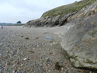
The Harlech Grits Group is a lower to middle Cambrian lithostratigraphic group in northwest Wales. The name is derived from the town of Harlech in Gwynedd.

The Mawddach Group is a middle to upper Cambrian lithostratigraphic group in Gwynedd, Wales. The name is derived from the river known as the Afon Mawddach.

The Sherwood Sandstone Group is a Triassic lithostratigraphic group which is widespread in Britain, especially in the English Midlands. The name is derived from Sherwood Forest in Nottinghamshire which is underlain by rocks of this age. It has economic importance as the reservoir of the Morecambe Bay gas field, the second largest gas field in the UK.
The Cumbrian Coast Group is a Permian lithostratigraphic group which occurs in the western part of Cumbria in northern England.

The Aylesbeare Mudstone Group is an early Triassic lithostratigraphic group in southwest England. The name is derived from the village of Aylesbeare in east Devon. The Group comprises the Littleham Mudstone Formation, the Exmouth Mudstone and Sandstone Formation and the underlying Clyst St Lawrence Formation. The strata are exposed on the coast between Exmouth and Budleigh Salterton where the type section is defined. The rocks of the Aylesbeare Mudstone Group have also previously been known as the Aylesbeare Group and the Aylesbeare Mudstone Formation.
The Caerfai Group is a Cambrian lithostratigraphic group in west Wales. The name is derived from Caerfai Bay on the north coast of St Brides Bay on the Pembrokeshire coast where the strata are well exposed in coastal cliffs. This rock succession has previously been known variously as the Caerfai Series, Caerfai Formation and Caerfai Beds and largely ascribed to the British regional stratigraphic unit Comley Epoch, though these terms are now obsolete.
The Lilstock Formation is a geologic formation in England. It preserves bivalve, insect and other invertebrate fossils, as well as fossil fish of Agkistracanthus mitgelensis and the basal theropod dinosaur Newtonsaurus cambrensis dating back to the Rhaetian of the Triassic period.

The Teign Valley Group is a late Devonian to late/middle Carboniferous lithostratigraphic group in north Cornwall through Devon and into west Somerset in southwest England. The name is derived from the valley of the River Teign. The Group comprises the Barras Nose, Trambley Cove, Teign Chert and Dowhills Mudstone formations. It also includes the Brendon and St Mellion formations whose stratigraphical context is unclear since all known boundaries of these two unit are tectonic. The Brendon Formation slates extend from Tavistock west to Bodmin Moor. The St Mellion Formation sandstones, siltstones and mudstones are found from Holne northeastwards. The Teign Valley Group was formerly known as the Lower Culm Group or Lower Culm Measures.

Fossil Beach, at Sedbury, Gloucestershire, England, is beneath the Sedbury Cliffs by the River Severn and is known as a rich source of easily discovered fossils. It is within the Severn Estuary Site of Special Scientific Interest (SSSI).
The Tyrone Group is a lithostratigraphical term coined to refer to a particular succession of rock strata which occur in Northern Ireland within the Visean Stage of the Carboniferous Period. It comprises a series of limestones, shales and sandstones which accumulated to a thickness of 2400m in the northwest Carboniferous basin of Ireland. The type areas for the group are the Clogher Valley of County Tyrone and the Fermanagh Highlands of nearby County Fermanagh. The rocks of the group sit unconformably on older rocks of the Shanmullagh Formation of the Fintona Group which are the local representatives of the Lower Old Red Sandstone. The top of the Dartry Limestone, the uppermost part of the group, is a disconformity, above which are the layered sandstones and shales of the Meenymore Formation of the Leitrim Group. The succession continues south and west across the border into the Republic of Ireland, though different names are typically applied.
The geology of Exmoor National Park in south-west England contributes significantly to the character of Exmoor, a landscape which was designated as a national park in 1954. The bedrock of the area consists almost wholly of a suite of sedimentary rocks deposited during the Devonian, a period named for the English county of Devon in which the western half of the park sits. The eastern part lies within Somerset and it is within this part of the park that limited outcrops of Triassic and Jurassic age rocks are to be found.
The geology of the Peak District National Park in England is dominated by a thick succession of faulted and folded sedimentary rocks of Carboniferous age. The Peak District is often divided into a southerly White Peak where Carboniferous Limestone outcrops and a northerly Dark Peak where the overlying succession of sandstones and mudstones dominate the landscape. The scarp and dip slope landscape which characterises the Dark Peak also extends along the eastern and western margins of the park. Although older rocks are present at depth, the oldest rocks which are to be found at the surface in the national park are dolomitic limestones of the Woo Dale Limestone Formation seen where Woo Dale enters Wye Dale east of Buxton.
The geology of the North York Moors National Park in northern England is provided largely by a thick southerly dipping sequence of sedimentary rocks deposited in the Cleveland Basin during the Jurassic Period. A series of ice ages during the Quaternary period has left a variety of glacial deposits, particularly around the margins of the National Park.
