Related Research Articles

Laurens County is a county located in the U.S. state of South Carolina. As of the 2020 census, its population was 67,539. Its county seat is Laurens.

Morganton is a city in and the county seat of Burke County, North Carolina, United States. The population was 16,918 at the 2010 census. Morganton is approximately 75 miles (121 km) northwest of Charlotte.
Ninety Six is a town in Greenwood County, South Carolina, United States. The population was 1,998 at the 2010 census.

Clinton is a city in Laurens County, South Carolina, United States. The population was 8,490 as of the 2010 census. It is part of the Greenville–Mauldin–Easley Metropolitan Statistical Area in upstate South Carolina. Clinton is the home of Presbyterian College.

Laurens is a city in Laurens County, South Carolina, United States. The population was 9,139 at the 2010 census. It is the county seat of Laurens County.

Cayce is a city in the U.S. state of South Carolina, along the Congaree River. The population was 12,528 at the 2010 census and rose to 13,789 in the 2020 United States Census, and it is the third-most populated municipality in Lexington County. The city is primarily in Lexington County, with additional, predominantly rural land to the east in Richland County. Cayce is part of the Columbia Metropolitan Statistical Area and is within South Carolina's Midlands region.

Fort Mill, also known as Fort Mill Township, is a town in York County, South Carolina, United States. It is a suburb of Charlotte, North Carolina. As of 2020 census, the population of the town was 24,521. Some businesses and residents in the Indian Land community of neighboring Lancaster County share a Fort Mill mailing address, but the official town boundary extends only within York County.
The Cherokee Path was the primary route of English and Scots traders from Charleston to Columbia, South Carolina in Colonial America. It was the way they reached Cherokee towns and territories along the upper Keowee River and its tributaries. In its lower section it was known as the Savannah River. They referred to these towns along the Keowee and Tugaloo rivers as the Lower Towns, in contrast to the Middle Towns in Western North Carolina and the Overhill Towns in present-day southeastern Tennessee west of the Appalachian Mountains.

Fort Gibson is a historic military site next to the modern city of Fort Gibson, in Muskogee County Oklahoma. It guarded the American frontier in Indian Territory from 1824 to 1888. When it was constructed, the fort was farther west than any other military post in the United States. It formed part of the north–south chain of forts that was intended to maintain peace on the frontier of the American West and to protect the southwestern border of the Louisiana Purchase. The fort succeeded in its peacekeeping mission for more than 50 years, as no massacres or battles occurred there.
Ninety Six National Historic Site, also known as Old Ninety Six and Star Fort, is a United States National Historic Site located about 60 miles south of Greenville, South Carolina. The historic site was listed on the National Register in 1969, declared to be a National Historic Landmark in 1973, and established as a National Historic Site in 1976 to preserve the original site of Ninety Six, South Carolina, a small town established in the early 18th century. It encompasses 1,022 acres of property.
Lulu City was a transient mining town in eastern Grand County, Colorado, in the Kawuneeche Valley in what is now Rocky Mountain National Park. The town appeared after silver was discovered in the area in 1879 by prospector Joe Shipler, and was built primarily by the Middle Park and Grand River Land Improvement Company in 1880. The company was backed by Benjamin F. Burnett of Fort Collins and Fort Collins rancher William Baker. The town was named after Burnett's daughter. By 1881, there were forty cabins and a number of business establishments. By this time it was apparent that the silver ore was of low grade, and that high transportation costs made mining in the area marginal, and the town began its decline. It was abandoned by 1885, except by Shipler, who lived there for thirty years.
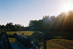
The Battle of Lindley's Fort was part of a campaign by Loyalist and Cherokee forces to gain control over the South Carolina backcountry from Patriot forces early in the American Revolutionary War. The Cherokees were involved because ongoing encroachment of their territory in the area had led them to take up arms. These activities prompted settlers to seek refuge at Lindley's Fort in present-day Laurens County. A joint force of Cherokee and Loyalists adorned with Indian warpaint descended on the fort one day after about 150 militiamen arrived at the stockade fort. The defenders repulsed the attackers, and when they withdrew, made a sortie and pursued them. Two Loyalists were killed and 13 taken prisoner.
Prior to the infamous Trail of Tears, much of the western part of South Carolina was controlled by native-American (Indian) tribes. The historic area of Fort Moore-Savano Town, is located near Aiken, South Carolina. It was one of the points of intersections between the white settlers and the native people. Fort Moore, built in earlier part of the 1700s, assisted the white people in restricting the native-Americans to interior lands. The fort was abandoned in 1763. Little is known about the town. The landmark was listed in the National Register of Historic Places on August 14, 1973.
Green's Shell Enclosure is a historic archeological site located at Hilton Head Island, Beaufort County, South Carolina. The site includes one of 20 or more prehistoric Indian shell middens in a ring shape located from the central coast of South Carolina to the central coast of Georgia. They are believed to date early in the second millennium BC, and they contain some of the earliest pottery known in North America.

Santee Indian Mound and Fort Watson is a historic archaeological site located in North Santee, Clarendon County, South Carolina, near Summerton. Santee Indian Mound was part of a Santee mound village complex; it was probably a burial and/or temple mound, likely constructed in some cultural period between 1200–1500.

Buford's Massacre Site, also known as Buford's Battleground, is a historic site and national historic district located near Lancaster, South Carolina. Two monuments at the site mark the battleground where the Battle of Waxhaws took place. A white monument ten feet tall, erected on June 2, 1860, marked the gravesite of American soldiers who died during the battle. This marker was gradually damaged over time by souvenir hunters who chipped off pieces, which led local authorities to erect a new monument on May 1, 1955, bearing the same inscription. The Battle of Waxhaws was a minor engagement during the American Revolutionary War between the Continental Army and Loyalist forces led by British colonel Banastre Tarleton, who became known as "Bloody Tarleton" as a result of accusations that his men massacred wounded American soldiers during the battle.

James Dunklin House, also known as the Williams-Watts-Todd-Dunklin House, is a historic home located in Laurens, Laurens County, South Carolina. It was built about 1812, and is a two-story, five bay, upcountry farmhouse, or I-house. It features informally spaced columns and two pipe-stem chimneys. An 1845 wing was removed in 1950 and converted into a six-room apartment building located behind the main house. At this time a first-floor sun porch was added to the rear of the house. Also on the property are outbuildings including a renovated slave cabin, a garage apartment, and a reconstruction of a kitchen at Colonial Williamsburg.
Rosemont Plantation is a historic archaeological site located near Waterloo, Laurens County, South Carolina. Development of the Piedmont plantation complex was begun sometime between 1750 and 1790. It reached its zenith as a cotton plantation during the second quarter of the 19th century, when it was occupied by the Cunningham family, whose descendants retained control. The main house of Rosemont burned in 1930. The Cunninghams sold it after that.

Pinckneyville is a historic frontier settlement site located near Union, Union County, South Carolina. Pinckneyville was established on February 19, 1791, by the General Assembly of South Carolina Act #1491 along with the Washington district, and is one of the earliest settlements in the South Carolina backcountry. Pinckneyville was named for Charles Cotesworth Pinckney. Pinckneyville was chosen because it was central to Union County, but Union was the seat of power.

Fort Johnson is a state-owned historic site of military and political significance located on the northeast point of James Island in Charleston County, South Carolina.
References
- 1 2 "National Register Information System". National Register of Historic Places . National Park Service. July 9, 2010.
- ↑ Ruth K. LaForge, and Sarah Nash (November 1976). "Lindley's Fort Site" (pdf). National Register of Historic Places - Nomination and Inventory. Retrieved June 14, 2014.
- ↑ "Lindley's Fort Site, Laurens County (Address Restricted)". National Register Properties in South Carolina. South Carolina Department of Archives and History. Retrieved June 14, 2014.
| Topics |  | |
|---|---|---|
| Lists by county |
| |
| Lists by city | ||
| Other lists | ||
| | This article about a property in Laurens County, South Carolina on the National Register of Historic Places is a stub. You can help Wikipedia by expanding it. |