Related Research Articles

Warragul is a town in Victoria, Australia, 102 kilometres south-east of Melbourne. Warragul lies between the Strzelecki Ranges to the south and the Mount Baw Baw Plateau of the Great Dividing Range to the north. As of the 2021 census, the town had a population of 19,856 people. Warragul forms part of a larger urban area that includes nearby Drouin that had an estimated total population of 42,827 as of the 2021 census.
The Potomac Heritage Trail, also known as the Potomac Heritage National Scenic Trail or the PHT, is a designated National Scenic Trail corridor spanning parts of the mid-Atlantic region of the United States that will connect various trails and historic sites in Virginia, Maryland, Pennsylvania, and the District of Columbia. The trail network includes 710 miles (1,140 km) of existing and planned sections, tracing the natural, historical, and cultural features of the Potomac River corridor, the upper Ohio River watershed in Pennsylvania and western Maryland, and a portion of the Rappahannock River watershed in Virginia. The trail is managed by the National Park Service and is one of three National Trails that are official NPS units.

Discovery Park is a 534-acre (2.16 km2) park on the shores of Puget Sound in the Magnolia neighborhood of Seattle, Washington. As the city's largest public park, it contains 11.81 miles (19.01 km) of walking trails. Daybreak Star Cultural Center is within the park's boundaries. A lighthouse is located on West Point, the westernmost point of the park and the entire city of Seattle, and on the south side of the North Beach strip is a sewage treatment plant, but it is almost entirely concealed from the marsh, beach, and trail. The Discovery Park Loop Trail, designated a National Recreation Trail in 1975, runs 2.8 miles (4.5 km) through the park, connecting to other trails.

A rail trail is a shared-use path on railway right of way. Rail trails are typically constructed after a railway has been abandoned and the track has been removed, but may also share the right of way with active railways, light rail, or streetcars, or with disused track. As shared-use paths, rail trails are primarily for non-motorized traffic including pedestrians, bicycles, horseback riders, skaters, and cross-country skiers, although snowmobiles and ATVs may be allowed. The characteristics of abandoned railways—gentle grades, well-engineered rights of way and structures, and passage through historical areas—lend themselves to rail trails and account for their popularity. Many rail trails are long-distance trails, while some shorter rail trails are known as greenways or linear parks.

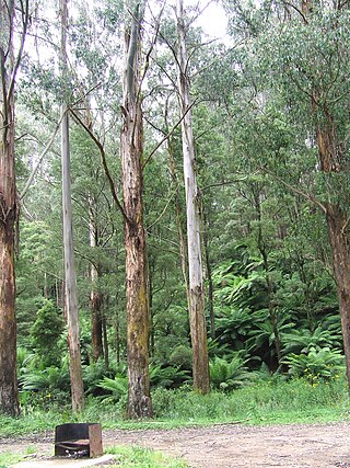
Mount Worth State Park is a state park in Victoria, Australia. It is located 15 km south of Warragul in the western Strzelecki Ranges. It offers rainforest walking trails and scenic views of Gippsland as well as across the Latrobe Valley to the Great Dividing Range.

Drouin is a town in the West Gippsland region, 90 kilometres (56 mi) east of Melbourne, in the Australian state of Victoria. Its local government area is the Shire of Baw Baw, and is home to the shire council’s headquarters despite being the second-largest town in the shire, behind neighbouring Warragul. The town’s name is believed to be an Aboriginal word meaning "north wind". New housing developments have accelerated the town's residential growth in recent years. As at the 2016 census, Drouin had a population of 11,887 people.

A greenway is usually a shared-use path along a strip of undeveloped land, in an urban or rural area, set aside for recreational use or environmental protection. Greenways are frequently created out of disused railways, canal towpaths, utility or similar rights of way, or derelict industrial land. Greenways also can also be linear parks, and can serve as wildlife corridors. The path's surface may be paved and often serves multiple users: walkers, runners, bicyclists, skaters and hikers. A characteristic of greenways, as defined by the European Greenways Association, is "ease of passage": that is that they have "either low or zero gradient", so that they can be used by all "types of users, including mobility impaired people".

Trail View State Park is a 454-acre (1.84 km2) state park located on Long Island on the Nassau–Suffolk county border in New York. The linear park, created in September 2002, runs between Bethpage State Park and Cold Spring Harbor State Park.
The Baltimore & Annapolis Trail is a 13.3-mile (21.4 km) rail trail in Anne Arundel County, Maryland. The trail starts at Boulter's Way in Arnold and ends near Baltimore Light Rail's Cromwell Station in Glen Burnie. Starting near Annapolis at Jonas Green Park, the trail passes (northward) through Arnold, Severna Park, Millersville, Pasadena, and Glen Burnie. The Baltimore & Annapolis Trail follows the route of the Baltimore & Annapolis Railroad from which it derives its name. Proposed in 1972 by Jim Hague, it opened on Oct 7, 1990 as the second rail trail in Maryland.

A linear park is a type of park that is significantly longer than it is wide. These linear parks are strips of public land running along canals, rivers, streams, defensive walls, electrical lines, or highways and shorelines. Examples of linear parks include everything from wildlife corridors to riverways to trails, capturing the broadest sense of the word. Other examples include rail trails, which are disused railroad beds converted for recreational use by removing existing structures. Commonly, these linear parks result from the public and private sectors acting on the dense urban need for open green space. Linear parks stretch through urban areas, coming through as a solution for the lack of space and need for urban greenery. They also effectively connect different neighborhoods in dense urban areas as a result, and create places that are ideal for activities such as jogging or walking. Linear parks may also be categorized as greenways. In Australia, a linear park along the coast is known as a foreshoreway. When being designed, linear parks appear unique as they are planned around the public's opinion of how the space will affect them.
Cycling in the Australian state of Victoria is a popular pastime, sport and way of getting around since at least 1896, as indicated by the Banjo Paterson poem Mulga Bill's Bicycle. Cycling in Victoria has been encouraged by the development of bicycle networks in town and cities throughout the state, and many regional rail trails. The sports popularity has been encouraged by the success of racing clubs such as the St Kilda Cycling Club and Victorian racing riders such as Cadel Evans, Simon Gerrans and Matthew Lloyd. Organised rides held annually including the Great Victorian Bike Ride, and races held in Victoria include the Herald Sun Tour.

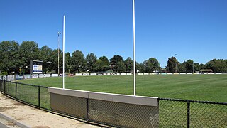
Western Park is a recreation reserve on the western side of the West Gippsland town of Warragul, Victoria.
The Noojee railway line is a closed railway line in Victoria, Australia. Branching off from the Gippsland line at Warragul station, it was built to service the timber industry in the upper Latrobe River area, transporting timber as well as providing a general goods and passenger service to townships in the area. The final section of the line between Neerim South and Noojee traversed increasingly hilly terrain and featured a number of large timber trestle bridges. Extensively and repeatedly damaged by bushfires over the years, the line was closed in the 1950s and dismantled. The last remaining large trestle bridge on the line has been preserved and has become a popular local tourist attraction.
The Drouin to Warragul Trail or Two Towns Trail is a cycling and walking path between Drouin and Warragul. It is primarily for use by commuters between the two towns. It is 8 kilometres long. It was funded by VicRoads.

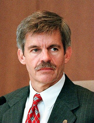
Howard W. Peak is an American politician who served as the mayor of San Antonio, Texas from 1997 to 2001. He was succeeded in office by Ed Garza. Prior to serving as mayor of the city, Peak served as a member of the San Antonio City Council from 1993 to 1997.

Westwood/Rancho Park station is an at-grade light rail station in the Los Angeles County Metro Rail system located at the intersection of Westwood Boulevard and Exposition Boulevard in the Rancho Park neighborhood of West Los Angeles, California. It serves the E Line.

The Hayward Area Recreation and Park District (H.A.R.D.) is the park management agency for most of the parks in the city of Hayward, California. It was created in 1944 and is an independent special district under California law. H.A.R.D. is the largest recreation district in California. It also manages parks in the bordering unincorporated communities of Castro Valley, San Lorenzo, Fairview, Ashland and Cherryland. It manages the park grounds for numerous schools in the region. Events and classes are scheduled and listed in a quarterly brochure. The parks' 2021 budget is $24,306,495.

The Maplewood Flats Conservation Area is a 126 hectare conservation area located in North Vancouver, British Columbia, Canada. The area is composed of a 96 hectare intertidal zone of mudflats and salt marsh, and a 30 hectare upland area. It is preserved by Port Metro Vancouver as one of their ecological land initiatives. The land is located approximately 2 km east of the Second Narrows Bridge along Burrard Inlet in North Vancouver.

The Underline is a 10-mile linear park being developed in Miami-Dade County, Florida. When complete, it will run underneath the county's elevated Metrorail system from the Miami River near Brickell to the Metrorail's southern terminus at Dadeland South. The project is essentially upgrading a pre-existing bike path, known as the M-Path, into a full linear park. As of 2022, the first phase of the Underline is complete in the Brickell area. The second phase, which will run from Brickell to just south of Vizcaya station, is set to be complete in December 2023. The full park will be complete in fall of 2026.
References
- ↑ "Archived copy" (PDF). Archived from the original (PDF) on 26 March 2012. Retrieved 19 April 2012.
{{cite web}}: CS1 maint: archived copy as title (link)