
This is a list of Category A listed buildings in the New Town of Edinburgh, Scotland.
Contents
For the main list, see List of Category A listed buildings in Edinburgh .
This is a list of Category A listed buildings in the New Town of Edinburgh, Scotland.
For the main list, see List of Category A listed buildings in Edinburgh .
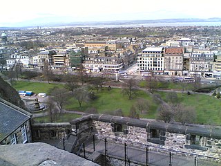
The New Town is defined here as the area shown in light brown on the map to the right, with some small exceptions:
| Name | Location | Date Listed | Grid Ref. [note 1] | Geo-coordinates | Notes | LB Number [note 2] | Image |
|---|---|---|---|---|---|---|---|
| West Register House | Charlotte Square | 3 March 1966 | 55°57′06″N3°12′34″W / 55.951602°N 3.209375°W | Former St George's Church. Robert Reid, 1811-14; gutted and reconstructed as registry office by R Saddler of Ministry of Public Building and Works, 1964-70. | 27360 |  | |
| 3 George Street (Incorporating Former No 13), Standard Life | 13 January 1966 | 55°57′15″N3°11′43″W / 55.954256°N 3.195156°W | J M Dick Peddie & George Washington Browne, 1897-1901, Palladian office block; former No 13 by W Hamilton Beattie (George Beattie & Sons), 1898, French Renaissance office; substantial additions and alterations by Michael Laird & Partners; phase 1, 1964; phase 2, with Robert Matthew, 1968; phase 3, 1975-8; sculpture and friezes by Sir John Steel and Gerald Ogilvy Laing. | 28829 |  | ||
| George Hotel | 19–25 George Street | 12 December 1974 | 55°57′14″N3°11′48″W / 55.953971°N 3.196732°W | John Young, circa 1780; now classical hotel with many later alterations. David Bryce, 1840-1; alterations and additions McGibbon and Ross, 1879-80; alterations R H Watherston, 1903; rear block Henry Wylie, 1968. | 28830 |  | |
| Clydesdale Bank | 29 and 31 George Street | 13 January 1966 | 55°57′14″N3°11′49″W / 55.953797°N 3.197063°W | David Bryce, 1841-2 and 1847-8. | 28831 |  | |
| 45 George Street | 13 January 1966 | 55°57′13″N3°11′55″W / 55.953665°N 3.198677°W | Circa 1775; refaced and extra storey added by Thomas Hamilton, 1829; alterations by Covell Matthews Partnership, 1974. | 28836 |  | ||
| 69 and 69A George Street | 13 January 1966 | 55°57′12″N3°12′01″W / 55.953254°N 3.200234°W | George Washington Browne, 1905. | 28844 |  | ||
| 91 and 91A George Street | 13 January 1966 | 55°57′10″N3°12′08″W / 55.952902°N 3.202289°W | 1785-90 with later alterations. | 28847 |  | ||
| Bank of Scotland | 97–105 George Street | 13 January 1966 | 55°57′10″N3°12′10″W / 55.952906°N 3.202801°W | J M Dick Peddie (Kinnear & Peddie), 1883-5. | 28850 |  | |
| 115 George Street | 13 January 1966 | 55°57′09″N3°12′16″W / 55.95263°N 3.20441°W | James Nisbet, circa 1790. | 28854 |  | ||
| Church of Scotland Offices | 117 to 121 George Street | 13 January 1966 | 55°57′10″N3°12′17″W / 55.952643°N 3.204827°W | Sydney Mitchell & Wilson, 1909-11; additional E bay by Auldjo Jamieson & Arnott. | 28855 |  | |
| 125 George Street | 14 December 1970 | 55°57′09″N3°12′19″W / 55.952558°N 3.205305°W | Circa 1785; additions to rear Robert Matheson, 1856, and George Morham, 1898. | 28856 |  | ||
| Former Commercial Bank | 14 George Street | 13 January 1966 | 55°57′12″N3°11′44″W / 55.953345°N 3.195544°W | David Rhind, 1846-7; internal alterations by Sydney Mitchell, 1885. | 28862 |  | |
| Royal Society of Edinburgh | 22 and 24 George Street | 14 December 1970 | 55°57′12″N3°11′47″W / 55.953389°N 3.196522°W | William Burn and David Bryce, 1843; adapted internally by W T Oldrieve, 1909; lecture theatre to rear by Robert Hurd and Partners, 1982. | 28864 |  | |
| 26 George Street | 13 January 1966 | 55°57′12″N3°11′49″W / 55.953332°N 3.196825°W | J M Dick Peddie, 1908-9. | 28865 |  | ||
| 30, 30A and 32 George Street | 13 January 1966 | 55°57′12″N3°11′51″W / 55.953264°N 3.197431°W | Circa 1775; alterations by David Bryce, 1860; later shops. | 28866 |  | ||
| 56 and 58 George Street | 13 January 1966 | 55°57′11″N3°11′57″W / 55.952959°N 3.199151°W | Circa 1775. | 28870 |  | ||
| Bank of Scotland | 62–66 George Street | 13 January 1966 | 55°57′10″N3°11′58″W / 55.952867°N 3.199453°W | David and John Bryce, 1874-78. | 28873 |  | |
| National Westminster Bank | 78 and 80 George Street | 13 January 1966 | 55°57′09″N3°12′04″W / 55.952544°N 3.201221°W | J J Burnet, 1903-7; altered circa 1936; restored by Ian Burke Associates, 1972. | 28876 |  | |
| Northern Lighthouse Board | 84 George Street | 13 January 1966 | 55°57′09″N3°12′06″W / 55.95255°N 3.201541°W | Built by Claud Cleghorn, 1786-8; reconstructed and united by Rowand Anderson, Kininmonth & Paul, 1971-3. | 28877 |  | |
| 112 George Street | 13 January 1966 | 55°57′08″N3°12′15″W / 55.952102°N 3.204186°W | 1790. | 28883 |  | ||
| Waverley Gate (former General Post Office) | North Bridge | 14 December 1970 | 55°57′11″N3°11′17″W / 55.952932°N 3.18802°W | Robert Matheson, 1861-65, with later additions, W W Robertson, 1891-2 and W T Oldrieve, 1907-10. | 27631 |  | |
| General Register House | Princes Street | 14 December 1970 | 55°57′13″N3°11′21″W / 55.953711°N 3.189293°W | Robert Adam, 1774-88; Robert Reid, 1822-34. Occupied by the General Register Office for Scotland | 27636 |  | |
| New Register House | West Register Street | 14 December 1970 | 55°57′15″N3°11′25″W / 55.954196°N 3.190189°W | Robert Matheson, 1856-62. Occupied by the General Register Office for Scotland | 27641 |  | |
| Governor's House | Calton Hill | 14 December 1970 | 55°57′11″N3°11′07″W / 55.953157°N 3.185224°W | Archibald Elliot, 1815. | 27646 |  | |
| Royal College of Physicians | 9 and 10 Queen Street | 3 March 1966 | 55°57′18″N3°11′47″W / 55.954899°N 3.196473°W | Thomas Hamilton, 1843-5; library block added and hall extended by David Bryce, 1864; New Library by David and John Bryce, 1876-7; conference centre and lecture theatre to rear by Baron Bercott Associates, 1984 principal rooms refurbished by Ben Tindall, 1994. | 27732 |  | |
| Royal Scottish Academy | 77A Princes Street | 14 December 1970 | 55°57′07″N3°11′47″W / 55.951818°N 3.196426°W | William Playfair, 1822-6, extended and enriched 1832-5, with later alterations and additions including WT Oldrieve, 1911-12. Sculpture, Sir John Steell, 1844. | 27744 |  | |
| Scottish National Portrait Gallery | Queen Street | 14 December 1970 | 55°57′20″N3°11′37″W / 55.955511°N 3.193609°W | Robert Rowand Anderson, 1885-90; sculpture by W Birnie Rhind, C McBride, DW & W Grant Stevenson, John Hutchison and Pittendrigh MacGillivray. | 27764 |  | |
| Melville Monument | St Andrew Square Gardens | 13 January 1966 | 55°57′15″N3°11′35″W / 55.954222°N 3.193169°W | William Burn, 1820-3. | 27816 |  | |
| National Monument of Scotland | Calton Hill | 19 April 1966 | 55°57′17″N3°10′55″W / 55.954743°N 3.181909°W | C.R. Cockerell and W. H. Playfair, designed 1823-1826, built 1826-9. | 27820 | 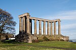 | |
| Nelson Monument | Calton Hill | 19 April 1966 | 55°57′15″N3°10′58″W / 55.954305°N 3.182649°W | Robert Burn, 1807; completed by Thomas Bonnar, 1814-1816. | 27823 |  | |
| Playfair's Monument | Calton Hill | 19 April 1966 | 55°57′17″N3°10′59″W / 55.954795°N 3.183064°W | William Henry Playfair, 1825-6. | 27826 |  | |
| Scott Monument | East Princes Street Gardens | 14 December 1970 | 55°57′09″N3°11′36″W / 55.952379°N 3.193272°W | George Meikle Kemp, 1840-4. | 27829 |  | |
| Catherine Sinclair Monument | Queen Street | 14 December 1970 | 55°57′11″N3°12′27″W / 55.953191°N 3.207615°W | David Bryce, 1866-8. Sculptor John Rhind. | 27832 |  | |
| Dugald Stewart's Monument | Calton Hill | 19 April 1966 | 55°57′16″N3°11′04″W / 55.954512°N 3.184481°W | William Henry Playfair, 1831. | 27835 |  | |
| Albert Memorial | Charlotte Square | 3 March 1966 | 55°57′06″N3°12′28″W / 55.951762°N 3.207666°W | David Bryce, 1873; statue by Sir John Steell, 1870-76. | 27840 | 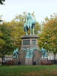 | |
| Adam Black Monument | East Princes Street Gardens | 14 December 1970 | 55°57′08″N3°11′40″W / 55.952179°N 3.194435°W | John Hutchison, 1877. | 27842 |  | |
| Statue of Dr Chalmers | George Street | 13 January 1966 | 55°57′09″N3°12′13″W / 55.952467°N 3.20354°W | Sir John Steell, 1878. | 27847 | 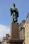 | |
| Statue of George IV | George Street | 13 January 1966 | 55°57′13″N3°11′50″W / 55.953526°N 3.197279°W | Sir Francis Chantrey, 1831. | 27854 |  | |
| Monument to John, 4th Earl of Hopetoun | St Andrew Square | 13 April 1965 | 55°57′16″N3°11′30″W / 55.954461°N 3.19167°W | Thomas Campbell, 1824-9. | 27862 |  | |
| Livingstone Monument | East Princes Street Gardens | 14 December 1970 | 55°57′09″N3°11′34″W / 55.952473°N 3.192762°W | Amelia R Hill, 1875. | 27864 |  | |
| Allan Ramsay Monument | West Princes Street Gardens | 14 December 1970 | 55°57′06″N3°11′50″W / 55.951701°N 3.197335°W | Sir John Steell, 1850 and David Bryce, 1865. | 27870 |  | |
| Monument to Duke of Wellington | Princes Street | 13 January 1966 | 55°57′13″N3°11′21″W / 55.953478°N 3.189174°W | David Bryce and James Gowans, 1849-52; equestrian statue by Sir John Steell, 1848. | 27879 | 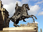 | |
| John Wilson Monument | East Princes Street Gardens | 14 December 1970 | 55°57′07″N3°11′42″W / 55.952073°N 3.195088°W | Sir John Steell, 1863-5. Plinth by David Bryce. | 27881 |  | |
| Ross Fountain | West Princes Street Gardens | 14 December 1970 | 55°57′00″N3°12′11″W / 55.950073°N 3.203066°W | Jean-Baptiste Klagmann, sculptor, cast by Antoine Durenne, 1862. | 27911 |  | |
| Old Royal High School | Calton Hill | 19 April 1966 | 55°57′12″N3°10′52″W / 55.953332°N 3.181066°W | Thomas Hamilton, 1825-9. Including Lodge, Classroom Block, Retaining/ Boundary Walls, Gateposts and Railings | 27987 |  | |
| 3, 3B Albany Street | 24 May 1966 | 55°57′24″N3°11′34″W / 55.956767°N 3.192862°W | Earlier 19th century. | 28218 |  | ||
| 5-7B Albany Street | 24 May 1966 | 55°57′25″N3°11′33″W / 55.956806°N 3.192591°W | Earlier 19th century. | 28219 |  | ||
| 9, 9A, 9B Albany Street | 24 May 1966 | 55°57′24″N3°11′33″W / 55.956789°N 3.192447°W | Earlier 19th century. | 28220 |  | ||
| 11–19 Albany Street | 24 May 1966 | 55°57′25″N3°11′31″W / 55.95693°N 3.191874°W | Earlier 19th century. | 28221 |  | ||
| 21-23A Albany Street | 24 May 1966 | 55°57′25″N3°11′29″W / 55.956997°N 3.191444°W | Earlier 19th century. | 28222 |  | ||
| 25, 25B Albany Street | 24 May 1966 | 55°57′25″N3°11′29″W / 55.957043°N 3.191333°W | Earlier 19th century. | 28223 |  | ||
| 27–33 Albany Street | 24 May 1966 | 55°57′26″N3°11′27″W / 55.957111°N 3.190807°W | Earlier 19th century. | 28224 |  | ||
| 39–43 Albany Street | 24 May 1966 | 55°57′26″N3°11′23″W / 55.95713°N 3.189734°W | Probably William Sibbald, earlier 19th century. | 28226 |  | ||
| 8–16 Albany Street | 13 September 1964 | 55°57′26″N3°11′35″W / 55.957126°N 3.192986°W | Earlier 19th century. | 28229 |  | ||
| 18–40 Albany Street | 13 September 1964 | 55°57′26″N3°11′31″W / 55.957308°N 3.191822°W | Probably William Sibbald, earlier 19th century. | 28230 |  | ||
| 42–44 Albany Street | 13 September 1964 | 55°57′27″N3°11′26″W / 55.957537°N 3.190436°W | Earlier 19th century. | 28231 |  | ||
| 1 and 2 Royal Terrace | 14 December 1970 | 55°57′24″N3°10′40″W / 55.956662°N 3.177643°W | William Playfair, designed 1820-4; No 1 and No 2 built circa 1857. | 29681 |  | ||
| 3 Royal Terrace | 14 December 1970 | 55°57′24″N3°10′51″W / 55.956732°N 3.180721°W | William Playfair, designed 1820-4; No 3 built circa 1859. | 49801 |  | ||
| 4 Royal Terrace | 14 December 1970 | 55°57′24″N3°10′50″W / 55.956742°N 3.180561°W | William Playfair, designed 1820-4. No 4 built between 1823-early 1830s. | 49802 |  | ||
| 5 Royal Terrace | 14 December 1970 | 55°57′24″N3°10′50″W / 55.956744°N 3.180417°W | William Playfair, designed 1820-4. No 5 built between 1823-early 1830s. | 49803 |  | ||
| 6 Royal Terrace | 14 December 1970 | 55°57′24″N3°10′49″W / 55.956736°N 3.180272°W | William Playfair, designed 1820-4. No 6 built between 1823- early 1830s. | 49804 |  | ||
| 7 Royal Terrace | 14 December 1970 | 55°57′24″N3°10′49″W / 55.956728°N 3.180176°W | William Playfair, designed 1820-4. No 7 built between 1823-early 1830s. | 49805 | 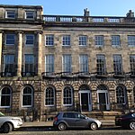 | ||
| 8 Royal Terrace | 14 December 1970 | 55°57′24″N3°10′48″W / 55.956729°N 3.180064°W | William Playfair, designed 1820-4. No 8 built between 1823- early 1830s. | 49806 |  | ||
| 9 Royal Terrace | 14 December 1970 | 55°57′24″N3°10′48″W / 55.956703°N 3.179935°W | William Playfair, designed 1820-4; No 9 built between 1823 and early 1830s. | 49807 | 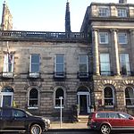 | ||
| 10 Royal Terrace | 14 December 1970 | 55°57′24″N3°10′47″W / 55.956705°N 3.179759°W | William Playfair, designed 1820-4; No 10 built between 1823 and early 1830s. | 49808 |  | ||
| 11 and 12 Royal Terrace | 14 December 1970 | 55°57′24″N3°10′46″W / 55.956716°N 3.179583°W | William Playfair, designed 1820-4; No 11 and 12 built between 1823 and early 1830s. | 49809 |  | ||
| 13 Royal Terrace | 14 December 1970 | 55°57′24″N3°10′45″W / 55.956709°N 3.179294°W | William Playfair, designed 1820-4. No 13 built between 1823- early 1830s. | 49810 |  | ||
| 14 Royal Terrace | 14 December 1970 | 55°57′24″N3°10′45″W / 55.956693°N 3.179134°W | William Playfair, designed 1820-4. No 14 built between 1823- early 1830s. | 49811 |  | ||
| 15 Royal Terrace | 14 December 1970 | 55°57′24″N3°10′45″W / 55.956703°N 3.179038°W | William Playfair, designed 1820-4. No 15 built 1860s. | 49812 |  | ||
| Crowne Plaza Hotel (As of 2014; formerly the Royal Terrace Hotel) | 16–22 Royal Terrace | 14 December 1970 | 55°57′24″N3°10′43″W / 55.95668°N 3.178621°W | William Playfair, designed 1820-4; Nos 16-22 built early 1860s. [1] | 49813 | 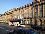 | |
| 23 Royal Terrace | 14 December 1970 | 55°57′24″N3°10′40″W / 55.956669°N 3.1779°W | William Playfair, designed 1820-4. No 23 built between 1823- early 1830s. | 49814 |  | ||
| 24 Royal Terrace | 14 December 1970 | 55°57′24″N3°10′40″W / 55.95667°N 3.177772°W | William Playfair, designed 1820-4. No 24 built between 1823- early 1830s. | 49815 |  | ||
| 25 Royal Terrace | 14 December 1970 | 55°57′24″N3°10′40″W / 55.956662°N 3.177643°W | William Playfair, designed 1820-4. No 25 built between 1823- early 1830s. | 49816 |  | ||
| 26 Royal Terrace | 14 December 1970 | 55°57′24″N3°10′39″W / 55.956664°N 3.177483°W | William Playfair, designed 1820-4. No 26 built between 1823 and early 1830s. | 49817 | 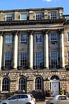 | ||
| 27 Royal Terrace | 14 December 1970 | 55°57′24″N3°10′38″W / 55.956656°N 3.177355°W | William Playfair, designed 1820-4. No 27 built between 1823 and early 1830s. | 49818 |  | ||
| 28 Royal Terrace | 14 December 1970 | 55°57′24″N3°10′38″W / 55.956658°N 3.177195°W | William Playfair, designed 1820-4. No 28 built between 1823- early 1830s. | 49819 |  | ||
| 29 Royal Terrace | 14 December 1970 | 55°57′24″N3°10′37″W / 55.95665°N 3.177066°W | William Playfair, designed 1820-4. No 29 built between 1823-early 1830s. | 49820 |  | ||
| 30 Royal Terrace | 14 December 1970 | 55°57′24″N3°10′37″W / 55.956651°N 3.176906°W | William Playfair, designed 1820-4. No 30 built between 1823-early 1830s. | 49821 |  | ||
| 31 Royal Terrace | 14 December 1970 | 55°57′24″N3°10′36″W / 55.956644°N 3.176746°W | William Playfair, designed 1820-4; No 31 built between 1854 and 1859. | 49823 |  | ||
| 32 Royal Terrace | 14 December 1970 | 55°57′24″N3°10′36″W / 55.956636°N 3.176601°W | William Playfair, designed 1820-4; No 32 built between 1854 and 1859. | 49824 |  | ||
| 33 Royal Terrace | 14 December 1970 | 55°57′24″N3°10′35″W / 55.95662°N 3.176425°W | William Playfair, designed 1820-4; No 33 built between 1854 and 1859. | 49825 |  | ||
| 34 Royal Terrace | 14 December 1970 | 55°57′24″N3°10′35″W / 55.956621°N 3.176265°W | William Playfair, designed 1820-4. No 34 built between 1854-1859. | 49826 |  | ||
| 35 Royal Terrace | 14 December 1970 | 55°57′24″N3°10′34″W / 55.956614°N 3.17612°W | William Playfair, designed 1820-4. No 35 built between 1823- early 1830s. | 49827 |  | ||
| 36 Royal Terrace | 14 December 1970 | 55°57′24″N3°10′33″W / 55.956616°N 3.175944°W | William Playfair, designed 1820-4. No 36 built between 1823- early 1830s. | 49828 |  | ||
| 37 Royal Terrace | 14 December 1970 | 55°57′24″N3°10′33″W / 55.956608°N 3.175784°W | William Playfair, designed 1820-4. No 37 built between 1823-early 1830s. | 49829 |  | ||
| 38 Royal Terrace | 14 December 1970 | 55°57′24″N3°10′32″W / 55.956618°N 3.17564°W | William Playfair, designed 1820-4; No 38 built between 1823 and early 1830s. | 49830 |  | ||
| 39 Royal Terrace | 14 December 1970 | 55°57′24″N3°10′32″W / 55.956611°N 3.175479°W | William Playfair, designed 1820-4; No 39 built 1823- early 1830s. | 49831 |  | ||
| 40 Royal Terrace | 14 December 1970 | 55°57′24″N3°10′31″W / 55.956613°N 3.175319°W | William Playfair, designed 1820-4; No 40 built 1821-22. | 49832 |  | ||
| 1 Regent Terrace | 16 December 1965 | 55°57′18″N3°10′35″W / 55.954959°N 3.176294°W | William Playfair, designed 1825 (redesigned 1831), built 1831-1833. | 29618 |  | ||
| 2 Regent Terrace | 16 December 1965 | 55°57′15″N3°10′41″W / 55.954214°N 3.178097°W | William Playfair, designed 1825 (redesigned 1831), built 1831-1833. | 49765 |  | ||
| 3 Regent Terrace | 16 December 1965 | 55°57′15″N3°10′41″W / 55.954224°N 3.177938°W | William Playfair, designed 1825, built 1826-1833. | 49766 |  | ||
| 4 Regent Terrace | 16 December 1965 | 55°57′15″N3°10′40″W / 55.954271°N 3.177811°W | William Playfair, designed 1825, built 1826-1833. | 49767 |  | ||
| 5 Regent Terrace | 16 December 1965 | 55°57′16″N3°10′40″W / 55.954352°N 3.177765°W | William Playfair, designed 1825, built 1826-1833. | 49768 |  | ||
| 6 Regent Terrace | 16 December 1965 | 55°57′16″N3°10′40″W / 55.954398°N 3.177639°W | William Playfair, designed 1825, built 1826-1833. | 49769 |  | ||
| 7 Regent Terrace | 16 December 1965 | 55°57′16″N3°10′39″W / 55.954434°N 3.177576°W | William Playfair, designed 1825, built 1826-1833. | 49770 |  | ||
| 8 Regent Terrace | 16 December 1965 | 55°57′16″N3°10′39″W / 55.95448°N 3.177465°W | William Playfair, designed 1825, built 1826-1833. | 49771 |  | ||
| 9 Regent Terrace | 16 December 1965 | 55°57′16″N3°10′39″W / 55.95458°N 3.177372°W | William Playfair, designed 1825, built 1826-1833. | 49772 |  | ||
| 10 Regent Terrace | 16 December 1965 | 55°57′17″N3°10′38″W / 55.9546°N 3.177212°W | William Playfair, designed 1825, built 1826-1833. | 49773 |  | ||
| 11 Regent Terrace | 16 December 1965 | 55°57′17″N3°10′37″W / 55.954628°N 3.177053°W | William Playfair, designed 1825, built 1826-1833. | 49774 |  | ||
| 12 Regent Terrace | 16 December 1965 | 55°57′17″N3°10′37″W / 55.954674°N 3.176958°W | William Playfair, designed 1825, built 1826-1833. | 49775 |  | ||
| 13 Regent Terrace | 16 December 1965 | 55°57′17″N3°10′37″W / 55.954711°N 3.176847°W | William Playfair, designed 1825, built 1826-1833. | 49776 |  | ||
| 14 Regent Terrace | 16 December 1965 | 55°57′17″N3°10′36″W / 55.954757°N 3.176737°W | William Playfair, designed 1825, built 1826-1833. | 49777 |  | ||
| 15 Regent Terrace | 16 December 1965 | 55°57′17″N3°10′36″W / 55.954803°N 3.176626°W | William Playfair, designed 1825, built 1826-1833. | 49778 |  | ||
| 16 Regent Terrace | 16 December 1965 | 55°57′17″N3°10′35″W / 55.954858°N 3.176499°W | William Playfair, designed 1825, built 1826-1833. | 49779 |  | ||
| 17 Regent Terrace | 16 December 1965 | 55°57′18″N3°10′35″W / 55.954913°N 3.176389°W | William Playfair, designed 1825, completed by 1830. | 49780 |  | ||
| 18 Regent Terrace | 16 December 1965 | 55°57′18″N3°10′35″W / 55.954959°N 3.176294°W | William Playfair, designed 1825, built 1826-1833. | 49781 |  | ||
| 19 Regent Terrace | 16 December 1965 | 55°57′18″N3°10′34″W / 55.955005°N 3.176168°W | William Playfair, designed 1825, built 1826-1833. | 49782 |  | ||
| 20 Regent Terrace | 16 December 1965 | 55°57′18″N3°10′34″W / 55.95506°N 3.176057°W | William Playfair, designed 1825, built 1826-1833. | 49783 |  | ||
| 21 Regent Terrace | 16 December 1965 | 55°57′18″N3°10′33″W / 55.955097°N 3.17593°W | William Playfair, designed 1825, built 1826-1833. | 49784 |  | ||
| 22 Regent Terrace | 16 December 1965 | 55°57′19″N3°10′33″W / 55.955152°N 3.175804°W | William Playfair, designed 1825, built 1826-1833. | 49785 |  | ||
| 23 Regent Terrace | 16 December 1965 | 55°57′19″N3°10′32″W / 55.95518°N 3.175692°W | William Playfair, designed 1825, built 1826-1833. | 49786 |  | ||
| 24 Regent Terrace | 16 December 1965 | 55°57′19″N3°10′32″W / 55.955244°N 3.175582°W | William Playfair, designed 1825, built 1826-1833. | 49787 |  | ||
| 25 Regent Terrace | 16 December 1965 | 55°57′19″N3°10′32″W / 55.955281°N 3.175471°W | William Playfair, designed 1825, built 1826-1833. | 49790 |  | ||
| 26 Regent Terrace | 16 December 1965 | 55°57′19″N3°10′31″W / 55.955327°N 3.175344°W | William Playfair, designed 1825, built 1826-1833. | 49791 |  | ||
| 27 Regent Terrace | 16 December 1965 | 55°57′19″N3°10′31″W / 55.955374°N 3.175218°W | William Playfair, designed 1825, built 1826-1833. | 49792 |  | ||
| 28 Regent Terrace | 16 December 1965 | 55°57′20″N3°10′31″W / 55.955464°N 3.17514°W | William Playfair, designed 1825, built 1826-1833. | 49793 |  | ||
| 29 Regent Terrace | 16 December 1965 | 55°57′20″N3°10′30″W / 55.955492°N 3.175013°W | William Playfair, designed 1825, built 1826-1833. | 49794 |  | ||
| 30 Regent Terrace | 16 December 1965 | 55°57′20″N3°10′30″W / 55.955529°N 3.174886°W | William Playfair, designed 1825, built 1826-1833. | 49795 |  | ||
| 31 Regent Terrace | 16 December 1965 | 55°57′20″N3°10′29″W / 55.955576°N 3.174759°W | William Playfair, designed 1825, built 1826-1833. | 49796 |  | ||
| 32 Regent Terrace | 16 December 1965 | 55°57′20″N3°10′29″W / 55.955613°N 3.174648°W | William Playfair, designed 1825, built 1826-1833. | 49797 |  | ||
| 33 Regent Terrace | 16 December 1965 | 55°57′20″N3°10′28″W / 55.955659°N 3.174538°W | William Playfair, designed 1825, built 1826-1833. | 49798 |  | ||
| 34 Regent Terrace | 16 December 1965 | 55°57′21″N3°10′28″W / 55.955704°N 3.174443°W | William Playfair, designed 1825, built 1826-1833. | 49799 |  | ||
| 1 Carlton Terrace | 16 December 1965 | 55°57′22″N3°10′25″W / 55.956189°N 3.173577°W | William Playfair, designed 1821-1825, built from late 1820s-mid 1830s. | 28460 |  | ||
| 2, 3, 4 Carlton Terrace | 16 December 1965 | 55°57′21″N3°10′27″W / 55.955887°N 3.174096°W | William Playfair, designed 1821-1825, built from late 1820s-mid 1830s. | 49746 |  | ||
| 5 Carlton Terrace | 16 December 1965 | 55°57′22″N3°10′25″W / 55.956008°N 3.173699°W | William Playfair, designed 1821-1825, built from late 1820s-mid 1830s. | 49747 |  | ||
| 6 Carlton Terrace | 16 December 1965 | 55°57′22″N3°10′25″W / 55.95609°N 3.173622°W | William Playfair, designed 1821-1825, built from late 1820s-mid 1830s. | 49748 | 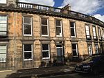 | ||
| 7 Carlton Terrace | 16 December 1965 | 55°57′22″N3°10′25″W / 55.956189°N 3.173577°W | William Playfair, designed 1821-1825, built from late 1820s-mid 1830s. | 49749 |  | ||
| 8 Carlton Terrace | 16 December 1965 | 55°57′23″N3°10′25″W / 55.956261°N 3.173579°W | William Playfair, designed 1821-1825, built from late 1820s-mid 1830s. | 49750 |  | ||
| 9 Carlton Terrace | 16 December 1965 | 55°57′23″N3°10′25″W / 55.956359°N 3.173614°W | William Playfair, designed 1821-1825, built from late 1820s-mid 1830s. | 49751 |  | ||
| 10 Carlton Terrace | 16 December 1965 | 55°57′23″N3°10′25″W / 55.956431°N 3.173664°W | William Playfair, designed 1821-1825, built from late 1820s-mid 1830s. | 49752 |  | ||
| 11 Carlton Terrace | 16 December 1965 | 55°57′23″N3°10′25″W / 55.956511°N 3.173715°W | William Playfair, designed 1821-1825, built from late 1820s-mid 1830s. | 49753 |  | ||
| 12 Carlton Terrace | 16 December 1965 | 55°57′24″N3°10′26″W / 55.956581°N 3.173909°W | William Playfair, designed 1821-1825, built from late 1820s-mid 1830s. | 49754 |  | ||
| 13 Carlton Terrace | 16 December 1965 | 55°57′24″N3°10′27″W / 55.956589°N 3.174069°W | William Playfair, designed 1821-1825, built from late 1820s-mid 1830s. | 49755 |  | ||
| 14 Carlton Terrace | 16 December 1965 | 55°57′24″N3°10′27″W / 55.956596°N 3.174198°W | William Playfair, designed 1821-1825, built from late 1820s-mid 1830s. | 49756 |  | ||
| 15 Carlton Terrace | 16 December 1965 | 55°57′24″N3°10′28″W / 55.956594°N 3.17439°W | William Playfair, designed 1821-1825, built from late 1820s-mid 1830s. | 49757 |  | ||
| 16 Carlton Terrace | 16 December 1965 | 55°57′24″N3°10′28″W / 55.956602°N 3.174534°W | William Playfair, designed 1821-1825, built from late 1820s-mid 1830s. | 49758 |  | ||
| 17 Carlton Terrace | 16 December 1965 | 55°57′24″N3°10′29″W / 55.95661°N 3.174695°W | William Playfair, designed 1821-1825, built from late 1820s-mid 1830s. | 49759 |  | ||
| 18 Carlton Terrace | 16 December 1965 | 55°57′24″N3°10′30″W / 55.95659°N 3.17487°W | William Playfair, designed 1821-1825, built from late 1820s-mid 1830s. | 49760 |  | ||
| 19 Carlton Terrace | 16 December 1965 | 55°57′24″N3°10′30″W / 55.956598°N 3.174983°W | William Playfair, designed 1821-1825, built from late 1820s-mid 1830s. | 49761 |  | ||
| Robert Louis Stevenson Memorial | West Princes Street Gardens | 15 October 2001 | 55°57′00″N3°12′08″W / 55.950026°N 3.202312°W | Ian Hamilton Finlay, 1999. | 48255 |  | |
| 87 George Street | New Town | 13 January 1966 | 55°57′11″N3°12′07″W / 55.952923°N 3.201985°W | Circa 1775; interior by David Bryce, 1835; shopfront renewed 1910, and again 1993. | 43287 |  | |
| 5–9 Hill Street | New Town | 3 March 1966 | 55°57′13″N3°12′07″W / 55.953605°N 3.20207°W | James Hill, 1788-94 with later alterations. | 43296 |  | |
| 11 and 13 Hill Street | New Town | 3 March 1966 | 55°57′13″N3°12′08″W / 55.953576°N 3.20231°W | James Hill, 1788-94. | 43297 |  | |
| 15 Hill Street | New Town | 3 March 1966 | 55°57′13″N3°12′10″W / 55.953509°N 3.202644°W | James Hill, 1788-94. | 43298 |  | |
| 6 and 8 Hill Street | New Town | 3 March 1966 | 55°57′12″N3°12′07″W / 55.953408°N 3.201952°W | James Hill, 1788-94. | 43299 |  | |
| 10 Hill Street | New Town | 3 March 1966 | 55°57′12″N3°12′07″W / 55.953398°N 3.202064°W | James Hill, 1788-94. | 43300 |  | |
| 12 Hill Street | New Town | 3 March 1966 | 55°57′12″N3°12′08″W / 55.95337°N 3.202191°W | James Hill, 1788-94. | 43301 |  | |
| 14 and 16 Hill Street | New Town | 3 March 1966 | 55°57′12″N3°12′09″W / 55.953332°N 3.202446°W | 43302 |  | ||
| 18 and 20 Hill Street | New Town | 3 March 1966 | 55°57′12″N3°12′09″W / 55.953312°N 3.20259°W | James Hill, 1788-94. | 43303 |  | |
| 22 Hill Street | New Town | 3 March 1966 | 55°57′12″N3°12′10″W / 55.953237°N 3.202908°W | James Hill, 1788-94. | 43304 |  | |
| 24 Hill Street | New Town | 3 March 1966 | 55°57′12″N3°12′11″W / 55.953209°N 3.203035°W | James Hill, 1788-94. | 43305 |  | |
| 84–87 Princes Street, incorporating the New Club | Princes Street, New Town | 28 March 1996 | 55°57′08″N3°11′53″W / 55.952161°N 3.198086°W | Alan Reiach, Eric Hall & Partners, 1966-9. | 43322 |  | |
| 9 and 10 St Andrew Square | 28 March 1996 | 55°57′12″N3°11′39″W / 55.953447°N 3.194298°W | Basil Spence and Partners (work supervised by J Hardie Glover), 1956-62. | 43349 |  | ||
| Thistle Street, 3 and 4 Thistle Court | 13 January 1966 | 55°57′16″N3°11′46″W / 55.954454°N 3.196075°W | 1767-8; subsequent alterations. | 43351 |  | ||
| 15 Young Street | 3 March 1966 | 55°57′11″N3°12′20″W / 55.953004°N 3.205591°W | 43366 |  | |||
| 16 Young Street | 3 March 1966 | 55°57′10″N3°12′20″W / 55.952789°N 3.2056°W | 43367 |  | |||
| 18 Young Street | 3 March 1966 | 55°57′10″N3°12′21″W / 55.95276°N 3.205776°W | 43368 |  | |||
| Cambridge Bar | 20 Young Street | 3 March 1966 | 55°57′10″N3°12′21″W / 55.952741°N 3.205919°W | 43369 |  | ||
| Doric Pavilion | Queen Street Gardens, New Town | 12 June 1996 | 55°57′19″N3°11′55″W / 55.955372°N 3.198698°W | 43498 |  | ||
| St Cuthbert's Church (Church of Scotland) | Lothian Road | 14 December 1970 | 55°56′59″N3°12′20″W / 55.949591°N 3.205453°W | 27339 |  | ||
| Waverley Station, 4, 17, 31 and 33 Waverley Bridge & 31, 32, 36–39 Market Street including Waverley Bridge and 45 Market Street (Sub-Structure Only) | 12 November 1991 | 55°57′07″N3°11′24″W / 55.951952°N 3.18996°W | 30270 |  | |||
| 28 St Andrew Square | 12 December 1974 | 55°57′19″N3°11′35″W / 55.955176°N 3.192942°W | 30160 |  | |||
| 139 and 141 Princes Street | 12 December 1974 | 55°57′02″N3°12′25″W / 55.950602°N 3.206878°W | 30149 |  | |||
| 71 George Street | 12 December 1974 | 55°57′12″N3°12′03″W / 55.953212°N 3.200857°W | 30102 |  | |||
| 90 and 90A George Street | 12 December 1974 | 55°57′08″N3°12′07″W / 55.952293°N 3.20203°W | 30107 |  | |||
| City Art Centre | 1–6 Market Street | 12 December 1974 | 55°57′03″N3°11′21″W / 55.950971°N 3.189193°W | 30139 |  | ||
| 34–40 Broughton Street | 12 December 1974 | 55°57′29″N3°11′23″W / 55.958109°N 3.189828°W | 30070 |  | |||
| 42-48A Broughton Street | 12 December 1974 | 55°57′30″N3°11′24″W / 55.958411°N 3.19011°W | 30071 |  | |||
| Freemasons' Hall | 96 George Street | 12 December 1974 | 55°57′08″N3°12′09″W / 55.95228°N 3.202478°W | 30024 |  | ||
| 7 Young Street | 3 March 1966 | 55°57′11″N3°12′18″W / 55.9531°N 3.205017°W | 30000 |  | |||
| 13 Young Street | 3 March 1966 | 55°57′11″N3°12′20″W / 55.953004°N 3.205591°W | 30001 |  | |||
| 17 Young Street | 3 March 1966 | 55°57′11″N3°12′21″W / 55.952976°N 3.205766°W | 30002 |  | |||
| 19 Young Street | 3 March 1966 | 55°57′11″N3°12′21″W / 55.952947°N 3.205926°W | 30003 |  | |||
| 21 Young Street | 3 March 1966 | 55°57′11″N3°12′22″W / 55.952919°N 3.206101°W | 30004 | 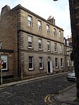 | |||
| 14 Young Street | 3 March 1966 | 55°57′10″N3°12′21″W / 55.952741°N 3.205919°W | 30007 |  | |||
| 22 Young Street | 3 March 1966 | 55°57′10″N3°12′22″W / 55.952712°N 3.206078°W | 30008 |  | |||
| 1-3C York Place | 14 September 1966 | 55°57′20″N3°11′33″W / 55.955692°N 3.192573°W | 29958 |  | |||
| 5, 5A York Place | 14 September 1966 | 55°57′21″N3°11′32″W / 55.955704°N 3.192253°W | 29959 |  | |||
| 7 York Place | 14 September 1966 | 55°57′21″N3°11′31″W / 55.95578°N 3.191839°W | 29960 |  | |||
| 9–13 York Place | 14 September 1966 | 55°57′21″N3°11′30″W / 55.9558°N 3.191599°W | 29961 |  | |||
| 15-19A York Place | 14 September 1966 | 55°57′21″N3°11′28″W / 55.955858°N 3.191201°W | 29962 |  | |||
| 21 York Place | 14 September 1966 | 55°57′21″N3°11′27″W / 55.955915°N 3.19093°W | 29963 |  | |||
| 27 York Place | 14 September 1966 | 55°57′22″N3°11′25″W / 55.95602°N 3.190293°W | 29964 | 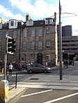 | |||
| 29–31 York Place | 14 September 1966 | 55°57′22″N3°11′24″W / 55.956066°N 3.190102°W | 29965 |  | |||
| 33–37 York Place | 14 September 1966 | 55°57′22″N3°11′23″W / 55.956132°N 3.189784°W | 29966 |  | |||
| 39–43 York Place | 14 September 1966 | 55°57′22″N3°11′22″W / 55.956171°N 3.189497°W | 29967 |  | |||
| 47–49 York Place | 14 September 1966 | 55°57′22″N3°11′21″W / 55.956229°N 3.189034°W | 29969 |  | |||
| 51 York Place | 14 September 1966 | 55°57′22″N3°11′20″W / 55.956212°N 3.188921°W | 29970 |  | |||
| 53–55 York Place | 14 September 1966 | 55°57′23″N3°11′19″W / 55.956286°N 3.188731°W | 29971 |  | |||
| 57-61A York Place | 14 September 1966 | 55°57′23″N3°11′19″W / 55.956324°N 3.188572°W | 29972 |  | |||
| 63–67 York Place | 14 September 1966 | 55°57′23″N3°11′17″W / 55.956381°N 3.18819°W | 29973 |  | |||
| 69–73 York Place | 14 September 1966 | 55°57′23″N3°11′17″W / 55.956429°N 3.187951°W | 29974 |  | |||
| 2-4A York Place | 14 September 1966 | 55°57′22″N3°11′34″W / 55.956094°N 3.192778°W | 29975 |  | |||
| 6 York Place | 14 September 1966 | 55°57′22″N3°11′33″W / 55.956142°N 3.192539°W | 29976 |  | |||
| 8 and 8A York Place | 14 September 1966 | 55°57′22″N3°11′33″W / 55.95617°N 3.192396°W | 29977 |  | |||
| 10 and 10A York Place | 14 September 1966 | 55°57′22″N3°11′32″W / 55.95618°N 3.192236°W | 29978 |  | |||
| 12 York Place | 14 September 1966 | 55°57′22″N3°11′31″W / 55.956227°N 3.192061°W | 29979 |  | |||
| 14 York Place | 14 September 1966 | 55°57′22″N3°11′31″W / 55.956229°N 3.191901°W | 29980 | 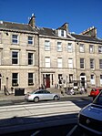 | |||
| 16 York Place | 14 September 1966 | 55°57′23″N3°11′30″W / 55.956266°N 3.191742°W | 29981 |  | |||
| 18 York Place | 14 September 1966 | 55°57′23″N3°11′30″W / 55.956312°N 3.191615°W | 29982 | 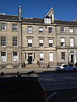 | |||
| 20 York Place | 14 September 1966 | 55°57′23″N3°11′29″W / 55.956341°N 3.191392°W | 29983 |  | |||
| 22 York Place | 14 September 1966 | 55°57′23″N3°11′28″W / 55.95637°N 3.191217°W | 29984 |  | |||
| 24 York Place | 14 September 1966 | 55°57′23″N3°11′28″W / 55.956399°N 3.191025°W | 29985 |  | |||
| 26 York Place | 14 September 1966 | 55°57′23″N3°11′27″W / 55.95641°N 3.190849°W | 29986 |  | |||
| 28 York Place | 14 September 1966 | 55°57′23″N3°11′27″W / 55.956429°N 3.190738°W | 29987 |  | |||
| 30 York Place | 14 September 1966 | 55°57′23″N3°11′26″W / 55.956475°N 3.190547°W | 29988 |  | |||
| Raeburn House | 32 York Place | 14 September 1966 | 55°57′24″N3°11′25″W / 55.956549°N 3.190389°W | 29989 |  | ||
| 34 York Place | 14 September 1966 | 55°57′23″N3°11′25″W / 55.956515°N 3.190212°W | 29990 |  | |||
| 36 York Place | 14 September 1966 | 55°57′24″N3°11′24″W / 55.956695°N 3.190137°W | 29991 | | |||
| 38 York Place | 14 September 1966 | 55°57′24″N3°11′24″W / 55.956554°N 3.189893°W | 29992 |  | |||
| 40, 42 York Place | 14 September 1966 | 55°57′24″N3°11′23″W / 55.956591°N 3.189734°W | 29993 |  | |||
| 1–21 Waterloo Place | 19 April 1966 | 55°57′13″N3°11′17″W / 55.953724°N 3.18798°W | 29895 |  | |||
| 23–27 Waterloo Place | 19 April 1966 | 55°57′14″N3°11′12″W / 55.953962°N 3.186578°W | 29896 |  | |||
| Calton Convening Rooms | 29 Waterloo Place | 19 April 1966 | 55°57′15″N3°11′09″W / 55.954095°N 3.185781°W | 29897 | 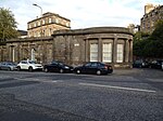 | ||
| 6–14 Waterloo Place | 14 December 1970 | 55°57′12″N3°11′15″W / 55.953466°N 3.18762°W | 29898 |  | |||
| 16–20 Waterloo Place | 14 December 1970 | 55°57′13″N3°11′13″W / 55.953492°N 3.18682°W | 29899 |  | |||
| 7 and 9 North St David Street and Queen Street | 14 December 1970 | 55°57′19″N3°11′40″W / 55.955278°N 3.19445°W | 29727 |  | |||
| 23, 24, 25 & 26 St James Square | 14 December 1970 | 55°57′17″N3°11′24″W / 55.954809°N 3.190047°W | 29728 |  | |||
| 3 and 3A St Andrew Square | 14 December 1970 | 55°57′12″N3°11′33″W / 55.953438°N 3.192408°W | 29696 |  | |||
| Guardian Royal Exchange | 12, 12A and 13 St Andrew Square | 8 December 1987 | 55°57′13″N3°11′40″W / 55.953742°N 3.194419°W | 29697 |  | ||
| 21 and 22 St Andrew Square | 13 April 1965 | 55°57′18″N3°11′40″W / 55.955126°N 3.194382°W | 29698 |  | |||
| 23 and 23A St Andrew Square | 13 April 1965 | 55°57′18″N3°11′38″W / 55.955032°N 3.193914°W | 29700 |  | |||
| 26 St Andrew Square | 13 April 1965 | 55°57′18″N3°11′36″W / 55.955002°N 3.193273°W | 29703 |  | |||
| 35 St Andrew Square | 13 April 1965 | 55°57′17″N3°11′31″W / 55.954639°N 3.191852°W | 29704 |  | |||
| Dundas House | 36 St Andrew Square | 13 April 1965 | 55°57′16″N3°11′27″W / 55.954567°N 3.190889°W | Head office of the Royal Bank of Scotland | 29705 | 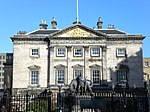 | |
| Bank of Scotland | 37 St Andrew Square | 13 April 1965 | 55°57′15″N3°11′29″W / 55.954238°N 3.191439°W | 29706 |  | ||
| Bank of Scotland | 38 and 39 St Andrew Square | 13 April 1965 | 55°57′15″N3°11′30″W / 55.954056°N 3.191658°W | 29707 |  | ||
| Royal Bank of Scotland | 42 St Andrew Square | 8 December 1987 | 55°57′14″N3°11′29″W / 55.953953°N 3.191254°W | 29708 | 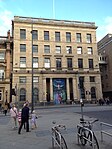 | ||
| 1–25 Royal Circus | 14 September 1966 | 55°57′24″N3°12′12″W / 55.956674°N 3.203431°W | 29677 |  | |||
| 2–32 Royal Circus | 14 September 1966 | 55°57′27″N3°12′13″W / 55.957569°N 3.203747°W | 29678 |  | |||
| Cafe Royal | West Register Street | 8 January 1970 | 55°57′14″N3°11′26″W / 55.95377°N 3.190608°W | 29619 |  | ||
| Kenilworth Bar | 152 and 154 Rose Street | 12 December 1974 | 55°57′06″N3°12′08″W / 55.951761°N 3.202221°W | 29651 |  | ||
| 4–6 Queen Street | 13 April 1965 | 55°57′18″N3°11′44″W / 55.955079°N 3.195581°W | Occupied by BBC Scotland | 29532 |  | ||
| Royal College of Physicians of Edinburgh | 8 Queen Street | 3 March 1966 | 55°57′18″N3°11′47″W / 55.955054°N 3.196301°W | 29535 | | ||
| 11–13 Queen Street | 3 March 1966 | 55°57′18″N3°11′48″W / 55.95487°N 3.196728°W | 29536 |  | |||
| 14 Queen Street | 3 March 1966 | 55°57′18″N3°11′50″W / 55.954874°N 3.197225°W | 29538 |  | |||
| 18–20 Queen Street | 3 March 1966 | 55°57′17″N3°11′55″W / 55.954673°N 3.1985°W | 29542 |  | |||
| 21 Queen Street | 14 December 1970 | 55°57′17″N3°11′55″W / 55.954626°N 3.198739°W | 29543 |  | |||
| 22 Queen Street | 14 December 1970 | 55°57′17″N3°11′56″W / 55.954597°N 3.198898°W | 29544 |  | |||
| 23–25 Queen Street | 14 December 1970 | 55°57′17″N3°11′57″W / 55.954586°N 3.199122°W | 29545 |  | |||
| 26, 26A and 27 Queen Street (including Stewart House) | 3 March 1966 | 55°57′16″N3°11′58″W / 55.95452°N 3.199472°W | 29546 |  | |||
| 28 and 29 Queen Street | 3 March 1966 | 55°57′16″N3°11′59″W / 55.954501°N 3.1996°W | 29548 |  | |||
| 32 and 33 Queen Street | 3 March 1966 | 55°57′16″N3°12′01″W / 55.954414°N 3.200157°W | 29550 |  | |||
| 34 Queen Street | 3 March 1966 | 55°57′16″N3°12′01″W / 55.954349°N 3.20038°W | 29551 |  | |||
| 35–37 Queen Street | 3 March 1966 | 55°57′16″N3°12′02″W / 55.95432°N 3.200603°W | 29552 |  | |||
| 38 Queen Street | 3 March 1966 | 55°57′15″N3°12′03″W / 55.954264°N 3.200841°W | 29553 |  | |||
| 39 and 39A Queen Street | 3 March 1966 | 55°57′15″N3°12′05″W / 55.95415°N 3.201479°W | 29554 |  | |||
| 40–42 (Inclusive), with 40A and 42A Queen Street | 3 March 1966 | 55°57′15″N3°12′06″W / 55.954129°N 3.20175°W | 29555 | | |||
| 43 (Hogarth House) and 44 Queen Street | 3 March 1966 | 55°57′15″N3°12′08″W / 55.954072°N 3.202117°W | 29556 |  | |||
| 45–47 Queen Street | 3 March 1966 | 55°57′14″N3°12′08″W / 55.954025°N 3.202307°W | 29557 |  | |||
| 48 Queen Street | 3 March 1966 | 55°57′14″N3°12′09″W / 55.953978°N 3.202514°W | the offices of Francis Brodie Imlach | 29558 |  | ||
| 49, 49A, 50 and 50A Queen Street | 3 March 1966 | 55°57′14″N3°12′10″W / 55.953994°N 3.202723°W | 29559 |  | |||
| 51 Queen Street | 3 March 1966 | 55°57′14″N3°12′11″W / 55.953911°N 3.202961°W | 29560 |  | |||
| 52 and 53 Queen Street | 3 March 1966 | 55°57′14″N3°12′11″W / 55.953865°N 3.203087°W | 29561 |  | |||
| 54 Queen Street | 3 March 1966 | 55°57′14″N3°12′12″W / 55.953826°N 3.203358°W | 29562 |  | |||
| 55–57 Queen Street | 3 March 1966 | 55°57′14″N3°12′13″W / 55.953789°N 3.203501°W | 29563 |  | |||
| 58 Queen Street | 3 March 1966 | 55°57′14″N3°12′14″W / 55.953786°N 3.20379°W | 29564 |  | |||
| 60 Queen Street and 58A, 60 and 62 North Castle Street | 3 March 1966 | 55°57′13″N3°12′16″W / 55.95359°N 3.20452°W | 29566 |  | |||
| 61, 61A, 62 & 63 Queen Street | 3 March 1966 | 55°57′13″N3°12′17″W / 55.953578°N 3.204792°W | 29567 |  | |||
| 64 Queen Street | 3 March 1966 | 55°57′13″N3°12′18″W / 55.95354°N 3.204999°W | 29568 |  | |||
| 65 Queen Street | 3 March 1966 | 55°57′13″N3°12′19″W / 55.953512°N 3.20519°W | 29569 |  | |||
| 66 and 67 Queen Street, with 33 and 35 Young Street Lane North | 3 March 1966 | 55°57′13″N3°12′19″W / 55.953483°N 3.205302°W | 29570 |  | |||
| 74–77 (Inclusive) Queen Street | 3 March 1966 | 55°57′11″N3°12′23″W / 55.953051°N 3.206329°W | 29571 |  | |||
| 78 and 78A Queen Street | 3 March 1966 | 55°57′12″N3°12′24″W / 55.953253°N 3.2068°W | 29573 |  | |||
| 79, 79A and 80 Queen Street and 5 and 6 North Charlotte Street | 3 March 1966 | 55°57′11″N3°12′25″W / 55.953072°N 3.206986°W | 29574 |  | |||
| 30 Princes Street | Formerly Forsyth's | 14 September 1966 | 55°57′11″N3°11′31″W / 55.95302°N 3.191946°W | 29503 |  | ||
| Jenners Department Store | 47–52 Princes Street | 14 December 1970 | 55°57′11″N3°11′39″W / 55.953107°N 3.194159°W | 29505 |  | ||
| Romanes and Paterson | 61-2 Princes Street | 19 December 1979 | 55°57′10″N3°11′43″W / 55.952665°N 3.195219°W | 29506 |  | ||
| 94–96 Princes Street | 19 December 1979 | 55°57′07″N3°11′57″W / 55.9519°N 3.199087°W | 29507 |  | |||
| St Andrew's and St George's Church | George Street | 13 January 1966 | 55°57′15″N3°11′45″W / 55.954123°N 3.195888°W | 27283 |  | ||
| Assembly Rooms | 54 George Street | 13 January 1966 | 55°57′10″N3°11′55″W / 55.95282°N 3.198683°W | 27567 |  | ||
| City Observatory | Calton Hill | 19 April 1966 | 55°57′18″N3°11′01″W / 55.954988°N 3.18355°W | 27603 |  | ||
| Observatory House (Old Observatory), City Observatory | Calton Hill | 19 April 1966 | 55°57′17″N3°11′03″W / 55.954803°N 3.184137°W | 27608 |  | ||
| National Gallery of Scotland | The Mound | 14 December 1970 | 55°57′03″N3°11′44″W / 55.9509°N 3.195661°W | 27679 |  | ||
| 39–43 North Castle Street | 3 March 1966 | 55°57′11″N3°12′12″W / 55.952972°N 3.203412°W | 28464 |  | |||
| 45, 45A, 47, 49 and 49A North Castle Street | 3 March 1966 | 55°57′11″N3°12′12″W / 55.953107°N 3.203416°W | 28465 |  | |||
| 51–55 North Castle Street | 3 March 1966 | 55°57′12″N3°12′13″W / 55.953356°N 3.203616°W | 28466 |  | |||
| 57–61 North Castle Street | 3 March 1966 | 55°57′13″N3°12′13″W / 55.953535°N 3.203718°W | 28467 |  | |||
| 63–69 North Castle Street | 3 March 1966 | 55°57′13″N3°12′14″W / 55.953722°N 3.203852°W | 28468 |  | |||
| 16–20 and 20A Castle Street and Connery's Bar, Rose Street | 3 March 1966 | 55°57′06″N3°12′13″W / 55.951587°N 3.203497°W | 28472 |  | |||
| 28 Castle Street | 3 March 1966 | 55°57′07″N3°12′13″W / 55.951936°N 3.203636°W | 28474 |  | |||
| 36–40 North Castle Street | 3 March 1966 | 55°57′10″N3°12′15″W / 55.952874°N 3.204194°W | 28476 |  | |||
| 42–46 North Castle Street | 3 March 1966 | 55°57′11″N3°12′16″W / 55.952988°N 3.204485°W | 28477 |  | |||
| 48–52 North Castle Street | 3 March 1966 | 55°57′12″N3°12′16″W / 55.953304°N 3.204399°W | 28478 |  | |||
| 54–58 and 58A North Castle Street | 3 March 1966 | 55°57′12″N3°12′16″W / 55.953438°N 3.204467°W | 28479 |  | |||
| 1–11 Charlotte Square | 3 March 1966 | 55°57′09″N3°12′28″W / 55.952616°N 3.207661°W | 28502 |  | |||
| 12–17 Charlotte Square | 3 March 1966 | 55°57′07″N3°12′34″W / 55.951926°N 3.209321°W | 28503 |  | |||
| 18–23 Charlotte Square | 3 March 1966 | 55°57′04″N3°12′33″W / 55.951234°N 3.209235°W | 28504 |  | |||
| 24–32 Charlotte Square, 13–19 Hope Street and 14 and 16 South Charlotte Street | 3 March 1966 | 55°57′03″N3°12′29″W / 55.950879°N 3.207927°W | 28505 |  | |||
| 33–39 Charlotte Square and 142–146 George Street | 3 March 1966 | 55°57′05″N3°12′22″W / 55.951437°N 3.205975°W | 28506 |  | |||
| 40–46 Charlotte Square and 143 George Street | 3 March 1966 | 55°57′08″N3°12′23″W / 55.952178°N 3.206446°W | 28507 |  | |||
| 1 North Charlotte Street | 3 March 1966 | 55°57′10″N3°12′24″W / 55.952787°N 3.206721°W | 28508 |  | |||
| 2–4 North Charlotte Street | 3 March 1966 | 55°57′10″N3°12′24″W / 55.952867°N 3.20674°W | 28509 |  | |||
| 5–9 South Charlotte Street | 3 March 1966 | 55°57′03″N3°12′21″W / 55.950927°N 3.205783°W | 28512 |  | |||
| 11 and 13 South Charlotte Street | 3 March 1966 | 55°57′04″N3°12′21″W / 55.951124°N 3.205837°W | 28514 |  | |||
| 15 South Charlotte Street | 3 March 1966 | 55°57′04″N3°12′21″W / 55.951195°N 3.205887°W | 28515 |  | |||
| 12 South Charlotte Street | 3 March 1966 | 55°57′04″N3°12′24″W / 55.950973°N 3.206537°W | 28516 |  | |||
| 1 and 2 Thistle Court | Thistle Street | 13 January 1966 | 55°57′16″N3°11′43″W / 55.95457°N 3.195229°W | 29836 |  | ||
| The Playhouse Theatre | 18–22 Greenside Place | 12 December 1974 | 55°57′24″N3°11′05″W / 55.956773°N 3.184838°W | 30029 |  | ||
| 1-13A Royal Crescent | 22 September 1965 | 55°57′34″N3°11′48″W / 55.959534°N 3.196632°W | 29679 |  | |||
| 15-23A Royal Crescent | 22 September 1965 | 55°57′34″N3°11′52″W / 55.959417°N 3.197653°W | 29680 |  | |||
| 1–8 Randolph Crescent, with 2 and 3–9 Randolph Lane | 14 December 1970 | 55°57′06″N3°12′39″W / 55.951642°N 3.210737°W | 29600 |  | |||
| 9–17 Randolph Crescent | 14 December 1970 | 55°57′08″N3°12′46″W / 55.952206°N 3.212757°W | 29601 |  | |||
| 1–8 Randolph Place, and 1 Randolph Crescent, with 1, 1A Randolph Lane | 14 December 1970 | 55°57′05″N3°12′37″W / 55.951521°N 3.210269°W | 29602 |  | |||
| 49 Northumberland Street | 24 May 1966 | 55°57′24″N3°12′01″W / 55.956793°N 3.200407°W | 29480 |  | |||
| 1 Northumberland Street | 22 September 1965 | 55°57′27″N3°11′47″W / 55.957479°N 3.19636°W | 29445 |  | |||
| 3-17A Northumberland Street | 22 September 1965 | 55°57′27″N3°11′48″W / 55.957459°N 3.196632°W | 29446 |  | |||
| 19–33 Northumberland Street | 22 September 1965 | 55°57′26″N3°11′52″W / 55.957286°N 3.197748°W | 29447 |  | |||
| 39–41 Northumberland Street | 24 May 1966 | 55°57′25″N3°11′59″W / 55.956916°N 3.199802°W | 29448 |  | |||
| 43–47 Northumberland Street | 24 May 1966 | 55°57′25″N3°12′00″W / 55.956869°N 3.199993°W | 29449 |  | |||
| 51–61 Northumberland Street | 24 May 1966 | 55°57′24″N3°12′04″W / 55.956696°N 3.201125°W | 29451 | | |||
| 63 and 65 Northumberland Street | 24 May 1966 | 55°57′24″N3°12′06″W / 55.956647°N 3.201556°W | 29452 |  | |||
| 67 and 69 Northumberland Street | 24 May 1966 | 55°57′24″N3°12′07″W / 55.956581°N 3.201906°W | 29453 |  | |||
| 6–12 Northumberland Street | 30 September 1964 | 55°57′25″N3°11′50″W / 55.957011°N 3.197355°W | 29454 |  | |||
| 14–26 Northumberland Street | 30 September 1964 | 55°57′25″N3°11′52″W / 55.956925°N 3.197881°W | 29455 |  | |||
| 28-30A Northumberland Street | 30 September 1964 | 55°57′25″N3°11′55″W / 55.956821°N 3.198486°W | 29456 |  | |||
| 38-40A Northumberland Street | 24 May 1966 | 55°57′24″N3°11′59″W / 55.956621°N 3.199617°W | 29457 |  | |||
| 42–68 Northumberland Street | 24 May 1966 | 55°57′23″N3°12′04″W / 55.9564°N 3.201036°W | 29458 |  | |||
| 70 Northumberland Street | 24 May 1966 | 55°57′23″N3°12′06″W / 55.956278°N 3.201641°W | 29459 |  | |||
| 2–5 Northumberland Place | 30 September 1964 | 55°57′26″N3°11′45″W / 55.95726°N 3.195857°W | 29444 |  | |||
| 5 and 7 Nelson Street | 22 September 1965 | 55°57′25″N3°11′45″W / 55.956944°N 3.195943°W | 29384 |  | |||
| 9–13 Nelson Street | 22 September 1965 | 55°57′25″N3°11′46″W / 55.957069°N 3.196027°W | 29385 |  | |||
| 15, 17 and 17A Nelson Street | 22 September 1965 | 55°57′26″N3°11′46″W / 55.957203°N 3.196095°W | 29386 |  | |||
| 19–23 Nelson Street | 22 September 1965 | 55°57′27″N3°11′44″W / 55.957486°N 3.195656°W | 29387 |  | |||
| 25–29 Nelson Street | 22 September 1965 | 55°57′28″N3°11′44″W / 55.957665°N 3.195693°W | 29388 |  | |||
| 10–14 Nelson Street | 22 September 1965 | 55°57′25″N3°11′48″W / 55.956973°N 3.196729°W | 29390 |  | |||
| 16 and 18 Nelson Street | 22 September 1965 | 55°57′26″N3°11′49″W / 55.957133°N 3.19683°W | 29391 |  | |||
| 24–28 Nelson Street | 22 September 1965 | 55°57′28″N3°11′47″W / 55.957685°N 3.196495°W | 29392 |  | |||
| 1-18A Moray Place, and 10 Doune Terrace, with 1–7 Gloucester Square, and 5-10A Gloucester Lane | 3 October 1967 | 55°57′19″N3°12′26″W / 55.955314°N 3.207361°W | 29368 |  | |||
| 19-36A Moray Place | 3 October 1967 | 55°57′19″N3°12′36″W / 55.955289°N 3.20997°W | 29369 |  | |||
| 37–43 Moray Place | 3 October 1967 | 55°57′14″N3°12′29″W / 55.953842°N 3.208164°W | 29370 | | |||
| 44-50A Moray Place, with 6 and 7 Wemyss Place Mews | 3 October 1967 | 55°57′14″N3°12′27″W / 55.954027°N 3.207609°W | 29371 |  | |||
| 1–41 London Street | 22 April 1965 | 55°57′31″N3°11′35″W / 55.958697°N 3.193098°W | 29260 |  | |||
| 2–36 London Street | 22 April 1965 | 55°57′33″N3°11′32″W / 55.959298°N 3.1923°W | 29261 |  | |||
| 42–54 London Street | 22 April 1965 | 55°57′33″N3°11′28″W / 55.959039°N 3.191218°W | 29262 |  | |||
| Gayfield House | 18 East London Street | 22 September 1965 | 55°57′37″N3°11′15″W / 55.960198°N 3.187474°W | 29263 |  | ||
| 1–5 Gloucester Place | 3 October 1967 | 55°57′23″N3°12′24″W / 55.95639°N 3.206657°W | 29141 |  | |||
| 2 Gloucester Place | 3 October 1967 | 55°57′25″N3°12′24″W / 55.956911°N 3.206738°W | 29142 |  | |||
| 5-9A India Street | 3 October 1967 | 55°57′19″N3°12′18″W / 55.955237°N 3.205116°W | 29127 |  | |||
| 11–15 India Street | 3 October 1967 | 55°57′20″N3°12′19″W / 55.955425°N 3.205186°W | 29128 |  | |||
| 17-21A India Street | 3 October 1967 | 55°57′21″N3°12′19″W / 55.955747°N 3.205388°W | 29129 |  | |||
| 23-27A India Street | 3 October 1967 | 55°57′21″N3°12′20″W / 55.955971°N 3.205475°W | 29130 |  | |||
| 4–10 India Street | 3 October 1967 | 55°57′18″N3°12′21″W / 55.955087°N 3.205768°W | 29131 |  | |||
| 12 India Street | 3 October 1967 | 55°57′19″N3°12′21″W / 55.955194°N 3.205867°W | 29132 |  | |||
| 14 India Street | 3 October 1967 | 55°57′19″N3°12′21″W / 55.955265°N 3.205934°W | 29133 |  | |||
| 16 India Street | 3 October 1967 | 55°57′19″N3°12′22″W / 55.955355°N 3.206°W | 29134 |  | |||
| 18 India Street | 3 October 1967 | 55°57′20″N3°12′22″W / 55.955426°N 3.206035°W | 29135 |  | |||
| 20–24 India Street | 3 October 1967 | 55°57′20″N3°12′22″W / 55.955525°N 3.20607°W | 29136 |  | |||
| 26–30 India Street | 3 October 1967 | 55°57′21″N3°12′22″W / 55.955793°N 3.20619°W | 29137 |  | |||
| 32 India Street | 3 October 1967 | 55°57′21″N3°12′23″W / 55.955953°N 3.206339°W | 29138 |  | |||
| 34 India Street | 3 October 1967 | 55°57′22″N3°12′23″W / 55.956025°N 3.206358°W | 29139 |  | |||
| 36–42 India Street | 3 October 1967 | 55°57′22″N3°12′23″W / 55.956106°N 3.206392°W | 29140 |  | |||
| 54–60 India Street | 3 October 1967 | 55°57′25″N3°12′25″W / 55.957017°N 3.206869°W | 29144 |  | |||
| 3–7 Howe Street | 10 November 1966 | 55°57′21″N3°12′06″W / 55.955811°N 3.201626°W | 29107 |  | |||
| 11 and 13 Howe Street | 10 November 1966 | 55°57′21″N3°12′06″W / 55.955971°N 3.201727°W | 29109 | 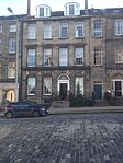 | |||
| 19 and 19B Howe Street | 10 November 1966 | 55°57′22″N3°12′07″W / 55.95623°N 3.201943°W | 29111 |  | |||
| 21-23B Howe Street | 10 November 1966 | 55°57′24″N3°12′07″W / 55.956561°N 3.202034°W | 29112 |  | |||
| 25–29 Howe Street | 10 November 1966 | 55°57′24″N3°12′08″W / 55.956731°N 3.202135°W | 29113 |  | |||
| 31–37 Howe Street | 10 November 1966 | 55°57′25″N3°12′08″W / 55.956919°N 3.202221°W | 29114 |  | |||
| 32–38 Howe Street | 10 November 1966 | 55°57′23″N3°12′10″W / 55.95651°N 3.202721°W | 29121 |  | |||
| 6–10 Hope Street | 3 March 1966 | 55°57′02″N3°12′31″W / 55.950648°N 3.208593°W | 29093 |  | |||
| 12–16 Hope Street | 3 March 1966 | 55°57′03″N3°12′32″W / 55.950808°N 3.208758°W | 29094 |  | |||
| 71 Hanover Street | 13 January 1966 | 55°57′14″N3°11′50″W / 55.953914°N 3.197099°W | 28999 |  | |||
| 79–89 Hanover Street | 24 March 1966 | 55°57′15″N3°11′50″W / 55.954103°N 3.197105°W | 29001 |  | |||
| 113–123 (odd nos, including 117A) Hanover Street | 3 March 1966 | 55°57′17″N3°11′51″W / 55.954754°N 3.197557°W | 29004 |  | |||
| 28 and 30 Hanover Street | 24 March 1966 | 55°57′10″N3°11′51″W / 55.952796°N 3.197449°W | 29007 |  | |||
| 1–19 Heriot Row | 24 May 1966 | 55°57′22″N3°12′00″W / 55.956194°N 3.200068°W | 29025 |  | |||
| 20–42 Heriot Row | 24 May 1966 | 55°57′18″N3°12′18″W / 55.955059°N 3.20495°W | 29026 |  | |||
| 43–47 Heriot Row | 24 May 1966 | 55°57′18″N3°12′20″W / 55.954972°N 3.205652°W | 29027 |  | |||
| 1 and 3 Hill Street | 3 March 1966 | 55°57′13″N3°12′07″W / 55.953605°N 3.20207°W | 29080 | 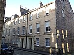 | |||
| Edinburgh Lodge No 1 | 17, 19 and 19A Hill Street | 3 March 1966 | 55°57′13″N3°12′10″W / 55.953481°N 3.202803°W | 29081 |  | ||
| 21 and 23 Hill Street | 14 December 1970 | 55°57′12″N3°12′11″W / 55.953433°N 3.203122°W | 29082 |  | |||
| 2 and 4 Hill Street | 3 March 1966 | 55°57′12″N3°12′07″W / 55.953428°N 3.201825°W | 29083 |  | |||
| 3–41 Great King Street | 15 July 1965 | 55°57′28″N3°11′52″W / 55.957869°N 3.197894°W | 28962 |  | |||
| 45–89 Great King Street | 24 May 1966 | 55°57′27″N3°12′00″W / 55.957544°N 3.199918°W | 28963 |  | |||
| 2-42A Great King Street | 15 July 1965 | 55°57′30″N3°11′53″W / 55.95828°N 3.198099°W | 28964 |  | |||
| 44–86 Great King Street | 24 May 1966 | 55°57′29″N3°12′00″W / 55.957983°N 3.199964°W | 28965 |  | |||
| 1–5 Great Stuart Street | 14 December 1970 | 55°57′14″N3°12′36″W / 55.95385°N 3.210038°W | 28966 |  | |||
| 7–19 Great Stuart Street | 14 December 1970 | 55°57′10″N3°12′40″W / 55.952833°N 3.211207°W | 28967 |  | |||
| 2–6 Great Stuart Street | 14 December 1970 | 55°57′13″N3°12′33″W / 55.953742°N 3.209217°W | 28968 |  | |||
| 8–20 Great Stuart Street | 14 December 1970 | 55°57′08″N3°12′40″W / 55.952232°N 3.211028°W | 28969 | 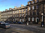 | |||
| 7–15 Gloucester Place | 3 October 1967 | 55°57′23″N3°12′26″W / 55.956258°N 3.207294°W | 28925 |  | |||
| 4–14 Gloucester Place | 3 October 1967 | 55°57′24″N3°12′28″W / 55.956722°N 3.207645°W | 28926 |  | |||
| 6–11 Glenfinlas Street | 14 December 1970 | 55°57′10″N3°12′35″W / 55.952749°N 3.209619°W | 28922 | 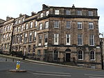 | |||
| 1–5 Gayfield Place and 33-33A Gayfield Square | 19 April 1966 | 55°57′32″N3°11′04″W / 55.958925°N 3.184391°W | 28798 |  | |||
| 12-17A Gayfield Square | 19 April 1966 | 55°57′35″N3°11′08″W / 55.959613°N 3.185678°W | 28805 | 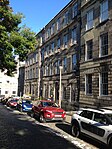 | |||
| 24, 25 and 26 Gayfield Square | 19 April 1966 | 55°57′34″N3°11′07″W / 55.959473°N 3.185289°W | 28807 |  | |||
| 43–49 Frederick Street | 24 March 1966 | 55°57′13″N3°12′02″W / 55.953657°N 3.200438°W | 28785 |  | |||
| 58–62 and 62A Frederick Street | 24 March 1966 | 55°57′14″N3°12′05″W / 55.953927°N 3.201327°W | 28796 |  | |||
| 41A-45 Broughton Street | 16 June 1966 | 55°57′28″N3°11′11″W / 55.957873°N 3.186265°W | 28772 |  | |||
| 1–11 Forres Street | 14 December 1970 | 55°57′14″N3°12′27″W / 55.954027°N 3.207609°W | 28768 |  | |||
| 2–10 Forres Street | 14 December 1970 | 55°57′13″N3°12′29″W / 55.953503°N 3.207945°W | 28769 |  | |||
| 23-23C Dundas Street | 18 August 1964 | 55°57′25″N3°11′56″W / 55.957078°N 3.198862°W | 28706 |  | |||
| 53–65 Dundas Street | 13 September 1964 | 55°57′30″N3°11′58″W / 55.958276°N 3.199428°W | 28709 |  | |||
| 67–77 Dundas Street | 13 September 1964 | 55°57′31″N3°11′59″W / 55.958553°N 3.199613°W | 28710 |  | |||
| 68–76 Dundas Street | 10 November 1966 | 55°57′30″N3°12′01″W / 55.958367°N 3.2002°W | 28720 |  | |||
| 78-86A Dundas Street | 10 November 1966 | 55°57′31″N3°12′02″W / 55.958662°N 3.200449°W | 28721 |  | |||
| 1–7 Dundonald Street | 22 September 1965 | 55°57′32″N3°11′50″W / 55.958972°N 3.197143°W | 28723 |  | |||
| 30–34 Elder Street | 14 December 1970 | 55°57′21″N3°11′27″W / 55.955772°N 3.19083°W | 28731 |  | |||
| 4 Dublin Street | 18 August 1964 | 55°57′21″N3°11′37″W / 55.955953°N 3.193494°W | 28688 |  | |||
| 1–10 Drummond Place | 22 April 1965 | 55°57′29″N3°11′40″W / 55.958019°N 3.194471°W | 28665 |  | |||
| 11–15 Drummond Place | 22 April 1965 | 55°57′28″N3°11′48″W / 55.957783°N 3.19653°W | 28666 |  | |||
| 16–20 Drummond Place | 22 April 1965 | 55°57′31″N3°11′49″W / 55.958651°N 3.196957°W | 28667 |  | |||
| 21–30 Drummond Place | 22 April 1965 | 55°57′33″N3°11′43″W / 55.959133°N 3.195386°W | 28668 |  | |||
| 31-36A Drummond Place | 22 April 1965 | 55°57′33″N3°11′38″W / 55.959256°N 3.193868°W | 28669 |  | |||
| 37–42 Drummond Place | 22 April 1965 | 55°57′31″N3°11′36″W / 55.958497°N 3.19338°W | 28670 |  | |||
| 1-9C Doune Terrace, with 8–11 Gloucester Square | 3 October 1967 | 55°57′21″N3°12′28″W / 55.95594°N 3.207668°W | 28659 | 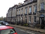 | |||
| 1–11 Darnaway Street | 3 October 1967 | 55°57′17″N3°12′25″W / 55.95485°N 3.207042°W | 28632 |  | |||
| 2–12 Darnaway Street, with 8–10 Wemyss Place Mews | 3 October 1967 | 55°57′16″N3°12′23″W / 55.954505°N 3.206519°W | 28633 | 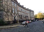 | |||
| 36-62B Cumberland Street | 10 November 1966 | 55°57′31″N3°12′05″W / 55.958536°N 3.20139°W | 28614 |  | |||
| Rock House | 28 Calton Hill | 19 April 1966 | 55°57′16″N3°11′07″W / 55.954315°N 3.185356°W | 28411 |  | ||
| 35 and 37 Broughton Street | 16 June 1966 | 55°57′26″N3°11′17″W / 55.957308°N 3.188042°W | 28361 |  | |||
| 10–12 Broughton Street | 16 June 1966 | 55°57′25″N3°11′18″W / 55.956999°N 3.188449°W | 28366 |  | |||
| 4–12 Broughton Place | 16 June 1966 | 55°57′32″N3°11′22″W / 55.958752°N 3.18932°W | 28355 |  | |||
| 1–11 Albyn Place | 14 December 1970 | 55°57′13″N3°12′25″W / 55.953693°N 3.206814°W | 28234 |  | |||
| 1-15B Ainslie Place | 14 December 1970 | 55°57′11″N3°12′40″W / 55.95303°N 3.211229°W | 28213 |  | |||
| 16–20 Ainslie Place, and 13–14 Glenfinlas Street | 14 December 1970 | 55°57′10″N3°12′37″W / 55.952699°N 3.21021°W | 28214 |  | |||
| 21-25A Ainslie Place | 14 December 1970 | 55°57′12″N3°12′33″W / 55.953337°N 3.209269°W | 28215 |  | |||
| 2–7 Abercromby Place | 14 December 1970 | 55°57′24″N3°11′38″W / 55.956568°N 3.193978°W | 28210 |  | |||
| 8 and 8A-20 Abercromby Place | 18 August 1964 | 55°57′24″N3°11′45″W / 55.956792°N 3.195874°W | 28211 |  | |||
| 21–34 Abercromby Place | 18 August 1964 | 55°57′22″N3°11′54″W / 55.956175°N 3.19837°W | 28212 |  | |||
| St John's Church (Episcopal) | Lothian Road | 14 December 1970 | 55°57′00″N3°12′22″W / 55.950017°N 3.206059°W | 27401 |  | ||
| Statue of William Pitt | George Street | 13 January 1966 | 55°57′11″N3°12′01″W / 55.952992°N 3.200402°W | 27868 |  | ||
| Former St George's Chapel (Episcopal) | 5B York Place | 14 September 1966 | 55°57′21″N3°11′31″W / 55.955734°N 3.191982°W | 27374 |  | ||
| St Paul's and St George's (Scottish Episcopal) Church | York Place | 24 May 1966 | 55°57′24″N3°11′19″W / 55.9567°N 3.188712°W | 27509 |  | ||
| Former Albany Street Chapel | 24A Broughton Street | 24 May 1966 | 55°57′27″N3°11′20″W / 55.957434°N 3.189007°W | 27157 |  | ||
| 45-57A Albany Street | 24 May 1966 | 55°57′27″N3°11′21″W / 55.957387°N 3.189166°W | 46114 |  | |||
| Glasite Meeting House | 33 Barony Street | 30 September 1964 | 55°57′28″N3°11′30″W / 55.957832°N 3.191534°W | 26973 |  | ||
| 14–18 Broughton Place | 16 June 1966 | 55°57′32″N3°11′20″W / 55.958845°N 3.188906°W | 45928 |  | |||
| 20–28 Broughton Place | 16 June 1966 | 55°57′32″N3°11′19″W / 55.958957°N 3.188525°W | 45929 |  | |||
| 30–34 Broughton Place | 16 June 1966 | 55°57′33″N3°11′17″W / 55.959052°N 3.187983°W | 45930 |  | |||
| 1–11 St Colme Street | 14 December 1970 | 55°57′12″N3°12′30″W / 55.953391°N 3.208326°W | 29724 |  | |||
| 1–11 Wemyss Place | 14 December 1970 | 55°57′14″N3°12′21″W / 55.953945°N 3.20586°W | 29901 |  | |||
| Moray Place Bank Gardens, Railings and Gates | 31 March 1999 | 55°57′17″N3°12′31″W / 55.954817°N 3.20861°W | 46120 |  | |||
| 4–8 Nelson Street | 22 September 1965 | 55°57′25″N3°11′48″W / 55.956821°N 3.196628°W | 49491 |  | |||
| Greenside Parish Church | Royal Terrace | 16 December 1965 | 55°57′25″N3°10′56″W / 55.956907°N 3.182103°W | 27007 |  | ||
| 1–5 Blenheim Place | 16 December 1965 | 55°57′27″N3°11′03″W / 55.957614°N 3.184239°W | 28334 |  | |||
| 6–10 Blenheim Place and 2 and 3 Greenside End | 16 December 1965 | 55°57′27″N3°10′59″W / 55.957418°N 3.183144°W | 28335 |  | |||
| 27, 28 and 29 Gayfield Square | Leith Walk | 19 April 1966 | 55°57′33″N3°11′06″W / 55.959288°N 3.184979°W | 49149 |  | ||
| 30, 31 and 32 Gayfield Square | Leith Walk | 19 April 1966 | 55°57′33″N3°11′05″W / 55.959093°N 3.184669°W | 49150 |  | ||
| 1–3 Annandale Street | 19 April 1966 | 55°57′34″N3°11′02″W / 55.959578°N 3.183755°W | 28252 |  | |||
| 5–9 Annandale Street | 19 April 1966 | 55°57′35″N3°11′03″W / 55.959772°N 3.184145°W | 28253 |  | |||
| 6-10A Annandale Street | 19 April 1966 | 55°57′36″N3°11′00″W / 55.959985°N 3.183447°W | 28254 |  | |||
| 18-22A Annandale Street | 19 April 1966 | 55°57′37″N3°11′02″W / 55.960304°N 3.183969°W | 28255 |  | |||
| Formerly Broughton Place Church and Offices | 33 and 35 Broughton Place | 16 June 1966 | 55°57′33″N3°11′14″W / 55.959148°N 3.187345°W | 26771 |  | ||
| St Stephen's Church (Church of Scotland) | St Stephen Street and St Vincent Street | 14 December 1970 | 55°57′31″N3°12′13″W / 55.958703°N 3.203526°W | 27527 |  | ||
| 1–11 Bellevue Crescent | 22 September 1965 | 55°57′36″N3°11′34″W / 55.960011°N 3.192898°W | 28285 | 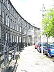 | |||
| 15–27 Bellevue Crescent, and 5–9 Cornwallis Place | 22 September 1965 | 55°57′39″N3°11′40″W / 55.96077°N 3.194315°W | 28286 | 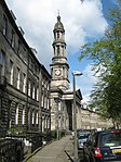 | |||
| St Mary's Church (Church of Scotland) | 13 Bellevue Crescent | 22 September 1965 | 55°57′37″N3°11′37″W / 55.960192°N 3.193625°W | 27461 |  | ||
| 1–10 Mansfield Place | 22 September 1965 | 55°57′35″N3°11′30″W / 55.959662°N 3.191798°W | 29302 |  |
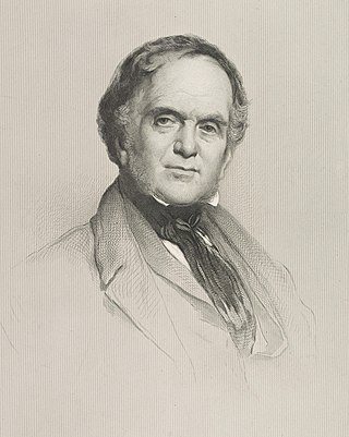
William Henry PlayfairFRSE was a prominent Scottish architect in the 19th century who designed the Eastern, or Third, New Town and many of Edinburgh's neoclassical landmarks.

The Royal Botanic Garden Edinburgh (RBGE) is a scientific centre for the study of plants, their diversity and conservation, as well as a popular tourist attraction. Founded in 1670 as a physic garden to grow medicinal plants, today it occupies four sites across Scotland—Edinburgh, Dawyck, Logan and Benmore—each with its own specialist collection. The RBGE's living collection consists of more than 13,302 plant species, whilst the herbarium contains in excess of 3 million preserved specimens.

Thomas Hamilton was a Scottish architect, based in Edinburgh where he designed many of that city's prominent buildings. Born in Glasgow, his works include: the Burns Monument in Alloway; the Royal High School on the south side of Calton Hill ; the Royal College of Physicians of Edinburgh; the George IV Bridge, which spans the Cowgate; the Dean Orphan Hospital, now the Dean Gallery; the New North Road Free Church, now the Bedlam Theatre; Cumstoun, a private house in Dumfries and Galloway; and the Scottish Political Martyrs' Monument in Old Calton Cemetery, Edinburgh.
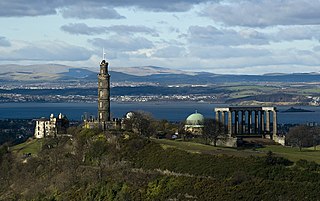
Calton Hill is a hill in central Edinburgh, Scotland, situated beyond the east end of Princes Street and included in the city's UNESCO World Heritage Site. Views of, and from, the hill are often used in photographs and paintings of the city.

This article is a timeline of the history of Edinburgh, Scotland, up to the present day. It traces its rise from an early hill fort and later royal residence to the bustling city and capital of Scotland that it is today.
The New Town is a central area of Edinburgh, the capital of Scotland. It was built in stages between 1767 and around 1850, and retains much of its original neo-classical and Georgian period architecture. Its best known street is Princes Street, facing Edinburgh Castle and the Old Town across the geological depression of the former Nor Loch. Together with the West End, the New Town was designated a UNESCO World Heritage Site alongside the Old Town in 1995. The area is also famed for the New Town Gardens, a heritage designation since March 2001.

Abbeyhill is an area of Edinburgh, the capital of Scotland.
Canonmills is a district of Edinburgh, the capital of Scotland. It lies to the south east of the Royal Botanic Garden at Inverleith, east of Stockbridge and west of Bellevue, in a low hollow north of Edinburgh's New Town. The area was formerly a loch which was drained in three phases in the 18th and 19th centuries, disappearing finally in 1865.

Leith Walk is one of the longest streets in Edinburgh, Scotland, and is the main road connecting the east end of the city centre to Leith.

There have been several town walls around Edinburgh, Scotland, since the 12th century. Some form of wall probably existed from the foundation of the royal burgh in around 1125, though the first building is recorded in the mid-15th century, when the King's Wall was constructed. In the 16th century the more extensive Flodden Wall was erected, following the Scots' defeat at the Battle of Flodden in 1513. This was extended by the Telfer Wall in the early 17th century. The walls had a number of gates, known as ports, the most important being the Netherbow Port, which stood halfway down what is now the Royal Mile. This gave access from the Canongate which was, at that time, a separate burgh.
The West End is an affluent district of Edinburgh, Scotland, which along with the rest of the New Town and Old Town forms central Edinburgh, and Edinburgh's UNESCO World Heritage Site. The area boasts several of the city's hotels, restaurants, independent shops, offices and arts venues, including the Edinburgh Filmhouse, Edinburgh International Conference Centre and the Caledonian Hotel. The area also hosts art festivals and crafts fairs.

John Chesser (1819-1892) was a nineteenth-century Scottish architect largely based in Edinburgh. He was described as "the prime exponent of terrace design at the time". A very high number of his works are now category A listed buildings, evidencing the quality of his work, particularly in the West End of Edinburgh.

Thomas Brown was a Scottish architect in the early 19th century based in Edinburgh. He is best known for St. Mary's Church, Bellevue, Edinburgh, usually known as Bellevue Church.

Royal Terrace is a grand street in the city of Edinburgh, Scotland, on the north side of Calton Hill within the New Town and part of the UNESCO World Heritage Site inscribed in 1995, built on the south side of a setted street, facing the sloping banks of London Road Gardens, formerly Royal Terrace Gardens, with views looking north towards Leith and the Firth of Forth.

The following outline is provided as an overview of and topical guide to Edinburgh:
Bellevue is a district of Edinburgh, the capital of Scotland. It lies to the south east of Canonmills, west of Leith Walk and south of Leith, incorporating the easternmost extent of Edinburgh's New Town UNESCO heritage site. The area was formerly open fields which became the second and penultimate location of the Royal Botanic Garden in 1763 .