Interactive map of all wharves served by Sydney Ferries
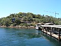
Name Image Coordinates Bs Route(s) Date opened Previous names [ a] Interchanges Abbotsford 33°50′37.3″S 151°07′41.5″E / 33.843694°S 151.128194°E / -33.843694; 151.128194 (Abbotsford ferry wharf ) 1 1834 (for Bedlams Ferry) [ 1] 2018 (renovation) Balmain 33°51′16.4″S 151°11′10.6″E / 33.854556°S 151.186278°E / -33.854556; 151.186278 (Balmain ferry wharf ) 1 circa 1895 (original) [ 2] 1997 (repairs) [ b] 2013 (renovation) [ 4] Thames Street, Balmain (–2002) Balmain East 33°51′24.6″S 151°11′46.2″E / 33.856833°S 151.196167°E / -33.856833; 151.196167 (Balmain East ferry wharf ) 1 1844 (original) [ 5] 18 June 2015 (renovation) [ 6] Darling Street, Balmain (–2002) Balmain West 33°51′18.0″S 151°10′07″W / 33.855000°S 151.16861°W / -33.855000; -151.16861 1 Unknown Reopened 18 August 2025 Elliot Street, Balmain (–2002) Barangaroo 33°51′51.6″S 151°12′03.3″E / 33.864333°S 151.200917°E / -33.864333; 151.200917 (Barangaroo ferry wharf 1 ) 2 Barangaroo 33°51′52.9″S 151°12′03.5″E / 33.864694°S 151.200972°E / -33.864694; 151.200972 (Barangaroo ferry wharf 2 ) 2 Birchgrove 33°50′47.3″S 151°11′10.7″E / 33.846472°S 151.186306°E / -33.846472; 151.186306 (Birchgrove ferry wharf ) 1 unknown
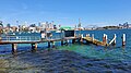
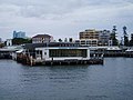
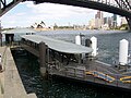
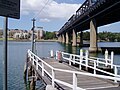
Longnose Point, Birchgrove (–1995) Yurulbin Point (1995–2002) Cabarita 33°50′27.4″S 151°06′59.3″E / 33.840944°S 151.116472°E / -33.840944; 151.116472 (Cabarita ferry wharf ) 1 Chiswick 33°50′44.1″S 151°08′30.4″E / 33.845583°S 151.141778°E / -33.845583; 151.141778 (Chiswick ferry wharf ) 1 circa 2000 (original) 31 July 2017 (renovation) [ 9] Circular Quay 33°51′38.7″S 151°12′43.4″E / 33.860750°S 151.212056°E / -33.860750; 151.212056 (Circular Quay ferry wharf 2 ) 2 1901 (original) [ 10] 1956 (first renovation) [ 10] 2002 (second renovation) [ 10] Circular Quay Ferry Terminal (–2013) Circular Quay 33°51′38.4″S 151°12′41.4″E / 33.860667°S 151.211500°E / -33.860667; 151.211500 (Circular Quay ferry wharf 3 ) 2 1901 (original) [ 10] 1956 (first renovation) [ 10] 1986 (second renovation) [ c] 2002 (third renovation) [ 10] Circular Quay 33°51′38.3″S 151°12′39.6″E / 33.860639°S 151.211000°E / -33.860639; 151.211000 (Circular Quay ferry wharf 4 ) 2 1901 (original) [ 10] 1956 (first renovation) [ 10] 2002 (second renovation) [ 10] Circular Quay 33°51′38.1″S 151°12′37.8″E / 33.860583°S 151.210500°E / -33.860583; 151.210500 (Circular Quay ferry wharf 5 ) 2 Cockatoo Island 33°50′44.0″S 151°10′23.7″E / 33.845556°S 151.173250°E / -33.845556; 151.173250 (Cockatoo Island ferry wharf ) 2 March 1908 (original) [ 11] circa 1950s (first renovation) [ 11] 2001 (second renovation) [ 12] 2004 (reconstruction) [ d] 18 August 2017 (third renovation) [ 12] [ 13] Cockatoo Dockyard (–2001) Cremorne Point 33°50′52.7″S 151°13′51.7″E / 33.847972°S 151.231028°E / -33.847972; 151.231028 (Cremorne Point ferry wharf ) 1 circa 1910s (original) [ 14] 15 September 2007 (reconstruction) [ e] 5 February 2015 (renovation) [ 16] Darling Point 33°51′59.4″S 151°14′22.3″E / 33.866500°S 151.239528°E / -33.866500; 151.239528 (Darling Point ferry wharf ) 1 unknown
Double Bay 33°52′23.3″S 151°14′33.2″E / 33.873139°S 151.242556°E / -33.873139; 151.242556 (Double Bay ferry wharf ) 1 December 2023 (renovation)
Drummoyne 33°50′43.6″S 151°09′25.8″E / 33.845444°S 151.157167°E / -33.845444; 151.157167 (Drummoyne ferry wharf ) 1 circa 1880s (original) [ 17] [ 18] 1915 (first renovation) [ 17] 17 September 2014 (second renovation) [ 19] Wolseley Street, Drummoyne (–2002) Greenwich Point 33°50′31.4″S 151°10′50.8″E / 33.842056°S 151.180778°E / -33.842056; 151.180778 (Greenwich Point ferry wharf ) 1 {{Bulleted list|circa 1980s [ 20] Greenwich (–2008, 2010–13) Huntleys Point 33°50′31.8″S 151°08′31.0″E / 33.842167°S 151.141944°E / -33.842167; 151.141944 (Huntleys Point ferry wharf ) 1 1928 (original) [ 21] 23 April 2013 (renovation) [ 22] Kirribilli 33°50′57.8″S 151°13′13.7″E / 33.849389°S 151.220472°E / -33.849389; 151.220472 (Kirribilli ferry wharf ) 1 unknown
North Sydney, Kirribilli (–2002) Kissing Point 33°49′54.1″S 151°06′07.0″E / 33.831694°S 151.101944°E / -33.831694; 151.101944 (Kissing Point ferry wharf ) 1 Kurraba Point 33°50′36.3″S 151°13′18.4″E / 33.843417°S 151.221778°E / -33.843417; 151.221778 (Kurraba Point ferry wharf ) 1 unknown
Kurraba Point, Neutral Bay (–2002) Manly 33°48′01.4″S 151°17′02.1″E / 33.800389°S 151.283917°E / -33.800389; 151.283917 (Manly ferry wharf ) 2 1855 (original) [ 23] 1945 (reconstruction) [ f] McMahons Point 33°50′55.3″S 151°12′23.2″E / 33.848694°S 151.206444°E / -33.848694; 151.206444 (McMahons Point ferry wharf ) 1 1860–71 (original) [ 25] 20 October 2016 (renovation) [ 26] McMahons Point & Luna Park (1995–2002) Meadowbank 33°49′16.13″S 151°5′23.52″E / 33.8211472°S 151.0898667°E / -33.8211472; 151.0898667 (Meadowbank ferry wharf ) 1 unknown
Milsons Point 33°50′57.6″S 151°12′37.8″E / 33.849333°S 151.210500°E / -33.849333; 151.210500 (Milsons Point ferry wharf 1 ) 1 before 1895 (original) [ 27] 29 November 2010 (first renovation) [ 28] 2017 (second renovation) [ 29] Milsons Point/Luna Park (2008–13) Milsons Point 33°50′59.6″S 151°12′39.8″E / 33.849889°S 151.211056°E / -33.849889; 151.211056 (Milsons Point ferry wharf 2 ) 1 Mosman Bay 33°50′18.5″S 151°13′56.2″E / 33.838472°S 151.232278°E / -33.838472; 151.232278 (Mosman Bay ferry wharf ) 1 Neutral Bay 33°50′32.4″S 151°13′09.8″E / 33.842333°S 151.219389°E / -33.842333; 151.219389 (Neutral Bay ferry wharf ) 1 1871 (original) [ 33] 20 August 2012 (renovation) Hayes Street, Neutral Bay (–2002) North Sydney 33°50′41.5″S 151°13′07.4″E / 33.844861°S 151.218722°E / -33.844861; 151.218722 (North Sydney ferry wharf ) 1 unknown
North Sydney, High Street (–2002) Old Cremorne 33°50′27.1″S 151°13′49.8″E / 33.840861°S 151.230500°E / -33.840861; 151.230500 (Old Cremorne ferry wharf ) 1 unknown
Parramatta 33°48′50.09″S 151°0′38.09″E / 33.8139139°S 151.0105806°E / -33.8139139; 151.0105806 (Parramatta ferry wharf ) 1 Pyrmont Bay 33°52′05.4″S 151°11′55.7″E / 33.868167°S 151.198806°E / -33.868167; 151.198806 (Pyrmont Bay ferry wharf ) 1 circa 1980s (original) [ 34] 8 September 2015 (renovation) [ 35] Rose Bay 33°52′14.2″S 151°15′43.8″E / 33.870611°S 151.262167°E / -33.870611; 151.262167 (Rose Bay ferry wharf ) 1 circa 1940s (original) [ 36] 1989 (reconstruction) [ g] 26 September 2012 (renovation) Rydalmere 33°49′4.76″S 151°2′37.46″E / 33.8179889°S 151.0437389°E / -33.8179889; 151.0437389 (Rydalmere ferry wharf ) 1 South Mosman 33°50′35.7″S 151°13′57.4″E / 33.843250°S 151.232611°E / -33.843250; 151.232611 (South Mosman ferry wharf ) 1 Musgrave Street, Mosman (–2002) Sydney Olympic Park 33°49′20.75″S 151°4′43.66″E / 33.8224306°S 151.0787944°E / -33.8224306; 151.0787944 (Sydney Olympic Park ferry wharf ) 2 22 September 1997 (original) 20 May 2015 (renovation) Taronga Zoo 33°50′46.9″S 151°14′22.2″E / 33.846361°S 151.239500°E / -33.846361; 151.239500 (Taronga Zoo ferry wharf ) 2 Taronga Zoo Athol Wharf (–1995) Watsons Bay 33°50′36.3″S 151°16′51.8″E / 33.843417°S 151.281056°E / -33.843417; 151.281056 (Watsons Bay ferry wharf ) 2 unknown
Woolwich 33°50′19.4″S 151°10′33.7″E / 33.838722°S 151.176028°E / -33.838722; 151.176028 (Woolwich ferry wharf ) 1 1856 (original) 2020 Renovation [ 39] Hunters Hill (Woolwich), Valentia Street (–2002) 


