List of cemeteries in Boston

Last updated

List of cemeteries in Boston includes currently operating, historical (closed for new interments), and defunct (graves abandoned or removed) cemeteries, columbaria, and mausolea which are historical and/or notable. It does not include pet cemeteries.

Contents

Cemeteries in Boston
ordered by founding date
NameEstablishedLocationAffiliationSizeNotes
King's Chapel Burying Ground 1630Tremont StreetMunicipal (Puritan) [1] [2]
Eliot Burying Ground 1630Eustis and Washington StreetsMunicipal (Puritan) [3] [4] [2]
Phipps Street Burying Ground 1630CharlestownMunicipal (Puritan)1.8 acres [5] [6]
Dorchester North Burying Ground 1633Stoughton Street and Columbia RoadMunicipal (Puritan) [7] [8] [2]
Copp's Hill Burying Ground 1659Copp's HillMunicipal (Puritan) [9] [10] [2]
Granary Burying Ground 1660Tremont StreetMunicipal (Puritan) [11] [2]
Westerly Burial Ground 1683West RoxburyMunicipal (Puritan) [12] [2]
Walter Street Burying Ground1711RoslindaleMunicipal0.8 acres [13] [14] [2]
Central Burying Ground 1756Boylston and Tremont StreetsMunicipal [15] [2]
Market Street Burying Ground1764BrightonMunicipal [16] [2]
Bunker Hill Burying Ground1807CharlestownMunicipal [17] [2]
South End Burying Ground1810South EndMunicipal [18] [19] [2]
Dorchester South Burying Ground 1814Dorchester AvenueMunicipal2 acres [20] [21]
Saint Augustine Chapel and Cemetery 1818South BostonRoman Catholic0.9 acres [2]
Hawes/Union Burying Ground1821 [22] South BostonMunicipal [23] [24]
St. Francis De Sales Cemetery1830CharlestownRoman Catholic [25] [26] [2]
Bennington Street Burying Ground 1838 [22] East BostonMunicipal [27] [28]
Temple Ohabei Shalom Cemetery 1844East BostonJewish2.4 acres [29] [2]
Forest Hills Cemetery 1848Forest Hills / Jamaica PlainNon-Sectarian275 acres [30] [31] [2]
Codman Burying Ground1848DorchesterProtestant [32] [33] [2]
St. Joseph Catholic Church 1850RoxburyRoman Catholic
Evergreen Cemetery 1850BrightonMunicipal20 acres [34] [2]
St. Mary's Cemetery1851DorchesterNon-Sectarian [35] [2]
Mount Hope Cemetery 1852Roslindale / MattapanMunicipal125 acres [36] [2]
Mount Calvary Cemetery1866RoslindaleNon-Sectarian [35] [2]
St. Mary's Cemetery1867West RoxburyRoman Catholic [37] [2]
Cedar Grove Cemetery1868DorchesterNon-Sectarian [38] [39] [2]
The Gardens (Gethsemane) Cemetery1873West RoxburyNon-Sectarian [40] [2]
Boston United Hand in Hand Cemetery 1875West Roxbury / DedhamJewish [41] [42] [2]
Mount Benedict Cemetery1879West RoxburyNon-Sectarian [35] [43] [2]
Grove Street Cemeteries1881West RoxburyJewish [44] [45] [2]
St. Joseph Cemetery 1888West RoxburyNon-Sectarian~200 acres [46]
Fairview Cemetery1893Hyde ParkMunicipal [47] [2]
New Calvary Cemetery1899MattapanNon-Sectarian [35] [2]
St. Michael Cemetery1905Jamaica Plain / Roslindale / MattapanNon-Sectarian [48] [2]
Baker Street Jewish Cemeteries 1920sWest RoxburyJewish [49] [50] [2]
Oak Lawn Cemetery1989Roslindale / Hyde Park [2]

See also

Related Research Articles

<span class="mw-page-title-main">Boston Public Library</span> Library in Massachusetts, US

The Boston Public Library is a municipal public library system in Boston, Massachusetts, founded in 1848. The Boston Public Library is also Massachusetts' Library for the Commonwealth, meaning all adult residents of the state are entitled to borrowing and research privileges, and the library receives state funding. The Boston Public Library contains approximately 24 million items, making it the third-largest public library in the United States behind the federal Library of Congress and New York Public Library, which is also privately endowed. This building was designated as a Boston Landmark by the Boston Landmarks Commission in 2000.

<span class="mw-page-title-main">Dorchester, Boston</span> Neighborhood of Boston in Suffolk County, Massachusetts, United States

Dorchester is a neighborhood comprising more than 6 square miles (16 km2) in the City of Boston, Massachusetts, United States. Originally, Dorchester was a separate town, founded by Puritans who emigrated in 1630 from Dorchester, Dorset, England, to the Massachusetts Bay Colony. This dissolved municipality, Boston's largest neighborhood by far, is often divided by city planners in order to create two planning areas roughly equivalent in size and population to other Boston neighborhoods.

<span class="mw-page-title-main">West Roxbury</span> Neighborhood of Boston in Suffolk, Massachusetts, United States

West Roxbury is a neighborhood in Boston, Massachusetts, United States, bordered by Roslindale and Jamaica Plain to the northeast, the village of Chestnut Hill and the town of Brookline to the north, the city of Newton to the northwest, the towns of Dedham and Needham to the southwest, and Hyde Park to the southeast. West Roxbury is often mistakenly confused with Roxbury, but the two are separated from each other by Roslindale and Jamaica Plain.

<span class="mw-page-title-main">Neighborhoods in Boston</span>

Boston's diverse neighborhoods serve as a political and cultural organizing mechanism. The City of Boston's Office of Neighborhood Services has designated 23 Neighborhoods in the city:
<span class="mw-page-title-main">National Register of Historic Places listings in Massachusetts</span>

The National Register of Historic Places is a United States federal official list of places and sites considered worthy of preservation. In the state of Massachusetts, there are over 4,300 listings, representing about 5% of all NRHP listings nationwide and the second-most of any U.S. state, behind only New York. Listings appear in all 14 Massachusetts counties.

<span class="mw-page-title-main">Copp's Hill Burying Ground</span> Historic cemetery in Boston, Massachusetts

Copp's Hill Burying Ground is a historic cemetery in the North End of Boston, Massachusetts. Established in 1659, it was originally named "North Burying Ground", and was the city's second cemetery.

<span class="mw-page-title-main">Phipps Street Burying Ground</span> Historic cemetery in Massachusetts, United States

The Phipps Street Burying Ground is a historic cemetery on Phipps Street in Charlestown, now a neighborhood of Boston, Massachusetts.

<span class="mw-page-title-main">Copp's Hill Terrace</span> United States historic place

Copp's Hill Terrace is a historic terrace and park between Commercial and Charter Streets west of Jackson Avenue on Copp's Hill in the North End of Boston, Massachusetts near Copp's Hill Burying Ground.

<span class="mw-page-title-main">Bennington Street Burying Ground</span> Historic cemetery in East Boston, Massachusetts

The Bennington Street Burying Ground is a historic cemetery on Bennington Street, between Swift St. and Harmony St., in East Boston, Massachusetts.

<span class="mw-page-title-main">Dorchester North Burying Ground</span> Graveyard in Boston, Massachusetts, US

The Dorchester North Burying Ground is a historic graveyard at Stoughton Street and Columbia Road in the Dorchester neighborhood of Boston, Massachusetts.

<span class="mw-page-title-main">Eliot Burying Ground</span> Historic cemetery in Massachusetts, United States

Eliot Burying Ground is a historic seventeenth-century graveyard at Eustis and Washington Streets in the Roxbury neighborhood of Boston, Massachusetts. It occupies a roughly triangular lot of 0.8 acres (0.32 ha).

<span class="mw-page-title-main">Westerly Burial Ground</span> Historic cemetery in Massachusetts, United States

The Westerly Burial Ground is an historic cemetery on Centre Street in the West Roxbury neighborhood of Boston, Massachusetts. Established in 1683, it is Boston's seventh-oldest cemetery, and where the first settlers of the West Roxbury area are buried. It was enlarged in 1832, and 1844, and its last documented burial was in 1962. Eight American Revolutionary War veterans are buried there as well as fifteen veterans of the American Civil War.
<span class="mw-page-title-main">Rumney Marsh Burying Ground</span> Historic cemetery in Massachusetts, United States

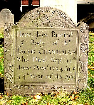
The Rumney Marsh Burying Ground is a historic cemetery on Butler Street between Elm and Bixby Streets in Revere, Massachusetts. It was added to the National Register of Historic Places in 2004. It was the first burying ground of an area that now encompasses Revere as well as neighboring Chelsea and Winthrop.

<span class="mw-page-title-main">Central Burying Ground, Boston</span> Cemetery in Boston, Massachusetts, United States

The Central Burying Ground is a cemetery in Boston, Massachusetts, United States. It was established on Boston Common in 1756. It is located on Boylston Street between Tremont Street and Charles Street.
<span class="mw-page-title-main">Walton and Roslin Halls</span> United States historic place

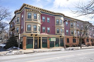
Walton and Roslin Halls is a mixed-used commercial and residential building that was built in two parts. They are located at the corner of Washington and Walton Streets in the Dorchester neighborhood of Boston, Massachusetts, and extend south along Washington Street. The first of the two buildings, that at 3-5 Walton Street and 702-708 Washington, is a three-story brick and wood-frame structure built in 1897 to a design by Cornelius A. Russell; the southern portion was completed a year later. The building housed a commercial space on the ground floor, and residential units above.

<span class="mw-page-title-main">Dorchester South Burying Ground</span> Graveyard in Boston, Massachusetts

The Dorchester South Burying Ground is a historic graveyard on Dorchester Avenue in the Dorchester neighborhood of Boston, Massachusetts. Established in 1814, it is the second oldest cemetery in Dorchester, after the North Burying Ground. It is a roughly 2-acre (0.81 ha) parcel on the west side of Dorchester Avenue, north of Dorchester Lower Mills. A paved roadway provides circulation around the perimeter of the property. There is some evidence that the cemetery was formally terraced, due to the sloping terrain, but there is no evidence of curbing that might have been used for this purpose. One of the cemetery's most prominent features is a line of granite tombs along the southern boundary.

<span class="mw-page-title-main">Intervale Street-Columbia Road Historic District</span> Historic district in Massachusetts, United States

The Intervale Street-Columbia Road Historic District is a historic district encompassing a small residential area in the Dorchester neighborhood of Boston, Massachusetts. Centered on a stretch of Intervale Street, the area was developed in the early 20th century during a major Jewish migration, and includes a fine sample of Colonial Revival architecture. The district was listed on the National Register of Historic Places in 2019.

<span class="mw-page-title-main">Intervale Street-Blue Hill Avenue Historic District</span> Historic district in Massachusetts, United States

The Intervale Street-Blue Hill Avenue Historic District is a historic district encompassing a densely built residential area in the Dorchester neighborhood of Boston, Massachusetts. Centered on a stretch of Intervale Street near Blue Hill Avenue, the area was developed in the late 19th and early 20th centuries during a major Jewish migration, and includes a fine sample of Colonial Revival architecture. The district was listed on the National Register of Historic Places in 2020.

<span class="mw-page-title-main">Thane Street Historic District</span> Historic district in Massachusetts, United States

The Thane Street Historic District is a historic district encompassing a group of apartment houses in the Dorchester neighborhood of Boston, Massachusetts. Extending along Thane Street from Harvard Street, the area was developed in 1910, during a major Jewish migration, and includes a fine sample of Colonial Revival architecture. The district was listed on the National Register of Historic Places in 2020.

References

  1. "King's Chapel Burying Ground". City of Boston. Retrieved October 20, 2024.
  2. 1 2 3 4 5 6 7 8 9 10 11 12 13 14 15 16 17 18 19 20 21 22 23 24 25 26 27 28 29 30 31 Lambert, David Allen (2009). A Guide to Massachusetts Cemeteries (Second ed.). Boston: New England Historic Genealogical Society. p. 26-37. ISBN   978-0-88082-222-0.
  3. "National Register of Historic Places Inventory/Nomination: Eliot Burying Ground". National Park Service . Retrieved February 18, 2023. With accompanying pictures
  4. "Eliot Burying Ground". City of Boston. Retrieved October 20, 2024.
  5. "National Register of Historic Places Inventory/Nomination: Phipps Street Burying Ground". National Park Service . Retrieved February 18, 2023. With accompanying pictures
  6. "Phipps Street Burying Ground". City of Boston. Retrieved October 20, 2024.
  7. The National Register of Historic Places, 1976. National Register of Historic Places, National Park Service, U.S. Department of the Interior. 1976. p. 348.
  8. "Dorchester North Burying Ground". City of Boston. Retrieved October 20, 2024.
  9. "National Register of Historic Places Inventory/Nomination: Copp's Hill Burial Ground". National Park Service . Retrieved February 18, 2023. With accompanying pictures
  10. "Copp's Hill Burying Ground". City of Boston. Retrieved October 20, 2024.
  11. "Granary Burying Ground". City of Boston. Retrieved October 19, 2024.
  12. "Westerly". City of Boston. Retrieved October 19, 2024.
  13. "Walter Street Burial Ground". MACRIS. Retrieved October 20, 2024.
  14. "Walter Street Burying Ground". City of Boston. Retrieved October 20, 2024.
  15. "Central Burying Ground". City of Boston. Retrieved October 19, 2024.
  16. "Market Street Burying Ground". City of Boston. Retrieved October 20, 2024.
  17. "Bunker Hill Burying Ground". City of Boston. Retrieved October 20, 2024.
  18. "South End Burying Ground". City of Boston. Retrieved October 20, 2024.
  19. "South End Burial Ground". MACRIS. Retrieved October 28, 2024.
  20. "Dorchester South Burying Ground". City of Boston. Retrieved October 20, 2024.
  21. "Dorchester South Burying Ground". MACRIS. Retrieved October 28, 2024.
  22. 1 2 Year officially sanctioned. In use prior to this date.
  23. "Hawes/Union Burying Ground". City of Boston. Retrieved October 20, 2024.
  24. "Hawes Cemetery". MACRIS. Retrieved October 28, 2024.
  25. "Saint Francis de Sales Parish Cemetery". Saint Francis de Sales Parish. Archived from the original on April 5, 2019. Retrieved November 4, 2024.
  26. "Saint Francis de Sales Roman Catholic Church". MACRIS. Retrieved November 4, 2024.
  27. "Bennington Street". City of Boston. Retrieved October 19, 2024.
  28. "Bennington Street Burying Ground". MACRIS. Retrieved October 28, 2024.
  29. "Temple Ohabei Shalom Cemetery". MACRIS. Retrieved October 28, 2024.
  30. "About Us". Forest Hills Cemetery. Retrieved October 28, 2024.
  31. "Forest Hills Cemetery". MACRIS. Retrieved October 28, 2024.
  32. "About". Codman Burial Ground. Retrieved October 28, 2024.
  33. "Codman Square Institutional Area". MACRIS. Retrieved October 28, 2024.
  34. "Evergreen Cemetery". City of Boston. Retrieved October 20, 2024.
  35. 1 2 3 4 "History". Boston Catholic Cemetery Association. Retrieved October 28, 2024.
  36. "Mount Hope Cemetery". City of Boston. Retrieved October 19, 2024.
  37. "History". St. Mary of the Assumption. Retrieved November 17, 2024.
  38. "A Brief History". Cedar Grove Cemetery. Retrieved October 28, 2024.
  39. "Cedar Grove Cemetery" . Retrieved October 28, 2024.
  40. "History & Future". The Gardens Cemetery. Retrieved October 19, 2024.
  41. "West Roxbury/Centre Street Cemeteries". JCAM. Retrieved October 19, 2024.
  42. "Hat In Hand Cemetery". JewishGen. Retrieved October 20, 2024.
  43. "Mount Benedict Catholic Cemetery". MACRIS. Retrieved October 19, 2024.
  44. "West Roxbury/Grove Street". JCAM. Retrieved October 20, 2024.
  45. "Grove Street Cemetery". MACRIS. Retrieved October 20, 2024.
  46. "History". Holyhood Cemetery Association. Retrieved October 19, 2024.
  47. "Fairview Cemetery". City of Boston. Retrieved October 20, 2024.
  48. "St. Michael Cemetery – serving the Greater Boston community for over 100 years". St. Michael Cemetery. Retrieved November 18, 2024.
  49. "Mount Lebanon Jewish Cemetery". MACRIS. Retrieved October 19, 2024.
  50. "West Roxbury/Baker Street Cemeteries". JCAM. Retrieved October 20, 2024.