Related Research Articles

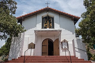
Mission San Luis Rey de Francia is a former Spanish mission in San Luis Rey, a neighborhood of Oceanside, California. This Mission lent its name to the Luiseño tribe of Mission Indians.

The Kumeyaay, also known as 'Iipai-Tiipai or by the historical Spanish name Diegueño, is a tribe of Indigenous peoples of the Americas who live at the northern border of Baja California in Mexico and the southern border of California in the United States. They are an indigenous people of California.
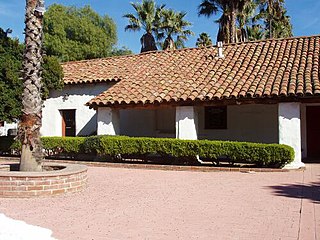
The San Antonio de Pala Asistencia, or the "Pala Mission", was founded on June 13, 1816, as an asistencia or "sub-mission" to Mission San Luis Rey de Francia, some twenty miles inland upstream from the latter mission on the San Luis Rey River. Pala Mission was part of the Spanish missions, asistencias, and estancias system in Las Californias—Alta California. Today it is located in the Pala Indian Reservation located in northern San Diego County, with the official name of Mission San Antonio de Pala. It is the only historic mission facility still serving a Mission Indian tribe.
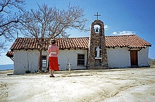
The Santa Ysabel Asistencia was founded on September 20, 1818, at Cañada de Santa Ysabel in the mountains east of San Diego, as a asistencia or "sub-mission" to Mission San Diego de Alcalá, and to serve as a rest stop for those travelling between San Diego and Sonora. The native population of approximately 450 neophytes consisted of both Luiseño and Diegueño peoples. Based on historical records, Santa Ysabel enjoyed a higher-than-average conversion rate when compared to the other California missions. Given its remote location, the facility was visited infrequently by the padres after secularization of the missions in the 1830s.
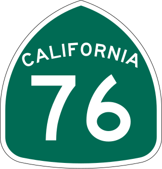
State Route 76 (SR 76) is a state highway 52.63 miles (84.70 km) long in the U.S. state of California. It is a much used east–west route in the North County region of San Diego County that begins in Oceanside near Interstate 5 (I-5) and continues east. The highway is a major route through the region, passing through the community of Bonsall and providing access to Fallbrook. East of the junction with I-15, SR 76 goes through Pala and Pauma Valley before terminating at SR 79.
Santa Ysabel, is an unincorporated community in the Santa Ysabel Valley of eastern San Diego County, in southern California.
America Newton was one of the original African-American pioneers who helped to found the former mining town of Julian, California, in the Cuyamaca Mountains east of San Diego. She was among the earliest female African-American settlers in the area. Newton was a former slave who provided laundry services in Julian during its gold rush days and beyond. She resided in Julian for more than 50 years.

Mission Indians are the indigenous peoples of California who lived in Southern California and were forcibly relocated from their traditional dwellings, villages, and homelands to live and work at 15 Franciscan missions in Southern California and the Asistencias and Estancias established between 1796 and 1823 in the Las Californias Province of the Viceroyalty of New Spain.

The Pala Indian Reservation is located in the middle of San Luis Rey River Valley in northern San Diego County, California, east of the community of Fallbrook, and has been assigned feature ID 272502.
San Pasqual Valley, historically spelled as San Pascual, is the northernmost community of the city of San Diego. It is named for the Kumeyaay village of San Pasqual that was once located there. It is bordered on the north by the city of Escondido, on the east and west by unincorporated land within San Diego County, and on the south by the city of Poway and the community of Rancho Bernardo. San Pasqual Valley is home to the San Diego Zoo Safari Park.
Mount Hope Cemetery is a municipal cemetery located at 3751 Market Street, San Diego, California, and gives its name to the neighborhood of Mount Hope. The cemetery is adjacent to Greenwood Memorial Park.
Warner Springs is set of springs and a small unincorporated community in northern San Diego County, California. Warner Springs is on the Pacific Crest Trail.

El Camino Memorial Park cemetery is located at 5600 Carroll Canyon Road in the Sorrento Valley neighborhood of San Diego. Founded in 1960, El Camino is a 220-acre (0.89 km2) memorial park and is the final resting site for Jonas Salk, as well as several members of the well-known Kroc family. There are many other prominent citizens from the greater San Diego and Los Angeles area as well.
Rancho Santa Ysabel was a 17,719-acre (71.71 km2) Mexican land grant in present-day San Diego County, California given in 1844 by Governor Manuel Micheltorena to José Joaquín Ortega and Edward Stokes after the Mexican secularization act of 1833. The grant was located in the Santa Ysabel Valley at the northern Cuyamaca Mountains, and encompassed present-day Santa Ysabel.
There are 34 routes assigned to the "S" zone of the California Route Marker Program, which designates county routes in California. The "S" zone includes county highways in Imperial, Orange, Riverside, San Diego, and Santa Barbara counties.
Greenwood Memorial Park is a cemetery located on unincorporated land surrounded by the city of San Diego at 4300 Imperial Avenue in San Diego County, California. The cemetery is adjacent to Mount Hope Cemetery.
Holy Cross Cemetery is a cemetery located in the Chollas View neighborhood of San Diego, California.

The Mexican Secularization Act of 1833, officially called the Decree for the Secularization of the Missions of California, was an act passed by the Congress of the Union of the First Mexican Republic which secularized the Californian missions. The act nationalized the missions, transferring their ownership from the Franciscan Order of the Catholic Church to the Mexican authorities.
References
- 1 2 3 4 5 6 7 Schlesinger, Nancy (1992-10-29). "Cemeteries Alive With History". Los Angeles Times. Retrieved 2020-10-27.
- ↑ Mt. Hope Cemetery Site
- ↑ Old Mission San Luis Rey Cemetery
- ↑ Valley Center Cemetery