List of cemeteries in Warren County, Indiana

Last updated

This is a list of cemeteries in Warren County, Indiana.

NameCoordinatesTownshipGNIS IDNotes
Adams 40°19′47.28″N87°13′55.38″W / 40.3298000°N 87.2320500°W / 40.3298000; -87.2320500 (Adams) Warren
Armstrong 40°25′39.65″N87°6′46.89″W / 40.4276806°N 87.1130250°W / 40.4276806; -87.1130250 (Armstrong) Medina Established in 1848 and located just west of Armstrong Chapel. George D. Wagner, Indiana state representative elected in 1856 and a colonel during the Civil War, is buried here.
Baltimore 40°9′58.59″N87°26′45.92″W / 40.1662750°N 87.4460889°W / 40.1662750; -87.4460889 (Baltimore) Mound 430468 Located on West Baltimore Hill Road, next to Rodgers. The town of Baltimore was located near here in the 1800s.
Bartlett 40°23′6″N87°19′01″W / 40.38500°N 87.31694°W / 40.38500; -87.31694 (Bartlett) Liberty 430544 Defunct
Bethel 40°21′8.17″N87°14′40.53″W / 40.3522694°N 87.2445917°W / 40.3522694; -87.2445917 (Bethel) Warren 430897 Located approximately 1 mile (1.6 km) east of Indiana State Road 55, on the north side of County Road 250 North.
Brier / County Farm 40°21′37.61″N87°19′48.22″W / 40.3604472°N 87.3300611°W / 40.3604472; -87.3300611 (Brier-County Farm) Liberty 431521
Briscoe / Keyes 40°24′51.66″N87°20′59.47″W / 40.4143500°N 87.3498528°W / 40.4143500; -87.3498528 (Briscoe-Keyes) Pine 431534 Located just northeast of the site of the defunct town of Brisco.
Bussell / Jones 40°27′34.7″N87°19′15.83″W / 40.459639°N 87.3210639°W / 40.459639; -87.3210639 (Bussell-Jones) Pine 437086 Located near the county meridian, on the south side of Indiana State Road 26 west of Pine Village. Stones here date from 1837 to 1961.
Carbondale 40°21′36.29″N87°20′53.34″W / 40.3600806°N 87.3481500°W / 40.3600806; -87.3481500 (Carbondale) Liberty
Cronkhite 40°14′7.29″N87°27′13.98″W / 40.2353583°N 87.4538833°W / 40.2353583; -87.4538833 (Cronkhite) Steuben Defunct
Davis / Kochert 40°24′19.8″N87°7′20.89″W / 40.405500°N 87.1224694°W / 40.405500; -87.1224694 (Davis-Kochert) Medina 433347
Goodwine 40°18′59.76″N87°20′42.87″W / 40.3166000°N 87.3452417°W / 40.3166000; -87.3452417 (Goodwine) Liberty 435176
Gopher Hill 40°11′7.75″N87°29′23.63″W / 40.1854861°N 87.4898972°W / 40.1854861; -87.4898972 (Gopher Hill) Kent 435216
Gray 40°26′28.79″N87°17′15.82″W / 40.4413306°N 87.2877278°W / 40.4413306; -87.2877278 (Gray) Pine 435365
Highland 40°17′34.56″N87°16′56.67″W / 40.2929333°N 87.2824083°W / 40.2929333; -87.2824083 (Highland) Washington 436156 Located on the northeast side of Williamsport.
Hillside 40°17′28.89″N87°16′49.57″W / 40.2913583°N 87.2804361°W / 40.2913583; -87.2804361 (Hillside) Washington 436224 Located on the northeast side of Williamsport, just to the southeast and across the railroad from Highland Cemetery. James Frank Hanly, Governor of Indiana from 1905 to 1909, is buried here.
Hiser 40°10′39.41″N87°31′33.95″W / 40.1776139°N 87.5260972°W / 40.1776139; -87.5260972 (Hiser) Kent Defunct
Hooker 40°26′57.19″N87°18′57.86″W / 40.4492194°N 87.3160722°W / 40.4492194; -87.3160722 (Hooker) Pine 436406
Independence 40°20′51″N87°10′40″W / 40.347513°N 87.177715°W / 40.347513; -87.177715 (Independence) Warren 436724 Located just to the north-northwest of the town of Independence. Zachariah Cicott, the county's first non-indigenous settler, is buried here.
Irish Catholic 40°14′0.05″N87°27′57.37″W / 40.2333472°N 87.4659361°W / 40.2333472; -87.4659361 (Irish Catholic) Steuben This Irish Catholic cemetery contains 42 marked graves and is the burial place of many of the Irish who had once worked on the railroads and had later worshiped at the Catholic Church at Marshfield.
James 40°22′52.13″N87°13′9.70″W / 40.3811472°N 87.2193611°W / 40.3811472; -87.2193611 (James) Warren 436920
Jordan 40°22′1.21″N87°30′25.05″W / 40.3670028°N 87.5069583°W / 40.3670028; -87.5069583 (Jordan) Jordan 437111 The earliest marker here is dated 1850.
Kester 40°19′38.98″N87°17′2.54″W / 40.3274944°N 87.2840389°W / 40.3274944; -87.2840389 (Kester) Liberty 437273
Locust Grove 40°26′14.26″N87°26′8.09″W / 40.4372944°N 87.4355806°W / 40.4372944; -87.4355806 (Locust Grove) Prairie Located about 2 miles (3.2 km) northeast of the town of Tab and was established in 1830. Locust Grove Church was built just north of this cemetery in 1893.
Lyons 40°12′25.76″N87°24′34.87″W / 40.2071556°N 87.4096861°W / 40.2071556; -87.4096861 (Lyons) Steuben 438442 Lyons Cemetery was in use from 1839 through 1932.
Masonic 40°11′3.40″N87°30′27.77″W / 40.1842778°N 87.5077139°W / 40.1842778; -87.5077139 (Masonic) Kent 439492 Sometimes incorrect listed as "Mosonic".
McCabe 40°19′25.37″N87°19′12.94″W / 40.3237139°N 87.3202611°W / 40.3237139; -87.3202611 (McCabe) Liberty 438780
Mitchel 40°20′44.76″N87°21′29.26″W / 40.3457667°N 87.3581278°W / 40.3457667; -87.3581278 (Mitchel) Liberty
Mound 40°25′4.10″N87°12′21.94″W / 40.4178056°N 87.2060944°W / 40.4178056; -87.2060944 (Mound) Adams 439511
Old Gopher Hill / Butterfield 40°10′46.33″N87°30′33.99″W / 40.1795361°N 87.5094417°W / 40.1795361; -87.5094417 (Old Gopher Hill) Kent Defunct. Approximately 30 graves were here, including one or two of William Henry Harrison's soldiers and members of the Butterfield family. This cemetery was destroyed in the 1920s.
Owens 40°17′14.36″N87°20′16.71″W / 40.2873222°N 87.3379750°W / 40.2873222; -87.3379750 (Owens) Washington 440799
Pine Village 40°26′55.51″N87°15′28.03″W / 40.4487528°N 87.2577861°W / 40.4487528; -87.2577861 (Pine Village) Adams
Pond Grove 40°28′2.92″N87°5′47.83″W / 40.4674778°N 87.0966194°W / 40.4674778; -87.0966194 (Pond Grove) Medina 441427
Quaker 40°23′46.04″N87°14′38.38″W / 40.3961222°N 87.2439944°W / 40.3961222; -87.2439944 (Quaker) Adams 441684
Rainsville 40°24′41.05″N87°18′53.72″W / 40.4114028°N 87.3149222°W / 40.4114028; -87.3149222 (Rainsville) Pine 441749
Redwood 40°16′48.61″N87°26′0.91″W / 40.2801694°N 87.4335861°W / 40.2801694; -87.4335861 (Redwood) Steuben 441842
Robb / Baumgartner 40°16′46.67″N87°19′12.07″W / 40.2796306°N 87.3200194°W / 40.2796306; -87.3200194 (Robb-Baumgartner) Washington 442133 Stones here date back to 1831.
Rodgers 40°9′58.45″N87°26′42.64″W / 40.1662361°N 87.4451778°W / 40.1662361; -87.4451778 (Rodgers) Mound 442243 Located on West Baltimore Hill Road, next to Baltimore. Sometimes incorrectly listed as "Roger".
Shanklin Hill 40°15′1.22″N87°24′52.87″W / 40.2503389°N 87.4146861°W / 40.2503389; -87.4146861 (Shanklin Hill) Pike 443283 This cemetery, and the hilly road upon which it is located, is sometimes incorrectly listed as "Shankland Hill".
Sisson 40°14′21.25″N87°28′41.61″W / 40.2392361°N 87.4782250°W / 40.2392361; -87.4782250 (Sisson) Steuben Defunct
Tomlinson 40°14′25.18″N87°28′19.33″W / 40.2403278°N 87.4720361°W / 40.2403278; -87.4720361 (Tomlinson) Steuben
Union-Harman 40°24′36.92″N87°11′46.50″W / 40.4102556°N 87.1962500°W / 40.4102556; -87.1962500 (Union-Harman) Adams 435742
Upper Mound 40°8′32.64″N87°25′23.42″W / 40.1424000°N 87.4231722°W / 40.1424000; -87.4231722 (Upper Mound) Mound 445169
Van Reed 40°23′30″N87°21′04″W / 40.39167°N 87.35111°W / 40.39167; -87.35111 (Van Reed) Pine 445217
West Lebanon 40°15′25.31″N87°22′41.45″W / 40.2570306°N 87.3781806°W / 40.2570306; -87.3781806 (West Lebanon) Pike 445781 Located on the southeast edge of the town of West Lebanon, this cemetery holds the grave of a Revolutionary War soldier named Richard Biddlecomb, along with a group of Civil War veterans in a circle surrounding a flag pole, the focus of the annual Memorial Day service.

Related Research Articles

<span class="mw-page-title-main">National Register of Historic Places listings in New Jersey</span>

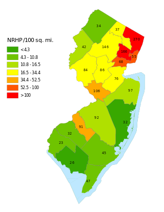
This is a list of properties and districts listed on the National Register of Historic Places in New Jersey. There are more than 1,700 listed sites in New Jersey. Of these, 58 are further designated as National Historic Landmarks. All 21 counties in New Jersey have listings on the National Register.
     This National Park Service list is complete through NPS recent listings posted March 15, 2024.

<span class="mw-page-title-main">National Register of Historic Places listings in Warren County, Ohio</span>

This is a list of the National Register of Historic Places listings in Warren County, Ohio.

<span class="mw-page-title-main">National Register of Historic Places listings in Greene County, Ohio</span>

This is a list of the National Register of Historic Places listings in Greene County, Ohio.

<span class="mw-page-title-main">National Register of Historic Places listings in Warren County, Pennsylvania</span>

This is a list of the National Register of Historic Places listings in Warren County, Pennsylvania.

<span class="mw-page-title-main">National Register of Historic Places listings in Clinton County, Ohio</span>

This is a list of the National Register of Historic Places listings in Clinton County, Ohio.

<span class="mw-page-title-main">National Register of Historic Places listings in Winchester, Virginia</span>

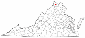
This is a list of the National Register of Historic Places listings in Winchester, Virginia.

<span class="mw-page-title-main">National Register of Historic Places listings in Carroll County, Indiana</span>

This is a list of the National Register of Historic Places listings in Carroll County, Indiana.

<span class="mw-page-title-main">National Register of Historic Places listings in Tippecanoe County, Indiana</span>

This is a list of the National Register of Historic Places listings in Tippecanoe County, Indiana.

<span class="mw-page-title-main">National Register of Historic Places listings in Benton County, Indiana</span>

This is a list of the National Register of Historic Places listings in Benton County, Indiana.

<span class="mw-page-title-main">National Register of Historic Places listings in Fountain County, Indiana</span>

This is a list of the National Register of Historic Places listings in Fountain County, Indiana.

<span class="mw-page-title-main">National Register of Historic Places listings in Gibson County, Indiana</span>

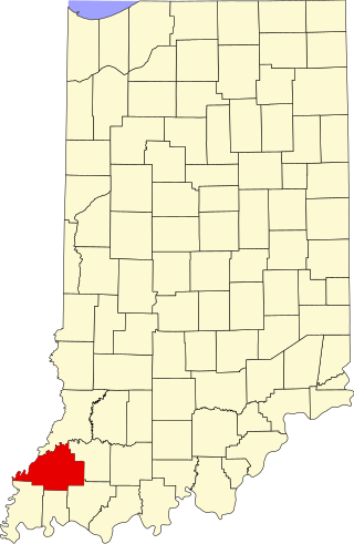
This is a list of the National Register of Historic Places listings in Gibson County, Indiana.

<span class="mw-page-title-main">National Register of Historic Places listings in Greene County, Indiana</span>

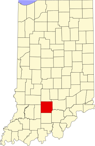
This is a list of the National Register of Historic Places listings in Greene County, Indiana.

<span class="mw-page-title-main">National Register of Historic Places listings in Lawrence County, Indiana</span>

This is a list of the National Register of Historic Places listings in Lawrence County, Indiana.

<span class="mw-page-title-main">National Register of Historic Places listings in Posey County, Indiana</span>

This is a list of the National Register of Historic Places listings in Posey County, Indiana.

<span class="mw-page-title-main">National Register of Historic Places listings in Vermillion County, Indiana</span>

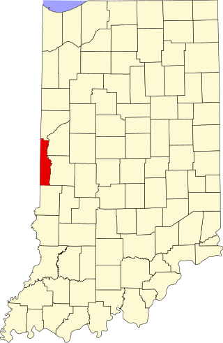
This is a list of the National Register of Historic Places listings in Vermillion County, Indiana.

<span class="mw-page-title-main">National Register of Historic Places listings in Warren County, Indiana</span>

This is a list of the National Register of Historic Places listings in Warren County, Indiana.

References