West Roxbury is a neighborhood in Boston, Massachusetts, United States, bordered by Roslindale and Jamaica Plain to the northeast, the village of Chestnut Hill and the town of Brookline to the north, the city of Newton to the northwest, the towns of Dedham and Needham to the southwest, and Hyde Park to the southeast. West Roxbury is often mistakenly confused with Roxbury, but the two are separated from each other by Roslindale and Jamaica Plain.

Winchester National Cemetery is a United States National Cemetery located in the city of Winchester in Frederick County, Virginia. Administered by the United States Department of Veterans Affairs, it encompasses 4.9 acres (2.0 ha), and as of the end of 2005, it had 5,561 interments. It is closed to new interments.

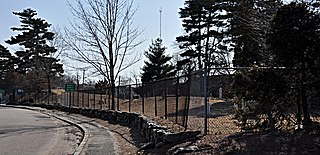
Holyhood Cemetery is a cemetery located in Brookline, Massachusetts.

The West Parish Burying Ground, also known as the River Street Burying Ground or River Street Cemetery, is a cemetery located at River and Cherry streets in West Newton, Massachusetts, and is listed on the National Register of Historic Places. Established in 1777, the cemetery is owned and maintained by the City of Newton; the Second Church in Newton, its original owner, was known as the West Parish.
The South Burying Ground, also known as Winchester Street Cemetery, or Evergreen Cemetery, is an historic cemetery located on Winchester Street in the village of Newton Highlands, in the city of Newton, Massachusetts. Established in 1802, it is Newton's third cemetery. It has 357 recorded burials, dating between 1803 and 1938. The cemetery was listed on the National Register of Historic Places in 2004.

Copp's Hill Burying Ground is a historic cemetery in the North End of Boston, Massachusetts. Established in 1659, it was originally named "North Burying Ground", and was the city's second cemetery.

The Phipps Street Burying Ground is a historic cemetery on Phipps Street in Charlestown, now a neighborhood of Boston, Massachusetts.

Cole's Hill is a National Historic Landmark containing the first cemetery used by the Mayflower Pilgrims in Plymouth, Massachusetts in 1620. The hill is located on Carver Street near the foot of Leyden Street and across the street from Plymouth Rock. Owned since 1820 by the preservationist Pilgrim Society, it is now a public park.

The Dorchester North Burying Ground is a historic graveyard at Stoughton Street and Columbia Road in the Dorchester neighborhood of Boston, Massachusetts.

Eliot Burying Ground is a historic seventeenth-century graveyard at Eustis and Washington Streets in the Roxbury neighborhood of Boston, Massachusetts. It occupies a roughly triangular lot of 0.8 acres (0.32 ha).
The Rumney Marsh Burying Ground is a historic cemetery on Butler Street between Elm and Bixby Streets in Revere, Massachusetts. It was added to the National Register of Historic Places in 2004. It was the first burying ground of an area that now encompasses Revere as well as neighboring Chelsea and Winthrop.

The Veterans of Foreign Wars Parkway is a historic parkway in Boston, Massachusetts. The southern terminus of the parkway is at Washington Street at the Dedham-West Roxbury border, from where it travels north and then east, ending at a junction with Centre Street, near the Arnold Arboretum. The highway is almost entirely contained within the West Roxbury neighborhood, although it passes through part of the Chestnut Hill neighborhood near its junction with the West Roxbury Parkway. Most of its length, from Spring Street in West Roxbury to its eastern end, is administered by the Massachusetts Department of Conservation and Recreation (DCR), a successor to the Metropolitan District Commission (MDC) which oversaw the road's construction. The parkway was built in stages between 1930 and 1942, and was designed to provide a parkway connection from the Upper Charles River Reservation to other MDC parks via the West Roxbury Parkway. The DCR portion of the road was listed on the National Register of Historic Places in 2005. The road formerly carried the designation for U.S. Route 1.

The First Burial Ground or Park Street Burial Ground is a historic cemetery on Park Street near Centre Street in Woburn, Massachusetts. Established c. 1646, it is the city's first and oldest cemetery. It occupies a 1.4-acre (0.57 ha) parcel at the corner of Park and Centre Streets near Woburn Square. Most of the burials took place before 1794, and are marked by slate headstones. The last documented burial took place in 1903. In a manner typical of early colonial cemeteries, there is no formal circulation pattern, and graves are not laid out in any formal, organized manner.

Amherst West Cemetery is a historic cemetery on Triangle Street in Amherst, Massachusetts. The 4-acre (1.6 ha) cemetery was first laid out in 1730, when the voters of Hadley elected to establish a new burying ground in its eastern precinct. When the area was separated as Amherst in 1786, the property was taken over by the newly established town. In addition to being the burial site of many of Amherst's early settlers and American Civil War veterans, it is also the burial site of members of the Dickinson family, most notably the poet Emily Dickinson. Their family plot is set off from the rest of the cemetery by a wrought iron fence.

Brigham Cemetery is a historic cemetery off West Main Street near Crescent Street in Marlborough, Massachusetts. The small cemetery's first burial was in 1793, and is significant as the city's burial ground for early victims of smallpox. Its burials also include veterans of the American Revolutionary War and the American Civil War. The cemetery was listed on the National Register of Historic Places in 2004. Its last burial was in 1934.

West Roxbury Parkway is a historic parkway running from Washington Street in Boston, Massachusetts, where the Enneking Parkway runs south, to Horace James Circle in Chestnut Hill, where it meets the Hammond Pond Parkway. The parkway serves as a connector between Stony Brook Reservation and Hammond Pond Reservation. West Roxbury Parkway was built between 1919 and 1929 and added to the National Register of Historic Places in 2006. The parkway is distinctive in the roadway system developed by the Metropolitan District Commission beginning around the turn of the 20th century in that it was built in collaboration with the City of Boston, and is maintained by the city.

The Revolutionary War Cemetery, also called the Old Salem Burying Ground, is located on Archibald Street, just off state highway NY 22 in the village of Salem, New York, United States. It is a 2.6-acre (1.1 ha) area with over a thousand graves, at least 100 of which are those of Revolutionary War dead or veterans.
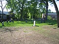
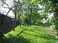
James Draper was an early settler of the Massachusetts Bay Colony. He was born and married in Heptonstall, Yorkshire, England, and came with his wife to New England shortly after 1647. He was a weaver by profession, and settled in the Massachusetts town of Roxbury, but also lived for a short while in the towns of Dedham and Charlestown. He and his wife had nine children and many notable descendants. They are buried in the Westerly Burial Ground in West Roxbury, now a neighborhood of Boston, and share the oldest marker in the cemetery.

The Dorchester South Burying Ground is a historic graveyard on Dorchester Avenue in the Dorchester neighborhood of Boston, Massachusetts. Established in 1814, it is the second oldest cemetery in Dorchester, after the North Burying Ground. It is a roughly 2-acre (0.81 ha) parcel on the west side of Dorchester Avenue, north of Dorchester Lower Mills. A paved roadway provides circulation around the perimeter of the property. There is some evidence that the cemetery was formally terraced, due to the sloping terrain, but there is no evidence of curbing that might have been used for this purpose. One of the cemetery's most prominent features is a line of granite tombs along the southern boundary.