
The Pearl River is a river in the U.S. states of Mississippi and Louisiana. It forms in Neshoba County, Mississippi from the confluence of Nanih Waiya and Tallahaga creeks, and has a meander length of 444 miles (715 km). The lower part of the river forms part of the boundary between Mississippi and Louisiana.

The Piney Woods is a temperate coniferous forest terrestrial ecoregion in the Southern United States covering 54,400 square miles (141,000 km2) of East Texas, southern Arkansas, western Louisiana, and southeastern Oklahoma. These coniferous forests are dominated by several species of pine as well as hardwoods including hickory and oak. Historically the most dense part of this forest region was the Big Thicket though the lumber industry dramatically reduced the forest concentration in this area and throughout the Piney Woods during the 19th and 20th centuries. The World Wide Fund for Nature considers the Piney Woods to be one of the critically endangered ecoregions of the United States. The United States Environmental Protection Agency (EPA) defines most of this ecoregion as the South Central Plains.

The Gulf Coastal Plain extends around the Gulf of Mexico in the Southern United States and eastern Mexico.

The Apalachicola National Forest is the largest U.S. National Forest in the state of Florida. It encompasses 632,890 acres and is the only national forest located in the Florida Panhandle. The National Forest provides water and land-based outdoors activities such as off-road biking, hiking, swimming, boating, hunting, fishing, horse-back riding, and off-road ATV usage.

The Western Gulf coastal grasslands are a subtropical grassland ecoregion of the southern United States and northeastern Mexico. It is known in Louisiana as the "Cajun Prairie", Texas as "Coastal Prairie," and as the Tamaulipan pastizal in Mexico.

The Atlantic Plain is one of eight distinct physiographic divisions of the contiguous United States. Using the USGS physiographic classification system, the Atlantic Plain division comprises two provinces and six sections. The Coastal Plain province is differentiated from the Continental Shelf province simply based on the portion of the land mass above and below sea level.

The Columbia Plateau ecoregion is a Level III ecoregion designated by the United States Environmental Protection Agency (EPA) encompassing approximately 32,100 square miles (83,139 km2) of land within the U.S. states of Washington, Oregon, and Idaho. The ecoregion extends across a wide swath of the Columbia River Basin from The Dalles, Oregon to Lewiston, Idaho to Okanogan, Washington near the Canada–U.S. border. It includes nearly 500 miles (800 km) of the Columbia River, as well as the lower reaches of major tributaries such as the Snake and Yakima rivers and the associated drainage basins. It is named for the Columbia Plateau, a flood basalt plateau formed by the Columbia River Basalt Group during the late Miocene and early Pliocene. The arid sagebrush steppe and grasslands of the region are flanked by moister, predominantly forested, mountainous ecoregions on all sides. The underlying basalt is up to 2 miles (3 km) thick and partially covered by thick loess deposits. Where precipitation amounts are sufficient, the deep loess soils have been extensively cultivated for wheat. Water from the Columbia River is subject to resource allocation debates involving fisheries, navigation, hydropower, recreation, and irrigation, and the Columbia Basin Project has dramatically converted much of the region to agricultural use.

The East Central Texas forests or East Central Texas Plains (33) is a small temperate broadleaf and mixed forests ecoregion almost entirely within the state of Texas, United States. The northern forests perimeter is partially within the southeast Oklahoma border.
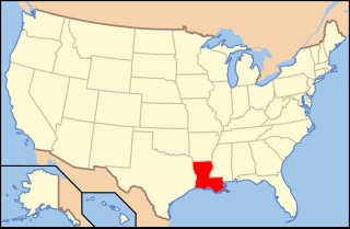
Paleontology in Louisiana refers to paleontological research occurring within or conducted by people from the U.S. state of Louisiana. Outcrops of fossil-bearing sediments and sedimentary rocks within Louisiana are quite rare. In part, this is because Louisiana’s semi-humid climate results in the rapid weathering and erosion of any exposures and the growth of thick vegetation that conceal any fossil-bearing strata. In addition, Holocene alluvial sediments left behind by rivers like the Mississippi, Red, and Ouachita, as well as marsh deposits, cover about 55% of Louisiana and deeply bury local fossiliferous strata.

The Southeastern conifer forests are a temperate coniferous forest ecoregion of the southeastern United States. It is the largest conifer forest ecoregion east of the Mississippi River. It is also the southernmost instance of temperate coniferous forest within the Nearctic realm.
The Mississippi Alluvial Plain is a Level III ecoregion designated by the Environmental Protection Agency (EPA) in seven U.S. states, though predominantly in Arkansas, Louisiana, and Mississippi. It parallels the Mississippi River from the Midwestern United States to the Gulf of Mexico.

The Arkansas Valley is a Level III ecoregion designated by the Environmental Protection Agency (EPA) in the U.S. states of Arkansas and Oklahoma. It parallels the Arkansas River between the flat plains of western Oklahoma and the Arkansas Delta, dividing the Ozarks and the Ouachita Mountains with the broad valleys created by the river's floodplain, occasionally interrupted by low hills, scattered ridges, and mountains. In Arkansas, the region is often known as the Arkansas River Valley, especially when describing the history and culture of the region.

The Western Corn Belt Plains is a Level III ecoregion designated by the Environmental Protection Agency (EPA) in seven U.S. states, though predominantly in Iowa.
The Eastern Temperate Forests is a Level I ecoregion of North America designated by the Commission for Environmental Cooperation (CEC) in its North American Environmental Atlas. The region covers much of the Eastern and Midwestern United States, the U.S. Interior Highlands, and parts of Ontario, Quebec, and the Maritimes.

The North American Southeastern Plains are a Level III ecoregion designated by the Environmental Protection Agency (EPA) in ten U.S. states. The region takes a U shape starting in western Tennessee, going south through eastern Mississippi, and forming most of Alabama. On the eastern side, the plains lie between the Appalachian Mountains and the coastal plains, forming central Georgia, South Carolina, and North Carolina. It forms part of eastern Virginia before terminating in Maryland.

The North American Mississippi Valley Loess Plains are a Level III ecoregion designated by the Environmental Protection Agency (EPA) in six U.S. states. The region lies primarily on the eastern border of the Mississippi Alluvial Plain, from the Ohio River in western Kentucky, through Tennessee and Mississippi, to Louisiana. A separate unit that includes Crowley's Ridge occurs west of the river in Arkansas and Missouri. It has been divided into four Level IV ecoregions.

The North American Southern Coastal Plain is a Level III ecoregion designated by the Environmental Protection Agency (EPA) in six U.S. states. The region stretches across the Gulf coast from eastern Louisiana to Florida, forms the majority of Florida, and forms the coastlines of Georgia and much of South Carolina. It has been divided into twelve Level IV ecoregions.

