List of lakes in Glacier County, Montana

Last updated
Map all coordinates using: OpenStreetMap  
Download coordinates as: KML  ·  GPX

There are at least 118 named lakes and reservoirs in Glacier County, Montana.

Lake A body of relatively still water, in a basin surrounded by land

A lake is an area filled with water, localized in a basin, surrounded by land, apart from any river or other outlet that serves to feed or drain the lake. Lakes lie on land and are not part of the ocean, and therefore are distinct from lagoons, and are also larger and deeper than ponds, though there are no official or scientific definitions. Lakes can be contrasted with rivers or streams, which are usually flowing. Most lakes are fed and drained by rivers and streams.

Reservoir A storage space for fluids

A reservoir is, most commonly, an enlarged natural or artificial lake, pond or impoundment created using a dam or lock to store water.
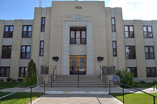
Glacier County, Montana U.S. county in Montana

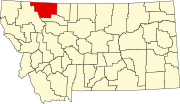
Glacier County is located in the U.S. state of Montana. As of the 2010 United States Census, the population was 13,399. The county is located in northwestern Montana between the Great Plains and the Rocky Mountains, known to the Blackfeet as the "Backbone of the World". The county is geographically and culturally diverse and includes the Blackfeet Native American Reservation, Glacier National Park, and Lewis and Clark National Forest. The county is bordered by 75 miles of international boundary with two ports of entry open year-round and one seasonal international border crossing into Alberta, Canada.

Contents

Lakes

Atsina Lake is in Glacier National Park in the U. S. state of Montana, just to the west of Pyramid Peak. Atsina Lake has several waterfalls nearby including Paiota Falls, Atsina Falls and the Mokowanis Cascade.

Bench Lake is located in Glacier National Park, in the U. S. state of Montana. Bench Lake is south of Kootenai Peak.

Boy Lake is located in Glacier National Park, in the U. S. state of Montana. Boy Lake is approximately 1 mile (1.6 km) WWN of Rising Wolf Mountain.

Ice Berg Lake (Ice Lake), Glacier National Park, Montana. Photo by T. J. Hileman. Part of James Willard Schultz Photos and Personal Papers Collection, Montana State University. Glacier National Park Ice Berg Lake.jpg
Ice Berg Lake (Ice Lake), Glacier National Park, Montana. Photo by T. J. Hileman. Part of James Willard Schultz Photos and Personal Papers Collection, Montana State University.

Ipasha Lake is located in Glacier National Park, in the U. S. state of Montana. Ipasha Lake is west of Ipasha Peak which rises more than 4,000 feet (1,200 m) above the lake. Melt water from the Ipasha Glacier descends 580 feet (180 m) over Ipasha Falls en route to Ipasha Lake.

Kaina Lake is located in Glacier National Park, in the U. S. state of Montana. Kaina Lake is south of Kaina Mountain.

Katoya Lake is located in Glacier National Park, in the U. S. state of Montana. The lake is northeast of Pitamakan Lake while Red Mountain rises more than 3,000 feet (910 m) above Katoya Lake to the northeast. The lake expands .25 miles on its length, and is just .10 miles wide. The surface elevation is 6,368 ft.

Reservoirs

Lake Sherburne is located in the Many Glacier region of Glacier National Park, in the U.S. state of Montana. The lake is a reservoir, formed by Lake Sherburne Dam, which impounded Swiftcurrent Creek and was constructed in between 1914 and 1921. The construction of the dam inundated several small lakes and highly productive riparian and wetland areas, and due to its fluctuating water levels, the surrounding area supports little vegetation. However, trumpeter swans are often observed along the lake in the spring and fall. The lake stretches nearly 6 miles (9.7 km) when full. The reservoir is the principal water storage component of the U.S. Bureau of Reclamation's Milk River Project, which provides irrigation water to north central Montana farms.

See also

Notes

  1. "Alkali Lake". Geographic Names Information System . United States Geological Survey.
  2. "Allison Lake". Geographic Names Information System . United States Geological Survey.
  3. "Atsina Lake". Geographic Names Information System . United States Geological Survey.
  4. "Aubery Lake". Geographic Names Information System . United States Geological Survey.
  5. "Bench Lake". Geographic Names Information System . United States Geological Survey.
  6. "Big Spring Lake". Geographic Names Information System . United States Geological Survey.
  7. "Boundary Lake". Geographic Names Information System . United States Geological Survey.
  8. "Boy Lake". Geographic Names Information System . United States Geological Survey.
  9. "Buffalo Lake". Geographic Names Information System . United States Geological Survey.
  10. "Buffalo Lakes". Geographic Names Information System . United States Geological Survey.
  11. "Bullhead Lake". Geographic Names Information System . United States Geological Survey.
  12. "Cameron Lake". Geographic Names Information System . United States Geological Survey.
  13. "Carcajou Lake". Geographic Names Information System . United States Geological Survey.
  14. "Carlow Lake". Geographic Names Information System . United States Geological Survey.
  15. "Cobalt Lake". Geographic Names Information System . United States Geological Survey.
  16. "Conway Lake". Geographic Names Information System . United States Geological Survey.
  17. "Cosley Lake". Geographic Names Information System . United States Geological Survey.
  18. "Cracker Lake". Geographic Names Information System . United States Geological Survey.
  19. "Croffs Lake". Geographic Names Information System . United States Geological Survey.
  20. "Dog Gun Lake". Geographic Names Information System . United States Geological Survey.
  21. "Duck Lake". Geographic Names Information System . United States Geological Survey.
  22. "Elizabeth Lake". Geographic Names Information System . United States Geological Survey.
  23. "Falling Leaf Lake". Geographic Names Information System . United States Geological Survey.
  24. "Fishercap Lake". Geographic Names Information System . United States Geological Survey.
  25. "Flatton Lake". Geographic Names Information System . United States Geological Survey.
  26. "Four Horns Lake". Geographic Names Information System . United States Geological Survey.
  27. "Glenns Lake". Geographic Names Information System . United States Geological Survey.
  28. "Goat Haunt Lake". Geographic Names Information System . United States Geological Survey.
  29. "Goat Lake". Geographic Names Information System . United States Geological Survey.
  30. "Goose Lake". Geographic Names Information System . United States Geological Survey.
  31. "Governor Pond". Geographic Names Information System . United States Geological Survey.
  32. "Grassy Lake". Geographic Names Information System . United States Geological Survey.
  33. "Green Lake". Geographic Names Information System . United States Geological Survey.
  34. "Grinnell Lake". Geographic Names Information System . United States Geological Survey.
  35. "Guardipee Lake". Geographic Names Information System . United States Geological Survey.
  36. "Gunsight Lake". Geographic Names Information System . United States Geological Survey.
  37. "Hay Lake". Geographic Names Information System . United States Geological Survey.
  38. "Helen Lake". Geographic Names Information System . United States Geological Survey.
  39. "Hidden Lake". Geographic Names Information System . United States Geological Survey.
  40. "Hope Lake". Geographic Names Information System . United States Geological Survey.
  41. "Horse Lake". Geographic Names Information System . United States Geological Survey.
  42. "Iceberg Lake". Geographic Names Information System . United States Geological Survey.
  43. "Ipasha Lake". Geographic Names Information System . United States Geological Survey.
  44. "Josephine Lake". Geographic Names Information System . United States Geological Survey.
  45. "Kaina Lake". Geographic Names Information System . United States Geological Survey.
  46. "Katoya Lake". Geographic Names Information System . United States Geological Survey.
  47. "Kennedy Lake". Geographic Names Information System . United States Geological Survey.
  48. "Kipp Lake". Geographic Names Information System . United States Geological Survey.
  49. "Kootenai Lakes". Geographic Names Information System . United States Geological Survey.
  50. "Lake Frances". Geographic Names Information System . United States Geological Survey.
  51. "Lake Janet". Geographic Names Information System . United States Geological Survey.
  52. "Lake Josephine". Geographic Names Information System . United States Geological Survey.
  53. "Lake Nooney". Geographic Names Information System . United States Geological Survey.
  54. "Lake Wurdeman". Geographic Names Information System . United States Geological Survey.
  55. "Lena Lake". Geographic Names Information System . United States Geological Survey.
  56. "Little Buffalo Lake". Geographic Names Information System . United States Geological Survey.
  57. "Lonely Lakes". Geographic Names Information System . United States Geological Survey.
  58. "Lost Lake". Geographic Names Information System . United States Geological Survey.
  59. "Lower Saint Mary Lake". Geographic Names Information System . United States Geological Survey.
  60. "Lower Two Medicine Lake". Geographic Names Information System . United States Geological Survey.
  61. "Lubec Lake". Geographic Names Information System . United States Geological Survey.
  62. "Lukins Lake". Geographic Names Information System . United States Geological Survey.
  63. "Magee Lake". Geographic Names Information System . United States Geological Survey.
  64. "Margaret Lake". Geographic Names Information System . United States Geological Survey.
  65. "Medicine Grizzly Lake". Geographic Names Information System . United States Geological Survey.
  66. "Medicine Owl Lake". Geographic Names Information System . United States Geological Survey.
  67. "Miche Wabun Lake". Geographic Names Information System . United States Geological Survey.
  68. "Minnie White Horse Lake". Geographic Names Information System . United States Geological Survey.
  69. "Mirror Pond". Geographic Names Information System . United States Geological Survey.
  70. "Mokowanis Lake". Geographic Names Information System . United States Geological Survey.
  71. "Morning Eagle Lake". Geographic Names Information System . United States Geological Survey.
  72. "Morning Star Lake". Geographic Names Information System . United States Geological Survey.
  73. "Nahsukin Lake". Geographic Names Information System . United States Geological Survey.
  74. "Natahki Lake". Geographic Names Information System . United States Geological Survey.
  75. "No Name Lake". Geographic Names Information System . United States Geological Survey.
  76. "North Lakes". Geographic Names Information System . United States Geological Survey.
  77. "Oldman Lake". Geographic Names Information System . United States Geological Survey.
  78. "Otatso Lake". Geographic Names Information System . United States Geological Survey.
  79. "Otokomi Lake". Geographic Names Information System . United States Geological Survey.
  80. "Pike Lake". Geographic Names Information System . United States Geological Survey.
  81. "Pitamakan Lake". Geographic Names Information System . United States Geological Survey.
  82. "Poia Lake". Geographic Names Information System . United States Geological Survey.
  83. "Pray Lake". Geographic Names Information System . United States Geological Survey.
  84. "Ptarmigan Lake". Geographic Names Information System . United States Geological Survey.
  85. "Red Eagle Lake". Geographic Names Information System . United States Geological Survey.
  86. "Redhorn Lake". Geographic Names Information System . United States Geological Survey.
  87. "Redrock Lake". Geographic Names Information System . United States Geological Survey.
  88. "Running Crane Lake". Geographic Names Information System . United States Geological Survey.
  89. "Saint Mary Lake". Geographic Names Information System . United States Geological Survey.
  90. "Seven Winds of the Lake". Geographic Names Information System . United States Geological Survey.
  91. "Shaheeya Lake". Geographic Names Information System . United States Geological Survey.
  92. "Sharp Lake". Geographic Names Information System . United States Geological Survey.
  93. "Sky Lake". Geographic Names Information System . United States Geological Survey.
  94. "Slide Lake". Geographic Names Information System . United States Geological Survey.
  95. "Snow Moon Lake". Geographic Names Information System . United States Geological Survey.
  96. "Spider Lake". Geographic Names Information System . United States Geological Survey.
  97. "Stoney Indian Lake". Geographic Names Information System . United States Geological Survey.
  98. "Stump Lake". Geographic Names Information System . United States Geological Survey.
  99. "Sue Lake". Geographic Names Information System . United States Geological Survey.
  100. "Swiftcurrent Lake". Geographic Names Information System . United States Geological Survey.
  101. "Swiftcurrent Ridge Lake". Geographic Names Information System . United States Geological Survey.
  102. "Three Bears Lake". Geographic Names Information System . United States Geological Survey.
  103. "Toad Lake". Geographic Names Information System . United States Geological Survey.
  104. "Twin Lakes". Geographic Names Information System . United States Geological Survey.
  105. "Twin Lakes". Geographic Names Information System . United States Geological Survey.
  106. "Two Medicine Lake". Geographic Names Information System . United States Geological Survey.
  107. "Upper Grinnell Lake". Geographic Names Information System . United States Geological Survey.
  108. "Upper Mission Lake". Geographic Names Information System . United States Geological Survey.
  109. "Upper Two Medicine Lake". Geographic Names Information System . United States Geological Survey.
  110. "Upper Waterton Lake". Geographic Names Information System . United States Geological Survey.
  111. "Wahseeja Lake". Geographic Names Information System . United States Geological Survey.
  112. "Whitecrow Lake". Geographic Names Information System . United States Geological Survey.
  113. "Windmaker Lake". Geographic Names Information System . United States Geological Survey.
  114. "Young Man Lake". Geographic Names Information System . United States Geological Survey.
  115. "Four Horns Lake". Geographic Names Information System . United States Geological Survey.
  116. "Kipps Lake". Geographic Names Information System . United States Geological Survey.
  117. "Lake Sherburne". Geographic Names Information System . United States Geological Survey.
  118. "Lower Two Medicine Reservoir". Geographic Names Information System . United States Geological Survey.
  119. "Mission Lake". Geographic Names Information System . United States Geological Survey.

Related Research Articles

Waterfalls of Montana Wikimedia list article

There are at least 120 named waterfalls in Montana. A waterfall is a place where flowing water rapidly drops in elevation as it flows over a steep region or a cliff. Waterfalls are most commonly formed when a river is young.