
In these lists of mountains in Ireland, those within Northern Ireland, or on the Republic of Ireland – United Kingdom border, are marked with an asterisk, while the rest are within the Republic of Ireland. Where mountains are ranked by height, the definition of the topographical prominence used to classify the mountain, is noted. In British definitions, a height of 600 metres (1,969 ft) is required for a mountain, whereas in Ireland, a lower threshold of 500 metres (1,640 ft) is sometimes advocated.

The Western Way is a long-distance trail in Ireland. It is 179 kilometres long and begins in Oughterard, County Galway and ends in Ballycastle, County Mayo. It is typically completed in seven days. It is designated as a National Waymarked Trail by the National Trails Office of the Irish Sports Council and is managed by Coillte, Galway County Council, Mayo County Council, South Mayo Development Company and Mayo North & East Development Company.

Nephin or Nefin, at 806 metres (2646 ft), is the highest standalone mountain in Ireland and the second-highest peak in Connacht, Ireland. It is to the west of Lough Conn in County Mayo. Néifinn is variously translated as meaning 'heavenly', 'sanctuary', or "Finn's Heaven".
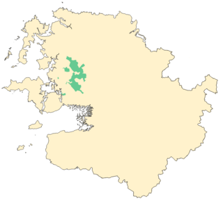
Wild Nephin is a national park in northwest County Mayo, Ireland. It includes much of the Nephin Beg Mountains and one of the largest expanses of peatland in Europe, consisting of 150 square kilometres of Atlantic blanket bog. It is a unique habitat with a diverse flora and fauna. It was established as Ballycroy National Park in 1998, then expanded and re-named in 2018, with plans to re-wild the area. Wild Nephin includes the most remote point of land on the Irish mainland. The park is a candidate Special Area of Conservation (cSAC) as part of a site known as the Owenduff/Nephin Complex. It is also a Special Protection Area and part of the Natura 2000 network.
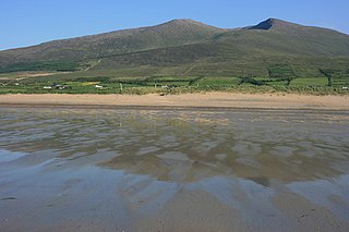
The Mountains of the Central Dingle Peninsula are the generic name given to the mountains that lie on the Dingle Peninsula between the Brandon Group of mountains in the west, and the Slieve Mish Mountains at the eastern end of the peninsula.
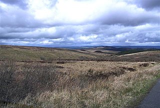
Slieve Beagh or Sliabh Beagh is a mountainous area straddling the border between County Monaghan in the Republic of Ireland and County Fermanagh and County Tyrone in Northern Ireland. A point just east of its summit is the highest point in Monaghan; however the true summit is on the Fermanagh-Tyrone border. The point where the three counties meet, is referred to as the "Three County Hollow".
Slieve Carr, also known as Slieve Cor or Corslieve, is a mountain with a height of 721 metres (2,365 ft) in County Mayo, Ireland. It is part of the Nephin Range and is beside Nephin Beg. On the summit is a burial cairn known as Laghtdauhybaun, from Leacht Dáithí Bháin, 'burial monument of white Dáithí'. This is believed to refer to Dathí, a king of Connacht in the 5th century.

The Ox Mountains or Slieve Gamph are a mountain range in County Sligo on the west coast of Ireland. They are also known as Saint Patrick's Mountains after the saint who built churches on its slopes and left his name to some of its wells.

Slieve na Calliagh are a range of hills and ancient burial site near Oldcastle, County Meath, Ireland. The summit is 276 metres (906 ft), the highest point in the county. On the hilltops are about twenty passage tombs, some decorated with rare megalithic art, which were built in the 4th millennium BC. Also called the Loughcrew tombs, it is one of the main passage tomb cemeteries in Ireland, along with Brú na Bóinne, Carrowkeel and Carrowmore.
Slieve True or Slievetrue is a 312 m-high (1,024 ft) hill in County Antrim, Northern Ireland. It is near Knockagh Monument and Monkstown, about 6 km (3.7 mi) north of Belfast.
Nephin Beg or Nefin Beg is a mountain in the Nephin Beg Range in north County Mayo, Ireland. The mountain takes its name from Nephin, although that mountain is some distance away and there are intervening mountains between them. Its highest point is 627 metres (2,057 ft).

The Nephin Beg Range or Nephin Mountains is a mountain range in County Mayo, Republic of Ireland. The range contains the mountains of Nephin, Nephin Beg, Slieve Carr, Birreencorragh and Corranabinnia/Cushcamcarragh, among others. The range hosts the Nephin forest, a 4,843 hectares forest managed by Coillte.

The Bangor Trail is a waymarked walking trail in Erris, North Mayo, Ireland.
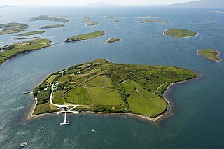
Inish Turk Beg is a private island in Clew Bay, County Mayo on the west coast of Ireland. Between 2003 and 2013, it was owned by Nadim Sadek, an Irish-Egyptian marketing entrepreneur. The island is approximately 10 km (6.2 mi) by road from the towns of Newport and Westport, County Mayo, and 67 km (42 mi) from Ireland West Airport Knock.
Birreencorragh is a mountain in the Nephin Beg Range, County Mayo, Ireland, reaching 698 metres (2,290 ft) above sea level.

Garraun at 598 metres (1,962 ft), is the 224th–highest peak in Ireland on the Arderin scale, however, while it is just short of the elevation threshold of 600-metres for other classifications, it does have the prominence to be a Marilyn. Garraun lies on an isolated massif near the mouth of Killary Harbour at the far north sector of the Twelve Bens/Garraun Complex Special Area of Conservation in the Connemara National Park in Galway. The southern slopes are a scenic backdrop to Kylemore Abbey and Kylemore Lough.
The Wild Atlantic Way is a tourism trail on the west coast, and on parts of the north and south coasts, of Ireland. The 2,500 km driving route passes through nine counties and three provinces, stretching from County Donegal's Inishowen Peninsula in Ulster to Kinsale, County Cork, in Munster, on the Celtic Sea coast.

The Owenmore River is a river in northwest County Mayo, Ireland. It is big spate river and drains a large area of bogs, moorland and mountains.
Slieve is an anglicisation of the Irish sliabh (mountain) in the names of various hills and mountains or ranges in the island of Ireland, including

