RTÉ Radio 1 is an Irish national radio station owned and operated by RTÉ and is the direct descendant of Dublin radio station 2RN, which began broadcasting on a regular basis on 1 January 1926.
The Llanddona transmitting station is a broadcasting and telecommunications facility, situated at Llanddona, near Beaumaris, on the isle of Anglesey, Wales. It comprises a 106.7 metres (350 ft) guyed mast with antennas attached at various heights. It is owned and operated by Arqiva.
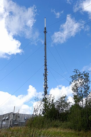
The Cairn Hill transmission site is a radio and television broadcasting facility located on a 277 metre hill at Dernacross, 10 km northeast of Longford town in County Longford, Ireland.
The Castlebar transmitter is a relay station used to broadcast television and radio to a large part of County Mayo, Ireland, located at Croaghmoyle. The site is part of the RTÉ Network Limited transmission network.

2RN is the trading name of RTÉ Transmission Network DAC, a wholly owned subsidiary of Raidió Teilifís Éireann, formerly trading as RTÉNL, which runs Ireland's principal digital terrestrial television and radio broadcast networks. In December 2002 it became an incorporated company and subsidiary of RTÉ; it was previously a division within RTÉ. It operates 12 main TV and radio transmitter sites and many smaller relays and transposers, which carry television and/or radio. It also provides site hosting for mobile telephone operators, the emergency services, wireless broadband and other private mobile communications service providers.
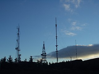
Three Rock Mountain is a mountain in Co Dublin, Ireland. It is 444 metres high and forms part of the group of hills in the Dublin Mountains which comprises Two Rock, Three Rock, Kilmashogue and Tibradden Mountains. The mountain takes its name from the three groups of granite rocks at the summit. It was once believed that these features were man-made: for instance, Gabriel Beranger wrote of them in 1780, "I take them to be altars upon which sacrifices were offered […] the regularity which is observed in piling them convinces me they are the work of man, as they could not grow in that position". In fact, the three outcrops are tors: natural geological features produced by the gradual process of weathering. Today, the summit is dominated by the many radio masts and towers that use the site to broadcast their signals across the Dublin area below. The forestry plantations on the slopes consist mainly of Sitka spruce, Japanese larch, Scots pine, Monterey pine and lodgepole pine.

Kippure at 757 metres (2,484 ft), is the 56th-highest peak in Ireland on the Arderin scale, and the 72nd-highest peak on the Vandeleur-Lynam scale. Kippure is situated in the far northern sector of the Wicklow Mountains, where it lies on the border of the counties of Dublin and Wicklow in Ireland. Kippure is the County Top for Dublin, and its height and positioning over Dublin city have made its summit an important site for transmission masts, which are highly visible from a distance. Kippure's slopes feed into the Liffey Head Bog which forms the source of the River Liffey. The summit can be easily accessed from the east via a path that lies off the R115 road along the route to the Sally Gap.

Mount Leinster is a 794-metre-high (2,605 ft) mountain in the Republic of Ireland. It straddles the border between Counties Carlow and Wexford, in the province of Leinster. It is the fifth-highest mountain in Leinster after Lugnaquilla 925 metres (3,035 ft), Mullaghcleevaun 849 metres (2,785 ft), Tonelagee 817 metres (2,680 ft), and Cloghernagh 800 metres (2,600 ft), and the highest of the Blackstairs Mountains. A 2RN transmission site tops the peak with a mast height of 122 metres (400 ft).

Clermont Carn, also known as Black Mountain, is a mountain that rises to 510 metres (1,670 ft) in the Cooley Mountains of County Louth, Ireland. It is at the border with Northern Ireland, and is also the location of the Clermont Carn transmission site. The mountain's name refers to an ancient burial cairn on its summit, and to Lord Clermont of Ravensdale.
The Black Mountain transmitting station is a broadcasting and telecommunications facility, situated on land 301 metres (988 ft) above Ordnance Datum to the west of the city of Belfast, in Northern Ireland. It includes a guyed steel lattice mast which is 228.6 metres (750 ft) in height. The height of the top of the structure above mean sea level is 529 metres (1,736 ft). It is owned and operated by Arqiva.

Mullaghanish is a 649 m high mountain in the Derrynasaggart range, located just northeast of Ballyvourney in County Cork, Ireland.

RTÉ Radio is a division and service of Raidió Teilifís Éireann (RTÉ), which broadcasts four analogue channels and five digital channels across Ireland and beyond.

The Holme Moss transmitting station is a radio transmitting station at Holme Moss in West Yorkshire, England. The mast provides VHF coverage of both FM and DAB to a wide area around the mast including Derbyshire, Greater Manchester, South Yorkshire and West Yorkshire.
Saorview is the national digital terrestrial television (DTT) service in Ireland. It is owned by RTÉ and operated by 2RN.
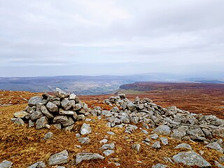
Truskmore South-East Cairn is the highest point in Leitrim at 631 m (2,070 ft) above sea level. It is part of Truskmore mountain and is located approximately 0.45 km southeast of the mountain's summit, which is 16 m (52 ft) higher and located in County Sligo.

Brougher Mountain transmitting station is a major transmitting station in Northern Ireland. It is located between County Tyrone and County Fermanagh, on top of a 317 m (1,040 ft) high hill called Brougher Mountain.
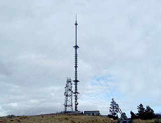
The Maghera transmission site is situated on a 400m hill located at Killanena in the East of County Clare, Ireland. It is home to one of 2RN's network of radio and television transmitters.
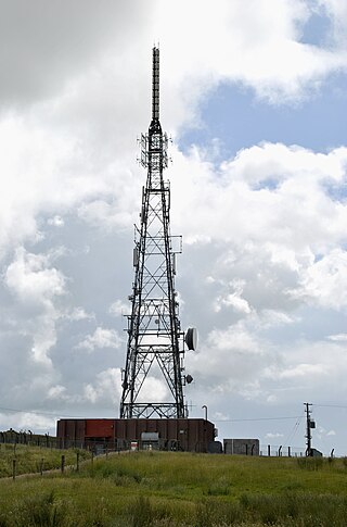
The Holywell Hill transmission site is located on a 260 metre hill near Killea in County Donegal, Ireland, and is owned and operated by 2RN.

The Spur Hill transmission site is located to the south of the city of Cork, Ireland, just north west of Cork airport, on a hill with a 137 metre elevation.
This is a timeline of RTÉ Radio.


