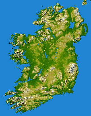
In these lists of mountains in Ireland, those within Northern Ireland, or on the Republic of Ireland – United Kingdom border, are marked with an asterisk, while the rest are within the Republic of Ireland. Where mountains are ranked by height, the definition of the topographical prominence used to classify the mountain, is noted. In British definitions, a height of 600 metres (1,969 ft) is required for a mountain, whereas in Ireland, a lower threshold of 500 metres (1,640 ft) is sometimes advocated.

The Western Way is a long-distance trail in Ireland. It is 179 kilometres long and begins in Oughterard, County Galway and ends in Ballycastle, County Mayo. It is typically completed in seven days. It is designated as a National Waymarked Trail by the National Trails Office of the Irish Sports Council and is managed by Coillte, Galway County Council, Mayo County Council, South Mayo Development Company and Mayo North & East Development Company.
Bangor Erris is a town in Kiltane parish in Erris, County Mayo, Ireland with a population of over 300. It is on the banks of the Owenmore River and is a "gateway" to the Erris Peninsula linking Belmullet with Ballina and Westport. It is located at the foot of the "Bangor Trail" a 22-mile mountain pass across the Nephin Beg Mountain Range to Newport. Approximately 2 km away is Carrowmore Lake, Bangor is a centre for wild atlantic salmon and sea trout fishing. Bangor Erris is located in the Parish of Kiltane. Due west from Bangor are the towns of Belmullet, Geesala, Mulranny, Westport and Doolough.
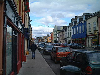
Kiltimagh is a town in County Mayo in Ireland. As of the 2022 census, the town had a population of 1,232 people. Although there is no river going through the town, three rivers flow around the town: the Glore River, Yellow River and Pollagh River. The town centre sits at the crest of a hill surrounding The High Fort in Fortlands and built out linearly on the main road from there.

Coillte is a state-owned commercial forestry business in Ireland based in Newtownmountkennedy. Coillte manage approximately 7% of the country’s land, and operates three businesses - their core forestry business, a 'land solutions' division, and a wood panel manufacturing business called 'Medite Smartply'.
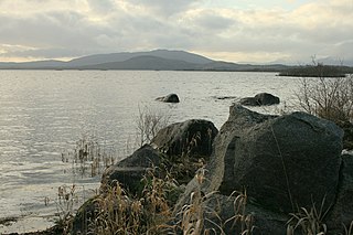
Wild Nephin is a national park in northwest County Mayo, Ireland. It includes much of the Nephin Beg Mountains and one of the largest expanses of peatland in Europe, consisting of 150 square kilometres of Atlantic blanket bog. It is a unique habitat with a diverse flora and fauna. It was established as Ballycroy National Park in 1998, then expanded and re-named in 2018, with plans to re-wild the additional lands acquired at Nephin Forest to the east of the Nephin Beg Mountains. Wild Nephin includes the most remote point of land on the Irish mainland. The park is a candidate Special Area of Conservation (cSAC) as part of a site known as the Owenduff/Nephin Complex. It is also a Special Protection Area and part of the Natura 2000 network.
Slieve Carr, also known as Slieve Cor or Corslieve, is a mountain with a height of 721 metres (2,365 ft) in County Mayo, Ireland. It is part of the Nephin Range and is beside Nephin Beg. The mountain is in Wild Nephin National Park and it is the most remote point of land on the Irish mainland.

Rossmore Forest Park is a national forest park located in County Monaghan in Ireland run by the Irish States forestry organisation, Coillte. It is situated approximately 5km outside Monaghan town and has its main entrance on the R189 Threemilehouse/Newbliss Road.
Nephin Beg or Nefin Beg is a mountain in the Nephin Beg Range in north County Mayo, Ireland. The mountain takes its name from Nephin, although that mountain is some distance away and there are intervening mountains between them. Its highest point is 627 metres (2,057 ft).

The Bangor Trail is a waymarked walking trail in Erris, North Mayo, Ireland. The trail, which is approximately 22 miles (35 km) in length, takes a route south from Bangor Erris through the Nephin Beg Range to Newport. Walking guides and maps of the Bangor Trail have been published by Mayo County Council.
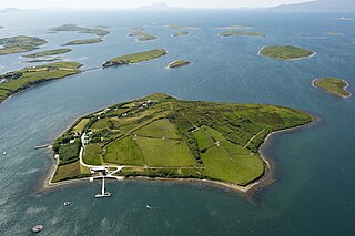
Inish Turk Beg is a private island in Clew Bay, County Mayo on the west coast of Ireland. Between 2003 and 2013, it was owned by Nadim Sadek, an Irish-Egyptian marketing entrepreneur. The island is approximately 10 km (6.2 mi) by road from the towns of Newport and Westport, County Mayo, and 67 km (42 mi) from Ireland West Airport Knock.

Birreencorragh is a mountain in the Nephin Beg Range, County Mayo, Ireland, reaching 698 metres (2,290 ft) above sea level.

The Stack's Mountains are a range of hills northeast of Tralee in County Kerry, Ireland. Traditionally they are deemed part of the hilly region known as Sliabh Luachra, which also includes the Mullaghareirk Mountains.

Moylussa is a mountain in the Slieve Bernagh range in western Ireland, and the highest point in County Clare at 532 metres (1,745 ft).

The Owenmore River is a river in northwest County Mayo, Ireland. It is big spate river and drains a large area of bogs, moorland and mountains.

Derryclare or Derryclare Mountain is a mountain at the southern edge of Twelve Bens range in Connemara National Park in County Galway, Ireland. At 677 metres (2,221 ft), it is the 119th–highest peak in Ireland on the Arderin list, and the 145th–highest peak on the Vandeleur-Lynam list. It is the 5th tallest of the core Twelve Bens. The Derryclare Lough on its southern slopes is a scenic location in Connemara, while Derryclare Wood, on its eastern slopes, contains a Statutory Nature Reserve (SRN).

Burren National Park is one of six national parks in Ireland, managed by the National Parks and Wildlife Service. It covers a small part of the Burren, a karst landscape in County Clare on the west coast.

Corranabinnia is a mountain with a height of 716 metres (2,349 ft) in County Mayo, Ireland. It is also known as Cushcamcarragh and is part of the Nephin Beg Range.
An Abhainn Mhór is the Irish name for several rivers etc. in Ireland:

