| Lissoughter | |
|---|---|
| Cnoc Lios Uachtair | |
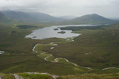
 Lissoughter from the southwest; the tallest peak behind it is Binn idir an da Log | |
| Highest point | |
| Elevation | 401 m (1,316 ft) [1] |
| Prominence | 336 m (1,102 ft) [1] |
| Listing | Marilyn |
| Coordinates | 53°29′01″N9°43′07″W / 53.48358°N 9.718475°W [1] |
| Naming | |
| English translation | hill of the upper ringfort |
| Language of name | Irish |
| Geography | |
 Lissoughter Location in Ireland | |
| Location | Recess, County Galway, Ireland |
| Parent range | Twelve Bens-Maumturks |
| OSI/OSNI grid | L8596849524 |
| Topo map | OSi Discovery 44 |
| Geology | |
| Rock type(s) | Pale quartzites, grits, graphitic top bedrock [1] |
Lissoughter or Lissoughter Hill (Irish : Cnoc Lios Uachtair, meaning 'hill of the upper ring-fort') [2] is a prominent hill between the Twelve Bens and Maumturks mountain ranges, at the southern entrance to the Inagh Valley, in the Connemara National Park of County Galway, Ireland. [3] [4] With a height of 401 metres (1,316 ft), it does not qualify to be an Arderin or a Vandeleur-Lynam, however, its prominence of 336 metres (1,102 ft) ranks it as a Marilyn. [5] [6] [3]
Contents
A quarry on Lissoughter's southern slopes (the Lissoughter-Derryclare quarry, named after the peak and the neighbouring Derryclare mountain), is a noted source of the green-coloured Connemara marble (sometimes called Connemara Lissoughter Marble). [2] [7] [8] As an isolated standalone peak, it is less frequented by hill-walkers, however, it is regarded for its views of the two ranges and the southern boglands of Connemara. [4] [7]