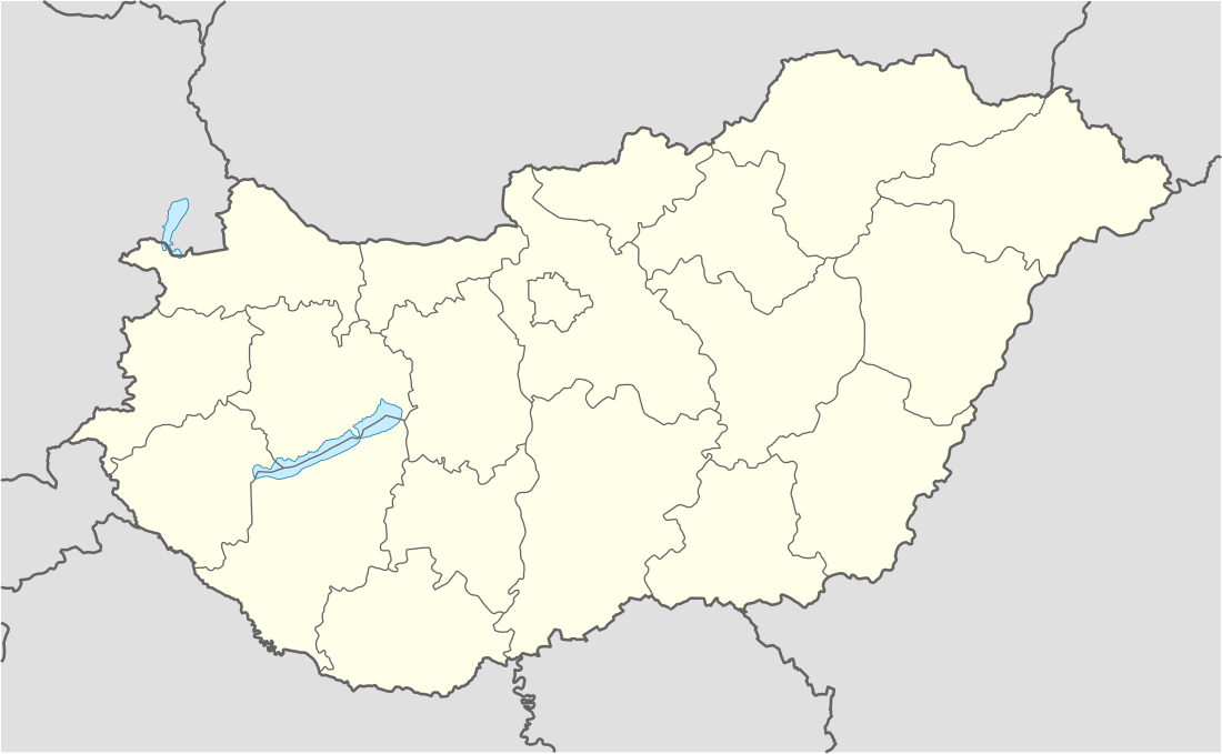
List of mountains in Hungary

Last updated

This list of mountains in Hungary is actually a series of sortable tables of major mountain peaks of Hungary. The summit of a mountain or hill may be measured or sorted in several ways.

Contents

  1. The topographic elevation of a summit measures the height of the summit above a geodetic sea level. [1] The first table below ranks the 10 highest major summits of Hungary by elevation with a prominence of 5 m or more. The second table is the same, just with a prominence of 100 m or more.
  2. The topographic prominence of a summit is a measure of how high the summit rises above its surroundings. The third table below ranks the 20 most prominent summits of Hungary.
  3. The highest summit of a given area. It could be an administrative region (e.g. county as it is in fourth table) or a mountain range as it is in fifth table.
  4. The topographic isolation (or radius of dominance) of a summit measures how far the summit lies from its nearest point of equal elevation.

Mountains by elevation

Mountains by elevation (with a prominence of 5 m or more)

Map all coordinates using: OpenStreetMap  
Download coordinates as: KML
List of mountains by elevation (with a prominence of 5 m or more) [2]
RankMountainHeight (m) Prominence (m)RangeCountyCoordinates
1 Kékes 1014.0774 Mátra Heves County 47°52′21″N20°00′30″E / 47.87250°N 20.00833°E / 47.87250; 20.00833 (1. Kékes (1014.0 m))
2 Hidas-bérc 972.710 Mátra Heves County 47°51′36″N20°00′57″E / 47.86000°N 20.01583°E / 47.86000; 20.01583 (2. Hidas-bérc (972.7 m))
3 Galya-tető 964.7349 Mátra Heves County 47°54′59″N19°54′59″E / 47.91639°N 19.91639°E / 47.91639; 19.91639 (3. Galya-tető (964.7 m))
4 Szilvási-kő 960.7713 Bükk Heves County 48°04′16″N20°26′06″E / 48.07111°N 20.43500°E / 48.07111; 20.43500 (4. Szilvási-kő (960.7 m))
5 Péter-hegyese 960.48 Mátra Nógrád County 47°55′05″N19°55′19″E / 47.91806°N 19.92194°E / 47.91806; 19.92194 (5. Péter-hegyese (960.4 m))
6 Kettős-bérc-2 958.28 Bükk Heves County 48°04′20″N20°26′07″E / 48.07222°N 20.43528°E / 48.07222; 20.43528 (6. Kettős-bérc (958.2 m))
7 Istállós-kő 958.114 Bükk Heves County 48°04′10″N20°25′49″E / 48.06944°N 20.43028°E / 48.06944; 20.43028 (7. Istállós-kő (958.1 m))
8 Bálvány 956.481 Bükk Heves County 48°05′58″N20°28′20″E / 48.09944°N 20.47222°E / 48.09944; 20.47222 (8. Bálvány (956.4 m))
9 Körös-bérc 955.961 Bükk Heves County 48°04′16″N20°27′12″E / 48.07111°N 20.45333°E / 48.07111; 20.45333 (9. Körös-bérc (955.9))
10 Virágos-sár-bérc 955.030 Bükk Heves County 48°04′02″N20°26′37″E / 48.06722°N 20.44361°E / 48.06722; 20.44361 (10. Virágos-sár-bérc (955.0 m))

Mountains with a prominence of 100 m or more

Mountains by elevation (with a prominence of 100 m or more)
RankMountainHeight (m) Prominence (m)RangeCountyCoordinates
1 Kékes 1014.0774 Mátra Heves County 47°52′21″N20°00′30″E / 47.87250°N 20.00833°E / 47.87250; 20.00833 (1. Kékes (1014.0 m))
2 Galya-tető 964.7349 Mátra Heves County 47°54′59″N19°54′59″E / 47.91639°N 19.91639°E / 47.91639; 19.91639 (2. Galya-tető (964.7 m))
3 Szilvási-kő 960.7713 Bükk Heves County 48°04′16″N20°26′06″E / 48.07111°N 20.43500°E / 48.07111; 20.43500 (3. Szilvási-kő (960.7 m))
4 Csóványos 937.9710 Börzsöny Pest County, Nógrád County 47°56′57″N18°56′54″E / 47.94917°N 18.94833°E / 47.94917; 18.94833 (4. Csóványos (937.9 m))
5 Nagy-Milic 894.7585 Zemplén Mountains Borsod-Abaúj-Zemplén County 48°34′36″N21°27′29″E / 48.57667°N 21.45806°E / 48.57667; 21.45806 (5. Nagy-Milic (894.7 m))
6 Írott-kő 884.0414 Kőszeg Mountains Vas County 47°21′10″N16°26′02″E / 47.35278°N 16.43389°E / 47.35278; 16.43389 (6. Írott-kő (884.0 m))
7 Tót-hegyes 815.8170 Mátra Heves County 47°52′22″N19°49′56″E / 47.87278°N 19.83222°E / 47.87278; 19.83222 (7. Tót-hegyes (815.8 m))
8 Muzsla 805.1180 Mátra Nógrád County 47°53′16″N19°45′33″E / 47.88778°N 19.75917°E / 47.88778; 19.75917 (8. Muzsla (805.1 m))
9Gergely-hegy783.2428 Zemplén Mountains Borsod-Abaúj-Zemplén County 48°24′58″N21°18′37″E / 48.41611°N 21.31028°E / 48.41611; 21.31028 (9. Gergely-hegy (783.2 m))
10 Pilis-tető 755.5606 Pilis Mountains Pest County 47°41′19″N18°52′25″E / 47.68861°N 18.87361°E / 47.68861; 18.87361 (10. Pilis-tető (755.5 m))

Mountains by prominence

Mountains by prominence [3] [4]
RankMountain Prominence (m)Height (m))RangeCoordinates
1 Kékes 7741014 Mátra 47°52′21″N20°00′30″E / 47.87250°N 20.00833°E / 47.87250; 20.00833 (1. Kékes (1014 m))
2 Szilvási-kő 713961 Bükk 48°04′16″N20°26′06″E / 48.07111°N 20.43500°E / 48.07111; 20.43500 (2. Szilvási-kő (961 m))
3 Csóványos 710938 Börzsöny 47°56′57″N18°56′54″E / 47.94917°N 18.94833°E / 47.94917; 18.94833 (3. Csóványos (938 m))
4 Pilis-tető 606756 Pilis Mountains 47°41′19″N18°52′25″E / 47.68861°N 18.87361°E / 47.68861; 18.87361 (4. Pilis-tető (756 m))
5 Nagy-Milic 585895 Zemplén Mountains 48°34′36″N21°27′29″E / 48.57667°N 21.45806°E / 48.57667; 21.45806 (5. Nagy-Milic (895 m))
6 Zengő 537682 Mecsek 46°10′50″N18°22′45″E / 46.18056°N 18.37917°E / 46.18056; 18.37917 (6. Zengő (682 m))
7 Karancs 497727 Karancs Hills 48°09′32″N19°47′27″E / 48.15889°N 19.79083°E / 48.15889; 19.79083 (7. Karancs (727 m))
8 Kőris-hegy 492711 Bakony 47°17′40″N17°45′23″E / 47.29444°N 17.75639°E / 47.29444; 17.75639 (8. Kőris-hegy (711 m))
9 Gergely-hegy 428783 Zemplén Mountains 48°24′59″N21°18′44″E / 48.41639°N 21.31222°E / 48.41639; 21.31222 (9. Gergely-hegy (783 m))
10 Írott-kő 414884 Kőszeg Mountains 47°21′10″N16°26′02″E / 47.35278°N 16.43389°E / 47.35278; 16.43389 (10. Írott-kő (884.0 m))
11 Gerecse 408633 Gerecse 47°40′45″N18°29′21″E / 47.67917°N 18.48917°E / 47.67917; 18.48917 (11. Gerecse (633 m))
12 Nagy-Kopasz 403528 Zemplén Mountains 48°07′15″N21°23′03″E / 48.12083°N 21.38417°E / 48.12083; 21.38417 (12. Nagy-Kopasz (528))
13 Naszály 402652 Cserhát 47°50′03″N19°09′13″E / 47.83417°N 19.15361°E / 47.83417; 19.15361 (13. Naszály (652 m))
14 Fekete-hegy 351576 Zemplén Mountains 48°26′22″N21°33′50″E / 48.43944°N 21.56389°E / 48.43944; 21.56389 (14. Fekete-hegy (576))
15 Galya-tető 349965 Mátra 47°54′59″N19°54′59″E / 47.91639°N 19.91639°E / 47.91639; 19.91639 (15. Galya-tető (964.7 m))
16 Szokolya 334607 Zemplén Mountains 48°15′54″N21°17′57″E / 48.26500°N 21.29917°E / 48.26500; 21.29917 (16. Szokolya (607))
17 Szár-hegy 331521 Aggtelek Karst 48°28′48″N20°44′05″E / 48.48000°N 20.73472°E / 48.48000; 20.73472 (17. Szár-hegy (521))
18 Magas-hegy 309514 Zemplén Mountains 48°24′08″N21°38′01″E / 48.40222°N 21.63361°E / 48.40222; 21.63361 (18. Magas-hegy (514))
19 Purga 305575 Cserhát 47°57′30″N19°38′39″E / 47.95833°N 19.64417°E / 47.95833; 19.64417 (19. Purga (575))
20 Magoska 299734 Zemplén Mountains 48°21′00″N21°17′12″E / 48.35000°N 21.28667°E / 48.35000; 21.28667 (20. Magoska (734))

Highest mountain of each county and Budapest

Highest mountain of each county and Budapest [5]
RankCountyPeakHeight (m))RangeCoordinates
1 Heves County Kékes 1014 Mátra 47°52′21″N20°00′30″E / 47.87250°N 20.00833°E / 47.87250; 20.00833 (1. Kékes (1014 m))
2 Nógrád County Péter-hegyese 960 Mátra 47°55′05″N19°55′19″E / 47.91806°N 19.92194°E / 47.91806; 19.92194 (2. Péter-hegyese (960 m))
3 Borsod-Abaúj-Zemplén County Felső-Borovnyák 945 Bükk 48°05′56″N20°29′26″E / 48.09889°N 20.49056°E / 48.09889; 20.49056 (3. Felső-Borovnyák (945 m))
4 Pest County Csóványos 938 Börzsöny 47°56′57″N18°56′54″E / 47.94917°N 18.94833°E / 47.94917; 18.94833 (4. Csóványos (938 m))
5 Vas County Írott-kő 884 Kőszeg Mountains 47°21′10″N16°26′02″E / 47.35278°N 16.43389°E / 47.35278; 16.43389 (5. Írott-kő (884.0 m))
6 Veszprém County Kőris-hegy 711 Bakony 47°17′40″N17°45′16″E / 47.29444°N 17.75444°E / 47.29444; 17.75444 (6. Kőris-hegy (711 m))
7 Komárom-Esztergom County Dobogókő 700 Visegrád Hills 47°43′10″N18°54′10″E / 47.71944°N 18.90278°E / 47.71944; 18.90278 (8. Dobogókő (700 m))
8 Baranya County Zengő 682 Mecsek 46°10′50″N18°22′39″E / 46.18056°N 18.37750°E / 46.18056; 18.37750 (9. Zengő (682 m))
9 Győr-Moson-Sopron County Kék-hegy 661 Bakony 47°18′18″N17°46′03″E / 47.30500°N 17.76750°E / 47.30500; 17.76750 (7. Kék-hegy (611 m))
10 Tolna County Dobogó 594 Mecsek 46°13′33″N18°21′40″E / 46.22583°N 18.36111°E / 46.22583; 18.36111 (10. Dobogó (594 m))
11 Budapest János Hill 527 Buda Hills 47°31′05″N18°57′33″E / 47.51806°N 18.95917°E / 47.51806; 18.95917 (11. János Hill (527 m))
12 Fejér County Csóka-hegy,
Köves-domb
479 Vértes,
Bakony
47°22′14″N18°15′20″E / 47.37056°N 18.25556°E / 47.37056; 18.25556 (12. Csóka-hegy (479 m)) ,
47°16′23″N18°04′48″E / 47.27306°N 18.08000°E / 47.27306; 18.08000 (12. Köves-domb (479 m))
13 Zala County Köves-tető 444 Keszthely Mountains 46°49′07″N17°19′46″E / 46.81861°N 17.32944°E / 46.81861; 17.32944 (13. Köves-tető (444 m))
14 Somogy County Alman-tető 316 Külső-Somogy 46°46′19″N17°52′52″E / 46.77194°N 17.88111°E / 46.77194; 17.88111 (14. Alman-tető (316 m))
15 Szabolcs-Szatmár-Bereg County Bárci-tető 220 Kaszonyi-hegy 48°15′02″N22°29′00″E / 48.25056°N 22.48333°E / 48.25056; 22.48333 (15. Bárci-tető (220))
16 Bács-Kiskun County Ólom-hegy 172 Illancs 46°15′46″N19°05′21″E / 46.26278°N 19.08917°E / 46.26278; 19.08917 (16. Ólom-hegy (172 m))
17 Hajdú-Bihar County Sós-hegy 172 Nyírség 47°41′20″N21°52′20″E / 47.68889°N 21.87222°E / 47.68889; 21.87222 (17. Sós-hegy (172 m))
18 Jász-Nagykun-Szolnok Hármas-határ 136 Jászság 47°37′16″N19°45′29″E / 47.62111°N 19.75806°E / 47.62111; 19.75806 (18. Hármas-határ (136 m))
19 Csongrád County Bukor-hegy130 Bácskai-síkvidék 46°15′46″N19°42′37″E / 46.26278°N 19.71028°E / 46.26278; 19.71028 (19. Bukor-hegy (130 m))
20 Békés County Landmark #B86108 Csanádi-hát 46°15′43″N20°55′19″E / 46.26194°N 20.92194°E / 46.26194; 20.92194 (20. Landmark #B86 (108 m))

Location

Hungary location map.svg
Red pog.svg
Kékes 1014m
Red pog.svg
Péter-hegyese 960m
Red pog.svg
Felső-Borovnyák 945m
Red pog.svg
Csóványos 938m
Red pog.svg
Írott-kő 884m
Red pog.svg
Kőris-hegy 711 m
Red pog.svg
Kék-hegy 661m
Red pog.svg
Dobogókő 700 m
Red pog.svg
Zengő 682m
Red pog.svg
Dobogó 594m
Red pog.svg
János-hegy 527m
Red pog.svg
Csóka-hegy 479m
Red pog.svg
Köves-domb 479m
Red pog.svg
Köves-tető 444m
Red pog.svg
Alman-tető 316m
Red pog.svg
Bárci-tető 220m
Red pog.svg
Ólom-hegy 172m
Red pog.svg
Sós-hegy 172m
Red pog.svg
Hármas-határ 136m
Red pog.svg
Bukor-hegy 130m
Red pog.svg
Landmark #B86 108m
Location of Highest mountain of each county and Budapest

Lists of mountain ranges in Hungary

Lists of mountain ranges in Hungary
RankRangeMapMountainHeight (m)Coordinates
1 Mátra HU mesoregion 6.4. Matra-videk.png Kékes 1014 47°52′21″N20°00′30″E / 47.87250°N 20.00833°E / 47.87250; 20.00833 (1. Kékes (1014 m))
2 Bükk HU mesoregion 6.5. Bukk-videk.png Szilvási-kő 961 48°04′16″N20°26′06″E / 48.07111°N 20.43500°E / 48.07111; 20.43500 (2. Szilvási-kő (961 m))
3 Börzsöny HU mesoregion 6.2. Borzsony.png Csóványos 938 47°56′57″N18°56′54″E / 47.94917°N 18.94833°E / 47.94917; 18.94833 (3. Csóványos (938 m))
4 Zemplén Mountains HU mesoregion 6.7. Tokaj-Zempleni-hegyvidek.png Nagy-Milic 895 48°34′36″N21°27′29″E / 48.57667°N 21.45806°E / 48.57667; 21.45806 (4. Nagy-Milic (895 m))
5 Alpokalja HU mesoregion 3.1. Alpokalja.png Írott-kő 884 47°21′10″N16°26′02″E / 47.35278°N 16.43389°E / 47.35278; 16.43389 (5. Írott-kő (884.0 m))
6 Pilis Mountains HU subregion 5.3.4. Pilis hegyseg.png Pilis-tető 756 47°41′19″N18°52′25″E / 47.68861°N 18.87361°E / 47.68861; 18.87361 (6. Pilis-tető (756 m))
7 Karancs Hills HU microregion 6.3.41. Karancs.png Karancs 727 48°09′32″N19°47′27″E / 48.15889°N 19.79083°E / 48.15889; 19.79083 (7. Karancs (727 m))
8 Bakony HU Bakony.png Kőris-hegy 711 47°17′40″N17°45′23″E / 47.29444°N 17.75639°E / 47.29444; 17.75639 (8. Kőris-hegy (711 m))
9 Visegrád Hills HU mesoregion 6.1. Visegradi-hegyseg.png Dobogókő 700 47°43′10″N18°54′10″E / 47.71944°N 18.90278°E / 47.71944; 18.90278 (9. Dobogókő (700 m))
10 Mecsek HU microregion 4.4.11. Mecsek-hegyseg.png Zengő 682 46°10′50″N18°22′45″E / 46.18056°N 18.37917°E / 46.18056; 18.37917 (10. Zengő (682 m))
11 Cserhát HU Cserhat.png Naszály 652 47°50′03″N19°09′13″E / 47.83417°N 19.15361°E / 47.83417; 19.15361 (11. Naszály (652 m))
12 Gerecse HU subregion 5.3.1. Gerecse-videk.png Gerecse 633 47°40′45″N18°29′21″E / 47.67917°N 18.48917°E / 47.67917; 18.48917 (12. Gerecse (633 m))
13 Aggtelek Karst HU subregion 6.6.1. Aggteleki-karszt.png Fertős-tető 604 48°30′42″N20°33′55″E / 48.51167°N 20.56528°E / 48.51167; 20.56528 (13. Fertős-tető (604 m))
14 Buda Hills HU subregion 5.3.3. Budai-hegyseg.png Nagy-Kopasz559 47°33′07″N18°51′55″E / 47.55194°N 18.86528°E / 47.55194; 18.86528 (14. Nagy-Kopasz (559 m))
15 Sopron Mountains HU subregion 3.1.1. Soproni-hegyseg.png Magas-bérc [6] 557 47°39′06″N16°27′51″E / 47.65167°N 16.46417°E / 47.65167; 16.46417 (15. Magas-bérc (557 m))
16 Vértes Hills HU subregion 5.2.2. Vertes-hegyseg.png Nagy-Csákány487 47°30′02″N18°27′45″E / 47.50056°N 18.46250°E / 47.50056; 18.46250 (16. Nagy-Csákány (487 m))
17 Keszthely Mountains HU subregion 5.1.1. Keszthelyi-hegyseg.png Köves-tető444 46°49′07″N17°19′47″E / 46.81861°N 17.32972°E / 46.81861; 17.32972 (17. Köves-tető (444 m))
18 Velence Hills HU subregion 5.2.3. Velencei-hegyseg es kornyeke.png Meleg-hegy352 47°15′30″N18°35′49″E / 47.25833°N 18.59694°E / 47.25833; 18.59694 (18. Meleg-hegy (352 m))
19 Cserehát HU subregion 6.8.5. Cserehat.png Kecske-pad340 48°25′30″N20°52′35″E / 48.42500°N 20.87639°E / 48.42500; 20.87639 (19. Kecske-pad (340 m))
20 Outer-Somogy HU mesoregion 4.2. Kulso-Somogy.png Almán-tető316 46°46′19″N17°52′52″E / 46.77194°N 17.88111°E / 46.77194; 17.88111 (20. Almán-tető (316 m))

List of the most isolated summits of Hungary

List of the most isolated summits of Hungary [7]
Rank [8] Mountain Isolation (km)Height (m)CoordinatesNearest higher neighbourHeight (m)
1 Köris-hegy
Bakony
94,6710,6 47°17′40″N17°45′16″E / 47.29444°N 17.75444°E / 47.29444; 17.75444 (1. Köris-hegy (710,6 m)) Pilis-tető
Pilis Mountains
757
2 Zengő
Mecsek
87,5679,9 46°10′48″N18°22′38″E / 46.18000°N 18.37722°E / 46.18000; 18.37722 (2. Zengő (679,9 m)) Kapovac
Krndija
792
3 Kékes
Mátra
82,61014,0 47°52′22″N20°00′34″E / 47.87278°N 20.00944°E / 47.87278; 20.00944 (3. Kékes (1014,0 m)) Javorie
Javorie
1044
4 Csóványos
Börzsöny
50,6938,2 47°56′57″N18°56′54″E / 47.94917°N 18.94833°E / 47.94917; 18.94833 (4. Csóványos (938,2 m)) Sitno  [ sk ]
Štiavnica Mountains
1009
5 Isten dombja
Zala Hills
43,0343,3 46°32′14″N16°52′57″E / 46.53722°N 16.88250°E / 46.53722; 16.88250 (5. Isten dombja (343,3 m)) Petö-hegy
Kesztehely Mountains
355
6 Szilvási-kő
Bükk
38,5960,7 48°04′16″N20°26′05″E / 48.07111°N 20.43472°E / 48.07111; 20.43472 (2. Szilvási-kő (960,7)) Kékes
Mátra
1014
7 Szársomlyó
Villány Mountains
30,8442,4 45°51′21″N18°24′44″E / 45.85583°N 18.41222°E / 45.85583; 18.41222 (7. Szársomlyó (442,4 m)) Misina
Mecsek
533
8 Nagy-Tenke
Zala Hills
29,1331,6 46°34′00″N16°30′12″E / 46.56667°N 16.50333°E / 46.56667; 16.50333 (8. Nagy-Tenke (331,6 m)) Hahót-hegy
Zala Hills
333
9 Gerecse
Gerecse
27,9633,2 47°40′50″N18°29′09″E / 47.68056°N 18.48583°E / 47.68056; 18.48583 (9. Gerecse (633,2 m)) Nagy-Szoplák
Pilis Mountains
710
10 Pilis-tető
Pilis Mountains
26,0756,6 47°41′18″N18°52′19″E / 47.68833°N 18.87194°E / 47.68833; 18.87194 (10. Pilis-tető (756,6 m)) Nagy-Inóc
Börzsöny
826
11 Karancs
Karancs Hills
25,9727,3 48°09′30″N19°47′22″E / 48.15833°N 19.78944°E / 48.15833; 19.78944 (11. Karancs (727,3 m)) Ágasvár
Mátra
789
12 Nagy-Milic
Zemplén Mountains
25,1892,8 48°34′36″N21°27′29″E / 48.57667°N 21.45806°E / 48.57667; 21.45806 (12. Nagy-Milic (892,8 m)) Mošník
Slanské Hills
911

Related Research Articles

Topographic prominence Characterizes the height of a mountain or hills summit by the vertical distance between it and the lowest contour line encircling it but containing no higher summit within it; it is a measure of the independence of a summit

In topography, prominence measures the height of a mountain or hill's summit relative to the lowest contour line encircling it but containing no higher summit within it. It is a measure of the independence of a summit. A peak's key col is a unique point on this contour line and the parent peak is some higher mountain, selected according to various criteria.

Mountain peaks of Virginia

This article comprises three sortable tables of the major mountain peaks of Virginia. This article defines a significant summit as a summit with at least 100 meters of topographic prominence, and a major summit as a summit with at least 500 meters of topographic prominence. All summits in this article have at least 500 meters of topographic prominence. An ultra-prominent summit is a summit with at least 1500 meters of topographic prominence.

References

  1. If the elevation or prominence of a summit is calculated as a range of values, the arithmetic mean is shown.
  2. "Magyarország 700 méter feletti csúcsai".
  3. "viewfinderpanoramas".
  4. "peakbagger".
  5. "Balassagyarmat". Magyar BarangolÓ (in Hungarian). 2012-01-08.
  6. Highest peak of Sopron Mountains is Brenntenriegel (606m). It is located in Austria.
  7. "HM Zrinyi".
  8. Only peaks with height of 300 m or more are ranked.