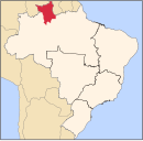
List of municipalities in Roraima by HDI

Last updated


This is a list of municipalities in Roraima ordered by Human Development Index (HDI) according to data released by the United Nations Development Program (UNDP) of the United Nations for the 2010. [1] [2] The Human Development Index was developed in 1990 by the Pakistani economist Mahbub ul Haq and the Indian economist Amartya Sen. [3] [4]

Contents

According to the list, of the 15 municipalities in the state of Roraima, none of them have very high HDI (equal to or greater than 0.800), 1 has high HDI (between 0.700 and 0.799), 9 have medium (between 0.600 and 0.699), 3 have low (between 0.500 and 0.599) and 2 have very low (less than 0.500). The HDI of Roraima is 0.707 (considered high). [5]

Criteria

Map of HDI of the municipalities of Roraima.
Legend:
.mw-parser-output .legend{page-break-inside:avoid;break-inside:avoid-column}.mw-parser-output .legend-color{display:inline-block;min-width:1.25em;height:1.25em;line-height:1.25;margin:1px 0;text-align:center;border:1px solid black;background-color:transparent;color:black}.mw-parser-output .legend-text{}
Very high (no municipality)
High (1 municipality)
Medium (9 municipalities)
Low (3 municipalities)
Very low (2 municipalities) Mapa do IDH de Roraima (2010).svg
Map of HDI of the municipalities of Roraima.
Legend:
  Very high (no municipality)
  High (1 municipality)
  Medium (9 municipalities)
  Low (3 municipalities)
  Very low (2 municipalities)

Categories

The index varies from 0 to 1, considering:

Components

The HDI of the municipalities is an average between the income index, life expectancy index and educational index.

List

RankMunicipalitiesData of 2010
HDI
Very high HDI
no municipality
High HDI
1 Boa Vista 0.752
Medium HDI
2 Mucajaí 0.665
3 São João da Baliza 0.655
4 Pacaraima 0.650
5 São Luís 0.649
6 Caroebe 0.639
7 Bonfim 0.626
8 Caracaraí 0.624
9 Rorainópolis 0.619
10 Cantá 0.619
Low HDI
11 Normandia 0.594
12 Iracema 0.582
13 Alto Alegre 0.542
Very low HDI
14 Amajari 0.488
15 Uiramutã 0.453

Related Research Articles

<span class="mw-page-title-main">Human Development Index</span> Composite statistic of life expectancy, education, and income indices

The Human Development Index (HDI) is a statistical composite index of life expectancy, education, and per capita income indicators, which is used to rank countries into four tiers of human development. A country scores a higher level of HDI when the lifespan is higher, the education level is higher, and the gross national income GNI (PPP) per capita is higher. It was developed by Pakistani economist Mahbub ul-Haq and was further used to measure a country's development by the United Nations Development Programme (UNDP)'s Human Development Report Office.

<span class="mw-page-title-main">Jeremoabo</span> Municipality in Nordeste, Brazil

Jeremoabo is a municipality in the state of Bahia in the North-East region of Brazil.

<span class="mw-page-title-main">Itaúna</span> Municipality in Southeast, Brazil

Itaúna is a municipality in the state of Minas Gerais in the Southeast region of Brazil.
<span class="mw-page-title-main">São João Evangelista</span> Municipality in Southeast, Brazil

São João Evangelista is a municipality in the state of Minas Gerais in the Southeast region of Brazil.

<span class="mw-page-title-main">Peçanha</span> Municipality in Southeast, Brazil

Peçanha is a municipality in the state of Minas Gerais in the Southeast region of Brazil.

<span class="mw-page-title-main">Pirapetinga</span> Municipality in Southeast, Brazil

Pirapetinga is a municipality in the state of Minas Gerais in the Southeast region of Brazil. Its estimated population in 2020 was 10,772 inhabitants (IBGE).

<span class="mw-page-title-main">Rio Preto, Minas Gerais</span> Place in Southeast, Brazil

Rio Preto is a municipality in the state of Minas Gerais in the Southeast region of Brazil.

Rebouças is a municipality in the state of Paraná in the Southern Region of Brazil. Being filled with some hills in the surroundings and some parts of the city, the high structures are a tower in the hill of Mourão and the church in the city center., One dominant group of ethnicities in the city are Polish and Ukrainians.
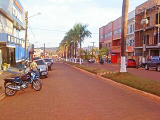
<span class="mw-page-title-main">Tucumã, Pará</span> Municipality in Northern, Brazil

Tucumã is a municipality in the state of Pará in the Northern region of Brazil. It is located in the southeastern region of the state, approximately 882 km away from the capital. The town experienced significant population growth in the 1980s due to favorable agricultural conditions, timber exploitation, and gold extraction. It has a total area of 2,535.11 km² and is part of the now-extinct Grande Carajás Program. According to the latest data from 2020, Tucumã had a population of 40,136 inhabitants. The municipality has a medium Human Development Index (HDI) of 0.747 and a per capita income of R$ 15,452.90. Tucumã, along with the neighboring city of Ourilândia do Norte, forms the only conurbated area in the southeastern part of Pará.

References

  1. PNUD Brasil. "Índice de Desenvolvimento Humano Municipal, 2010 – Todos os Estados do Brasil" (PDF). Archived from the original (PDF) on 21 August 2013. Retrieved 29 July 2013.
  2. Atlas do Desenvolvimento Humano no Brasil 2013. "IDHM Municípios 2010". United Nations Development Programme . Retrieved 29 January 2017.{{cite web}}: CS1 maint: numeric names: authors list (link)
  3. "História do Relatório do Desenvolvimento Humano". United Nations Development Programme. Archived from the original on 3 April 2009. Retrieved 26 March 2009.
  4. "About HDRO". United Nations Development Programme. 2006. Archived from the original on 28 October 2006. Retrieved 20 December 2018.
  5. "2013 Human Development Atlas in Brazil". Database (in Portuguese). United Nations Development Programme. Retrieved 5 August 2013.

See also