List of parks in Nelson, New Zealand

Last updated

This is a list of parks in Nelson City at the top of New Zealand's South Island. [1] [2]

NameCoordinatesLocationTerritorial authority areaType
Abraham Heights Reserve 41°16′36″S173°15′51″E / 41.2767273°S 173.2640375°E / -41.2767273; 173.2640375 Washington Valley Nelson Local park
Airport Peninsula Esplanade 41°17′47″S173°13′50″E / 41.296485°S 173.230496°E / -41.296485; 173.230496 Tāhunanui Nelson Local park
Andrews Farm Reserve 41°17′36″S173°17′44″E / 41.2934029°S 173.295637°E / -41.2934029; 173.295637 The Brook Nelson Local park
Annesbrook Youth Park 41°18′15″S173°14′31″E / 41.304193°S 173.241909°E / -41.304193; 173.241909 Tāhunanui Nelson Local park
Anzac Memorial Park 41°16′16″S173°16′41″E / 41.2711546°S 173.2780127°E / -41.2711546; 173.2780127 Nelson Central Nelson Local park
Bayview Reserve 41°15′00″S173°18′43″E / 41.2501228°S 173.3120812°E / -41.2501228; 173.3120812 Atawhai Nelson Local park
Betsy Eyre Park 41°17′27″S173°17′24″E / 41.2909014°S 173.290101°E / -41.2909014; 173.290101 The Brook Nelson Local park
Bishopdale Reserve 41°17′53″S173°15′54″E / 41.2979699°S 173.2650049°E / -41.2979699; 173.2650049 Bishopdale Nelson Local park
Bishopdale Retention Dam Bank 41°18′10″S173°16′06″E / 41.302910°S 173.268327°E / -41.302910; 173.268327 Bishopdale Nelson Local park
Bisley Reserve 41°16′51″S173°15′12″E / 41.280739°S 173.253252°E / -41.280739; 173.253252 Moana Nelson Local park
Botanical Reserve / Botanical Hill 41°16′00″S173°16′57″E / 41.2666648°S 173.2824904°E / -41.2666648; 173.2824904 The Wood Nelson Local park
Blackwood Reserve 41°17′43″S173°14′38″E / 41.2951996°S 173.2438858°E / -41.2951996; 173.2438858 Wakatu Nelson Local park
Bolt Reserve 41°17′39″S173°14′02″E / 41.294069°S 173.233918°E / -41.294069; 173.233918 Tāhunanui Nelson Local park
Botanical Gardens Cricket Ground 41°16′26″S173°17′37″E / 41.274016°S 173.2936138°E / -41.274016; 173.2936138 Maitai Nelson Sports ground
Boulder Bank 41°13′42″S173°19′06″E / 41.2282396°S 173.3183677°E / -41.2282396; 173.3183677 Marybank Nelson DOC reserve
Branford Park 41°16′20″S173°18′05″E / 41.2722542°S 173.3013463°E / -41.2722542; 173.3013463 Maitai Nelson Local park
Brook Park 41°18′42″S173°17′32″E / 41.3116212°S 173.2922419°E / -41.3116212; 173.2922419 The Brook Nelson Local park
Bruno Reserve 41°16′51″S173°15′12″E / 41.280739°S 173.253252°E / -41.280739; 173.253252 Moana Nelson Local park
Burrell Park 41°17′11″S173°14′35″E / 41.2863597°S 173.2429754°E / -41.2863597; 173.2429754 Tāhunanui Nelson Local park
Cable Bay Walkway 41°9′20″S173°24′39″E / 41.15556°S 173.41083°E / -41.15556; 173.41083 Cable Bay to Glenduan Nelson DOC reserve
Cattle Market Reserve 41°17′38″S173°16′00″E / 41.2939879°S 173.2665587°E / -41.2939879; 173.2665587 Bishopdale Nelson Local park
Centennial Park 41°17′07″S173°14′29″E / 41.2851399°S 173.2413337°E / -41.2851399; 173.2413337 Tāhunanui Nelson Local park
Church Hill 41°16′35″S173°15′57″E / 41.2763207°S 173.2659145°E / -41.2763207; 173.2659145 Nelson Central Nelson Local park
Corder Park 41°14′08″S173°18′58″E / 41.2356678°S 173.3160478°E / -41.2356678; 173.3160478 Atawhai Nelson Local park
Custom House Reserve 41°15′47″S173°16′06″E / 41.2629584°S 173.2682585°E / -41.2629584; 173.2682585 Port Nelson Nelson Local park
Douglas Reserve 41°17′47″S173°14′47″E / 41.296323°S 173.246344°E / -41.296323; 173.246344 Wakatu Nelson Local park
Emano East Reserve 41°17′05″S173°15′38″E / 41.2848333°S 173.2605628°E / -41.2848333; 173.2605628 Toi Toi Nelson Local park
Enner Glynn North Reserve 41°18′08″S173°15′08″E / 41.3020945°S 173.2522834°E / -41.3020945; 173.2522834 Enner Glynn Nelson Local park
Erin Reserve 41°16′43″S173°17′22″E / 41.2787104°S 173.2894286°E / -41.2787104; 173.2894286 Nelson Central Nelson Local park
Fairfield Park 41°16′57″S173°16′49″E / 41.2825034°S 173.2803°E / -41.2825034; 173.2803 Nelson South Nelson Local park
Fountain Place Gardens 41°16′02″S173°16′22″E / 41.2672358°S 173.2727506°E / -41.2672358; 173.2727506 Beachville Nelson Public garden
Fountain Reserve 41°16′02″S173°16′30″E / 41.267222°S 173.2751021°E / -41.267222; 173.2751021 Beachville Nelson Local park
Frenchay Reserve 41°14′38″S173°19′21″E / 41.2439737°S 173.3225012°E / -41.2439737; 173.3225012 Atawhai Nelson Local park
Glenduan Reserve 41°11′13″S173°21′43″E / 41.1868076°S 173.3618198°E / -41.1868076; 173.3618198 Glenduan Nelson Beach, local park
Grampians Reserve 41°17′49″S173°16′38″E / 41.2969743°S 173.2773053°E / -41.2969743; 173.2773053 The Brook Nelson Local park
Grove Reserve 41°18′10″S173°17′34″E / 41.3027262°S 173.2928584°E / -41.3027262; 173.2928584 The Brook Nelson Local park
Guppy Park 41°15′54″S173°17′11″E / 41.2651091°S 173.2864949°E / -41.2651091; 173.2864949 The Wood Nelson Local park
Hallowell Cemetery 41°16′41″S173°17′01″E / 41.2779778°S 173.2836021°E / -41.2779778; 173.2836021 Nelson Central Nelson Cemetery
Hanby Park 41°16′29″S173°18′09″E / 41.2746077°S 173.3025308°E / -41.2746077; 173.3025308 Maitai Nelson Local park
Haulashore Island 41°16′20″S173°16′11″E / 41.2721983°S 173.269757°E / -41.2721983; 173.269757 Stepneyville Nelson Local park
Highview Reserve 41°17′57″S173°15′04″E / 41.299069°S 173.251106°E / -41.299069; 173.251106 Wakatu Nelson Local park
Horoirangi Marine Reserve 41°09′44″S173°22′36″E / 41.1623°S 173.3768°E / -41.1623; 173.3768 Glenduan Nelson Marine reserve
Jenkins Creek Esplanade 41°18′14″S173°15′15″E / 41.303865°S 173.254189°E / -41.303865; 173.254189 Enner Glynn Nelson Local park
Maitai Arboretum 41°16′20″S173°16′11″E / 41.2721983°S 173.269757°E / -41.2721983; 173.269757 Maitai Nelson Local park
Maitai Cricket Ground 41°16′20″S173°16′11″E / 41.2721983°S 173.269757°E / -41.2721983; 173.269757 Maitai Nelson Sports ground
Maitai River Esplanade 41°16′20″S173°16′11″E / 41.2721983°S 173.269757°E / -41.2721983; 173.269757 Maitai Nelson Local park
Marybank Reserve 41°13′42″S173°19′06″E / 41.2282396°S 173.3183677°E / -41.2282396; 173.3183677 Marybank Nelson Local park
Miyazu Japanese Garden 41°15′21″S173°17′52″E / 41.2558391°S 173.2977755°E / -41.2558391; 173.2977755 Atawhai Nelson Public garden
Montrose Reserve 41°15′11″S173°18′33″E / 41.2531462°S 173.3092096°E / -41.2531462; 173.3092096 Atawhai Nelson Local park
Melrose Gardens 41°16′54″S173°16′56″E / 41.281736°S 173.2823323°E / -41.281736; 173.2823323 Nelson South Nelson Public garden
Moncrieff Reserve 41°16′30″S173°15′33″E / 41.2750239°S 173.2590572°E / -41.2750239; 173.2590572 Britannia Heights Nelson Local park
Murphy North Reserve 41°17′09″S173°15′40″E / 41.2857644°S 173.2611334°E / -41.2857644; 173.2611334 Toi Toi Nelson Local park
Neale Park 41°15′52″S173°17′22″E / 41.2645245°S 173.2894498°E / -41.2645245; 173.2894498 The Wood Nelson Local park
Nelson Marina 41°15′45″S173°15′58″E / 41.2625163°S 173.2661329°E / -41.2625163; 173.2661329 Port Nelson Nelson Marina
Ngapua Reserve 41°14′34″S173°19′06″E / 41.2428823°S 173.3184616°E / -41.2428823; 173.3184616 Atawhai Nelson Local park
Norgate Reserve 41°17′53″S173°14′46″E / 41.298044°S 173.246067°E / -41.298044; 173.246067 Wakatu Nelson Local park
Oyster Island 41°18′04″S173°11′50″E / 41.3011258°S 173.1973481°E / -41.3011258; 173.1973481 Tāhunanui Nelson Local park
Old Bank Lane Gardens 41°16′25″S173°17′08″E / 41.2735701°S 173.2855102°E / -41.2735701; 173.2855102 Nelson Central Nelson Public garden
Paddys Knob Reserve 41°16′55″S173°15′01″E / 41.282024°S 173.250252°E / -41.282024; 173.250252 Tāhunanui Nelson Local park
Paru Paru Reserve 41°16′03″S173°16′47″E / 41.267475°S 173.279627°E / -41.267475; 173.279627 Nelson Central Nelson Local park
Peace Grove 41°15′50″S173°17′14″E / 41.2638504°S 173.2872678°E / -41.2638504; 173.2872678 The Wood Nelson Local park
Pepper Tree Park 41°16′03″S173°17′23″E / 41.2674211°S 173.2897642°E / -41.2674211; 173.2897642 The Wood Nelson Local park
Pioneers Park 41°16′20″S173°16′26″E / 41.2721342°S 173.2739019°E / -41.2721342; 173.2739019 Stepneyville Nelson Local park
Pipers Park Reserve 41°16′58″S173°15′14″E / 41.2828689°S 173.253985°E / -41.2828689; 173.253985 Britannia Heights Nelson Local park
Princes Lookout Reserve 41°16′20″S173°16′26″E / 41.2721342°S 173.2739019°E / -41.2721342; 173.2739019 Nelson Central Nelson Local park
Quakers Acre Cemetery 41°16′32″S173°16′48″E / 41.2756087°S 173.2800037°E / -41.2756087; 173.2800037 Nelson Central Nelson Cemetery
Queen Elizabeth II Reserve 41°15′35″S173°17′42″E / 41.2595999°S 173.2950411°E / -41.2595999; 173.2950411 Atawhai Nelson Public gardens, local park
Queens Gardens 41°16′25″S173°17′18″E / 41.2734805°S 173.288407°E / -41.2734805; 173.288407 Nelson Central Nelson Public garden
Riverside Pool Complex 41°16′19″S173°17′16″E / 41.2719235°S 173.2878053°E / -41.2719235; 173.2878053 Nelson Central Nelson Public pools
Riverside Reserve 41°16′17″S173°17′22″E / 41.271443°S 173.289348°E / -41.271443; 173.289348 Nelson Central Nelson Local park
Ronaki Reserve 41°17′09″S173°16′52″E / 41.285924°S 173.281092°E / -41.285924; 173.281092 Nelson South Nelson Local park
Russell Reserve 41°16′03″S173°16′07″E / 41.2673655°S 173.2687118°E / -41.2673655; 173.2687118 Stepneyville Nelson Local park
Rutherford Park 41°16′06″S173°16′45″E / 41.2682426°S 173.279195°E / -41.2682426; 173.279195 Nelson Central Nelson Local park
Sequoia Reserve 41°16′25″S173°15′49″E / 41.2734889°S 173.2634891°E / -41.2734889; 173.2634891 Washington Valley Nelson Local park
Sharland Hill Reserve 41°16′33″S173°19′44″E / 41.275844°S 173.328784°E / -41.275844; 173.328784 Maitai Nelson Local park
Sir Stanley Whitehead Park 41°16′23″S173°17′49″E / 41.2729258°S 173.2970161°E / -41.2729258; 173.2970161 Maitai Nelson Local park
St Lawrence Reserve 41°16′34″S173°16′24″E / 41.276236°S 173.273471°E / -41.276236; 173.273471 Toi Toi Nelson Local park
Station Reserve 41°17′52″S173°15′40″E / 41.2977922°S 173.26108°E / -41.2977922; 173.26108 Bishopdale Nelson Local park
Tāhunanui Beach 41°16′45″S173°13′34″E / 41.2791672°S 173.2260645°E / -41.2791672; 173.2260645 Tāhunanui Nelson Local park
Tāhunanui Recreation Reserve 41°16′51″S173°14′42″E / 41.2809304°S 173.2448776°E / -41.2809304; 173.2448776 Tāhunanui Nelson Local park
Tantragee Reserve 41°17′36″S173°17′56″E / 41.293417°S 173.298817°E / -41.293417; 173.298817 The Brook Nelson Local park
Tasman Heights Reserve 36°49′17″S174°40′07″E / 36.8214565°S 174.6685772°E / -36.8214565; 174.6685772 Tāhunanui Nelson Local park
Te-Ata Reserve 41°14′28″S173°19′08″E / 41.2411133°S 173.3188794°E / -41.2411133; 173.3188794 Atawhai Nelson Local park
Titoki Reserve 41°14′13″S173°19′27″E / 41.236997°S 173.3242463°E / -41.236997; 173.3242463 Atawhai Nelson Local park
Tosswill Reserve 41°17′21″S173°14′43″E / 41.2892249°S 173.2452338°E / -41.2892249; 173.2452338 Tāhunanui Nelson Local park
Trafalgar Park 41°15′59″S173°16′49″E / 41.2662743°S 173.2802172°E / -41.2662743; 173.2802172 The Wood Nelson Local park
Tresillian Reserve 41°13′36″S173°19′23″E / 41.2265749°S 173.3230398°E / -41.2265749; 173.3230398 Atawhai Nelson Local park
Victory Square 41°16′51″S173°16′09″E / 41.2806956°S 173.2690915°E / -41.2806956; 173.2690915 Toi Toi Nelson Local park
Vosper Reserve 41°16′47″S173°16′03″E / 41.279678°S 173.267440°E / -41.279678; 173.267440 Toi Toi Nelson Local park
Waimea North Reserve 41°16′56″S173°16′33″E / 41.2821632°S 173.2757184°E / -41.2821632; 173.2757184 Nelson South Nelson Local park
Waimea South Reserve 41°17′53″N173°15′48″E / 41.298157°N 173.263208°E / 41.298157; 173.263208 Bishopdale Nelson Local park
Wakapuaka Cemetery 41°15′19″S173°18′02″E / 41.2552594°S 173.300678°E / -41.2552594; 173.300678 Atawhai Nelson Cemetery
Wakapuaka Sandflats Esplanade 41°12′25″S173°20′02″E / 41.2069019°S 173.3338253°E / -41.2069019; 173.3338253 Wakapuaka Nelson Local park
Wakefield Quay Gardens 41°16′56″S173°17′25″E / 41.2823087°S 173.2902412°E / -41.2823087; 173.2902412 Stepneyville Nelson Public garden
Wards Reserve 41°16′56″S173°17′25″E / 41.2823087°S 173.2902412°E / -41.2823087; 173.2902412 The Brook Nelson Local park
Wellington Reserve 41°16′38″S173°16′45″E / 41.2772863°S 173.2791239°E / -41.2772863; 173.2791239 Nelson South Nelson Local park
Werneth Reserve 41°14′17″S173°19′15″E / 41.2379896°S 173.3209562°E / -41.2379896; 173.3209562 Atawhai Nelson Local park
Wigzell Park 41°17′00″S173°16′19″E / 41.2833911°S 173.2719623°E / -41.2833911; 173.2719623 Nelson South Nelson Local park
Wolfe Reserve 41°16′28″S173°15′55″E / 41.2744604°S 173.2652819°E / -41.2744604; 173.2652819 Washington Valley Nelson Local park

See also

Related Research Articles

<span class="mw-page-title-main">National parks of New Zealand</span>

The national parks of New Zealand are protected natural areas administered by the Department of Conservation (DOC). The first national parks established in the country were all focused on mountain scenery. Since the 1980s the focus has been on developing a more diverse representation of New Zealand landscapes. The parks are all culturally significant and many also contain historic features. Tongariro National Park is one of the World Heritage Sites that are of both cultural and natural significance, while four of the South Island national parks form Te Wahipounamu, another World Heritage Site. There are currently 13 national parks; a 14th, Te Urewera National Park, was disestablished in 2014.

<span class="mw-page-title-main">Nelson Lakes National Park</span> National park in New Zealand

Nelson Lakes National Park is in the South Island of New Zealand, at the northern end of the Southern Alps. It was formed after the passing of the National Parks Act in 1952. It was created in 1956. The park contains beech forests, multiple lakes, snow-covered mountains and valleys created by glaciers during the ice ages.

<span class="mw-page-title-main">Arthur's Pass National Park</span> National park in New Zealand

Arthur's Pass National Park is located in the South Island of New Zealand and covers 1,185 km2 of mostly mountainous terrain. Adjacent to it lies Craigieburn Forest Park.

<span class="mw-page-title-main">Richmond, New Zealand</span> Town in Tasman, New Zealand

Richmond is a town and the seat of the Tasman District Council in New Zealand. It lies 13 kilometres (8 mi) south of Nelson in the South Island, close to the southern extremity of Tasman Bay / Te Tai-o-Aorere. The town, first settled by Europeans in 1842, was named in 1854 after the town of Richmond on Thames near London. The town has an estimated population of 18,450 as of June 2022.

<span class="mw-page-title-main">Protected areas of New Zealand</span>

Protected areas of New Zealand are areas that are in some way protected to preserve their environmental, scientific, scenic, historical, cultural or recreational value. There are about 10,000 protected areas covering about a third of the country. The method and aims of protection vary according to the importance of the resource and whether it is publicly or privately owned.

The Arnst River in New Zealand is a tributary of the Travers River, which itself flows into Lake Rotoiti, in Nelson Lakes National Park.

<span class="mw-page-title-main">Torrent Bay</span> Body of water

Torrent Bay / Rākauroa is a bay in Abel Tasman National Park, New Zealand.
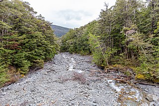
<span class="mw-page-title-main">Hinemoatū / Howard River</span> River in New Zealand

The Hinemoatū / Howard River is a river of the northern South Island of New Zealand. A tributary of the Buller River, the Hinemoatū/Howard starts at the confluence of the Hodgson and Tier Streams in the Travers Range of Nelson Lakes National Park, flowing north between Lakes Rotoroa and Rotoiti, before reaching the Buller between Kawatiri and Saint Arnaud. Close to its confluence with the Buller, the river is bridged by State Highway 63 and further up by Howard Valley Road.

<span class="mw-page-title-main">Waiheke River</span> River in New Zealand

The Waiheke River is a river of the West Coast Region of New Zealand's South Island. It flows west from its origins on Mount Barron in the Southern Alps to reach the Ahaura River, which it forms where it joins the Tūtaekurī River, 20 kilometres northwest of Lake Sumner.

<span class="mw-page-title-main">Lake Ngatu</span> Body of water

Lake Ngatu is a dune lake in the Northland Region of New Zealand. It is located to the northwest of Awanui, near Waipapakauri.

<span class="mw-page-title-main">Cape Rodney-Okakari Point Marine Reserve</span>

Cape Rodney-Okakari Point Marine Reserve is a 5.5 km2 (2.1 sq mi) protected area in the North Island of New Zealand.

<span class="mw-page-title-main">North Island kōkako</span> Species of bird

The North Island kōkako is an endangered forest bird which is endemic to the North Island of New Zealand. It is grey in colour, with a small black mask. It has blue wattles. Because of its wattle, the bird is sometimes locally called the blue-wattled crow, although it is not a corvid.

<span class="mw-page-title-main">Glenduan</span> Town in Nelson, New Zealand

Glenduan is a small township lying to the north of Nelson, New Zealand. It lies on the shore of Tasman Bay / Te Tai-o-Aorere between the northern end of Boulder Bank and Pepin Island.

<span class="mw-page-title-main">Marybank, New Zealand</span> Suburb in Nelson, Nelson, New Zealand

Marybank is a suburb of Nelson, New Zealand. It lies on State Highway 6 close to the northern end of Nelson Haven, between Atawhai and Wakapuaka.

Nelson South is an inner suburb of Nelson, New Zealand. It lies to the southwest of Nelson city centre, between it and Bishopdale, close to the foot of The Grampians. The main inland route to Stoke, New Zealand, Waimea Road, is Nelson South's main road.

<span class="mw-page-title-main">Mount Richmond Forest Park</span> Forest park in New Zealand

Mount Richmond Forest Park is a forest park in New Zealand, administered by the Department of Conservation.

Long Island-Kokomohua Marine Reserve is a marine reserve, in the Marlborough Region of New Zealand's South Island. It covers an area of 619 hectares at the entrance to the Queen Charlotte Sound in the Marlborough Sounds. It was the first marine reserve established on the South Island.

Northland Conservation Park is a group of protected areas in the Northland Region of New Zealand's North Island.

<span class="mw-page-title-main">Westhaven (Te Tai Tapu) Marine Reserve</span>

Westhaven Marine Reserve is a marine reserve covering an area of 536 hectares in the Whanganui Inlet at the top of New Zealand's South Island. It was established in 1994 and is administered by the Department of Conservation.

Maniniaro / Angelus Peak is a mountain in Nelson Lakes National Park, near the northwestern extent of New Zealand's main divide. Although it is not the tallest peak in the Angelus Ridge or the wider Travers Range, Maniniaro remains a popular tramping destination and is significant to the Ngāti Apa ki te Rā Tō iwi, who claim mana whenua within the area. According to Ngāti Apa ki te Rā Tō beliefs, the mountain is intrinsically linked with nearby Rotomaninitua / Lake Angelus, with the two both said to represent the footprints of the iwi's ancestors as they embarked on their journey back to Hawaiki. It is also near both major lakes of the national park, being roughly 6 kilometres (3.7 mi) from the southern ends of both Lakes Rotoiti and Rotoroa.

References

  1. "Nelson Parks and Reserves". gdc.govt.nz. Gisborne District Council.
  2. "DOC Places to Go - Nelson-Tasman". doc.govt.nz. Department of Conservation.