The Brook, Nelson

Last updated

The Brook
Suburb
The Grampians viewed from Botanical Hill.jpg
Grampians Reserve in The Brook
The Brook, Nelson
Coordinates: 41°17′46″S173°17′53″E / 41.296°S 173.298°E / -41.296; 173.298
CountryNew Zealand
Region Nelson
Ward
  • Central General Ward
  • Whakatū Māori Ward
Electorates
Government
  Territorial Authority Nelson City Council
   Nelson City Mayor Nick Smith
   Nelson MP Blair Cameron
   Te Tai Tonga MP Tākuta Ferris
Area
[1]
  Total6.90 km2 (2.66 sq mi)
  Land6.90 km2 (2.66 sq mi)
  Water0 km2 (0 sq mi)
Population
 (June 2022) [2]
  Total2,060
  Density300/km2 (770/sq mi)
Time zone UTC+12 (NZST)
  Summer (DST) UTC+13 (NZDT)
Postcode
7010
Area code 03

The Brook is one of the suburbs of Nelson, New Zealand. It lies to the south of Nelson and is the location of the Brook Waimarama Sanctuary, a conservation project at the head of the Brook Valley. [3]

Contents

Geography

The Brook covers a land area of 6.90 km². [1]

It has seven public reserves: Andrews Farm Reserve, Betsy Eyre Park, Brook Park, Grampians Reserve, Grove Reserve, Tantragee Reserve and Wards Reserve. [4]

The Seymour Avenue Heritage Precinct consists of a tree lined street at the North West corner of the suburb. The avenue consist of a short street with a mix of transitional villa and Californian bungalow style houses. The initial subdivision occurred in the 1910s with additional development on the 1940s. The subdivision was created on land originally part of a 20 acre property owned by Alfred Fell who built the first house on the land in 1854. This house was purchased by Nathaniel Edwards in 1860 and was considerably extended in the Victorian Gothic Revivalist style. Warwick House as this house is now named still looms over Seymour Avenue and is used as a function and wedding venue. [5] [6]

History

The estimated population of The Brook reached 1,700 in 1996. [7]

It reached 1,720 in 2001, 1,605 in 2006, 1,857 in 2013, and 1,992 in 2018. [7]

Demography

The Brook has an estimated population of 2,060 as of June 2022, [2] with a population density of 299 people per km2.

Historical population
YearPop.±% p.a.
20061,605    
20131,857+2.11%
20181,992+1.41%
Source: [8]
Warwick House Warwick House Nelson.png
Warwick House

The Brook had a population of 1,992 at the 2018 New Zealand census, an increase of 135 people (7.3%) since the 2013 census, and an increase of 387 people (24.1%) since the 2006 census. There were 735 households, comprising 969 males and 1,023 females, giving a sex ratio of 0.95 males per female. The median age was 37.8 years (compared with 37.4 years nationally), with 468 people (23.5%) aged under 15 years, 312 (15.7%) aged 15 to 29, 996 (50.0%) aged 30 to 64, and 216 (10.8%) aged 65 or older.

Ethnicities were 92.2% European/Pākehā, 8.4% Māori, 1.7% Pasifika, 5.7% Asian, and 1.5% other ethnicities. People may identify with more than one ethnicity.

The percentage of people born overseas was 26.2, compared with 27.1% nationally.

Although some people chose not to answer the census's question about religious affiliation, 65.2% had no religion, 23.0% were Christian, 0.2% had Māori religious beliefs, 0.2% were Hindu, 0.2% were Muslim, 1.1% were Buddhist and 2.9% had other religions.

Of those at least 15 years old, 435 (28.5%) people had a bachelor's or higher degree, and 222 (14.6%) people had no formal qualifications. The median income was $31,100, compared with $31,800 nationally. 225 people (14.8%) earned over $70,000 compared to 17.2% nationally. The employment status of those at least 15 was that 777 (51.0%) people were employed full-time, 288 (18.9%) were part-time, and 42 (2.8%) were unemployed. [8]

Economy

In 2018, 7.0% worked in manufacturing, 9.3% worked in construction, 7.0% worked in hospitality, 4.2% worked in transport, 9.6% worked in education, and 14.0% worked in healthcare. [7]

Transport

As of 2018, among those who commute to work, 66.6% drove a car, 3.1% rode in a car, 0.0% use public transport, 10.1% use a bike, and 10.1% walk or run. [7]

In August 2023, bus services across Nelson were upgraded and extended, and The Brook now has a direct connection to Nelson Airport, with electric buses running every half hour between 7am and 7pm. [9]

Related Research Articles

<span class="mw-page-title-main">Maketu</span> Town in the Bay of Plenty, New Zealand

Maketu is a small town on the Western Bay of Plenty coast in New Zealand.

Awapuni is a suburb of the New Zealand city of Gisborne, located in the southwest of the city. It is named after the Awapuni lagoon, where the Waipaoa River runs into the ocean. The New Zealand Ministry for Culture and Heritage gives a translation of "blocked-up river" for Awapuni.

<span class="mw-page-title-main">The Wood, New Zealand</span> Suburb of Nelson, New Zealand

The Wood is a suburb of the South Island, New Zealand city of Nelson. It lies just to the north-east of the city centre and adjoins it.

<span class="mw-page-title-main">Anakiwa</span> Rural settlement in Marlborough, New Zealand

Anakiwa is a coastal residential village in the Marlborough region of New Zealand. It sits at the head of Queen Charlotte Sound/Tōtaranui, one of the Marlborough Sounds, 23 km (14 mi) west of Picton and 18 km (11 mi) east of Havelock. At the 2018 census, the village had a usual resident population of 171.

<span class="mw-page-title-main">Tāhunanui</span> Suburb of Nelson, New Zealand

Tāhunanui is one of the suburbs of Nelson, New Zealand. It lies between Port Nelson and Nelson Airport and is the site of the main beach for Nelson with a shoreline on the Tasman Bay.

<span class="mw-page-title-main">Atawhai</span> Suburb of Nelson, New Zealand

Atawhai is a suburb of Nelson, New Zealand. It lies north of Nelson and is the location of Wakapuaka Cemetery, a burial place since 1861. It also has a coastline on Nelson Haven and access to Boulder Bank from State Highway 6.

<span class="mw-page-title-main">Marybank, New Zealand</span> Suburb of Nelson, New Zealand

Marybank is a suburb of Nelson, New Zealand. It lies on State Highway 6 close to the northern end of Nelson Haven, between Atawhai and Wakapuaka.

<span class="mw-page-title-main">Bishopdale, Nelson</span> Suburb in Nelson, Nelson, New Zealand

Bishopdale is one of the suburbs of Nelson, New Zealand.

Washington Valley is a major inner suburb of Nelson, New Zealand. It lies to the west of Nelson city centre and south of Stepneyville and Beachville.

<span class="mw-page-title-main">Port Nelson, New Zealand</span> Suburb in Nelson, New Zealand

Port Nelson, as its name suggests, is the main port area of Nelson, New Zealand.

<span class="mw-page-title-main">Stepneyville</span> Suburb of Nelson, New Zealand

Stepneyville is a suburb of Nelson, New Zealand.

<span class="mw-page-title-main">Maitai, New Zealand</span> Suburb of Nelson, New Zealand

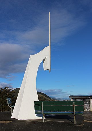
Maitai is an inner suburb of Nelson, New Zealand. It lies at the western edge of Nelson city centre, immediately to the south of The Wood, on the northern bank of the Maitai River. A monument representing the location of the geographic centre of New Zealand is located in Maitai.

Maitlands is one of the suburbs of Nelson, New Zealand. It lies to the east of Stoke, immediately to the west of Enner Glynn.

Moana is one of the suburbs of Nelson, New Zealand.

Annesbrook is an industrial suburb of Nelson, New Zealand.

<span class="mw-page-title-main">Nayland, New Zealand</span> Suburb of Nelson, New Zealand

Nayland is a suburb of Stoke, New Zealand. It lies to the north of Stoke, close to Nelson Airport, southwest of Nelson city centre.

<span class="mw-page-title-main">Monaco, New Zealand</span> Suburb of Nelson, New Zealand

Monaco is a small suburb of Nelson, New Zealand, west of town centre of Stoke. It lies on a narrow peninsula which extends into Tasman Bay / Te Tai-o-Aorere immediately to the south of Nelson Airport, southwest of central Nelson.

<span class="mw-page-title-main">Saxton, New Zealand</span> Suburb of Nelson, New Zealand

Saxton is a suburb of Nelson, New Zealand, south of Stoke and northwest of Richmond.
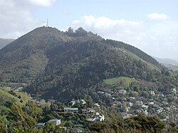
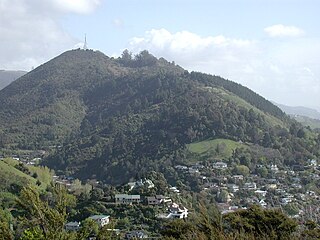
<span class="mw-page-title-main">Nelson Central</span> Central business district of Nelson, New Zealand

Nelson Central is the central suburb and central business district of Nelson, New Zealand.

Riverdale is a suburb of Gisborne, in the Gisborne District of New Zealand's North Island.

References

  1. 1 2 "Statistical Area 2 2018 (generalised) GIS" (Data table). stats.govt.nz. Statistics New Zealand.
  2. 1 2 "Population estimate tables - NZ.Stat". Statistics New Zealand . Retrieved 25 October 2022.
  3. Arnold, Naomi (29 April 2013). "Two Sides of the Fence". Stuff.co.nz. Retrieved 2 May 2014.
  4. "Nelson Parks and Reserves". gdc.govt.nz. Gisborne District Council.
  5. "History | Warwick House - luxury accommodation in historic house in Nelson New Zealand" . Retrieved 12 March 2021.
  6. "Nelson City Heritage Precinct Design Guide" (PDF).
  7. 1 2 3 4 "Place Summary – The Brook". Stats NZ. Statistics New Zealand.
  8. 1 2 "Statistical area 1 dataset for 2018 Census". Statistics New Zealand. March 2020. The Brook (306200). 2018 Census place summary: The Brook
  9. https://ebus.nz/routes-and-timetables/the-brook-airport/

41°17′46″S173°17′53″E / 41.296°S 173.298°E / -41.296; 173.298