Related Research Articles

Havelock is a small town in the Marlborough Region of New Zealand, at the head of Pelorus Sound / Te Hoiere, one of the Marlborough Sounds, and at the mouth of the Pelorus and Kaituna Rivers

Renwick is a small town in Marlborough, New Zealand, close to the south bank of the Wairau River. It is located on State Highway 6, 12 kilometres (7 mi) west of Blenheim. Havelock is 31 km (19 mi) north. State Highway 63 runs southwest from Renwick through the Wairau River valley.

Stoke is a suburb of Nelson in New Zealand, located between Richmond and Tahunanui. In 2013 its population was 17,163. Stoke was named by William Songer, the personal servant of Arthur Wakefield, after his birthplace Stoke-by-Nayland in Suffolk.

Rapaura is a village northwest of Blenheim, New Zealand. The Wairau River flows past to the north. Spring Creek lies to the east.
Tuamarina River is a river in Marlborough in the South Island of New Zealand. It flows into the Wairau River just south of Tuamarina.
Redwoodtown is a suburb to the south of Blenheim's Central business district.

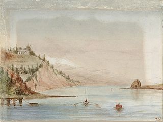
Arrow Rock is a small island in Tasman Bay / Te Tai-o-Aorere, off the coast of Nelson, New Zealand. There is a narrow channel between the rock and Haulashore Island. Situated within Nelson Harbour, Arrow Rock was site of the Fifeshire wreck in 1842, which gave the rock is secondary name. There are a number of spotted shags who live on the rock.
Wakatu is an industrial suburb of Nelson, New Zealand.
Bronte, a locality in the Tasman Region of New Zealand, lies between Richmond and Mapua.
Brooklands is a suburb in the north of Nelson, New Zealand. It lies on State Highway 6 on the shore of Nelson Haven, between Atawhai and central Nelson. Nelson's largest cemetery, Wakapuaka Cemetery, is located in Brooklands.

Glenduan is a small township lying to the north of Nelson, New Zealand. It lies on the shore of Tasman Bay / Te Tai-o-Aorere between the northern end of Boulder Bank and Pepin Island.

Marybank is a small township lying to the north of Nelson, New Zealand. It lies on State Highway 6 close to the northern end of Nelson Haven, between Atawhai and Wakapuaka.

Wakapuaka is a small township lying to the north of Nelson, New Zealand. It lies on State Highway 6 inland from the northern end of Nelson Haven, between Marybank and Hira. The road to Glenduan joins SH 6 at Wakapuaka.
Britannia Heights is a major inner suburb of Nelson, New Zealand. It lies on State Highway 6 to the southwest of Nelson city centre, on the shore of Tasman Bay / Te Tai-o-Aorere, between Stepneyville and Tahunanui.
Stepneyville is a suburb of Nelson, New Zealand.
Enner Glynn is a suburb of Nelson, New Zealand. It lies to the south of Nelson city centre and east of Stoke, inland from Wakatu.
Moana is one of the suburbs of Nelson, New Zealand.
Delaware Bay is an indentation in the New Zealand South Island coast east of Pepin Island, to the north of Nelson. It is part of the larger Tasman Bay / Te Tai-o-Aorere. The bay is named after the Delaware, a newly built brig which sank here on its maiden voyage from Nelson to Napier in 1863, an incident best remembered for the dramatic rescue attempts by a group of local Māori.
The Whangamoa Saddle is a pass traversed by State Highway 6 on its route between Blenheim and Nelson, immediately to the east of Hira. One of the two passes on the route, the Whangamoa Saddle lies between the valleys of the Whangamoa and Wakapuaka Rivers south of Delaware Bay. The elevation of the pass is 466 metres (1,529 ft) above sea level. The pass marks part of the boundary between Nelson and Marlborough District.

The Bryant Range is a range of low mountains in the northern South Island of New Zealand. They form part of the boundary of the Nelson and Tasman Districts with Marlborough Region, as well as forming the western boundary of Mount Richmond Forest Park The range is traversed by State Highway 6 at the Rai Saddle close to its northern end.
References
- ↑ Reed New Zealand atlas (2004) Auckland: Reed Publishing. Map 59. ISBN 0 7900 0952 8
- ↑ Wise's Nelson-Blenheim "Easyread" Map ISBN 1 877402 50 8
Coordinates: 41°17′30″S173°15′10″E / 41.29167°S 173.25278°E