Washington Valley, New Zealand

Last updated

Washington Valley
Suburb
Washington Valley, New Zealand
Coordinates: 41°16′20″S173°16′10″E / 41.27222°S 173.26944°E / -41.27222; 173.26944
CountryNew Zealand
Region Nelson
Territorial authority Nelson
Government
   Nelson City Mayor Nick Smith
   Nelson MP Rachel Boyack
   Te Tai Tonga MP Rino Tirikatene
Area
  Total1.12 km2 (0.43 sq mi)
  Land1.12 km2 (0.43 sq mi)
  Water0 km2 (0 sq mi)
Population
 (June 2022) [1]
  Total3,080
  Density2,800/km2 (7,100/sq mi)
Time zone UTC+12 (NZST)
  Summer (DST) UTC+13 (NZDT)
Postcode
7010
Area code 03

Washington Valley is a major inner suburb of Nelson, New Zealand. It lies to the west of Nelson city centre and south of Stepneyville and Beachville. [2]

Contents

The equivalent Statistics New Zealand statistical area of Washington covers a land area of 1.12 km2. [3]

The suburb has three local parks: Abraham Heights Reserve, Sequoia Reserve and Wolfe Reserve. [4]

History

The estimated population of Washington reached 2,510 in 1996, before dropping to 2,450 in 2001. [5]

It reached 2,526 in 2006, 2,469 in 2013, and 2,847 in 2018. [5]

Demography

The Washington statistical area had an estimated population of 3,080 as of June 2022, [1] with a population density of 2,750 people per km2.

Historical population
YearPop.±% p.a.
20062,526    
20132,469−0.33%
20182,847+2.89%
Source: [6]

Washington had a population of 2,847 at the 2018 New Zealand census, an increase of 378 people (15.3%) since the 2013 census, and an increase of 321 people (12.7%) since the 2006 census. There were 1,011 households. There were 1,437 males and 1,413 females, giving a sex ratio of 1.02 males per female. The median age was 33.4 years (compared with 37.4 years nationally), with 573 people (20.1%) aged under 15 years, 672 (23.6%) aged 15 to 29, 1,299 (45.6%) aged 30 to 64, and 303 (10.6%) aged 65 or older.

Ethnicities were 74.9% European/Pākehā, 14.3% Māori, 3.6% Pacific peoples, 15.0% Asian, and 3.5% other ethnicities (totals add to more than 100% since people could identify with multiple ethnicities).

The proportion of people born overseas was 29.9%, compared with 27.1% nationally.

Although some people objected to giving their religion, 53.7% had no religion, 29.7% were Christian, 1.9% were Hindu, 0.1% were Muslim, 2.8% were Buddhist and 3.6% had other religions.

Of those at least 15 years old, 507 (22.3%) people had a bachelor or higher degree, and 396 (17.4%) people had no formal qualifications. The median income was $28,700, compared with $31,800 nationally. The employment status of those at least 15 was that 1,149 (50.5%) people were employed full-time, 435 (19.1%) were part-time, and 81 (3.6%) were unemployed. [6]

Economy

In 2018, 11.5% worked in manufacturing, 7.6% worked in construction, 11.0% worked in hospitality, 3.4% worked in transport, 6.2% worked in education, and 11.2% worked in healthcare. [5]

Transport

As of 2018, among those who commuted to work, 67.1% drove a car, 5.7% rode in a car, 4.7% use a bike, and 4.7% walk or run. [5]

No one used public transport. [5]

Related Research Articles

Westbrook is a suburb in the city of Palmerston North, New Zealand.

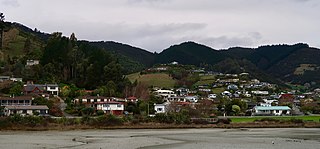
The Wood is a suburb of the South Island, New Zealand city of Nelson. It lies just to the north-east of the city centre and adjoins it.

<span class="mw-page-title-main">Anakiwa</span> Place in Marlborough, New Zealand

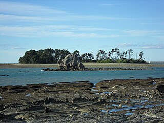
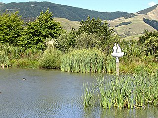
Anakiwa is a coastal residential village in the Marlborough region of New Zealand. It sits at the head of Queen Charlotte Sound/Tōtaranui, one of the Marlborough Sounds, 23 km (14 mi) west of Picton and 18 km (11 mi) east of Havelock. At the 2018 census, the village had a usual resident population of 171.

<span class="mw-page-title-main">Tāhunanui</span> Suburb in Nelson, Nelson, New Zealand

Tāhunanui is one of the suburbs of Nelson, New Zealand. It lies between Port Nelson and Nelson Airport and is the site of the main beach for Nelson with a shoreline on the Tasman Bay / Te Tai-o-Aorere.

<span class="mw-page-title-main">Atawhai</span> Township in Nelson, New Zealand

Atawhai is a suburb of Nelson, New Zealand. It lies north of Nelson and is the location of Wakapuaka Cemetery, a burial place since 1861. It also has a coastline on Nelson Haven and access to Boulder Bank from State Highway 6.

<span class="mw-page-title-main">The Brook, Nelson</span> Suburb in Nelson, Nelson, New Zealand

The Brook is one of the suburbs of Nelson, New Zealand. It lies to the south of Nelson and is the location of the Brook Waimarama Sanctuary, a conservation project at the head of the Brook Valley.

<span class="mw-page-title-main">Marybank, New Zealand</span> Suburb in Nelson, Nelson, New Zealand

Marybank is a suburb of Nelson, New Zealand. It lies on State Highway 6 close to the northern end of Nelson Haven, between Atawhai and Wakapuaka.

<span class="mw-page-title-main">Bishopdale, Nelson</span> Suburb in Nelson, Nelson, New Zealand

Bishopdale is one of the suburbs of Nelson, New Zealand.

Toi Toi is an inner suburb of Nelson, New Zealand. It lies to the southwest of Nelson city centre, inland from Britannia Heights and Washington Valley. Toi Toi is also known as Victory Village.

<span class="mw-page-title-main">Port Nelson, New Zealand</span> Suburb in Nelson, Nelson, New Zealand

Port Nelson, as its name suggests, is the main port area of Nelson, New Zealand.

<span class="mw-page-title-main">Stepneyville</span> Suburb in Nelson, Nelson, New Zealand

Stepneyville is a suburb of Nelson, New Zealand.

<span class="mw-page-title-main">Maitai, New Zealand</span> Suburb in Nelson, Nelson, New Zealand

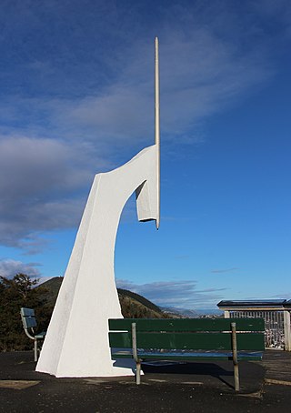
Maitai is an inner suburb of Nelson, New Zealand. It lies at the western edge of Nelson city centre, immediately to the south of The Wood, on the northern bank of the Maitai River. A monument representing the location of the geographic centre of New Zealand is located in Maitai.

Maitlands is one of the suburbs of Nelson, New Zealand. It lies to the east of Stoke, immediately to the west of Enner Glynn.

Moana is one of the suburbs of Nelson, New Zealand.

Annesbrook is an industrial suburb of Nelson, New Zealand.

Nayland is a suburb of Stoke, New Zealand. It lies to the north of Stoke, close to Nelson Airport, southwest of Nelson city centre.

Monaco is a small suburb of Nelson, New Zealand, west of town centre of Stoke. It lies on a narrow peninsula which extends into Tasman Bay / Te Tai-o-Aorere immediately to the south of Nelson Airport, southwest of central Nelson.

<span class="mw-page-title-main">Saxton, New Zealand</span> Suburb in Nelson, Nelson, New Zealand

Saxton is a suburb of Nelson, New Zealand, south of Stoke and northwest of Richmond.

Nelson South is an inner suburb of Nelson, New Zealand. It lies to the southwest of Nelson city centre, between it and Bishopdale, close to the foot of The Grampians. The main inland route to Stoke, New Zealand, Waimea Road, is Nelson South's main road.

<span class="mw-page-title-main">Nelson Central</span> Suburb in Nelson, Nelson, New Zealand

Nelson Central is the central suburb and central business district of Nelson, New Zealand.

References

  1. 1 2 "Population estimate tables - NZ.Stat". Statistics New Zealand . Retrieved 25 October 2022.
  2. Wise's Nelson-Blenheim "Easyread" Map ISBN   1-877402-50-8
  3. "Statistical Area 2 2018 (generalised) GIS" (Data table). stats.govt.nz. Statistics New Zealand.
  4. "Nelson Parks and Reserves". gdc.govt.nz. Gisborne District Council.
  5. 1 2 3 4 5 "Place Summary – Washington". Stats NZ. Statistics New Zealand.
  6. 1 2 "Statistical area 1 dataset for 2018 Census". Statistics New Zealand. March 2020. Washington (304500). 2018 Census place summary: Washington

41°16′20″S173°16′10″E / 41.27222°S 173.26944°E / -41.27222; 173.26944