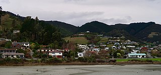
Annesbrook

Last updated

Annesbrook
Suburb
Annesbrook
Coordinates: 41°18′00″S173°14′10″E / 41.30000°S 173.23611°E / -41.30000; 173.23611
CountryNew Zealand
Region Nelson
Ward
  • Stoke-Tāhunanui General Ward
  • Whakatū Māori Ward
Electorates
Government
  Territorial Authority Nelson City Council
   Nelson City Mayor Nick Smith
   Nelson MP Rachel Boyack
   Te Tai Tonga MP Tākuta Ferris
Area
[1]
  Total2.96 km2 (1.14 sq mi)
  Land2.96 km2 (1.14 sq mi)
  Water0 km2 (0 sq mi)
Population
 (June 2023) [2]
  Total100
  Density34/km2 (87/sq mi)
Time zone UTC+12 (NZST)
  Summer (DST) UTC+13 (NZDT)
Postcode
7011
Area code 03

Annesbrook is an industrial suburb of Nelson, New Zealand.

Contents

It lies between State Highway 6 and Nelson Airport to the southwest of Nelson city centre and north of Stoke. [3]

The Nelson Classic Car Museum (which was previously the World of WearableArt & Classic Cars Museum) is located in Annesbrook. [4] [5]

Geography

The corresponding statistical area of Nelson Airport covers an area of 2.96 km2. [1]

History

The estimated population of the area reached 80 in 1996. [6]

It reached 90 in 2001, 96 in 2006, 105 in 2013, and 96 in 2018. [6]

Demography

The statistical area of Nelson Airport had an estimated population of 100 as of June 2023, [2] with a population density of 34 people per km2.

Historical population
YearPop.±% p.a.
200696    
2013105+1.29%
201896−1.78%
Source: [7]

Nelson Airport had a population of 96 at the 2018 New Zealand census, a decrease of 9 people (−8.6%) since the 2013 census, and unchanged since the 2006 census. There were 33 households, comprising 57 males and 39 females, giving a sex ratio of 1.46 males per female. The median age was 36.4 years (compared with 37.4 years nationally), with 15 people (15.6%) aged under 15 years, 24 (25.0%) aged 15 to 29, 51 (53.1%) aged 30 to 64, and 9 (9.4%) aged 65 or older.

Ethnicities were 75.0% European/Pākehā, 9.4% Māori, 12.5% Pasifika, 6.2% Asian, and 6.2% other ethnicities. People may identify with more than one ethnicity.

The percentage of people born overseas was 18.8, compared with 27.1% nationally.

Although some people chose not to answer the census's question about religious affiliation, 50.0% had no religion, 31.2% were Christian, 3.1% had Māori religious beliefs, 3.1% were Hindu and 3.1% had other religions.

Of those at least 15 years old, 6 (7.4%) people had a bachelor's or higher degree, and 15 (18.5%) people had no formal qualifications. The median income was $32,300, compared with $31,800 nationally. 3 people (3.7%) earned over $70,000 compared to 17.2% nationally. The employment status of those at least 15 was that 51 (63.0%) people were employed full-time, and 6 (7.4%) were part-time. [7]

Economy

In 2018, 21.1% worked in manufacturing, 5.3% worked in construction, 21.1% worked in hospitality, 5.3% worked in transport, and 5.3% worked in education. [6]

Transport

As of 2018, among those who commuted to work, 63.2% drove a car, 5.3% rode in a car, 15.8% used a bike, and 15.8% walk or run. [6]

No one used public transport. [6]

Related Research Articles

Onepoto is a locality of Porirua City in New Zealand. It is bounded to the north by Whitireia Park, a large park which is slowly being returned to native bush, and to the east by the Porirua Harbour.

<span class="mw-page-title-main">Wairau Valley</span> Valley and settlement in Marlborough, New Zealand

Wairau Valley is the valley of the Wairau River in Marlborough, New Zealand and also the name of the main settlement in the upper valley. State Highway 63 runs through the valley. The valley opens onto the Wairau Plain, where Renwick and Blenheim are sited. The Alpine–Wairau Fault runs along the length of the valley.

<span class="mw-page-title-main">Tāhunanui</span> Suburb of Nelson, New Zealand

Tāhunanui is one of the suburbs of Nelson, New Zealand. It lies between Port Nelson and Nelson Airport and is the site of the main beach for Nelson with a shoreline on the Tasman Bay.

<span class="mw-page-title-main">Atawhai</span> Suburb of Nelson, New Zealand

Atawhai is a suburb of Nelson, New Zealand. It lies north of Nelson and is the location of Wakapuaka Cemetery, a burial place since 1861. It also has a coastline on Nelson Haven and access to Boulder Bank from State Highway 6.

<span class="mw-page-title-main">The Brook, Nelson</span> Suburb of Nelson, New Zealand

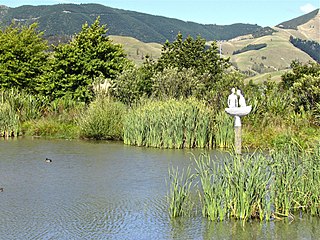
The Brook is one of the suburbs of Nelson, New Zealand. It lies to the south of Nelson and is the location of the Brook Waimarama Sanctuary, a conservation project at the head of the Brook Valley.

<span class="mw-page-title-main">Wakefield, New Zealand</span> Town in Tasman District, New Zealand

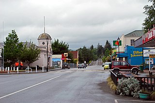
Wakefield is a settlement in the Tasman District of New Zealand's South Island, located about 25km south west of Nelson.

<span class="mw-page-title-main">Marybank, New Zealand</span> Suburb of Nelson, New Zealand

Marybank is a suburb of Nelson, New Zealand. It lies on State Highway 6 close to the northern end of Nelson Haven, between Atawhai and Wakapuaka.

<span class="mw-page-title-main">Bishopdale, Nelson</span> Suburb in Nelson, Nelson, New Zealand

Bishopdale is one of the suburbs of Nelson, New Zealand.

Washington Valley is a major inner suburb of Nelson, New Zealand. It lies to the west of Nelson city centre and south of Stepneyville and Beachville.

<span class="mw-page-title-main">Port Nelson, New Zealand</span> Suburb in Nelson, New Zealand

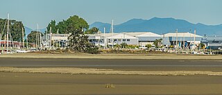
Port Nelson, as its name suggests, is the main port area of Nelson, New Zealand.

<span class="mw-page-title-main">Stepneyville</span> Suburb of Nelson, New Zealand

Stepneyville is a suburb of Nelson, New Zealand.

<span class="mw-page-title-main">Maitai, New Zealand</span> Suburb of Nelson, New Zealand

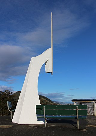
Maitai is an inner suburb of Nelson, New Zealand. It lies at the western edge of Nelson city centre, immediately to the south of The Wood, on the northern bank of the Maitai River. A monument representing the location of the geographic centre of New Zealand is located in Maitai.

Maitlands is one of the suburbs of Nelson, New Zealand. It lies to the east of Stoke, immediately to the west of Enner Glynn.

<span class="mw-page-title-main">Nayland, New Zealand</span> Suburb of Nelson, New Zealand

Nayland is a suburb of Stoke, New Zealand. It lies to the north of Stoke, close to Nelson Airport, southwest of Nelson city centre.

<span class="mw-page-title-main">Monaco, New Zealand</span> Suburb of Nelson, New Zealand

Monaco is a small suburb of Nelson, New Zealand, west of town centre of Stoke. It lies on a narrow peninsula which extends into Tasman Bay / Te Tai-o-Aorere immediately to the south of Nelson Airport, southwest of central Nelson.

<span class="mw-page-title-main">Saxton, New Zealand</span> Suburb of Nelson, New Zealand

Saxton is a suburb of Nelson, New Zealand, south of Stoke and northwest of Richmond.

<span class="mw-page-title-main">Nelson Central</span> Central business district of Nelson, New Zealand

Nelson Central is the central suburb and central business district of Nelson, New Zealand.

<span class="mw-page-title-main">Kopu, New Zealand</span> Place in Waikato, New Zealand

Kopu is a settlement in on the Coromandel Peninsula in New Zealand's North Island. It is located near Thames, in the Thames-Coromandel District in the Waikato region.

<span class="mw-page-title-main">Tasman (settlement)</span> Settlement in Tasman District, New Zealand

Tasman is a settlement in the Tasman District of New Zealand's upper South Island. It is located between Māpua and Motueka, 45 kilometres (28 mi) from Abel Tasman National Park and 40 kilometres (25 mi) from Nelson.

<span class="mw-page-title-main">Lower Moutere</span> Rural locality in Tasman, New Zealand

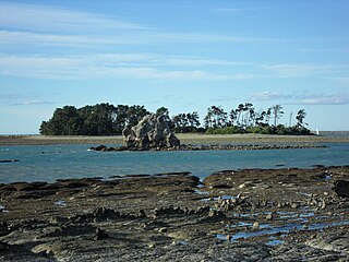
Lower Moutere is a settlement in the Tasman District of New Zealand's upper South Island. It is a farming community it the Lower Moutere valley, 6 km (3.7 mi) from Motueka close to the Moutere Inlet.

References

  1. 1 2 "Statistical Area 2 2018 (generalised) GIS" (Data table). stats.govt.nz. Statistics New Zealand.
  2. 1 2 "Population estimate tables - NZ.Stat". Statistics New Zealand . Retrieved 25 October 2023.
  3. Wise's Nelson-Blenheim "Easyread" Map ISBN   1 877402 50 8
  4. "Nelson Classic Car Museum" . Retrieved 1 August 2021.
  5. Newman, Tim (28 August 2020). "Nelson's Classic Car museum back up and running". Stuff. Retrieved 14 April 2023.
  6. 1 2 3 4 5 "Place Summary – Nelson Airport". Stats NZ. Statistics New Zealand.
  7. 1 2 "Statistical area 1 dataset for 2018 Census". Statistics New Zealand. March 2020. Nelson Airport (304000). 2018 Census place summary: Nelson Airport

41°18′00″S173°14′10″E / 41.30000°S 173.23611°E / -41.30000; 173.23611