Stepneyville | |
---|---|
Suburb | |
Coordinates: 41°16′00″S173°16′10″E / 41.26667°S 173.26944°E | |
Country | New Zealand |
Region | Nelson |
Ward |
|
Electorates | |
Government | |
• Territorial Authority | Nelson City Council |
• Nelson City Mayor | Nick Smith |
• Nelson MP | Rachel Boyack |
• Te Tai Tonga MP | Tākuta Ferris |
Area | |
• Total | 0.84 km2 (0.32 sq mi) |
• Land | 0.84 km2 (0.32 sq mi) |
• Water | 0 km2 (0 sq mi) |
Population (June 2023) [2] | |
• Total | 1,900 [2] |
Time zone | UTC+12 (NZST) |
• Summer (DST) | UTC+13 (NZDT) |
Postcode | 7010 |
Area code | 03 |
Stepneyville is a suburb of Nelson, New Zealand.
It lies on State Highway 6 to the west of Nelson city centre, on the shore of Tasman Bay / Te Tai-o-Aorere, between Port Nelson and Britannia Heights. [3] [4]
The corresponding Statistics New Zealand statistical area is Britannia, which also includes Beachville and covers a land area of 0.84 km2. [1]
Haulashore Island is located offshore from Stepneyville. [5]
Other public reserves in Stepneyville include Pioneers Park, Russell Reserve and Wakefield Quay Gardens. [5]
The estimated population of Britannia reached 1,770 in 1996. [6] The boundaries prior to 2006 may not have been the same.
It was 1,830 in 2001, 1,566 in 2006, 1,650 in 2013, and 1,767 in 2018. [6]
Britannia had an estimated population of 1,900 as of June 2023, [2] with a population density of 2,262 people per km2.
Year | Pop. | ±% p.a. |
---|---|---|
2006 | 1,566 | — |
2013 | 1,650 | +0.75% |
2018 | 1,767 | +1.38% |
Source: [7] |
Britannia had a population of 1,767 at the 2018 New Zealand census, an increase of 117 people (7.1%) since the 2013 census, and an increase of 201 people (12.8%) since the 2006 census. There were 768 households, comprising 846 males and 924 females, giving a sex ratio of 0.92 males per female. The median age was 45.0 years (compared with 37.4 years nationally), with 291 people (16.5%) aged under 15 years, 276 (15.6%) aged 15 to 29, 873 (49.4%) aged 30 to 64, and 330 (18.7%) aged 65 or older.
Ethnicities were 86.2% European/Pākehā, 10.2% Māori, 3.7% Pasifika, 5.8% Asian, and 2.5% other ethnicities. People may identify with more than one ethnicity.
The percentage of people born overseas was 27.5, compared with 27.1% nationally.
Although some people chose not to answer the census's question about religious affiliation, 58.2% had no religion, 28.0% were Christian, 0.2% had Māori religious beliefs, 1.2% were Hindu, 0.3% were Muslim, 1.0% were Buddhist and 3.7% had other religions.
Of those at least 15 years old, 468 (31.7%) people had a bachelor's or higher degree, and 198 (13.4%) people had no formal qualifications. The median income was $33,000, compared with $31,800 nationally. 255 people (17.3%) earned over $70,000 compared to 17.2% nationally. The employment status of those at least 15 was that 690 (46.7%) people were employed full-time, 255 (17.3%) were part-time, and 48 (3.3%) were unemployed. [7]
In 2018, 8.3% of the workforce worked in manufacturing, 6.7% worked in construction, 0.0% worked in retail and wholesale, 8.9% worked in hospitality, 5.7% worked in transport, 7.3% worked in education, and 10.8% worked in healthcare. [6]
As of 2018, among those who commute to work, 78.6% drove a car, 2.8% rode in a car, 1.5% use a bike, and 1.5% walk or run. [6]
No one used public transport. [6]
Reporoa is a rural community in Rotorua Lakes within the Waikato region of New Zealand's North Island.
The Wood is a suburb of the South Island, New Zealand city of Nelson. It lies just to the north-east of the city centre and adjoins it.
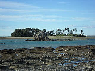
Tāhunanui is one of the suburbs of Nelson, New Zealand. It lies between Port Nelson and Nelson Airport and is the site of the main beach for Nelson with a shoreline on the Tasman Bay.
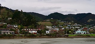
Atawhai is a suburb of Nelson, New Zealand. It lies north of Nelson and is the location of Wakapuaka Cemetery, a burial place since 1861. It also has a coastline on Nelson Haven and access to Boulder Bank from State Highway 6.
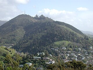
The Brook is one of the suburbs of Nelson, New Zealand. It lies to the south of Nelson and is the location of the Brook Waimarama Sanctuary, a conservation project at the head of the Brook Valley.
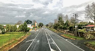
Maramarua is a locality in the north-eastern part of the Waikato District of New Zealand. State Highway 2 runs through the settlement.
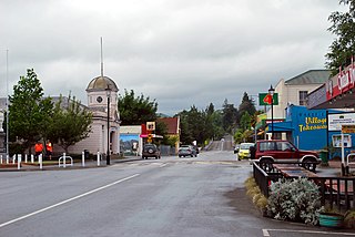
Wakefield is a settlement in the Tasman District of New Zealand's South Island, located about 25km south west of Nelson.
Marybank is a suburb of Nelson, New Zealand. It lies on State Highway 6 close to the northern end of Nelson Haven, between Atawhai and Wakapuaka.
Bishopdale is one of the suburbs of Nelson, New Zealand.
Toi Toi is an inner suburb of Nelson, New Zealand. It lies to the southwest of Nelson city centre, inland from Britannia Heights and Washington Valley. Toi Toi is also known as Victory Village.
Washington Valley is a major inner suburb of Nelson, New Zealand. It lies to the west of Nelson city centre and south of Stepneyville and Beachville.
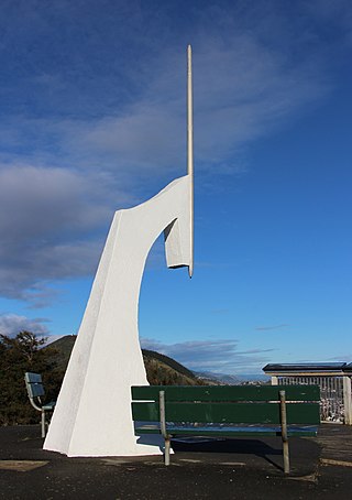
Maitai is an inner suburb of Nelson, New Zealand. It lies at the western edge of Nelson city centre, immediately to the south of The Wood, on the northern bank of the Maitai River. A monument representing the location of the geographic centre of New Zealand is located in Maitai.
Maitlands is one of the suburbs of Nelson, New Zealand. It lies to the east of Stoke, immediately to the west of Enner Glynn.
Annesbrook is an industrial suburb of Nelson, New Zealand.
Nayland is a suburb of Stoke, New Zealand. It lies to the north of Stoke, close to Nelson Airport, southwest of Nelson city centre.
Monaco is a small suburb of Nelson, New Zealand, west of town centre of Stoke. It lies on a narrow peninsula which extends into Tasman Bay / Te Tai-o-Aorere immediately to the south of Nelson Airport, southwest of central Nelson.
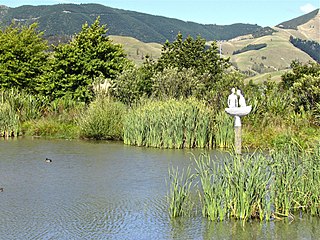
Saxton is a suburb of Nelson, New Zealand, south of Stoke and northwest of Richmond.
Nelson South is an inner suburb of Nelson, New Zealand. It lies to the southwest of Nelson city centre, between it and Bishopdale, close to the foot of The Grampians. The main inland route to Stoke, New Zealand, Waimea Road, is Nelson South's main road.
Nelson Central is the central suburb and central business district of Nelson, New Zealand.
Tasman is a settlement in the Tasman District of New Zealand's upper South Island. It is located between Māpua and Motueka, 45 kilometres (28 mi) from Abel Tasman National Park and 40 kilometres (25 mi) from Nelson.