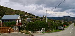
Glenduan

Last updated

Glenduan
Town
Glenduan, Nelson.jpg
Glenduan
Glenduan
Coordinates: 41°11′10″S173°21′50″E / 41.18611°S 173.36389°E / -41.18611; 173.36389
Country New Zealand
Region Nelson

Glenduan is a small township lying to the north of Nelson, New Zealand. It lies on the shore of Tasman Bay / Te Tai-o-Aorere between the northern end of Boulder Bank and Pepin Island. [1] [2]

The settlement's main park, Glenduan Reserve, is a public beach and local park. [3]

Horoirangi Marine Reserve is located offshore of Glenduan. [4]

Demographics

The population was 477 in the 2013 census. This was an increase of 27 people since the 2006 census. [5]

Glenduan is part of the Nelson Rural statistical area. [6]

Related Research Articles

<span class="mw-page-title-main">Nelson, New Zealand</span> City in the South Island, New Zealand

Nelson is a city on the eastern shores of Tasman Bay / Te Tai-o-Aorere. It is the oldest city in the South Island and the second-oldest settled city in New Zealand; it was established in 1841 and became a city by royal charter in 1858.

<span class="mw-page-title-main">Motueka</span> Town in Tasman District, New Zealand

Motueka is a town in the South Island of New Zealand, close to the mouth of the Motueka River on the western shore of Tasman Bay / Te Tai-o-Aorere. It is the second largest in the Tasman Region, with a population of 8,340 as of June 2022.

<span class="mw-page-title-main">Richmond, New Zealand</span> Town in Tasman, New Zealand

Richmond is a town and the seat of the Tasman District Council in New Zealand. It lies 13 kilometres (8 mi) south of Nelson in the South Island, close to the southern extremity of Tasman Bay / Te Tai-o-Aorere. The town, first settled by Europeans in 1842, was named in 1854 after the town of Richmond on Thames near London. The town has an estimated population of 18,450 as of June 2022.

Hope, previously known as Ranzau, is a small settlement in the Tasman District of New Zealand. It lies south of Nelson city, between Richmond and Wakefield.

<span class="mw-page-title-main">Hinemoatū / Howard River</span> River in New Zealand

The Hinemoatū / Howard River is a river of the northern South Island of New Zealand. A tributary of the Buller River, the Hinemoatū/Howard starts at the confluence of the Hodgson and Tier Streams in the Travers Range of Nelson Lakes National Park, flowing north between Lakes Rotoroa and Rotoiti, before reaching the Buller between Kawatiri and Saint Arnaud. Close to its confluence with the Buller, the river is bridged by State Highway 63 and further up by Howard Valley Road.

<span class="mw-page-title-main">Tāhunanui</span> Suburb in Nelson, Nelson, New Zealand

Tāhunanui is one of the suburbs of Nelson, New Zealand. It lies between Port Nelson and Nelson Airport and is the site of the main beach for Nelson with a shoreline on the Tasman Bay / Te Tai-o-Aorere.

<span class="mw-page-title-main">Tonga Island</span>

Tonga Island is a small (0.15 km2) island in Tasman Bay / Te Tai-o-Aorere, off the northern coast of the South Island of New Zealand. It lies within the Abel Tasman National Park, about 1 kilometre (0.62 mi) off Onetahuti Beach. The island has a flourishing fur seal colony, and is surrounded by the Tonga Island Marine Reserve, which was inaugurated in 1993.

Wakatu is an industrial suburb of Nelson in New Zealand.

Hira is a small settlement approximately 20 kilometres (12 mi) northeast of Nelson, New Zealand. It sits in the valley of the Wakapuaka River.

<span class="mw-page-title-main">Marybank, New Zealand</span> Suburb in Nelson, Nelson, New Zealand

Marybank is a suburb of Nelson, New Zealand. It lies on State Highway 6 close to the northern end of Nelson Haven, between Atawhai and Wakapuaka.

<span class="mw-page-title-main">Wakapuaka</span> Town in Nelson, New Zealand

Wakapuaka is a small township lying to the north of Nelson, New Zealand. It lies on State Highway 6 inland from the northern end of Nelson Haven, between Marybank and Hira. The road to Glenduan joins SH 6 at Wakapuaka.

<span class="mw-page-title-main">Bishopdale, Nelson</span> Suburb in Nelson, Nelson, New Zealand

Bishopdale is one of the suburbs of Nelson, New Zealand.

Britannia Heights is a major inner suburb of Nelson, New Zealand. It lies on State Highway 6 to the southwest of Nelson city centre, on the shore of Tasman Bay / Te Tai-o-Aorere, between Stepneyville and Tāhunanui.

<span class="mw-page-title-main">Port Nelson, New Zealand</span> Suburb in Nelson, Nelson, New Zealand

Port Nelson, as its name suggests, is the main port area of Nelson, New Zealand.

<span class="mw-page-title-main">Stepneyville</span> Suburb in Nelson, Nelson, New Zealand

Stepneyville is a suburb of Nelson, New Zealand.

Beachville is an inner suburb of Nelson, New Zealand. It lies at the western edge of Nelson city centre, to the southeast of Port Nelson.

Enner Glynn is a suburb of Nelson, New Zealand. It lies to the south of Nelson city centre and east of Stoke, inland from Wakatu.

Nelson South is an inner suburb of Nelson, New Zealand. It lies to the southwest of Nelson city centre, between it and Bishopdale, close to the foot of The Grampians. The main inland route to Stoke, New Zealand, Waimea Road, is Nelson South's main road.

<span class="mw-page-title-main">Tasman (settlement)</span> Rural settlement in Tasman, New Zealand

Tasman is a settlement in the Tasman District of New Zealand's upper South Island. It is located between Māpua and Motueka, 45 kilometres (28 mi) from Abel Tasman National Park and 40 kilometres (25 mi) from Nelson.

References

  1. Reed New Zealand atlas (2004) Auckland: Reed Publishing. Map 59. ISBN   0 7900 0952 8
  2. Wise's Nelson-Blenheim "Easyread" Map ISBN   1 877402 50 8
  3. "Nelson Parks and Reserves". gdc.govt.nz. Gisborne District Council.
  4. "DOC Places to Go - Nelson-Tasman". doc.govt.nz. Department of Conservation.
  5. 2013 Census QuickStats about a place  : Glenduan
  6. 2018 Census place summary: Nelson Rural