List of parks in the Gisborne District

Last updated

This is a list of parks, beaches, sports grounds, marine reserves and other protected areas in the Gisborne District of New Zealand's North Island. [1] [2]

NameCoordinatesLocationTerritorial authority areaType
Adventure Playground 38°40′11″S178°00′01″E / 38.6698178°S 178.0001475°E / -38.6698178; 178.0001475 Awapuni Gisborne Playground, picnic area, public toilets
Alfred Cox Park 38°40′02″S178°01′01″E / 38.6672949°S 178.0168547°E / -38.6672949; 178.0168547 Gisborne Central Gisborne Local park, dog walking area
Anaura Bay Reserve 38°14′07″S178°17′38″E / 38.2352586°S 178.2938409°E / -38.2352586; 178.2938409 Anaura Bay Gisborne DOC reserve, walking track
Anzac Park 38°39′39″S178°01′48″E / 38.6608775°S 178.0299974°E / -38.6608775; 178.0299974 Inner Kaiti Gisborne Barbecue area, boat ramp, football, picnic area, playground
Atkinson Street Park 38°38′52″S178°00′23″E / 38.6477069°S 178.0064963°E / -38.6477069; 178.0064963 Mangapapa Gisborne Local park, dog walking area
Awapuni Stadium 38°40′18″S177°59′57″E / 38.671543°S 177.9991682°E / -38.671543; 177.9991682 Awapuni Gisborne Sports ground, dog walking area
Ballance Street Reserve 38°39′20″S178°01′26″E / 38.655623°S 178.023796°E / -38.655623; 178.023796 Whataupoko Gisborne Local park, dog walking area
Barry Park 38°39′18″S178°00′35″E / 38.6549461°S 178.0096161°E / -38.6549461; 178.0096161 Te Hapara Gisborne Sports ground
Blackpool Street Reserve 38°39′40″S177°59′51″E / 38.6611581°S 177.9976302°E / -38.6611581; 177.9976302 Te Hapara Gisborne Local park, dog walking area
Childers Road Reserve 38°39′38″S178°00′53″E / 38.660609°S 178.014712°E / -38.660609; 178.014712 Gisborne Central Gisborne Sports ground
Eastwoodhill Arboretum 38°33′45″S177°42′58″E / 38.562546°S 177.7160803°E / -38.562546; 177.7160803 Ngatapa Gisborne Walkway, cycleway
Fox Street Reserve 38°39′20″S178°02′25″E / 38.655438°S 178.040289°E / -38.655438; 178.040289 Whataupoko Gisborne Local park, dog walking area
Gisborne Botanical Gardens 38°39′27″S178°01′13″E / 38.657633°S 178.0202722°E / -38.657633; 178.0202722 Gisborne Central Gisborne Picnic area, aviary, playground, toilets
Grant Road Reserve 38°39′53″S178°02′15″E / 38.6647487°S 178.0373676°E / -38.6647487; 178.0373676 Whataupoko Gisborne Local park, dog walking area
Gray's Bush Scenic Reserve 38°35′48″S177°57′27″E / 38.5965613°S 177.957448°E / -38.5965613; 177.957448 Waimata Valley Gisborne DOC reserve, walking track
Hall Street Reserve 38°39′30″S178°01′27″E / 38.658384°S 178.024120°E / -38.658384; 178.024120 Whataupoko Gisborne Local park, dog walking area
Harry Barker Reserve 38°39′00″S177°59′39″E / 38.6498855°S 177.994233°E / -38.6498855; 177.994233 Te Hapara Gisborne Cricket, hockey, public toilets
Hatea-A-Rangi Memorial Park 38°07′53″S178°18′51″E / 38.1314129°S 178.3141495°E / -38.1314129; 178.3141495 Tokomaru Bay Gisborne Sports ground
Heath Johnston Park 38°41′01″S178°03′08″E / 38.6837048°S 178.0521516°E / -38.6837048; 178.0521516 Tamarau Gisborne Sports ground
Kaiti Beach 38°40′45″S178°01′32″E / 38.6791243°S 178.0256725°E / -38.6791243; 178.0256725 Kaiti Gisborne Beach, local park, dog walking area
London Street Reserve 38°40′36″S178°02′30″E / 38.6765484°S 178.0416775°E / -38.6765484; 178.0416775 Kaiti Gisborne Local park, dog walking area
Makorori Headland 38°39′55″S178°06′01″E / 38.6654064°S 178.10019°E / -38.6654064; 178.10019 Okitu Gisborne Walkway, cycleway
Matawai Reserve 38°21′33″S177°32′00″E / 38.359030°S 177.533289°E / -38.359030; 177.533289 Matawai Gisborne Sports ground
Midway Beach / Kopututea Sand Dunes 38°41′27″S177°57′30″E / 38.6908788°S 177.9583343°E / -38.6908788; 177.9583343 Awapuni Gisborne Beach, barbecue area, horse riding, jet skiing, kite surfing, dog walking area
Nelson Park 38°38′45″S177°59′36″E / 38.6456956°S 177.9933004°E / -38.6456956; 177.9933004 Riverdale Gisborne Sports ground, local park, dog walking area
Okitu Bush Scenic Reserve 38°39′53″S178°05′54″E / 38.664829°S 178.0984292°E / -38.664829; 178.0984292 Okitu Gisborne DOC reserve, walkway
Otoko Walkway 38°27′54″S177°39′28″E / 38.4648949°S 177.6578689°E / -38.4648949; 177.6578689 Otoko Gisborne DOC reserve, walkway
Oval Reserve 38°39′47″S178°00′24″E / 38.6629659°S 178.0065999°E / -38.6629659; 178.0065999 Awapuni Gisborne Cricket, rugby, public toilets
Patutahi Soccer Ground 38°37′31″S177°53′19″E / 38.625401°S 177.888512°E / -38.625401; 177.888512 Patutahi Gisborne Sports ground
Rere Falls / Rere Reserve 38°32′15″S177°36′27″E / 38.5374631°S 177.6074253°E / -38.5374631; 177.6074253 Rere Gisborne Walkway, cycleway, picnic area, swimming, trout fishing, public toilets
Reynolds Creek Reserve / Sandown Park 38°39′34″S177°59′52″E / 38.65947°S 177.9978555°E / -38.65947; 177.9978555 Elgin Gisborne Local park, dog walking area
Sheehan Street Reserve 38°39′32″S178°01′37″E / 38.658785°S 178.026855°E / -38.658785; 178.026855 Whataupoko Gisborne Local park, dog walking area
Stafford Street Reserve 38°39′39″S178°01′57″E / 38.660772°S 178.032551°E / -38.660772; 178.032551 Whataupoko Gisborne Local park, dog walking area
Te Arai Domain 38°40′38″S177°54′35″E / 38.677125°S 177.909728°E / -38.677125; 177.909728 Manutuke Gisborne Sports ground
Te Araroa Domain 37°37′59″S178°22′26″E / 37.633096°S 178.373828°E / -37.633096; 178.373828 Te Araroa Gisborne Sports ground
Te Karaka Recreation Ground 38°28′23″S177°51′56″E / 38.472995°S 177.865507°E / -38.472995; 177.865507 Te Karaka Gisborne Sports ground
Te Tapuwae o Rongokako Marine Reserve 38°36′25″S178°11′21″E / 38.6069599°S 178.1891548°E / -38.6069599; 178.1891548 Whangara Gisborne DOC reserve, marine reserve
Titirangi Reserve / Titirangi Domain / Kaiti Hill 38°40′39″S178°01′39″E / 38.6774868°S 178.027636°E / -38.6774868; 178.027636 Inner Kaiti Gisborne Dog walking area, fitness trail, lookout, picnic area, playground
Uawa Reserve 38°22′21″S178°17′23″E / 38.372395°S 178.289588°E / -38.372395; 178.289588 Tolaga Bay Gisborne Sports ground
Waiherere Domain 38°34′39″S177°56′02″E / 38.5773729°S 177.9338123°E / -38.5773729; 177.9338123 Waihirere Gisborne Playground, cycleway, dog walking area, jet skiing, kite surfing, picnic area
Waikanae Beach 38°40′13″S178°00′52″E / 38.6703344°S 178.014442°E / -38.6703344; 178.014442 Victoria Gisborne Walkway
Wainui Reserve 38°41′03″S178°04′21″E / 38.6841539°S 178.072362°E / -38.6841539; 178.072362 Wainui Beach Gisborne Sports ground
Waikirikiri Reserve 38°40′15″S178°03′06″E / 38.6707554°S 178.0517678°E / -38.6707554; 178.0517678 Outer Kaiti Gisborne Sports ground, dog walking area, picnic area, public toilets
Wainui Beach / Lysnar Reserve 38°41′03″S178°04′22″E / 38.6842828°S 178.0727553°E / -38.6842828; 178.0727553 Wainui Beach Gisborne Boat fishing, boat ramp, dog walking area, horse riding, kite surfing
Waiteata Park 38°39′19″S178°01′54″E / 38.6552782°S 178.031528°E / -38.6552782; 178.031528 Whataupoko Gisborne Picnic area, playground
Watson Park 38°40′18″S177°59′32″E / 38.6717084°S 177.9923513°E / -38.6717084; 177.9923513 Awapuni Gisborne Sports ground
Whataupoko Reserve 38°39′24″S178°00′36″E / 38.6565509°S 178.0100323°E / -38.6565509; 178.0100323 Whataupoko Gisborne Dog walking, mountain biking, walkway

See also

Related Research Articles

Te Araroa (town) Town in the North Island of New Zealand

Te Araroa is a town in the Gisborne Region of the North Island of New Zealand. It is situated 175 km north of Gisborne city, along State Highway 35 between Tokata and Awatere. Te Araroa is the birthplace of noted Māori politician Sir Āpirana Ngata. Māori in the area are generally associated with the Ngāti Porou iwi. It is 100 metres from its local beach.

Victoria is a suburb of the New Zealand city of Gisborne. It is located close to the shore of Poverty Bay, to the southeast of the city centre, between the mouth of the Awapuni Creek and Awapuni.

Kaiti, New Zealand Suburb of Gisborne in New Zealand

Kaiti is a suburb of the New Zealand city of Gisborne. It is located immediately to the east of the city centre, on the opposing bank of the Waimata River.

Te Hapara Suburb of Gisborne in New Zealand

Te Hapara is a suburb of the New Zealand city of Gisborne. It is located in the northwest of the city. It contains one primary school, Te Hapara School, which is located in Mill Road.

Whataupoko is the central suburb of the New Zealand city of Gisborne. It is located to the northeast of the city business district.

Patutahi is a small settlement 15 kilometres from Gisborne, in the northeast of New Zealand's North Island. It is located in the valley of the Waipaoa River.

Matawai is a small inland settlement in the Gisborne Region in the northeast of New Zealand's North Island. It is located on the upper reaches of the Motu River, in the Raukumara Range. It is on State Highway 2 between Gisborne and Opotiki.

Whangara is a small community in the northeast of New Zealand's North Island.

Glenduan Town in Nelson, New Zealand

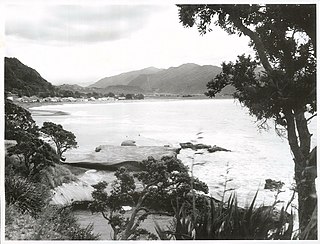
Glenduan is a small township lying to the north of Nelson, New Zealand. It lies on the shore of Tasman Bay / Te Tai-o-Aorere between the northern end of Boulder Bank and Pepin Island.

Beachville is an inner suburb of Nelson, New Zealand. It lies at the western edge of Nelson city centre, to the southeast of Port Nelson.

Anaura Bay

Anaura Bay is a bay and community in the Gisborne District of New Zealand's North Island. It is located just south of Tokomaru Bay and north of Tolaga Bay.

Riverdale is a suburb of Gisborne, in the Gisborne District of New Zealand's North Island.

Elgin is a suburb of Gisborne, in the Gisborne District of New Zealand's North Island. It is located east and north of Awapuni, south of Te Hapara and west of Gisborne Central.

Gisborne Central Suburb of Gisborne in New Zealand

Gisborne Central is the central business district and central suburb of Gisborne, in the Gisborne District of New Zealand's North Island. It is located east of Elgin, south of Whataupoko and west of Kaiti.

Okitu is a suburb and coastal settlement of Gisborne, in the Gisborne District of New Zealand's North Island. It is located north east of Wainui Beach.

Otoko is a settlement in the Gisborne District of New Zealand's North Island.

Waihirere is a settlement and rural area in the Gisborne District of New Zealand's North Island. It is located 16 kilometres inland from the coastal city of Gisborne.

Waimata is a rural valley in the Gisborne District of New Zealand's North Island.

Raukumara Conservation Park

Raukumara Conservation Park or Raukūmara Conservation Park is a protected area in the Gisborne District of New Zealand's North Island.

References

  1. "Gisborne Parks and Reserves". gdc.govt.nz. Gisborne District Council.
  2. "DOC Places to Go - East Coast". doc.govt.nz. Department of Conservation.