Related Research Articles

A volcano is a rupture in the crust of a planetary-mass object, such as Earth, that allows hot lava, volcanic ash, and gases to escape from a magma chamber below the surface.

Mount Ruapehu is an active stratovolcano at the southern end of the Taupo Volcanic Zone in New Zealand. It is 23 kilometres (14 mi) northeast of Ohakune and 23 km (14 mi) southwest of the southern shore of Lake Taupo, within Tongariro National Park. The North Island's major ski resorts and only glaciers are on its slopes.

The Ring of Fire is a region around much of the rim of the Pacific Ocean where many volcanic eruptions and earthquakes occur. The Ring of Fire is a horseshoe-shaped belt about 40,000 km (25,000 mi) long and up to about 500 km (310 mi) wide.

Rangitoto Island is a volcanic island in the Hauraki Gulf near Auckland, New Zealand. The 5.5 km (3.4 mi) wide island is a symmetrical shield volcano cone, reaching a height of 260 m (850 ft). Rangitoto is the youngest and largest of the approximately 50 volcanoes of the Auckland volcanic field, having formed in an eruption about 600 years ago, and covering an area of 2,311 ha. It is separated from the mainland of Auckland's North Shore by the Rangitoto Channel. Since World War II, it has been linked by a causeway to the much older, non-volcanic Motutapu Island.

Whakaari / White Island is an active andesite stratovolcano situated 48 km (30 mi) from the east coast of the North Island of New Zealand, in the Bay of Plenty. The island covers an area of approximately 325 ha, which is only the peak of a much larger submarine volcano.
Te Araroa is a town in the Gisborne Region of the North Island of New Zealand. It is situated 175 km north of Gisborne city, along State Highway 35 between Tokata and Awatere. Te Araroa is the birthplace of noted Māori politician Sir Āpirana Ngata. Māori in the area are generally associated with the Ngāti Porou iwi. It is 100 metres from its local beach.

The Gisborne District is an area of northeastern New Zealand governed by the Gisborne District Council. A unitary authority, it is also known as the Gisborne Region. It is named after its largest settlement, the city of Gisborne. The region is also commonly referred to as the East Coast.
Victoria is a suburb of the New Zealand city of Gisborne. It is located close to the shore of Poverty Bay, to the southeast of the city centre, between the mouth of the Awapuni Creek and Awapuni.
Kaiti is a suburb of the New Zealand city of Gisborne. It is located immediately to the east of the city centre, on the opposing bank of the Waimata River.

Whangara is a small community in the northeast of New Zealand's North Island.

The Taruheru River is a river of the Gisborne Region of New Zealand's North Island. It flows predominantly southeast from sources close to the settlement of Ormond before flowing through the city of Gisborne. Here it meets the waters of the Waimata River, and the combined waters flow to the northern end of Poverty Bay as the Turanganui River.
The Raukumara Region of New Zealand corresponds to the East Cape of the North Island, and associated mountain ranges.

The Turanganui River is a river in the city of Gisborne, New Zealand. Formed by the confluence of the Taruheru River and the Waimata River, it flows through downtown Gisborne to reach the Pacific Ocean at the northern end of Poverty Bay. A memorial to the first landing place in New Zealand by Captain James Cook is located close to the mouth of the river. The entire river is tidal.
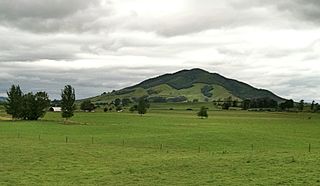
Kakepuku (Kakipuku-o-kahurere) rises from the plain between the Waipa and Puniu rivers, about 3 km (2 mi) NW of Te Kawa and 8 km (5 mi) SW of Te Awamutu in the Waikato region of New Zealand's North Island.

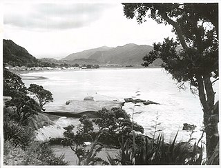
Anaura Bay is a bay and community in the Gisborne District of New Zealand's North Island. It is located just south of Tokomaru Bay and north of Tolaga Bay.
Okitu is a suburb and coastal settlement of Gisborne, in the Gisborne District of New Zealand's North Island. It is located north east of Wainui Beach.
Otoko is a settlement in the Gisborne District of New Zealand's North Island.
Waihirere is a settlement and rural area in the Gisborne District of New Zealand's North Island. It is located 16 kilometres inland from the coastal city of Gisborne.
References
- ↑ "On Farm Story – Lee Askew, Waimata Valley". Farmer Weekly. 8 April 2020.
- 1 2 Sharpe, Marty (10 January 2019). "Mud volcano continues to bubble away following eruption near Gisborne". stuff.co.nz.
- ↑ "Mud volcano erupts at Waimata Valley". Gisborne Herald. 5 January 2019.
- ↑ "DOC Places to Go – East Coast". doc.govt.nz. Department of Conservation.
Coordinates: 38°30′15″S178°03′24″E / 38.504224°S 178.056610°E